Easement Survey NSW: What Property Owners Need

Easement Survey NSW: What Property Owners Need

A fence line looks simple until a sewer main, drainage line or access right runs straight through it. That is usually when an easement stops being a title note and starts affecting real decisions – where you can build, what council may approve, and whether a deal or project keeps moving.

If you are searching for easement survey NSW: what property owners need, the short answer is this: you need clarity before design, construction or registration work starts. An easement survey identifies where the easement sits in relation to your land, improvements and boundaries, and it provides the measured information needed for approvals, plan preparation and title registration.

What an easement survey actually covers

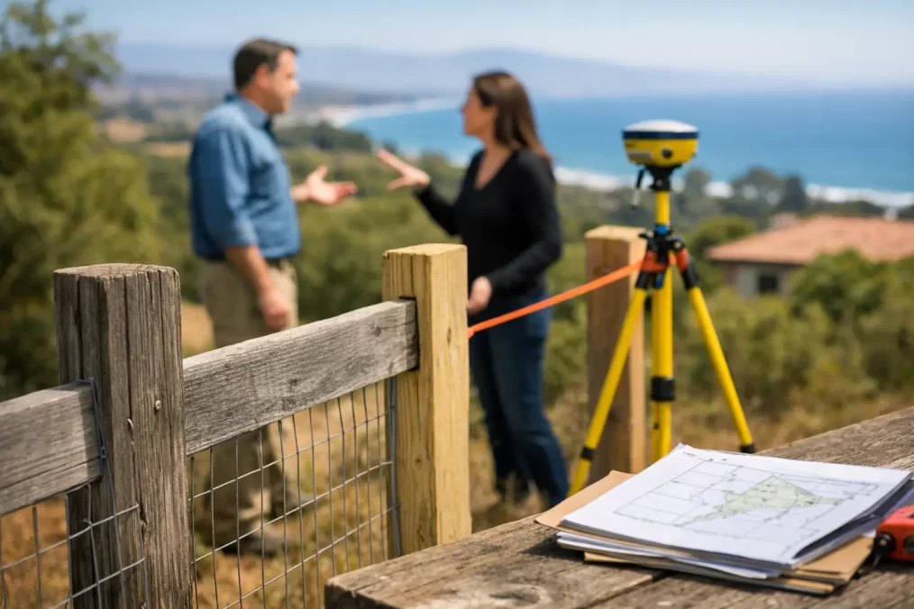
An easement is a legal right affecting land. It may allow access through one property, protect drainage infrastructure, carry sewer or water services, or preserve rights for utilities and neighbouring landowners. In NSW, easements are usually created, varied or removed through formal plans and legal documentation, not informal agreements or assumptions on site.

An easement survey is the surveying work required to locate, define or create that easement accurately. Depending on the job, that might involve confirming title boundaries, measuring existing improvements, locating services, preparing a survey plan for a proposed easement, or supplying data that a solicitor, planner, architect or civil engineer needs to progress the matter.

For property owners, the practical issue is not just whether an easement exists. It is whether the easement affects what you want to do with the land. A deck extension, granny flat, driveway relocation, retaining wall, subdivision layout or stormwater upgrade can all be affected.

When property owners in NSW usually need an easement survey

Most clients do not ask for an easement survey out of curiosity. They need one because a project has reached a point where assumptions are risky and delays are expensive.

A common trigger is a proposed build near a service corridor or drainage line. If plans are being prepared and the title shows an easement, the designer needs reliable surveyed information rather than scaling from old documents. Another common situation is subdivision, where a new drainage, access or services easement may be required to satisfy council or servicing authorities.

You may also need an easement survey when buying or selling a property, resolving a boundary or access issue, applying for approvals, transferring a waterfront matter, or dealing with non-compliant structures built close to an easement area. In older parts of the Central Coast, it is not unusual for physical occupation on site to tell a different story from the title and deposited plan history. That is where a registered surveyor becomes essential.

Easement survey NSW: what property owners need to understand first

The first thing to understand is that title diagrams do not always give you enough practical site information to make building or compliance decisions. They show the legal framework, but they do not replace a current field survey.

The second is that not every easement problem has the same solution. Sometimes the easement simply needs to be located and shown in relation to your proposed works. Sometimes a new easement must be created because a stormwater design, access arrangement or services connection cannot be approved without it. In other cases, a variation or extinguishment may be considered, but that depends on who benefits from the easement, what authorities are involved and whether the legal and planning pathway is realistic.

The third is timing. If an easement issue is discovered late – after architectural plans, engineering drawings or construction pricing are already underway – redesign costs can follow quickly. Surveying early is usually the cheaper option.

What the survey process usually looks like

The process starts with document review. A registered surveyor examines the title, deposited plans, any easement instruments and other relevant records to understand the legal position of the land. This matters because easements are defined by legal description, and the wording can be just as important as the dimensions.

Field work then confirms the cadastral framework and measures the site. That may include boundary evidence, existing structures, fences, driveways, pits, visible services, levels and features relevant to the easement question. If a proposed easement is being created, the surveyor also needs enough site data to position it accurately and ensure the plan will work with the design intent and title requirements.

After field work, the survey information is processed and analysed. If the project involves plan preparation, the surveyor prepares the required plan documentation for the relevant approval or registration pathway. If the project is still in design phase, the survey output may instead be issued to your architect, planner or engineer so they can proceed with confidence.

That process sounds straightforward, but the complexity can vary. A single residential drainage easement is very different from a multi-lot subdivision with new access rights, services coordination and plan registration requirements.

Why registered surveyors matter on easement work

Easements sit at the intersection of land law, measurement, construction and approval processes. That is why this is not a job for guesswork, rough set-outs or title scaling.

In NSW, a registered land surveyor has the qualifications and authority to deal with cadastral definition and the preparation of plans that support legal registration outcomes. For property owners, that means the work is grounded in proper boundary reinstatement, defensible measurements and compliance with the relevant registry standards.

It also helps avoid a common and costly problem – receiving advice from different parties that sounds reasonable but does not line up legally. Builders, neighbours and contractors often have practical observations, but they are not a substitute for a registered survey opinion when rights over land are involved.

What can affect cost and timing

Property owners often want a quick price for an easement survey, but scope matters. The cost will depend on the type of easement, site access, terrain, title complexity, availability of records, whether boundary reinstatement is required, and whether the outcome is advisory, design support or a formal plan for registration.

Timing also depends on how many moving parts are involved. If the survey is only needed to identify an existing easement against a current site survey, the turnaround may be relatively quick. If multiple owners, solicitors, councils, authorities or consultants need to coordinate, the overall timeframe expands.

The trade-off is simple. A faster early survey usually reduces downstream delays. Waiting until the design is advanced can save nothing if the easement forces redesign, approval amendments or construction changes.

Common mistakes property owners make

One mistake is assuming an easement shown on title is already obvious on the ground. It often is not. Another is building near an easement without checking restrictions, authority requirements or whether access for maintenance must be preserved.

A third mistake is treating the issue as purely legal or purely engineering. In practice, easement matters usually need both accurate survey definition and coordinated input from the wider project team. If the surveyor, designer and solicitor are not working from the same information, small inconsistencies can become major hold-ups.

Some owners also leave the question too late because they are trying to keep early costs down. That can work on very simple sites, but where boundaries, services and approvals are already tight, it is a false economy.

Easement survey NSW: what property owners need from the right consultant

You need more than a plan. You need a surveyor who can explain what is affecting the site, identify the likely pathway, and provide information that other consultants can use without rework.

That means local experience matters. On the Central Coast, approval expectations, site constraints and property history can differ significantly from one suburb or development pattern to another. A consultant who regularly works across residential lots, rural holdings, waterfront land and subdivisions is usually better placed to spot issues early and keep the process moving.

It also means responsiveness matters. Easement work often sits on the critical path for design or approval. Slow turnaround from one consultant can stall everyone else. A capable surveying team should be able to move from records review to field work to usable output efficiently, while still maintaining the precision required for legal and construction purposes.

Where a project needs broader support, Central Coast Surveyors can assist from early site survey through easement plan preparation and the registration stage, which helps reduce handover delays between separate providers.

What to have ready before you call

If you need advice on an easement matter, it helps to have the property address, any title or deposited plan references, a clear description of the issue, and copies of any concept plans, engineering sketches or council correspondence. If you know what you are trying to achieve – build over, build near, create, vary or clarify an easement – say that at the start.

That does not mean you need all the answers before making contact. It just helps the surveyor identify scope quickly and tell you whether the next step is a boundary survey, detail survey, easement investigation, plan preparation or coordination with your designer or solicitor.

The best time to sort out an easement is before it turns into a construction or approval problem. If something on title, site or design does not line up, getting accurate advice early usually keeps your options wider and your project a lot easier to manage.

What a Detail and Contour Survey Shows

What a Detail and Contour Survey Shows

A block can look straightforward until the design starts. Then the questions arrive quickly – where do the levels actually sit, how steep is the fall, where are the existing services, and what site features will affect approvals or construction? A detail and contour survey answers those questions early, with measured site information that architects, planners, engineers and builders can rely on.

For homeowners, that usually means fewer surprises once plans are drawn. For designers and consultants, it means a proper base survey that supports decisions from concept design through to documentation. For developers, it is one of the first steps in controlling risk, programme and cost.

What is a detail and contour survey?

A detail and contour survey, sometimes called a topographical survey, captures the physical features and levels of a site. It maps the shape of the land and records the visible improvements and site conditions that may affect design, approvals and construction.

That typically includes building footprints, fences, retaining walls, driveways, kerbs, footpaths, trees, surface drainage, visible services, pits, power poles and significant ground levels across the land. Contours are then generated from surveyed levels to show the rise and fall of the site.

The exact scope depends on the project. A small residential addition on a suburban lot will not need the same level of information as a duplex development, a waterfront site or a large rural parcel. The key is making sure the survey matches the design and approval pathway, rather than treating every site the same.

Why accurate site data matters so early

The biggest value of a survey is not the drawing itself. It is the decisions that become easier and more accurate once the real site conditions are known.

If the levels are wrong, finished floor levels can be set incorrectly. If drainage paths are missed, stormwater design can become more complicated than expected. If retaining walls, easements or adjoining features are not properly shown, the design may need to be revised after lodgement. That costs time, consultant fees and often money on rework.

On sloping sites across the Central Coast, accurate contours are especially important. They affect cut and fill, driveway grades, retaining requirements, drainage design, overlooking, height compliance and how comfortably a proposed building sits on the land. A site that looks mildly sloping by eye can produce very different design outcomes once surveyed levels are plotted.

For architects and building designers, good survey data supports a more efficient design process. For engineers, it provides the base for stormwater and civil design. For owners, it reduces the chance of being told halfway through the process that the plans need to change.

What a detail and contour survey usually includes

A useful survey is not just a set of spot levels. It needs enough measured information for the broader consultant team to work from confidently.

In most cases, the survey will show boundaries in relation to occupation, site levels and contours, existing structures and improvements, nearby road features, visible service infrastructure and relevant adjoining information where it affects the project. Depending on the brief, it may also include floor levels, invert levels, tree locations, ridge and gutter heights, or additional detail for access and drainage design.

This is where experience matters. The right fieldwork and drafting detail can save a project from avoidable follow-up questions later. Over-surveying can add unnecessary cost, but under-surveying often creates bigger problems because missing information tends to surface after design has already started.

When you need a detail and contour survey

In practical terms, a detail and contour survey is usually needed before architectural design begins. It is commonly the starting point for new homes, extensions, duplexes, secondary dwellings, townhouse developments, subdivisions and many commercial projects.

It is also frequently required where council submissions, CDC documentation, stormwater design or civil works are involved. If a consultant is designing around levels, setbacks, drainage, access or existing structures, they will usually need a reliable survey base.

There are also situations where timing matters. If demolition is proposed, it is often worth confirming what needs to be captured before any structures are removed. Once site features disappear, they cannot be surveyed in their original condition. The same applies if vegetation clearing, bulk earthworks or service changes are planned early.

Detail and contour survey for residential projects

For homeowners, the survey is often the point where a project starts to feel real. Instead of relying on aerial imagery or rough assumptions, the design team can see the site as it actually is.

That matters for practical reasons. On a renovation, the architect may need existing floor levels, roof lines and surrounding site grades to connect new work properly. On a new dwelling, contours influence slab design, driveway access, drainage and retaining. On a narrow or irregular lot, accurate feature pick-up can make a difference to building layout and private open space.

It also helps with approval confidence. If the site plan is based on proper survey data, there is less guesswork in the documents being lodged. That tends to reduce avoidable questions from consultants, certifiers and councils.

Detail and contour survey for architects, builders and developers

For industry clients, speed and reliability are just as important as accuracy. Delayed survey information can hold up concept design, engineering input and authority coordination. In a tight programme, that lost time flows directly into approvals and construction.

A well-executed survey supports better coordination across the whole project team. Architects can design to actual site constraints. Engineers can resolve levels, stormwater and structural interfaces earlier. Builders can price with a clearer understanding of the landform and site conditions. Developers can assess feasibility with fewer assumptions.

There is also a compliance benefit. Where a registered surveyor is involved, the survey is produced by someone trained to understand land, measurement, title and statutory requirements, not just field capture. That distinction matters when the data will influence approvals, construction setting out and later registration work.

What affects the cost and turnaround?

Clients often ask how long a detail and contour survey takes and what it will cost. The honest answer is that it depends on the site and the project brief.

A relatively clear residential lot with good access is usually faster to survey than a densely built site with heavy vegetation, multiple retaining walls, difficult access or extensive surrounding detail requirements. Larger sites, waterfront land, steep terrain and projects needing extra neighbouring information will generally involve more field time and more drafting.

Urgency can also affect delivery. If an architect or planner is waiting on survey data to keep a job moving, responsive scheduling makes a real difference. Fast turnaround is useful, but only if the output is complete and dependable. Rushed surveys that lead to missing detail are rarely a saving.

Why local experience makes a difference

Surveying is technical work, but local knowledge still counts. Across the Central Coast, site conditions vary from established suburban areas to steep escarpments, rural holdings and waterfront properties. Each comes with its own practical issues around access, vegetation, drainage, services and approval expectations.

A local surveyor who works regularly with architects, certifiers, planners and engineers in the area can often anticipate what information will be needed before it becomes a problem. That helps the survey align with the project pathway from the start.

Central Coast Surveyors works across this full process, from early detail and contour surveys through construction set-out, final surveys and plan registration. That end-to-end view is useful because the initial survey is not treated as an isolated deliverable. It is the first piece of project information that other stages will build on.

Choosing the right survey scope

Not every project needs the same level of pick-up, and this is where clear briefing matters. If the survey is being used for architectural concept design only, the requirements may be different from a site that is heading straight into DA documentation, subdivision design or complex engineering.

The best approach is to define the likely downstream use at the start. If floor levels, drainage points, adjoining building information or additional road detail will matter later, it is usually more efficient to capture them upfront than arrange a return visit. On the other hand, there is no value in adding survey detail that no one will use.

A good surveyor will usually ask the right questions early – what is being designed, who needs the survey, what stage the project is at, and whether there are any known issues on site. Those conversations are often what separate a straightforward project from one that gets bogged down in preventable revisions.

A detail and contour survey is one of the smallest line items on many projects, but it influences some of the biggest decisions. Getting that first step right gives the rest of the team something solid to work from – and that is often what keeps a project moving.

Topographical Survey for House Extension

Topographical Survey for House Extension

You can often spot the projects that started without proper survey information. The plans look fine on paper, then the builder finds an unexpected slope, a retaining wall that is not where anyone thought, or drainage that changes the layout completely. A topographical survey for house extension work helps prevent that kind of expensive surprise by giving your architect, designer and engineer an accurate picture of the site before design decisions are locked in.

For homeowners, that means fewer assumptions. For architects, builders and planners, it means working from measured data rather than guesswork. On sites across the Central Coast, where blocks can be sloping, irregular, coastal, constrained or affected by easements and existing services, that accuracy matters early.

What a topographical survey for house extension projects shows

A topographical survey maps the physical features of your land and the levels across it. It typically captures existing buildings, fences, retaining walls, driveways, trees, surface levels, kerbs, footpaths, stormwater pits, visible services, and other site features that may affect design and construction.

For a house extension, the survey is not just about contours. It is also about context. Designers need to understand how the proposed addition sits relative to the existing dwelling, site fall, boundaries, access points and neighbouring conditions. If the extension is planned near a side setback, over sloping ground or close to drainage infrastructure, the survey data becomes critical.

This is why a detail and contour survey is usually one of the first steps in the process. It gives the wider consultant team a reliable base plan to work from and reduces redesign later.

Why this survey matters before design starts

A house extension can look straightforward until the site starts dictating terms. A rear addition might need cut and fill. A second storey addition may trigger different height checks. A new garage or granny flat-style extension might be limited by stormwater grades or access constraints. Without an accurate survey, these issues often appear after drawings are well underway.

That creates delays, extra consultant time and sometimes avoidable changes to the footprint or floor level. In practical terms, the cost of a survey upfront is usually minor compared with the cost of revising plans, resubmitting documents or adjusting works during construction.

A good topographical survey for house extension planning also helps with council and approval requirements. If your architect or planner needs to demonstrate setbacks, building height, site coverage, drainage intent or relationship to existing site conditions, accurate survey information makes that process cleaner.

What your architect, planner or builder needs from the survey

Not every extension project needs the same level of detail. A simple enclosed patio on a relatively flat suburban lot may not require the same scope as a major addition on a steep waterfront block. The right approach depends on the site, the size of the works and the approval pathway.

In most cases, the survey should provide enough information for design and compliance decisions without leaving gaps that force follow-up site visits. That usually includes contours or spot levels, floor levels of the existing house, visible site improvements, boundary-related occupation details, adjoining street information and relevant structures near the proposed work area.

Where the project is tight to a boundary, involves drainage design, or may be affected by easements, additional detail can be especially useful. The surveyor should understand what the downstream consultants need and capture the site accordingly. That coordination saves time for everyone.

Topographical survey and boundary survey are not the same thing

This is one of the most common points of confusion for property owners. A topographical survey records physical features and levels across the land. A boundary survey deals with the legal boundaries of the property.

Sometimes a topographical survey for house extension design is enough on its own, especially where the extension is clearly internal to the site and there is no uncertainty about title boundaries. In other cases, a boundary identification or cadastral investigation may also be appropriate, particularly if the proposed works are close to a side or rear boundary, or if existing fencing does not align neatly with title information.

It depends on the risk. If a design assumes a boundary location that later proves incorrect, setbacks and compliance can quickly become a problem. This is why early advice from a registered surveyor is useful. It helps define the right scope before the project moves too far.

What happens during the survey process

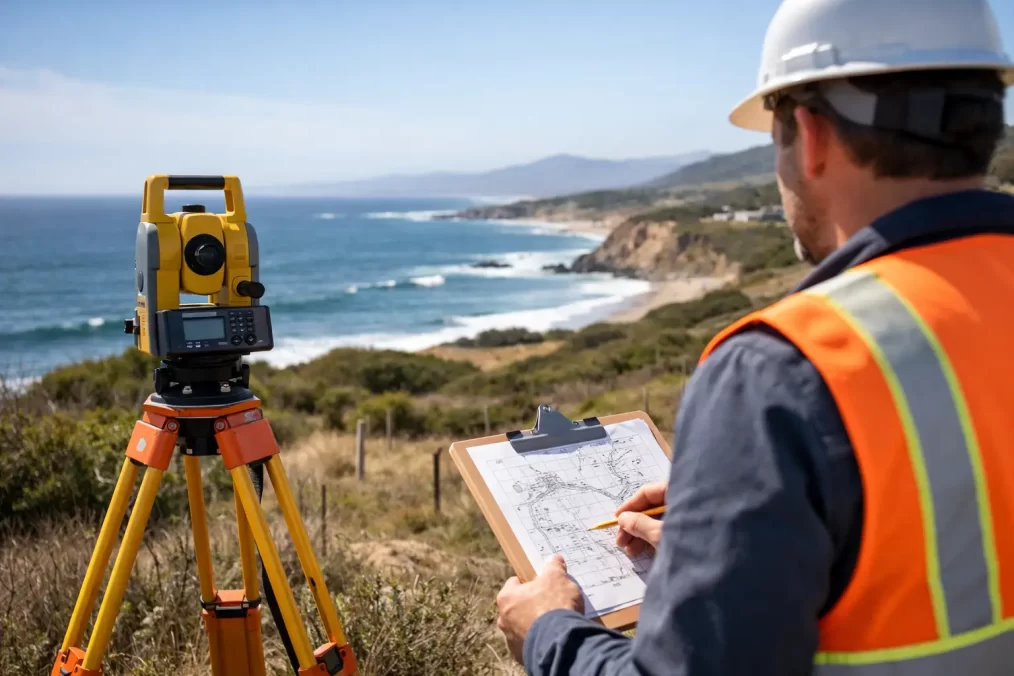
The fieldwork itself is generally straightforward, but the value comes from accuracy and experience. A surveyor attends site with specialised equipment to measure levels and features across the property. On the Central Coast, that can mean dealing with everything from narrow access and dense vegetation to steep grades and built-up residential lots.

After capture, the data is processed and drafted into a survey plan that the design team can use. That plan becomes the reference point for architectural design, engineering input and often parts of the approval documentation.

If the project later moves into construction, the same survey partner can often assist with set-out, floor level checks and final surveys. That continuity reduces handover issues because the consultant already understands the site and the approved intent.

Common site issues a topographical survey can reveal

Some of the most useful survey findings are the ones that stop assumptions early. A topographical survey may reveal that the land falls more sharply than expected, that an existing retaining wall affects the proposed extension area, or that stormwater infrastructure limits where new works can go.

It can also identify practical buildability issues. Driveway grades, access constraints, existing outbuildings, neighbouring improvements and surface drainage paths all influence how easily an extension can be built. On older properties, the relationship between the existing house and the surrounding ground can also affect finished floor levels and connection details.

None of these issues automatically stop a project. They simply need to be known early so the design responds properly.

How this helps control cost and time

The main benefit is not the drawing itself. It is the reduction in uncertainty. Better site information leads to better decisions about layout, levels, drainage and structural design. That generally means fewer redesigns, fewer approval queries and less disruption once the builder is on site.

There is also a program benefit. When architects, planners and engineers receive clear survey data early, they can progress their work faster and with more confidence. That matters when approvals are time-sensitive or when construction needs to align with financing, tenancy, family living arrangements or builder availability.

For professionals managing multiple consultants, survey accuracy also improves coordination. Everyone works from the same base information rather than interpreting site conditions differently.

Choosing the right surveyor for an extension project

For residential work, local knowledge matters more than many people expect. A registered surveyor who regularly works across the Central Coast will be familiar with the types of sites, approval conditions and practical constraints common in the region. That can help with both scope and turnaround.

It is worth choosing a consultancy that understands the full project path, not just the initial survey. An extension often involves interaction between survey, architecture, engineering, planning and later construction set-out. When the surveyor knows how that process unfolds, the initial deliverable is usually more useful.

Speed also matters, but only if it comes with accuracy. Fast turnaround is valuable when a project is waiting on survey information, yet rushed or incomplete work can create more delay later. The balance should be responsive service backed by registered expertise and reliable field-to-plan workflows.

That is the standard Central Coast Surveyors works to – clear scope, accurate site data and practical support that helps the next stage move without unnecessary hold-ups.

When to arrange a topographical survey for house extension works

The best time is before design starts in earnest. If you already know you want concept plans, council advice or builder pricing, organise the survey first. That allows the design team to respond to the actual site rather than trying to retrofit a concept once constraints emerge.

If plans are already underway without a survey, it is still worth stopping to get proper site information before the design goes too far. That small pause is often cheaper than correcting assumptions later.

A house extension is rarely just about adding floor area. It is about making the new work fit the land, the existing dwelling and the approval framework. When the survey is done properly from the outset, the rest of the project tends to move with fewer surprises and better decisions. That is usually the difference between a smooth extension and one that keeps needing to be fixed on paper and on site.

Role of Survey Services

The Importance of Residential Housing Construction in Australia and the Role of Survey Services

Australia’s residential housing market has evolved significantly, driven by population growth and urbanization. This increasing demand necessitates adherence to regulatory standards to ensure quality and safety in construction. Professional survey services play a vital role in this process.

The Role of Survey Services

Surveying is essential for successful construction, offering several key benefits:

  1. Accuracy: Surveyors provide precise boundary and topographical data, crucial for planning construction layouts within zoning laws.
  1. Regulatory Compliance: They ensure all aspects of construction meet local building codes, reducing legal risks and costly modifications.
  1. Risk Mitigation: Early identification of potential issues related to land stability and environmental impact helps avoid delays and additional costs.
  1. Quality Assurance: Regular surveys during construction maintain adherence to approved plans, ensuring the project meets quality expectations.
  1. Documentation: Detailed reports serve as compliance records and can be invaluable in case of disputes.

Conclusion

As Australia’s housing demand grows, integrating professional survey services is essential for compliance, quality, and safety. Investing in skilled surveyors ensures that new residential developments are functional, safe, and built to last, ultimately fostering a sustainable housing market.