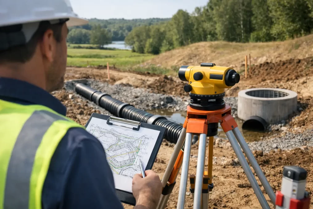
Property Title Survey Process in NSW Explained

Property Title Survey Process in NSW Explained

A title issue rarely announces itself before it affects a sale, building certificate, fence location or subdivision programme. A boundary that appears straightforward on a real estate plan may not align with occupation on site, older fencing or the dimensions required for a new registered plan. Understanding the property title survey process helps property owners and project teams identify what is needed early, engage the right professional and avoid expensive changes later.

In NSW, there is no single document called a “property title survey” that suits every situation. The process may involve an identification survey, a cadastral boundary survey, easement work or a subdivision survey, depending on the decision that needs to be made. The common thread is that a registered surveyor investigates the legal boundary and prepares survey information or plans that can be relied on for the relevant purpose.

What a property title survey process is designed to establish

Land title records describe legal interests in land, including ownership, easements, restrictions and the lot boundaries shown on registered plans. A survey examines how those records relate to the physical parcel of land.

For an existing home, the immediate need may be an identification survey for a council building certificate, waterfront licence transfer or conveyancing matter. For a new dwelling, an architect may need the boundary established before finalising setbacks and siting. For a subdivision, the work progresses through survey, plan preparation, approvals and registration to create new titles.

It is worth separating two ideas that are often confused. A title search and deposited plan provide valuable legal and dimensional information, but they do not confirm that a fence, wall or driveway sits on the boundary. Likewise, a peg found in the ground may be useful evidence, but it should not be treated as conclusive without assessment by a registered surveyor.

Step 1: Define the decision the survey must support

The fastest way to start well is to be clear about why the survey is required. A surveyor will usually ask for the property address, lot and deposited plan details if available, the scope of proposed works, and any relevant council, consultant or conveyancing requirements.

This early discussion matters because the survey standard and deliverable must match the risk. Marking an approximate line for preliminary design is different from re-establishing a boundary for construction close to a side setback. Creating an easement or new Torrens title lot requires a far more formal process than locating existing improvements for an identification report.

For Central Coast sites, access, vegetation, steep terrain, waterfront interfaces and older development patterns can all influence the time required. Raising these factors at the quoting stage allows the surveyor to plan suitable fieldwork and coordinate with architects, planners, engineers or builders before the project is held up.

Common reasons clients need title-related survey work

A property title survey process is commonly triggered by a proposed extension near a boundary, an uncertain fence line, a sale or building certificate, an easement for access or services, or a subdivision and title registration project. Each involves different documentation, so the right question is not simply “Do I need a survey?” but “What decision must this survey allow us to make?”

Step 2: Research titles, plans and survey evidence

Before attending site, the registered surveyor reviews the available land title information and relevant historical records. This can include current title particulars, deposited plans, survey plans, dealings that created easements or restrictions, and adjoining parcel information where it affects boundary definition.

The purpose is to understand the original survey framework and locate the evidence needed to test the boundary on the ground. Older parcels can be more complex than modern estates. Marks may be missing, disturbed by past construction, buried under landscaping or affected by road upgrades. Titles can also carry easements that limit where a building, pool, retaining wall or services may be placed.

Research is not administrative paperwork added after the fact. It is the foundation for defensible cadastral work. A surveyor needs to reconcile the title dimensions with surrounding marks, adjoining surveys and the broader survey control network where applicable.

Step 3: Complete fieldwork and assess the boundary

On site, the survey team searches for physical evidence such as survey marks, reference marks, old corner marks and occupation features. They also measure relevant buildings, fences, retaining walls, driveways and other improvements where these are part of the brief.

Modern instruments, including Trimble surveying technology, allow precise and efficient measurement. However, technology does not replace professional judgement. The surveyor must evaluate the quality of each mark and determine whether the evidence supports the legal boundary position under NSW cadastral requirements.

This is why a quick measurement from a phone, consumer GPS device or an old sketch is not a substitute for a registered survey. It may be useful for an early conversation, but it cannot provide the certainty needed where construction, title rights or neighbour discussions are involved.

If a boundary mark needs to be placed or reinstated, the surveyor can advise on the appropriate method. Where occupation differs from the surveyed boundary, the report or plan will identify the issue clearly so the client can obtain legal advice or adjust the project before work begins.

Step 4: Prepare the right survey deliverable

The output should be practical for the people making decisions. An identification survey typically shows the property boundaries in relation to existing improvements and may identify encroachments or other relevant observations. A boundary mark-out gives a builder or owner the physical position of a re-established boundary, subject to the survey scope.

For design work, a detail and contour survey may be combined with accurate boundary information. This gives architects and engineers a reliable base for setbacks, levels, drainage design and building placement. It is often more efficient to coordinate these requirements from the outset rather than commission separate site visits later.

For easement and subdivision work, the surveyor prepares plans and supporting documentation to meet the requirements of NSW Land Registry Services and relevant approval authorities. The plan must be accurate, compliant and consistent with the approved development pathway. Errors at this stage can delay registration and affect settlement, construction sequencing or finance arrangements.

Step 5: Coordinate approvals, signatures and registration

A subdivision or easement does not become effective simply because fieldwork is complete. Depending on the proposal, the process may involve development consent, a subdivision certificate, lender consent, utility authority requirements, council conditions, legal documentation and plan examination.

The registered surveyor works within this chain, preparing and updating survey plans as required and coordinating with the project team. A planner may manage development approval conditions, an engineer may finalise servicing design, and a solicitor or conveyancer may prepare dealings. Clear communication between these parties keeps technical issues from becoming late-stage surprises.

Once the plan and associated documents satisfy the relevant requirements, they are lodged for registration. Registration is the point at which new lots, easements or other title changes are formally recorded. Timing varies with the complexity of the project, the readiness of supporting documents and the requirements of the assessing authorities.

What can slow the process down

The most common delays are avoidable, although not every issue can be predicted. Missing boundary evidence, incomplete title information, access constraints, unapproved structures near boundaries and late changes to a building or subdivision layout can all require additional work.

A fence dispute is another example where care is needed. A survey can establish the boundary position, but it does not by itself resolve who must pay for a fence or determine legal rights arising from an encroachment. Those matters may require legal advice. The surveyor’s role is to provide accurate, independent spatial evidence on which informed decisions can be based.

For a straightforward identification survey, the pathway is usually shorter than for an easement or multi-lot subdivision. It depends on the purpose, site history, available survey marks and the level of approval and registration work involved. Requesting the survey before designs are locked in remains one of the best ways to protect programme and budget.

Choosing the right surveyor for title work

For work that defines or changes a legal boundary, engage a NSW registered surveyor. Registration, formal training and demonstrated competency matter because cadastral surveying carries legal consequences beyond ordinary site measurement.

Ask what survey type is proposed, what records will be reviewed, whether boundary marks will be located or reinstated, and what plan or report will be supplied. If your project involves a builder, architect or planner, provide their drawings and requirements early. A surveyor who can coordinate across the full project lifecycle can reduce duplicated fieldwork and keep everyone working from the same base information.

A property title survey is most valuable before assumptions become concrete, literally or financially. Whether you are preparing a building certificate, designing close to a boundary or creating new lots, early registered-surveyor advice gives the project a clear line to work from.

Land Survey Turnaround Times: What to Expect

Land Survey Turnaround Times: What to Expect

A builder waiting on set-out, an architect ready to finalise a design, or an owner facing a settlement date all have the same practical question: how soon can the survey be delivered? Land survey turnaround times can directly affect council submissions, construction sequencing, finance, contracts and legal documentation. The right answer depends on the survey type, the site and the information already available – not simply the date a surveyor attends.

For projects across the Central Coast, a clear scope and early engagement usually make the greatest difference. A registered surveyor can identify the work required, obtain the relevant records and set realistic delivery expectations before a delay becomes costly.

Typical land survey turnaround times

There is no single timeframe for every survey. Fieldwork may take only a few hours on a straightforward residential block, but research, processing, plan preparation, coordination and certification can take longer than the site visit itself.

A detail and contour survey for a typical accessible residential site is often one of the faster services. Once the work is booked, site data can generally be captured efficiently using modern survey equipment, then processed into a plan suitable for an architect, designer or engineer. Complex topography, dense vegetation, large acreage, waterfront conditions or restricted access can extend the programme.

Identification surveys and boundary mark-outs require more title and cadastral research than a topographical survey. The surveyor must examine deposited plans, title information, existing marks and the legal relationship between neighbouring parcels before giving an opinion on boundaries. If original marks are missing, disturbed or difficult to locate, additional fieldwork and calculation may be needed. That diligence protects the client from relying on an assumption about where a boundary lies.

Construction set-out can be arranged quickly when approved drawings, coordinates, levels and site access are ready. However, the timing is tied closely to the builder’s programme. Changes to architectural or engineering drawings, unprepared excavation or an inaccessible site can mean a return visit is necessary.

Subdivision, easement and strata work operates on a different timescale. Survey preparation is only one part of a broader approval and registration process involving councils, certifiers, planners, solicitors, lenders, utility authorities and NSW Land Registry Services. A survey plan may be prepared promptly, but the overall project cannot progress until each required party has reviewed, approved or executed their component.

What actually affects survey delivery

The most common reason for delayed survey delivery is an incomplete brief. A request for a “survey” can mean very different things: a contour plan for a new dwelling, an identification survey for a building certificate, a boundary re-establishment before fencing, or a full subdivision plan for registration. Each has different legal, technical and drafting requirements.

The site itself also matters. A cleared, accessible block with visible survey marks is not comparable to a steep bush block, a waterfront parcel, a property with extensive retaining walls, or a site affected by tidal conditions. Central Coast properties can present a mix of undulating terrain, mature vegetation, narrow access, older development and complex title history. These conditions do not prevent accurate work, but they need to be allowed for in the survey programme.

Information from the client and project team is equally influential. Current architectural plans, engineering drawings, DA conditions, previous survey plans, the correct lot and DP details, and contact details for site access all help the surveyor begin without avoidable back-and-forth. For construction work, issuing the latest approved drawings is essential. Setting out from superseded plans creates far greater risk than waiting briefly for the correct information.

External parties can also affect timing. An identification survey may need clarification of adjoining title information. A subdivision may require council conditions to be satisfied before the final plan can proceed. Easement plans can require agreement between affected owners and review by legal representatives or service authorities. These are not surveying delays in the narrow sense, but they are part of the real project timeline.

Weather is another variable, particularly for detailed feature surveys and construction set-out. Heavy rain, flooding, unsafe ground conditions and poor visibility can make fieldwork impractical or compromise the accuracy expected from a professional survey. A short reschedule is preferable to collecting data that does not meet the standard required for design or construction.

Faster is useful only when the scope is right

Rapid delivery is valuable when a project team is waiting to make a decision. But speed should not mean skipping cadastral research, reducing site checks or issuing a plan that does not suit its intended purpose.

For example, a designer may only need a detail and contour survey to establish levels, visible features, services and site constraints for concept design. A builder preparing to build close to a side boundary may need a cadastral boundary mark-out as well. Treating those as the same service can produce a fast result that is insufficient for the next stage.

The most efficient approach is to tell the surveyor what decision the plan needs to support. Is it for a DA, a building certificate, a waterfront licence transfer, fencing, excavation, a new dwelling, subdivision or final registration? This enables the registered surveyor to recommend the correct survey at the outset and avoids paying for a second mobilisation or revised plan later.

How to reduce delays before the surveyor arrives

Clients and consultants can materially improve turnaround by preparing the job properly. Provide the full property address, lot and deposited plan details where known, the purpose of the survey, expected delivery date and any relevant plans or approval documents. If there is a known issue – such as a neighbour dispute, missing fence alignment, difficult access or an urgent settlement – raise it early.

Site access should be confirmed before the booking. Gates need to be unlocked, dogs secured, tenants or occupants notified, and any access restrictions explained. On vacant land, clear directions and safe entry can save significant time. For construction sites, the surveyor should know site induction requirements, PPE expectations, crane or plant movements and the appropriate site contact.

Project teams should also nominate who will receive the final files. Architects may need a PDF plan and CAD data. Engineers may require a particular coordinate system or file format. Builders may need marked-up construction drawings and a set-out appointment coordinated with excavation or formwork. Agreeing these requirements early prevents a technically correct deliverable from being unusable in practice.

When a deadline is genuinely fixed, explain why. A pending council lodgement, concrete pour, contract condition or finance date helps the surveyor assess whether the work can be prioritised, whether more information is needed immediately, and whether another sequencing option may protect the programme.

Turnaround for approvals, construction and title work

Different project stages call for different expectations. A preliminary feature survey is often the starting point for design and may need to be commissioned before the architect can make meaningful progress. Waiting until plans are nearly complete can force redesign if levels, easements, drainage features, vegetation or boundary conditions reveal constraints.

During construction, set-out is most effective when it is treated as part of the programme rather than an emergency booking. Give notice before excavations, pier drilling, formwork, structural steel or final floor-level checks. The surveyor can then coordinate the right control, drawings and field time to support the construction sequence.

For subdivision and title matters, allow time for the full chain of actions. Survey work must align with planning approvals, servicing requirements, legal documentation, owner signatures and registry processes. A registered surveyor can explain the surveying component clearly, but no responsible consultant should promise a registration date before the external requirements are understood.

Questions to ask when comparing survey quotes

Price matters, but a low quote without a defined scope can be expensive if the work does not satisfy the next consultant, council requirement or construction need. Ask whether the quoted timeframe covers fieldwork only or the completed plan, what files are included, whether title and cadastral research is included, and what assumptions have been made about access and site conditions.

It is also reasonable to ask who will undertake and review the work. For boundary, identification, subdivision and title matters, the involvement of a registered surveyor is central to reliable advice and compliant documentation. Experience with local development patterns, council expectations and NSW land title processes can reduce uncertainty where a job is not straightforward.

Central Coast Surveyors approaches timing as a project commitment rather than a generic promise. The goal is to provide the survey information the next decision-maker needs, when they need it, while preserving the accuracy and compliance that protects the project.

If your programme has a fixed milestone, raise the survey requirement before that milestone becomes urgent. A short conversation at feasibility, design or pre-construction stage can often prevent weeks of avoidable waiting later.

A Guide to Floor Level Compliance in NSW

A Guide to Floor Level Compliance in NSW

A proposed finished floor level can look like a single number on an architectural drawing. In practice, it can determine whether a home is suitable for a flood-prone site, whether a development consent condition has been met, and whether construction proceeds without expensive redesign. This guide to floor level compliance explains what that number means, who sets it, and how an accurate survey keeps a Central Coast project moving.

What floor level compliance means

Floor level compliance is the process of confirming that a building’s finished floor level, or FFL, meets the level required by the applicable approval, planning controls and site constraints. The required level may be driven by flood planning, drainage, coastal inundation, access, existing development, engineering design or a specific condition of consent.

There is no single compliant floor level for every NSW property. A level appropriate for a flat, serviced block in an established estate may be unsuitable for a waterfront site, a floodplain, or a sloping rural lot. The relevant requirement needs to be established for the particular land and proposal before design is fixed or concrete is poured.

A surveyor’s role is to accurately establish and report levels on a recognised datum, set out the approved design level on site where required, and verify the constructed level. The survey does not replace planning advice, engineering certification or the decision of the consent authority or certifier. It provides the reliable spatial evidence those decisions depend on.

Start with the right datum and the right site information

A floor level only has meaning when everyone is working from the same reference system. In NSW, project levels are commonly related to Australian Height Datum, known as AHD. This is the vertical datum used for many council records, flood studies and engineering designs.

Problems arise when plans use a temporary site datum, an assumed level, or a datum transferred incorrectly from an earlier drawing. A difference that appears minor on paper can become significant where a flood planning level is involved. Before relying on a stated FFL, confirm the datum shown on the survey, architectural plans, civil design and approval documents is consistent.

For an existing home, a floor level survey records the actual height of the floor at selected points, generally in relation to AHD. It may also capture surrounding ground levels, kerbs, drainage features, nearby structures and other information relevant to the brief. The scope should match the question being asked. A report for a building certificate or flood assessment may need different detail from a construction check of a new slab.

On the Central Coast, this early verification is particularly useful for sites influenced by creeks, lagoons, lakes, tidal waterways or steep terrain. Local conditions can change substantially over a short distance. Do not assume a neighbour’s floor level, or a figure from a historic plan, applies to your site.

How a compliant floor level is determined

The required level is usually established through the planning and approval process, not selected by the builder or surveyor in isolation. The assessment may draw on council planning controls, a flood study, the adopted flood planning level, the development consent, engineering advice and the building design.

For flood-affected land, the flood planning level is often based on a nominated flood event plus a freeboard allowance. The exact approach, event and allowance depend on the applicable controls and circumstances. Some proposals may also require consideration of evacuation, flood-compatible materials, garage levels, habitable and non-habitable areas, or variations supported by specialist evidence.

The key distinction is between the required design level and the level that has actually been built. Both need attention. A sensible workflow is to establish the existing site levels before design, document the approved FFL clearly, set it out during construction, then obtain an as-built floor level report when the slab or floor is complete.

Common terms on plans and reports

Finished floor level is the intended final height of the occupied floor surface. For a concrete slab, clarify whether the stated level refers to the top of slab, a future finished floor covering, or another nominated point.

Natural ground level describes the ground surface before proposed earthworks, although its definition can vary in planning controls and must be checked carefully. Existing ground level is what the survey records at the time of survey. They are not always identical.

Freeboard is an additional vertical allowance above a nominated flood level. It is intended to provide a margin for uncertainty and safety, but it is not a substitute for checking the actual planning requirement.

A benchmark is a fixed reference point with a known level. It allows levels to be checked and transferred consistently during design and construction.

A practical guide to floor level compliance before construction

The best time to resolve a floor-level issue is before the design, engineering and approval documents are locked in. Once excavation, fill or a slab has commenced, correcting a level can affect cost, programme, access and drainage outcomes.

A practical sequence is to first obtain a current detail and contour survey that identifies the land, existing improvements and levels on an appropriate datum. Next, have the project team confirm the planning and approval requirements that apply to the proposed building. The architect and engineer can then nominate a design floor level that addresses those requirements while still working with site access, stairs, ramps, driveway grades, ceiling heights and stormwater design.

Before the pour, the builder should have the approved level available on site and arrange construction set-out where needed. This is not simply a matter of marking a height on a peg. The set-out must relate correctly to the design drawings, boundary position, site works and datum. Once the relevant floor has been constructed, an as-built survey can verify the achieved level against the approved requirement.

This sequence is especially valuable where several consultants are involved. A clear survey drawing and a shared datum reduce the risk of an architect designing from one level source, an engineer using another and a contractor building from a third.

What a floor level report should answer

A useful report should be clear enough for the intended reader to compare the measured floor level with the relevant required level. Depending on the purpose and agreed scope, it may identify the property, survey date, datum, benchmark or control information, measured floor levels, relevant ground levels and a plan showing where observations were taken.

The report should also state what has and has not been assessed. For example, a report may measure a floor at accessible locations but not determine whether a proposed extension satisfies every condition of a development consent. That assessment may require the consent documents, flood advice, engineering drawings and input from the appropriate approval professional.

Accuracy matters, but so does communication. A level expressed as 4.62 m AHD is only useful if the recipient understands where it was measured, what surface it represents and which requirement it is being compared against.

Where projects commonly go wrong

The most frequent issue is relying on incomplete or outdated information. An old contour plan may not show later filling, renovations, road upgrades or drainage works. Similarly, a preliminary architectural FFL can remain on drawings after approval conditions have changed.

Another common problem is treating floor level as separate from the rest of the design. Raising a home may improve flood performance, but it can create difficult driveway grades, additional retaining, stairs, accessible-entry challenges or altered overlooking impacts. Lowering the building may assist streetscape outcomes but reduce the available margin above a flood-related requirement. These trade-offs need to be considered early by the full project team.

It is also risky to request a report only after a concern has been raised by council, a certifier, insurer or purchaser. A post-construction report can establish what exists, but it cannot retrospectively make a non-compliant level compliant. Early surveying gives the team choices; late surveying often confirms a problem when choices are limited.

When to engage a registered surveyor

Engage a registered surveyor at feasibility stage if the property has flood, waterfront, slope, boundary or complex title considerations. For a straightforward new build, arrange the initial survey before design and discuss whether construction set-out and an as-built floor level report will be needed under the approval pathway.

Provide the surveyor with the site address, available plans, proposed use of the report and any known consent conditions or flood advice. If a particular FFL has already been nominated, provide that figure and its stated datum. This helps the survey scope target the information your architect, engineer, planner, certifier or council officer will actually need.

Central Coast Surveyors can coordinate the site survey, construction set-out and final level verification with the wider consultant team, so the project is working from one dependable source of level information. The practical aim is simple: establish the right level early, build to it accurately, and retain clear evidence when the project needs it.

Why Site Levels for Drainage Design Matter

Why Site Levels for Drainage Design Matter

A drainage plan can look sensible on paper and still fail on site if the ground levels are wrong. Accurate site levels for drainage design give the architect, civil engineer and builder a reliable picture of where water will travel, what can be built, and how the finished site can drain without creating problems for the building or neighbouring land.

On the Central Coast, this is rarely a theoretical exercise. Sloping blocks, low-lying land, waterfront locations, reactive soils and intense rainfall can all make minor level errors expensive. A detail and contour survey completed early provides the measured data needed to make sound drainage decisions before design work, approvals and construction are underway.

What site levels mean in a drainage plan

Site levels are the surveyed heights of features and ground points across a property. They are commonly shown relative to Australian Height Datum (AHD), a recognised vertical reference system. Using a consistent datum allows different consultants to work from the same information and compare proposed levels with existing roads, stormwater systems, floor levels and neighbouring properties.

For drainage design, a survey needs to capture more than a few spot heights. The civil engineer needs sufficient levels to understand the landform, including contours, ridges, swales, low points, driveways, kerbs, drainage pits, channels, retaining walls, building footprints and visible stormwater infrastructure.

The purpose is straightforward: water moves downhill. The design team must know the actual direction and grade of that downhill path, rather than relying on an assumed fall or an old plan that may not reflect current conditions.

Existing levels versus proposed levels

Existing levels record the site as it stands before work begins. Proposed levels show how the site is intended to be after earthworks, building construction, paving, landscaping and drainage installation.

The difference between the two is where much of the project risk sits. Raising a building pad may improve flood resilience or create usable outdoor space, but it can also change how runoff reaches a boundary. Lowering a driveway may improve vehicle access while making it harder to maintain a practical fall away from the dwelling. Good drainage design weighs these connected decisions rather than treating them as separate items.

Why accurate site levels for drainage design save time

Drainage relies on gradients. If the survey levels are incomplete, incorrectly referenced or too widely spaced, the engineer may design pipe grades, pit levels and surface falls that cannot be achieved when the builder starts work. The result can be redesign, additional excavation, deeper pits, retaining walls, pumps or delays while consultants resolve the issue.

Accurate levels also help the team identify constraints before they become construction variations. These may include a shallow public stormwater connection, a road kerb that is higher than the proposed driveway, a neighbouring property that sheds water towards the site, or a low section of land that needs a carefully controlled overland flow path.

For homeowners, this early clarity can prevent the common and frustrating outcome of completing a new home, extension or hardscape only to find water ponding near doors, crossing a path or collecting against a retaining wall. For developers and builders, it supports more reliable costing and construction programming.

The levels a drainage designer usually needs

The exact survey scope depends on the site and project, but drainage design commonly relies on levels at key locations across the block and beyond its boundaries where relevant. A useful detail and contour survey may include the following information:

  • Ground levels and contours that show the natural fall of the land.
  • Finished floor levels for existing buildings, plus thresholds, garages and external doors where available.
  • Boundary features such as fences, walls, retaining structures and changes in surface treatment.
  • Driveway, footpath, road, kerb and gutter levels, including nearby drainage pits.
  • Visible stormwater pipes, pits, headwalls, channels and outlets.
  • Significant trees, rock outcrops, watercourses and other physical constraints.

Not every project needs the same density of information. A relatively flat suburban block with a known kerb outlet may need a different survey scope from a steep block at Terrigal, a rural site with long overland flow paths, or land close to a creek or foreshore. The right approach is to define the intended use of the survey before fieldwork begins.

Floor levels are not just a building detail

The relationship between finished floor level and surrounding ground is critical. External paving and landscaped areas need enough fall away from the building to direct surface water away from walls, openings and subfloor areas. At the same time, proposed levels must work with accessible entries, driveway grades, ceiling heights, flood requirements and the available drainage point.

There is no universal finished floor level that suits every property. The appropriate level depends on site topography, planning controls, flood information where applicable, the building design and the lawful drainage strategy. Surveyed data gives the design team a dependable starting point for that assessment.

Surface drainage and pipe drainage need to work together

A frequent misconception is that underground pipes alone solve drainage. Pipes are only part of the system. During heavy rain, debris, blocked grates or rainfall greater than the system’s design capacity can cause water to travel over the surface. That surface flow needs a safe and deliberate route.

The drainage designer may use grades, spoon drains, grated drains, pits and pipes to collect normal runoff. They also consider overland flow paths so water does not become trapped against the house, garage, boundary wall or neighbouring property.

This is particularly relevant where a new retaining wall, pool, granny flat, driveway or extension alters natural drainage. Even a small level change can redirect runoff. Surveying the existing site accurately makes it easier to see what has changed and design practical measures around it.

Datum control matters more than most people expect

Levels are only useful when everyone is working from the same vertical reference. A site plan may show relative levels, but if those levels are not connected to a reliable datum, it can be difficult to coordinate drainage with external services or confirm final construction levels.

A registered surveyor can establish and document suitable control for the project. This gives architects, engineers and builders a common reference for design, set-out and verification. It also reduces the risk of one consultant using a different assumed datum from another.

For projects involving flood planning, public drainage infrastructure or complex civil works, AHD levels are often especially valuable because they allow levels to be assessed against external information. The required approach should be confirmed with the relevant design and approval team.

From survey to buildable drainage outcome

The most efficient sequence is to obtain a detail and contour survey before the building and civil design are fixed. The surveyor captures the site and relevant surrounding features, then supplies clear digital and plan information for the project team. The architect and engineer can develop floor levels, finished surfaces, stormwater design and any required earthworks using measured data rather than estimates.

Once the design is approved, construction set-out translates those proposed levels to the ground. Set-out is not simply marking a building footprint. Depending on the scope, it can include building corners, excavation levels, retaining walls, driveways, drainage pits and other design elements that need to be constructed at a specific level.

A final survey or level check may then be appropriate where compliance, certification, flood requirements or construction tolerances need to be demonstrated. The scope depends on the project and the requirements of the certifier, engineer, council or client.

Clear roles avoid gaps between consultants

The surveyor measures and establishes the spatial framework. The civil or hydraulic engineer designs the drainage solution, including pipe sizing, grades and lawful discharge arrangements. The architect coordinates the building design, while the builder constructs the works to the documented levels.

These roles overlap at key points, which is why early coordination matters. A registered surveyor who understands construction and approval workflows can provide data in a form the wider team can use efficiently, identify obvious site constraints, and respond when further set-out or verification is needed.

Questions to raise before commissioning a survey

Before arranging a survey for a drainage-related project, explain what is being proposed and who will use the information. Is it for a new dwelling, an extension, a subdivision, a driveway, a pool, a retaining wall or stormwater design? Will a civil engineer require AHD levels? Is there a known drainage easement, public pit, creek, flood issue or difficult access?

It is also worth asking whether levels are needed beyond the property boundary. Road kerb and gutter, adjacent ground levels and visible drainage structures can be essential to understanding the available drainage path. Capturing them early is generally more efficient than sending a survey crew back after the design team identifies a missing level.

Good drainage starts with an honest reading of the land. When the existing site is measured properly, the project team can make level decisions early, coordinate with confidence and build a result that directs water where it needs to go.

As Constructed Survey Requirements in NSW

As Constructed Survey Requirements in NSW

A driveway may look complete, a drainage line may already be covered and a new building may be ready for occupation. But if the final works do not match the approved design, or nobody can demonstrate their finished location and level, the project can stall at the point it should be closing out. Understanding as constructed survey requirements before construction starts gives owners, builders and design consultants the evidence needed to manage approvals, certification and future asset records with far less pressure.

An as constructed survey is not simply a final site measure. It is a record of what was actually built, positioned and installed on the land. On Central Coast projects, it is often the document that connects the approved plans, construction work and final compliance process.

What is an as constructed survey?

An as constructed survey, also called a work-as-executed survey, accurately records completed works in relation to property boundaries, design set-out, existing features and a recognised level datum. The resulting plan shows the constructed outcome rather than what was proposed at design stage.

The information captured depends on the project. For a new dwelling, that may include the building footprint, finished floor level, driveway grades, retaining walls, stormwater infrastructure and the relationship of the work to boundaries. For civil or subdivision works, it may cover roads, kerbs, pits, pipes, basins, service connections, easements and finished surface levels.

A registered surveyor uses survey control, field observations and appropriate equipment to produce reliable spatial data. This is materially different from measuring from a construction drawing, relying on a contractor’s mark-up, or estimating locations after excavation has been backfilled.

Why the requirements vary from project to project

There is no single checklist that applies to every NSW site. As constructed survey requirements are usually driven by the development consent, approved engineering drawings, construction certificate conditions, certifier requests and the asset owner’s specifications. A council may require particular drainage or public infrastructure details, while a private certifier may need clear confirmation of building levels and setbacks.

The most efficient approach is to review the relevant documents before work begins. Waiting until practical completion can create an avoidable problem: the critical pipe, pit invert or footing level may no longer be visible, and the surveyor may have to work around finished landscaping, paving or structures.

For works connected to council-controlled assets, the requirements can be particularly detailed. Plans may need nominated coordinates, Australian Height Datum levels, pipe sizes, materials, invert levels, pit details, connection points and final road or drainage grades. The required format, scale, annotation and digital files should be confirmed with the relevant authority rather than assumed from a previous job.

Consent conditions come first

The development consent and stamped plans are the starting point. Look for conditions requiring a work-as-executed plan, certification of drainage, confirmation of finished levels or evidence that an approved design has been followed. Conditions may specify when documents must be provided, such as before the release of a subdivision certificate, occupation certificate or final asset handover.

If changes were made on site, the team also needs to establish whether they are minor construction adjustments or changes that require formal approval. A survey can identify the difference, but it does not make a non-compliant variation acceptable. Early communication between the owner, builder, certifier, engineer and planner is usually the quickest way to resolve it.

Engineering designs set the technical detail

Civil engineers commonly nominate the features and tolerances that require verification. This may include design surface levels, kerb alignments, pipe grades, drainage structures, detention systems and retaining wall locations. Their specifications may also identify a coordinate system, datum and required survey accuracy.

A good survey plan makes it easy for the engineer to compare design against construction. It should provide clear, usable information, not a crowded drawing that leaves the reviewer guessing which level or structure is being shown.

What an as constructed plan commonly includes

The exact scope should be set for the job, but most plans need enough information to identify the site, locate the constructed works and verify key levels. That generally means title details, boundaries, north point, survey datum, plan scale and notes explaining the survey basis.

For a residential building project, the survey may record the following elements where relevant:

  • building corners and external walls, including distances to boundaries;
  • finished floor levels, garage levels and relevant threshold levels;
  • retaining walls, decks, pools, driveways and external stairs;
  • stormwater pits, pipes, outlets, on-site detention components and easement connections; and
  • finished ground levels where drainage, flood planning or building height is being assessed.

For subdivision and civil construction, the plan can be more extensive. It may need to show lot boundaries, road works, footpaths, kerbs, services, manholes, pits, pipe inverts, headwalls, drainage structures, batters and public-domain works. A schedule of coordinates and levels is often useful where an asset owner needs data for its records.

Not every feature needs the same level of detail. Recording every garden edge on a completed house site adds cost without necessarily helping approval. Conversely, omitting a stormwater connection because it is concealed can prevent final certification. The survey brief should focus on the items the approval authority, engineer or certifier must assess.

When to arrange the survey

The best time to engage a surveyor is before the work starts, ideally as the construction set-out and engineering documentation are being finalised. This allows the survey team to check the conditions, establish control and identify hold points for features that will later be hidden.

For a typical dwelling, a survey may be needed after slab completion to confirm location and level, then again when external drainage and site works are complete. A drainage inspection before trench backfill can be essential where pipe alignment, depth and invert levels need to be proven.

On larger civil jobs, as constructed observations are often collected progressively. Surveying kerb, pavement, pits and pipework at the relevant construction stages is more accurate and usually more economical than attempting one large final survey. It also gives the project manager an early warning if finished works depart from design tolerances.

Accuracy, datum and boundary confidence

A plan is only useful if its measurements are referenced properly. Levels need a clear datum, commonly Australian Height Datum where required by the approval or engineering design. Coordinates also need to match the project’s nominated system so data can be compared without introducing conversion errors.

Boundary issues deserve separate attention. An as constructed survey can show the relationship between visible works and a boundary, but the certainty required depends on the purpose. If a new wall, building or structure is close to a title boundary, a cadastral survey and boundary mark-out by a registered surveyor may be needed before construction, not merely at final inspection.

This distinction matters on constrained sites around Terrigal, Avoca Beach and other established Central Coast suburbs, where older fencing, sloping land and tight setbacks can make assumptions expensive. A fence is not reliable evidence of the legal boundary, and an approved building design does not remove the need for accurate construction set-out.

Common causes of close-out delays

Most late problems are preventable. The first is treating the final survey as an administrative task rather than part of construction quality control. By the time a certifier asks for evidence, the necessary features may be concealed.

The second is using the wrong documents. A surveyor needs the current approved architectural and civil drawings, not an early concept plan or a superseded issue. The third is unclear responsibility. On many projects, the owner assumes the builder is arranging the survey, while the builder assumes the engineer or developer will do it.

A short pre-start conversation can settle the scope, timing and deliverables. Confirm who will supply drawings, which works require pre-backfill observations, whether a registered surveyor’s certification is needed, and who receives the final PDF and any digital survey files.

Choosing the right survey support

The lowest-priced final plan is not always the lowest project cost. A surveyor who understands the approval pathway can identify missing inputs before the team reaches a deadline. They can also coordinate with architects, engineers, certifiers and construction crews so measurements are taken when access is available and the information is still visible.

For clients, the practical questions are straightforward: What does the consent require? Which features must be captured? At what stage should the survey occur? And does the plan need registered surveyor certification or a specific authority format?

Central Coast Surveyors can review the available plans and conditions, define a survey scope suited to the works, and coordinate field observations around the construction programme. That support is particularly valuable where levels, drainage, boundary proximity or subdivision works affect the final approval.

Treat the as constructed survey as a planned project record, not a document to chase at the finish line. When the right information is captured at the right time, final certification and handover become a controlled next step rather than a costly search for evidence.

Registered Surveyor Selection for NSW Projects

Registered Surveyor Selection for NSW Projects

A boundary shown in the wrong place, a missed easement or a plan that cannot proceed to registration can hold up a project long after the survey fee has been paid. That is why registered surveyor selection should begin with the work your project actually requires, not simply the first available quote. For Central Coast property owners and project teams, the right surveyor provides accurate information early, keeps consultants aligned and helps prevent expensive rework later.

Why registration changes the decision

Not every person who measures a site is qualified to complete every type of land survey. In NSW, cadastral work – work that determines property boundaries, creates new parcels or easements, or supports plans for title registration – must be carried out and certified by a registered land surveyor where required. This is a professional responsibility backed by formal qualifications, practical training, competency assessment and registration.

That distinction matters when your decision affects ownership, construction location or a legal plan. A building designer may need a detailed topographical survey to start a concept. A builder may need set-out marks to position a slab. A solicitor, purchaser or council may need an identification survey to address a building certificate, encroachment concern or waterfront licence transfer. Some projects need one service; a subdivision often needs coordinated surveying from initial feasibility through to registration.

Registration is not a marketing label. It is a safeguard that the person taking responsibility for cadastral decisions has the authority and competence to do so. Ask who the registered surveyor is, whether they will review and certify the relevant work, and whether their registration is current. It is sensible to verify registration through the NSW surveying regulator rather than relying on broad descriptions such as ‘licensed’, ‘qualified’ or ‘experienced’.

Start registered surveyor selection with the project outcome

The best surveyor for a straightforward boundary mark-out may not be the best fit for a multi-stage townhouse subdivision, and vice versa. Explain what you are trying to achieve before asking for a price. Include the property address, any plans you already have, the stage of the project and the deadline that matters.

For a new home, extension or retaining wall near a boundary, the immediate need may be an identification survey or cadastral boundary mark-out. These services establish how existing improvements relate to title boundaries and can reveal issues before design is locked in. Assuming a fence is the boundary is risky, particularly on older sites where fences may have shifted, been rebuilt or never aligned with the legal boundary.

For an architect or engineer, a detail and contour survey may be the starting point. It should provide reliable levels, site features, structures, services visible on site and enough surrounding information for a workable design. The required coverage differs between a modest dwelling and a steep, constrained or waterfront site. A low initial fee has little value if the design team later needs a return visit to capture omitted features or levels.

For a developer, clarify the intended title outcome from the outset. Torrens title, strata and community title subdivisions each have different requirements, sequencing and consultant interfaces. Easement creation also needs careful coordination between owners, legal advisers, planners, engineers and the surveyor. Choosing a practice that can support the full pathway can reduce handovers and preserve critical project knowledge.

Look beyond a generic scope of work

A useful quote identifies the survey type, deliverables, assumptions and exclusions. It should make clear whether the fee includes fieldwork, title research, plan preparation, council or authority liaison where applicable, lodgement work, and the registered surveyor’s certification. If the project has multiple stages, ask whether the proposal covers only the first survey or the work required through construction and registration.

This is particularly important with subdivision and title matters. The cost can depend on title complexity, the number of lots, existing easements and restrictions, utility authority requirements, planning conditions, access to marks, construction progress and whether additional survey work is needed after design changes. An honest surveyor will explain what can be fixed up front and what may vary as approvals or site conditions develop.

Compare deliverables rather than comparing a single total. One proposal may include a detailed digital file for the architect, contour data at the required interval and coordination with the engineer. Another may provide a basic plan that is adequate for a preliminary conversation but not for final design. Neither is automatically wrong, but they are not equivalent services.

Assess local knowledge and site judgement

Surveying is precise work, but good judgement is just as valuable. Central Coast projects can involve steep terrain, irregular older subdivisions, narrow access, coastal exposure, bushfire constraints, waterfront interfaces and dense established neighbourhoods. These conditions affect how a survey is planned, how much field time is required and which project risks need to be raised early.

Local experience can also improve the practical flow of a job. A surveyor familiar with local development patterns understands the information designers and planners commonly need, and can anticipate where a site may need more thorough investigation. That does not replace a formal assessment of your property, but it can save time when the project is moving from feasibility to approval and then construction.

Ask how the surveyor will work with the wider team. The strongest arrangements are collaborative: survey data is issued in a format the architect, engineer or planner can use; queries are answered promptly; and construction set-out is coordinated with the builder’s programme. Surveying should not become a disconnected task that delays every other consultant.

Consider turnaround in context

Fast turnaround is valuable when an architect is waiting to begin design, a builder needs set-out before a concrete pour or a settlement date is approaching. However, speed must be matched with adequate research, field verification and checking. Cadastral records, title information and site evidence need to be reconciled properly. The right question is not simply, ‘How quickly can you attend?’ It is, ‘When will I receive a checked deliverable that my next consultant can rely on?’

Provide the real deadline and explain why it matters. A surveyor can then advise whether the timeframe is realistic, what information is needed from you, and whether access arrangements may affect the programme. For occupied homes, ensure gates are unlocked, pets are secured and tenants or neighbours are informed where access is required. Small delays at this stage can disrupt an otherwise tight schedule.

Technology supports efficiency too. Modern equipment, including Trimble survey technology, can capture and process accurate site information efficiently. But equipment alone does not determine survey quality. The planning, controls, checks and professional interpretation behind the data remain essential.

Use the first conversation to test responsiveness

You do not need to be a surveying expert to judge whether a consultant communicates clearly. A dependable surveyor should be able to explain the proposed service in plain language, identify information that is still unknown and outline the next steps without making unrealistic promises.

Ask who your day-to-day contact will be, how design changes are handled, what files or plans you will receive and whether the surveyor can remain involved through later stages. If boundaries are uncertain, ask whether the recommended service will establish them or merely show visible occupation. If registration is the goal, ask what approvals, construction certification or external inputs must be completed before a plan can be lodged.

For larger projects, experience with coordination is often worth more than a modest saving at the first stage. A surveyor who can identify a missing piece of information early and speak directly with the relevant consultant may prevent a far more costly delay on site.

Choose value that protects the whole project

Price matters, and a clear quote helps you budget. Yet the cheapest option can become expensive when its scope is incomplete, its turnaround is uncertain or the deliverable cannot be used for the next decision. On the other hand, the highest fee is not automatically the best choice if it includes work your project does not need. The aim is a proportionate service delivered by a properly registered professional who understands the outcome you are working towards.

Before engaging, confirm the property details, intended use of the survey, deliverables, programme and responsible registered surveyor in writing. Give the surveyor complete information, including old plans, notices, concept drawings and known disputes or encroachments. Clear information at the beginning allows the right work to be scoped, rather than discovered halfway through the job.

A well-chosen surveyor does more than supply measurements. They give your design, approval, construction or title process a dependable starting point – and that is often where a smoother project begins.