
How to Verify Boundary Marks on Your Property
A fence that has stood for 30 years can still be in the wrong place. So can a garden edge, retaining wall, driveway or neighbour’s informal ‘boundary peg’. If you are asking how to verify boundary marks, the key point is simple: finding a mark is not the same as proving a legal boundary.
For Central Coast property owners, this distinction matters before fencing, building near a side boundary, buying or selling, applying for a building certificate, resolving a neighbour discussion, or planning a subdivision. A boundary error can lead to redesign costs, construction delays and difficult disputes that were avoidable with the right survey evidence.
What counts as a boundary mark?
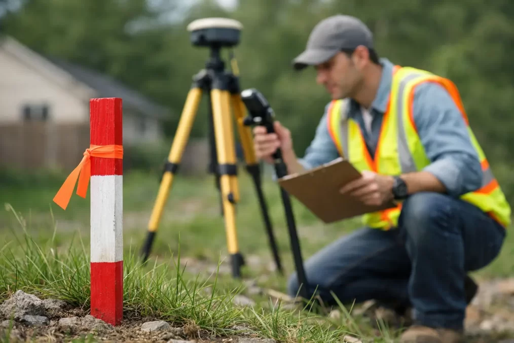
Boundary marks are physical reference points that help define the legal limits of a parcel of land. Depending on the age and type of subdivision, they may include survey pegs, metal pipes, nails, drill holes, concrete marks, reference marks or marks set into kerbs and walls.
Not every visible object near a boundary is an official survey mark. Old timber pegs can rot, be shifted or be mistaken for building set-out pegs. A star picket may have been installed for a fence. A concrete path may have been poured over a mark. Even a genuine survey mark cannot be relied on in isolation without checking it against the registered plan, title information and surrounding survey evidence.
The legal boundary is established through the cadastral survey process, not by the fence line or what a neighbour believes has always been accepted.
How to verify boundary marks correctly
Verification is a process of gathering and assessing evidence. It is not a matter of measuring from a kerb with a tape measure or using a mobile mapping app. Those methods can be useful for rough orientation, but they cannot establish a boundary suitable for construction, legal documentation or dispute resolution.
Start with your title and deposited plan
Your Certificate of Title and deposited plan provide a starting point. They identify the lot, plan number, dimensions, easements and other registered interests affecting the land. The plan may show boundary lengths, angles, curved frontages and the relationship between lots.
However, plans are technical documents. A listed dimension does not always translate into a straightforward on-site measurement. Older plans may reference original marks that are no longer visible, while later developments can involve multiple stages, easements, road widening or changes to adjoining parcels.
Title information also does not show where a boundary sits on the ground in a way that makes it safe to build a wall, place a fence or excavate. It must be interpreted alongside physical evidence and relevant survey records.
Look for marks, but do not move them
You can inspect the property for visible marks at corners, along side boundaries and near the road frontage. Check garden beds, fence returns, driveway edges and areas near retaining walls, where marks may be obscured. Take clear photos and note their approximate positions for the surveyor.
Do not dig aggressively, remove soil around a mark, pull it out or replace a missing peg yourself. A mark may be evidence that needs professional assessment, and moving it can create confusion or compromise the survey. It may also be an offence to interfere with a survey mark.
Visible marks are useful clues. They are not a DIY confirmation of ownership.
Compare the site with the survey evidence
A registered land surveyor examines the available plans and survey records, then searches for and assesses marks on the subject land and often on neighbouring land or in the road reserve. The surveyor considers the age, type and condition of each mark, as well as its relationship to other original and reference marks.
This is where professional judgement matters. Surveyors do not simply accept the nearest peg. They weigh the evidence under NSW surveying requirements to determine whether a mark is original, undisturbed and consistent with the adopted boundary definition.
Modern Trimble equipment provides highly accurate measurement, but technology alone does not decide the legal position. Accurate field observations must be combined with cadastral records, calculations and the expertise of a registered surveyor.
Have the boundary marked out for the purpose you need
Once the boundary has been determined, the surveyor can mark it on site. A cadastral boundary mark-out is commonly requested before fencing, demolition, excavation, designing an extension or building close to a side or rear boundary.
The right service depends on the project. If you need to establish where the boundary is, a boundary mark-out may be appropriate. If council, a purchaser or a lender needs confirmation of buildings, fences, encroachments and easements in relation to the title, an identification survey may be required. For a new dwelling or development, the boundary work may also inform building set-out and floor level planning.
Asking for the correct survey at the start avoids paying for information that does not answer the question your builder, architect, council or conveyancer actually has.
Why fences are not reliable boundary evidence
Many boundary questions begin with a fence. It is natural to assume that a long-standing fence follows the title line, particularly in established Terrigal and Central Coast neighbourhoods. Sometimes it does. Sometimes it does not.
Fences can be set inside a boundary to avoid difficult ground, established before a later subdivision, rebuilt without a survey, or shifted over time. They may also jog around trees, rock shelves, drainage lines or existing structures. On rural and larger residential lots, the difference can be more substantial than expected.
A fence that encroaches by a small amount may seem inconsequential until you plan a new garage, sell the property, replace a retaining wall or subdivide. At that point, the location of the legal line can affect setbacks, design options, consent requirements and negotiations with adjoining owners.
When a boundary survey is worth arranging
A professional boundary assessment is sensible whenever the answer will influence a decision with cost, approval or legal consequences. This includes situations such as:
- installing or replacing a boundary fence, retaining wall or pool barrier;
- building an addition, garage, deck or secondary dwelling near a boundary;
- purchasing a property where improvements appear close to lot lines;
- responding to a concern about an encroachment or access arrangement;
- preparing plans for subdivision, easement creation or title work; and
- obtaining an identification survey for a building certificate or property transaction.
It can also be valuable before design work begins. Architects and builders can make better decisions when they have confirmed boundary information, easement locations and accurate site detail before drawings are advanced. That early clarity is usually less expensive than redesigning plans after a boundary issue appears on site.
Boundary marks, easements and other limits
Verifying the parcel boundary does not automatically answer every question about where you can build. A registered easement for drainage, sewer, services, access or another purpose may run within the property. Council planning controls, building setbacks, bushfire requirements, flood constraints and utility infrastructure can also affect what is possible.
For example, a proposed shed may sit wholly within your lot but still conflict with an easement. Likewise, a wall may be clear of the title boundary yet create a problem if the design assumes the fence is the legal line. Survey information provides the accurate spatial foundation, but it should be coordinated with planning, engineering and construction advice.
This is particularly relevant on sloping sites, waterfront land and properties with older improvements, where levels, structures and title constraints often need to be considered together.
What to provide your surveyor
A surveyor can begin with the property address and lot and plan details, but any additional information may help streamline the work. Provide copies of your title documents or deposited plan if available, photos of suspected marks, details of proposed work and any correspondence that explains why the boundary is being checked.
Tell the surveyor if access is restricted, dogs are on site, dense vegetation covers corners, or a neighbour has raised a specific concern. If the work supports an architect, builder, planner or conveyancer, explain their required deliverable and timeframe. Clear coordination helps keep approvals and construction moving.
A practical next step
If the boundary location will affect a fence, building line, approval, purchase or neighbour discussion, arrange a registered surveyor before committing to work on the ground. A clear, properly marked boundary gives everyone involved a reliable point from which to make decisions – and helps keep a straightforward project from becoming an expensive correction later.