Topographic Surveys for Central Coast Projects

Topographic Surveys for Central Coast Projects

A contour shown 300 mm out of position can change a driveway grade, drainage solution, retaining wall height or finished floor level. That is why topographic surveys are usually the first technical step for a Central Coast development, renovation or construction project. They give the design team a reliable picture of the land before plans are drawn, costs are committed or work begins on site.

For homeowners, this may mean knowing whether a proposed extension works with the slope of the block. For architects, builders and engineers, it means having coordinated site data they can design and set out from with confidence. The quality and scope of the survey directly affect the decisions that follow.

What a topographic survey shows

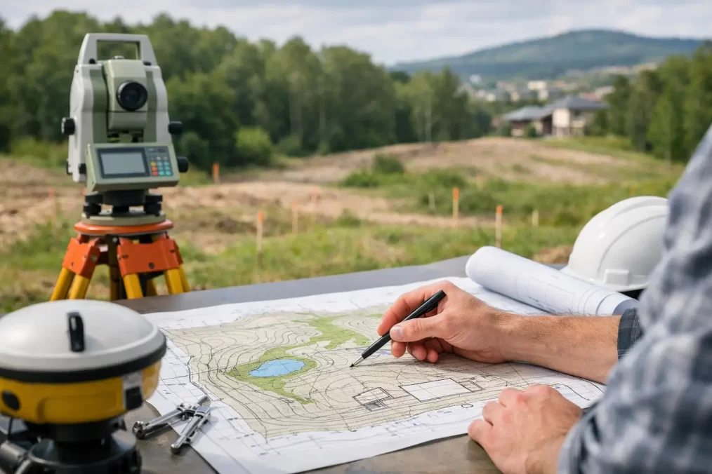
A topographic survey, often called a detail and contour survey, records the shape of the land and the physical features that may affect a proposal. The final plan presents measured information in a form that architects, planners, engineers and certifiers can use for design, approvals and construction planning.

The survey will typically show contours or spot levels across the site, building footprints, fences, driveways, kerbs, paths and retaining walls. It can also locate visible services and drainage structures, trees, rock outcrops, pools, sheds, walls, power poles and other relevant improvements. Road features, adjoining structures and available survey marks may be included where they influence the design outcome.

The required scope depends on the project. A compact residential block may need a focused survey of the lot, street frontage and immediate adjoining conditions. A sloping acreage, waterfront property or subdivision site may require a wider survey extent, more detailed level coverage and information beyond the title boundary.

A topographic survey is not automatically a boundary definition or an identification survey. While it may show apparent fencing and occupation, those features do not establish the legal boundary. Where boundary position, encroachments, building certificates, a sale or title matter is involved, a separate cadastral or identification survey may be needed.

When topographic surveys should be commissioned

The best time to arrange a survey is before design starts, not after preliminary plans have been developed around assumptions. Early site data helps the design team work with real levels and constraints from the outset, reducing redesign when the site conditions are later confirmed.

Before architectural and engineering design

Architects need accurate levels, building locations and site features to position a new dwelling, alteration, duplex or commercial building. Civil and structural engineers rely on the same information to develop drainage, earthworks, retaining, access and footing designs.

On the Central Coast, changes in level can be significant even within a standard residential lot. A survey that captures the existing ground properly helps determine whether a split-level solution, retaining wall, compliant driveway or cut-and-fill approach is practical before plans are finalised.

For development applications and approvals

Councils and certifiers often require plans that reflect the existing site conditions. A current survey provides the base information for site plans, shadow diagrams, stormwater design and documentation supporting a development application or complying development proposal.

Requirements vary according to the site, proposal and approval pathway. Flood-affected land, bushfire-prone areas, waterfront sites and properties with difficult access can involve additional consultant input. A clear survey brief allows the necessary information to be captured efficiently and issued in a format that works for the broader consultant team.

Before construction and site set-out

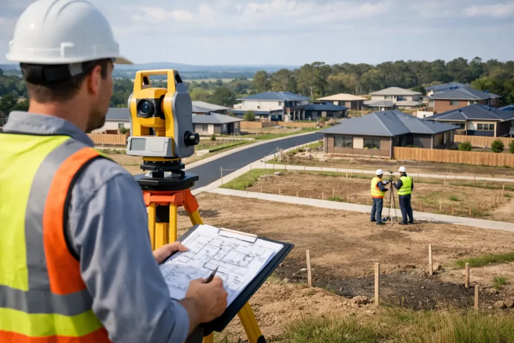
Builders use topographic information to understand access, levels and likely site works before quoting and programming construction. Once the design is approved, construction set-out translates the approved plans to the ground. Starting with a dependable survey reduces the risk that the set-out is based on unsuitable or incomplete background information.

It is also useful for renovation projects. Existing house levels, floor levels, roof features and nearby structures may be critical when planning additions, decks, garages, pools or secondary dwellings.

The site information that makes a difference

Not every visible feature needs to appear on every plan, but missing the wrong feature can create a costly problem. Before fieldwork begins, the surveyor should understand what is being designed and which consultants will use the data.

For a typical building project, the survey scope may include:

  • contours and spot levels across the site and relevant road frontage;
  • existing buildings, floor levels, rooflines and major structures;
  • visible drainage pits, service covers, poles, overhead wires and utility features;
  • fences, retaining walls, driveways, paths, vegetation and surface materials; and
  • relevant adjoining features, including building locations and levels where accessible or visible.

Visible services should not be confused with a full underground services investigation. A survey can locate what is apparent above ground and identify visible lids, pits and markers, but it does not prove the route or depth of buried assets. Where excavation is proposed, service searches and specialist locating may be required before work proceeds.

Similarly, trees can be recorded to suit a design or arborist brief, but the required level of detail should be agreed first. Tree position, trunk diameter, canopy spread and height are different data points, and the right approach depends on council requirements and the proposed works.

How the survey process works

A well-managed survey starts with the right documents. Providing the current plans, property address, lot details, any previous survey information and a short description of the proposal helps the survey team set the correct scope. Access arrangements matter too, particularly where the property is occupied, gated or includes areas that cannot be safely observed from the street.

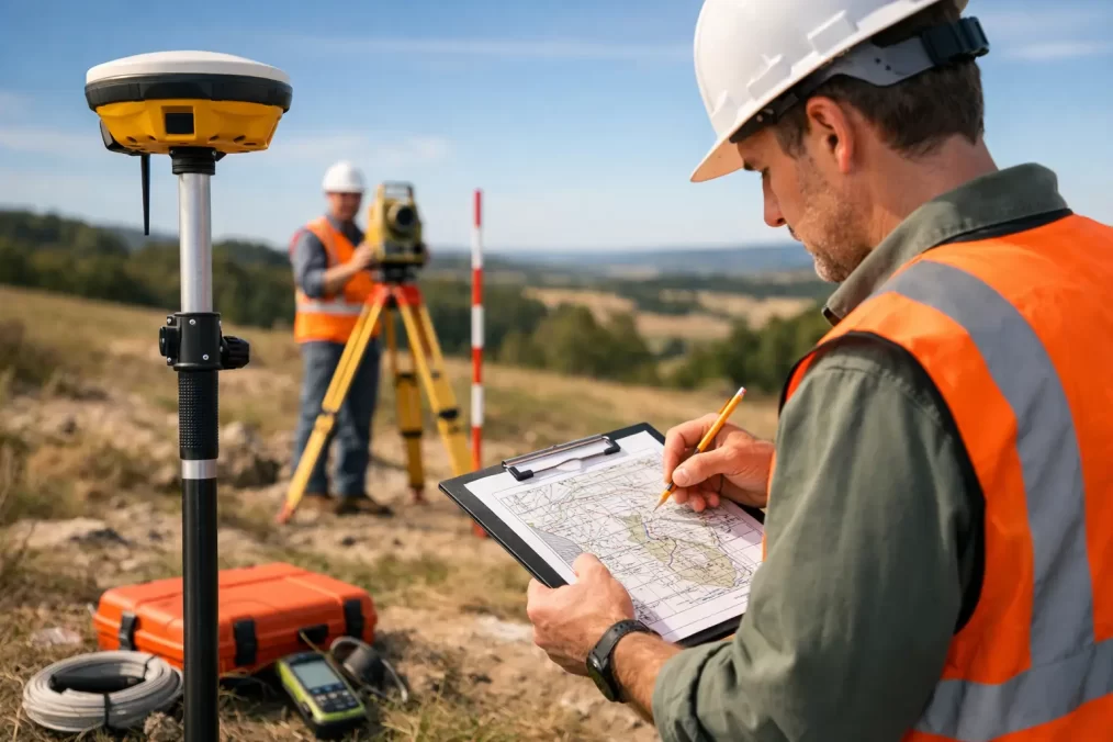
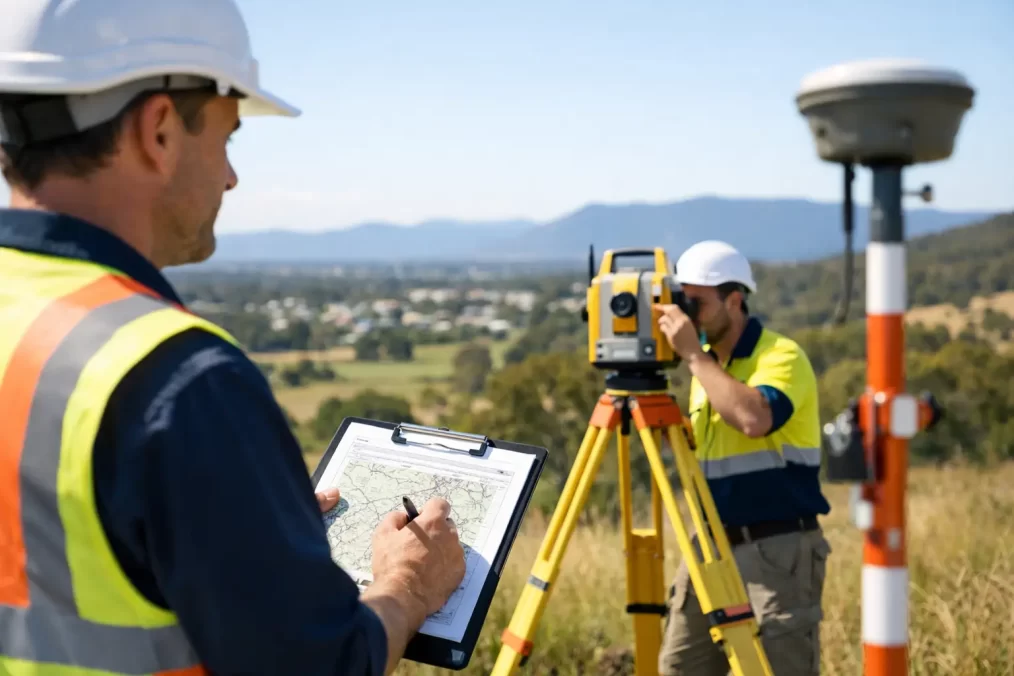
On site, surveyors use modern equipment such as GNSS, total stations and digital data capture systems to measure features and levels accurately. Trimble surveying technology supports efficient field collection and integration with established control, but technology is only part of the outcome. The survey must be planned, checked and interpreted by people who understand the site, the purpose of the work and NSW surveying requirements.

The field data is then processed into a scaled plan. Depending on the brief, the deliverable may be supplied as a PDF for review and as a CAD file for architects, engineers or planners. Levels are commonly presented relative to Australian Height Datum where suitable control is available, allowing different consultant drawings to work from a consistent vertical reference.

Turnaround depends on site size, access, vegetation, the amount of detail required and current project demands. Straightforward residential sites can often be completed promptly, while large, steep, heavily vegetated or complex sites need more field time and checking. Fast delivery is valuable, but a rushed survey that misses critical features can delay the project later.

Accuracy, scope and cost: the practical trade-off

A survey does not need to capture every item on a property. It needs to capture the information necessary for the intended decision. Over-scoping can add cost without improving the design. Under-scoping often leads to an architect or engineer requesting further site work after the design has already started.

For example, a basic survey for preliminary feasibility may not require roof details or extensive adjoining information. A detailed survey for a new home on a constrained site may need floor levels, ridge levels, retaining walls, drainage, visible services and street data. If the project involves an existing building, the relationship between internal floor levels and external ground levels can be especially important.

Tell the surveyor if the project includes a pool, basement, drainage design, subdivision, waterfront works, a new driveway or substantial earthworks. Each can change the survey extent and detail required. This is not about adding unnecessary items. It is about issuing usable information once, rather than discovering a gap when another consultant is waiting on it.

Choosing the right survey partner

The survey should fit within the wider project sequence. A capable local surveying consultancy can coordinate with the architect, town planner, engineer, builder and certifier, ensuring the deliverable is appropriate for the next stage rather than simply producing a generic plan.

Ask whether the surveyor has experience with comparable Central Coast sites and whether they can assist beyond the initial detail survey if the project progresses. Boundary mark-outs, construction set-out, floor level reports, subdivisions and final plans each require different expertise, but continuity across those stages can reduce duplicated information and avoidable delays.

For title, boundary and subdivision matters, registered surveying expertise is essential. Registered surveyors are qualified to undertake cadastral work that affects legal boundaries and plans lodged with NSW Land Registry Services. Knowing when a topographic survey is enough – and when a separate legal boundary service is required – protects the project from assumptions that are expensive to correct.

Central Coast Surveyors approaches the initial site survey as working project information, not a stand-alone drawing. The aim is to give every consultant a clear, accurate base from which to make the next decision.

Before finalising a design fee, arranging a builder’s quote or lodging an application, make sure the site is understood in measured terms. A properly scoped topographic survey gives the project a sound starting point and lets the rest of the team move forward with fewer surprises.

Council Building Certificate Survey Explained

Council Building Certificate Survey Explained

A building certificate application can stall quickly when council needs clear evidence of where an existing building sits in relation to the title boundaries. A council building certificate survey provides that evidence. It is commonly an identification survey prepared by a registered land surveyor, showing the parcel boundaries and the position of buildings and other relevant improvements.

For Central Coast property owners, this is often required when a building was completed without the expected approvals, when records are incomplete, or when council needs reliable information before deciding a building certificate application. The survey does not guarantee that council will issue a certificate. It gives council, and the professionals advising you, an accurate legal and spatial basis for assessing the property.

What a council building certificate survey shows

A building certificate is issued by the local council under the NSW planning framework. It generally confirms that, at the time it is issued, council will not take certain enforcement action in relation to the building for a specified period. Council assesses the application and may request plans, reports, photographs, compliance information and a survey, depending on the property and the work involved.

Where a survey is requested, an identification survey is usually the appropriate starting point. It is not a simple tape measure exercise or a sketch based on online mapping. A registered surveyor researches the title and relevant survey records, locates or reinstates boundary evidence, and measures the site using survey-grade equipment.

The resulting plan can show:

  • title boundaries and dimensions, including relevant easements or restrictions
  • existing buildings, additions, decks, garages, sheds and other structures relevant to the application
  • offsets from buildings to boundaries, so setbacks and encroachments can be assessed
  • fences, retaining walls and visible occupation where these help explain the site arrangement
  • any apparent encroachment over a boundary or into an easement.

The exact content should be matched to council’s request and the nature of the building certificate application. A small older shed and a dwelling with several unapproved additions do not necessarily need the same level of detail. Obtaining the council request before commissioning the work helps avoid duplicated surveys and unnecessary cost.

Why council needs a registered survey

Council records, aerial imagery and old building plans can be useful, but they are not a substitute for a current boundary-based survey. Aerial images can be distorted, old plans may not reflect later additions, and a fence is not proof of a legal boundary. These differences matter when a wall, eave, gutter or deck is close to a side boundary.

An identification survey establishes the relationship between the improvements on the ground and the cadastral boundaries of the land. That information can identify issues early, including a carport built too close to the boundary, a garage partly over an easement, or a neighbour’s structure encroaching onto the title.

Finding an issue is not the same as determining the solution. Council may need further information from a building certifier, architect, engineer, planner or solicitor. In some cases, the answer may involve amended plans, a compliance assessment, an easement, neighbour discussions or a separate approval pathway. The value of the survey is that everyone is working from measured facts rather than assumptions.

When to arrange the survey

The best time is usually as soon as council indicates that a survey is required, or earlier if you know the building is close to a boundary and its approval history is unclear. Waiting until the rest of the application is ready can create avoidable delays, particularly where boundary marks are missing or additional research is needed.

Property owners also commonly arrange a survey before lodging an application where they have bought an older home, inherited a property, or are trying to resolve approval questions before a sale. It provides a clearer picture of the site before design, legal or compliance costs begin to build.

For builders, architects and planners, an early survey makes coordination easier. Setback dimensions on concept drawings should be based on reliable boundary information, not on an assumed fence line. If the project later needs a building certificate for existing work, having an accurate survey already available can save time and reduce redesign risk.

The survey process on the Central Coast

A practical survey process starts with a clear brief. Provide the council letter or request for information, property address, any historic plans you hold, and details of the structures that are part of the application. If there are access limitations, locked gates, tenants or dogs on site, mention these when booking.

A registered surveyor then reviews title information and available survey records before attending the site. On site, the survey team searches for boundary marks and measures the land, structures and relevant features. Modern Trimble survey equipment helps capture precise field data efficiently, but sound cadastral interpretation remains essential. Technology records measurements; the registered surveyor determines how the evidence fits the legal boundary.

After the fieldwork, the survey is calculated, checked and drafted into a plan suitable for the agreed purpose. If the work identifies a concern, it is better to know promptly. Early communication allows your wider consultant team to assess the impact before it becomes a late-stage surprise in the council process.

Turnaround depends on site size, access, the availability of survey evidence, the complexity of buildings and the level of detail required. A straightforward residential site can be completed more quickly than a large waterfront property, a site with difficult terrain, or land where boundary marks need to be carefully reinstated. A clear brief at the outset is the most reliable way to keep the work moving.

Common issues a building certificate survey can uncover

Close boundary clearances are a frequent issue, particularly on established Central Coast sites where houses have been extended over decades. Eaves, gutters, air-conditioning units, decks and retaining walls may be closer to the boundary than expected. Their location does not automatically prevent a building certificate from being issued, but council may need accurate dimensions to assess the circumstances.

Easements are another important consideration. A drainage easement, sewer easement or right of carriageway can affect what may remain on the site and whether further approvals are needed. A survey can show the relationship between a structure and the easement, while the relevant authority, council or legal adviser determines the practical implications.

Boundary occupation can also differ from title boundaries. A fence may have been placed for convenience, around landscaping or in line with a previous owner’s assumptions. If a building has been positioned from that fence, the discrepancy can become significant. This is why a visual inspection or informal measurement is not enough for compliance-related decisions.

Avoiding delays and repeat work

The fastest survey is not necessarily the one that merely produces a drawing. It is the one scoped correctly for council’s requirements and prepared from proper title and field evidence. Before work begins, confirm whether council has specifically asked for an identification survey, whether it needs floor levels or contour information, and which structures must be shown.

Do not rely on a real estate floorplan, a previous owner’s sketch or an unverified boundary peg. These documents may be useful background, but they cannot replace a registered survey for an application involving legal boundaries. Similarly, do not arrange demolition, rectification work or new construction based solely on assumed setbacks.

Where a building certificate matter involves multiple consultants, nominate who will provide the final package to council and share the survey plan early. Your architect may need it for drawings, an engineer may need it to identify a retaining wall or structure, and a planner may need it to explain the site context. Coordinating these inputs early reduces conflicting dimensions and repeated requests for clarification.

Choosing the right surveyor

For a council building certificate matter, choose a registered land surveyor with experience in identification work and local approval processes. Registration matters because cadastral boundary work requires professional judgement, formal competency and responsibility for the plan produced.

Local knowledge also helps. Central Coast properties range from compact urban allotments to steep bushland sites, waterfront land and older subdivisions with varied survey history. A surveyor familiar with these conditions can identify likely constraints, plan the fieldwork appropriately and communicate clearly with your project team.

Central Coast Surveyors prepares identification surveys and related plans for property compliance matters, working alongside owners, builders and consultants to provide accurate information when it is needed. The aim is straightforward: establish the facts early, give council a clear plan to assess, and keep the next project decision moving.

Residential Subdivision Survey Guide for NSW

Residential Subdivision Survey Guide for NSW

A residential subdivision can look straightforward on paper: split one allotment into two, create a driveway and register the new titles. On the Central Coast, the reality is usually more detailed. This residential subdivision survey guide sets out where surveying fits into a NSW subdivision, what information is needed at each stage and how early advice can prevent approval, construction and registration delays.

The right survey is not simply a drawing required for an application. It is the base information that lets your architect, town planner, civil engineer, certifier and builder work from the same reliable position. If boundaries, levels, easements or existing services are misunderstood at the start, the cost is often felt later through redesign, additional approvals or site work that cannot proceed.

Start with subdivision feasibility, not a plan of lots

Before committing to a design or purchase, establish what is physically and legally possible on the land. Minimum lot size, zoning, access, bushfire constraints, flooding, drainage, heritage considerations and servicing all influence the outcome. Council planning controls and the particular characteristics of the site will determine whether a proposed layout is practical.

A registered surveyor can provide the accurate site information needed for that assessment. This commonly begins with a detail and contour survey, supported by title and cadastral information. It gives the project team a measured picture of the site rather than relying on aerial imagery, old sketches or assumed fence lines.

Confirm the title position and boundary evidence

A title search may identify registered easements, restrictions on use, covenants and rights of carriageway that affect where lots, buildings and access can sit. However, title information alone does not show whether occupation on the ground agrees with the legal boundary.

An identification survey or boundary investigation may be appropriate where boundaries are unclear, fencing is disputed, structures sit close to a boundary or an existing dwelling is intended to remain. A registered surveyor assesses the available survey evidence, marks or reinstates boundaries where required, and identifies encroachments or discrepancies that need attention before the subdivision proceeds.

This work is especially valuable on older Central Coast properties, waterfront land and sites with informal access arrangements. A fence, driveway or retaining wall may have been in place for years without representing the true title boundary.

Capture levels, improvements and site constraints accurately

The detail and contour survey records features relevant to design and approvals. Depending on the brief, this can include buildings, fences, driveways, kerbs, visible services, drainage structures, trees, retaining walls, spot levels and contours. It should also locate adjoining features where they may affect setbacks, stormwater, access or construction.

For a sloping site, quality level data is critical. A subdivision that meets minimum lot dimensions may still become expensive or impractical once cut and fill, driveway grades, stormwater paths, retaining walls and accessible access are considered. Early survey data helps the design team test these issues before a proposal is locked in.

Residential subdivision survey guide: the NSW process

The precise pathway depends on the development type and consent conditions. A simple Torrens title subdivision is different from a strata plan, community title scheme or subdivision involving new roads and significant civil works. Even so, most residential projects follow a similar sequence.

1. Establish a workable concept

Your planner and designer use the survey information to prepare a concept that responds to the applicable planning controls. At this stage, the team should test lot dimensions, building envelopes, vehicle access, waste collection, stormwater and utility servicing. The surveyor can advise on cadastral implications, existing easements and whether new easements may be needed for drainage, access or services.

Do not leave easements until the end. A proposed stormwater line or shared driveway that crosses another lot needs a legal mechanism to remain in place. Identifying this early keeps the layout, engineering design and title documentation aligned.

2. Obtain development consent and satisfy conditions

Many subdivisions require development consent from the relevant consent authority. Conditions may call for civil works, drainage design, road upgrades, utility connections, contributions, landscaping or specific survey plans. Read those conditions as a project checklist, not as paperwork to deal with at the finish line.

The surveyor works alongside the planner, civil engineer and certifier to provide plans and survey data in the required format. Clear coordination matters here. A lot layout adjusted during engineering must be checked against the approved subdivision design and title requirements before work is set out on site.

3. Set out approved works accurately

Where subdivision works are required, construction set-out transfers the approved design to the ground. This may include new lot boundaries, road alignments, kerbs, drainage pits, driveways, retaining walls and building locations.

Set-out is not a one-off exercise. Construction often requires staged marks and level checks as earthworks, drainage and pavements are completed. Prompt survey support helps contractors resolve questions before an error becomes buried under concrete, asphalt or fill.

4. Complete final surveys and compliance information

Once the physical works are complete, final survey information is used to demonstrate that the constructed outcome matches the approved design and relevant conditions. The exact requirements vary, but final levels, drainage structures, road works and lot dimensions may all need verification.

This is where an early, accurate survey record pays off. If the final location or level of a structure differs from the approval, the project team has time to assess the issue and seek a solution. Discovering it shortly before registration can delay the release of new titles and settlement.

5. Prepare the subdivision plan for registration

After approvals and required works are addressed, a registered surveyor prepares the appropriate plan of subdivision and supporting documentation for lodgement. For Torrens title land, this commonly involves a deposited plan. The plan defines the new lots and any easements or restrictions required for the development.

The plan must satisfy NSW surveying and land registration requirements, not merely show the intended layout. It is checked against survey evidence, title information, approved plans and any relevant dealings. Other parties may also need to provide certificates, consents or documents before NSW Land Registry Services can register the plan and issue the new titles.

Timing at this stage depends on the complexity of the project, the responsiveness of authorities and service providers, and whether the submitted documents are complete. It is worth allowing proper time for this process rather than promising purchasers a date based solely on construction completion.

Common issues that add cost or delay

The most avoidable subdivision problems usually arise from assumptions made early. An old plan may not reflect later easements. A proposed driveway may not fit within the available land once boundary evidence is assessed. A drainage solution may require an easement over a neighbouring parcel, while a steep site may need more retaining and stormwater work than the first concept allowed for.

Existing buildings also require careful consideration. If a house remains on one lot, check whether the new boundary creates non-compliant setbacks, fire separation issues, access constraints or service conflicts. The same applies to garages, pools, sheds, septic systems and retaining walls. A subdivision creates legal lots, but each resulting lot must also function safely and practically.

Another common issue is treating visible service locations as confirmed information. A detail survey can locate visible features, but service authority records, service locating and engineering investigation may be required before excavation or final design. The level of investigation should match the risk and scale of the work.

Choosing a surveyor for your subdivision

Subdivision surveying combines cadastral expertise, planning awareness, precise field work and land registration knowledge. For this reason, appoint a registered surveyor with experience in the type of subdivision you are proposing, whether it is a two-lot infill project, a rural subdivision, strata conversion or a larger community title development.

Ask how the surveyor will coordinate with your planner, architect, engineer and certifier, and what deliverables are required at each stage. Fast turnaround is useful, but accuracy and communication are just as important. A survey file that is clear, complete and supplied in the format the design team needs can save days of back-and-forth.

Central Coast Surveyors supports projects from initial detail and contour surveys through boundary work, construction set-out, final surveys and plan registration. That continuity reduces duplicated site visits and helps keep the cadastral, design and construction information consistent as the project changes.

Before you finalise a subdivision concept, arrange a site discussion with your consultant team and put the title, boundaries, levels, access and easement questions on the table. The earlier those fundamentals are resolved, the more confidently you can move from an idea on a plan to registered land ready for its next use.

Property Survey Approval Process Guide for NSW

Property Survey Approval Process Guide for NSW

A survey is rarely the document that receives development consent on its own. It is the evidence that lets your architect, planner, engineer, certifier, council and NSW Land Registry Services make the right decisions. This property survey approval process guide explains where surveying fits, what to organise first and how to avoid the errors that hold up Central Coast projects.

The first question is not, “Which survey do I need?” It is, “What decision needs to be made?” A new dwelling, secondary dwelling, extension, subdivision, building certificate, waterfront licence transfer or boundary dispute each calls for different information. Ordering the right survey early saves redesign, repeat site visits and avoidable approval delays.

Start with the project outcome, not a generic survey

Before a surveyor attends site, clarify the intended work, the property address and lot details, whether construction has already occurred, and the approval pathway you expect to use. Your surveyor can then advise what survey information is likely to be required and coordinate it with the wider consultant team.

For a new home, alteration or development application, a detail and contour survey is often the practical starting point. It records the existing ground levels, buildings, visible services, trees, fences, roads, kerbs and other site features relevant to design. Your architect can use this base information to position the building, manage drainage and assess the site against planning controls.

If the question is whether an existing building sits within its legal parcel, an identification survey may be the appropriate document. This is commonly requested for council building certificate matters, property transactions and waterfront licence transfers. It compares improvements and occupation with the title boundaries and identifies issues that need to be addressed.

A cadastral boundary mark-out has a narrower purpose. It identifies the legal boundary position on the ground, which is useful before fencing, building near a boundary, resolving uncertainty or planning an easement. It should not be substituted for a topographical survey where design levels and site features are required.

The property survey approval process in NSW

Every site has its own constraints, but the survey approval process generally follows a clear sequence. Good coordination at each stage is what keeps the next consultant moving.

1. Confirm title, controls and the scope of work

A registered surveyor reviews the available title information, deposited plans and relevant survey records before fieldwork. For development work, the team also needs to understand the proposed design and likely approval requirements. This early review helps identify whether the site involves an easement, restricted covenant, irregular boundary, access issue or existing encroachment that could affect the proposal.

Do not assume a fence represents the boundary. Fences can be offset, replaced over time or built for convenience rather than legal accuracy. Similarly, online mapping and old marketing plans can help with orientation, but they are not a substitute for a cadastral survey.

2. Complete field survey work accurately

The field component varies with the scope. A detail and contour survey captures physical site information and levels. A boundary survey involves cadastral evidence, measurements and boundary reinstatement. For construction, the surveyor translates approved design coordinates and levels into accurate marks on site.

Access matters. Make sure gates are unlocked where possible, dogs are secured and any relevant site hazards are disclosed. On steep, heavily vegetated or waterfront land, fieldwork can take longer because visibility and safe access affect what can be observed. Fast turnaround is valuable, but it should never mean incomplete site data.

3. Issue survey plans in a format the project team can use

A survey plan should be clear enough for the next decision-maker to rely on it. Depending on the project, the deliverable may include a PDF plan, CAD file, digital terrain model, boundary information or a formal identification survey report.

The architect or building designer uses the survey to develop a concept that responds to the land. Town planners may use it to assess setbacks, height planes, site coverage and environmental controls. Civil and structural engineers use accurate levels and features to design drainage, retaining, access and structural solutions.

This is where a common false economy appears. Designing from rough measurements, aerial imagery or an old plan can look cheaper at first. If the finished survey later reveals a fall across the block, an overlooked easement or a building envelope problem, the redesign cost can be far higher than commissioning suitable information at the outset.

4. Resolve issues before lodging an application

A survey can reveal matters that need a response before plans are lodged. These may include a building close to a boundary, inconsistent fence lines, a drainage easement, insufficient information about existing levels or an access constraint.

Not every issue prevents approval. Some are managed through revised design, further investigation, an easement, owner consent, a planning variation or advice from the relevant authority. The key is to identify the issue while the project remains flexible, rather than after drawings, consultant reports and application fees have been committed.

For work requiring development consent, the consent authority will assess the complete application against applicable planning controls. For complying development or building work, a private certifier or council may require survey information to verify siting and compliance. Requirements differ between projects, so your surveyor should work alongside the designer, planner and certifier rather than attempting to replace their roles.

5. Use survey control during construction

Approval is not the end of the surveying role. Once work starts, construction set-out establishes the positions and levels shown on the approved drawings. This can include building corners, excavation lines, piers, retaining walls, roads, drainage and finished floor levels.

Set-out should occur before irreversible work begins. A slab or wall built in the wrong position can create expensive compliance and boundary problems, especially on tighter residential sites. Builders also benefit from clear, timely marks that reduce uncertainty for trades and keep the programme on track.

As construction progresses, floor level reports or as-built surveys may be needed to confirm completed work. These reports can assist with certification, contractual checks and evidence that required levels have been achieved.

6. Register subdivision, strata or easement plans correctly

Subdivision and title work requires a more formal process. Whether the project involves Torrens title subdivision, strata subdivision, community title, a lease plan or an easement, the plan must meet NSW Land Registry Services requirements and be prepared by a registered surveyor where required.

The surveyor coordinates boundary definition, plan preparation and the technical steps needed for registration. Other parties may include council, a certifier, solicitor, conveyancer, lender, owners corporation, utility authority and adjoining owners. Timing depends on the type of title, conditions of consent, service works and the speed at which each party provides approvals or signatures.

This is not a stage to leave until construction is nearly complete. Conditions of consent can require plans, works, certificates or easement documentation before final registration. Early surveying advice gives the project team time to sequence these requirements properly.

What commonly delays property approvals

Most survey-related delays are preventable. They usually arise because survey information is ordered late, the scope does not match the project, design changes are not sent to the surveyor, or a boundary assumption is treated as fact.

Communication across consultants is equally important. If an architect changes the building footprint, the civil engineer revises levels or a planner identifies a setback issue, the surveyor needs the current information. One coordinated survey partner can reduce duplicated effort by supplying consistent site control and responding quickly as the design develops.

Property owners should also retain copies of titles, old plans, approvals and relevant correspondence. These documents may not settle every boundary question, but they can help the project team understand the history of the site and identify issues sooner.

Choosing the right surveyor for an approval project

For land boundary, subdivision and title matters, use a registered surveyor with NSW cadastral expertise. Registration matters because legal boundaries and plans for registration involve professional responsibilities that go beyond measuring visible features on site.

For development and construction work, look for a surveyor who can support the full project cycle: initial detail and contour work, boundary advice, set-out, final surveys and title registration where needed. Local knowledge also helps. Central Coast sites can involve steep grades, bushland, coastal exposure, older subdivisions, waterfront land and constrained access, all of which affect survey planning and design decisions.

Central Coast Surveyors works with property owners and project teams from early site information through to construction and registration. The practical benefit is straightforward: fewer handovers, clearer information and a surveyor who understands why the next deadline matters.

The best time to involve a surveyor is before the first plans are drawn in detail. A clear survey brief, accurate site data and regular communication give every later decision a firmer foundation – and give your project a better chance of progressing without costly surprises.

Lease Area Surveys for NSW Property Projects

Lease Area Surveys for NSW Property Projects

A lease can be commercially straightforward while the area it covers is anything but. A driveway, loading bay, waterfront strip, access corridor or part of a larger parcel may be used by one party without being separately titled. Lease area surveys establish exactly where that leased land begins and ends, so the lease, plan and physical occupation all refer to the same area.

For property owners, developers and tenants on the Central Coast, that clarity matters before a lease is signed, varied, renewed or transferred. It also matters when a lease is connected to a development application, a building approval, a Crown tenure matter or registration through NSW Land Registry Services.

What is a lease area survey?

A lease area survey is a cadastral survey that defines the land proposed to be leased within a parent parcel, or confirms the extent of an existing lease area. The result is generally a survey plan prepared for the particular legal and administrative purpose of the transaction.

Unlike a general site measure, this work is concerned with legal definition. A registered surveyor investigates title information, existing deposited plans, survey marks, adjoining boundaries and the intended occupation area. They then measure and calculate the lease boundaries so they can be shown accurately on a suitable plan.

The area may be a whole lot, but it is often only part of a lot. Common examples include a portion of industrial land for a tenant’s yard, a telecommunications site, a café area within a larger property, a car park, a marina-related area, or a section of land used for storage or access.

The right plan and process depend on who owns the land, the type of tenure, the lease terms and the requirements of the relevant authority. This is why an early discussion with a registered surveyor can prevent the wrong survey product being commissioned.

Why lease area surveys matter before documents are finalised

Lease descriptions can look clear on paper while leaving room for disagreement on site. Phrases such as “the rear portion”, “approximately 500 square metres” or “the area beside the shed” are rarely enough where legal rights, construction works or public land are involved.

A properly defined lease area gives the parties a fixed reference for what is included. It can identify whether fencing, parking, services, accessways, structures and improvements sit within the proposed area or outside it. It can also expose practical issues early, such as a tenant needing access over land that is not included in the lease.

That early certainty helps avoid several costly problems:

  • a lease area unintentionally crossing a title boundary or encroaching on an adjoining owner’s land;
  • an access route, fire egress path or service connection falling outside the leased area;
  • a proposed building, fit-out or storage use conflicting with the area shown in approval documents;
  • delays when a solicitor, managing authority or NSW Land Registry Services requires a more precise plan; and
  • disputes at renewal or expiry about which land must be handed back.

For a development project, the survey can also give architects, planners and engineers a dependable base for their drawings. Design decisions made from an assumed lease boundary may need costly revision once the legal area is properly established.

When you may need a lease area survey

A lease area survey is commonly required where only part of a parcel is being leased and the area must be formally identified. It may be requested by a landowner, solicitor, property manager, government authority, lender or the organisation administering the tenure.

It is particularly relevant when a new lease is being created over part of a lot, an existing leased area is changing, or a tenant is taking over rights to a defined area. Waterfront and foreshore-related tenure can require careful attention, as the leased or licensed area may sit beside private title, public land or water boundaries that have their own administrative requirements.

Not every commercial lease needs a new cadastral survey. If the lease is over an entire existing lot with a clear legal description, title information may be sufficient. Similarly, a simple internal tenancy within a building can sometimes be described through a lease plan prepared from architectural information rather than a field survey. The deciding factor is the legal purpose and whether the boundary must be tied to land title, physical features or an authority’s prescribed plan standard.

If the area includes external land, exclusive-use space, vehicle access, a yard, a wharf, or land near an irregular boundary, it is wise to check the requirement before documents are prepared.

The lease area survey process in NSW

The process starts with a clear brief. The surveyor needs to know the property address, title details, proposed use, approximate area, whether the lease is new or existing, and who will rely on the plan. A marked-up aerial image or site sketch can help explain the commercial intention, but it is not a substitute for survey definition.

Title and records investigation

The surveyor reviews the available title documents, deposited plans, easements, restrictions and relevant survey records. This investigation establishes the parent parcel and identifies matters that may affect the proposed lease area, including rights of way, drainage easements or other interests.

For Crown, council or waterfront land, there may be additional tenure records and plan requirements. These should be confirmed early because they can affect the plan format, approvals and programme.

Field survey and boundary control

A field survey is then carried out where required. Existing survey marks are located and assessed, boundaries are re-established where necessary, and the proposed lease lines are measured in relation to the parent parcel and relevant site features.

Modern Trimble equipment supports efficient, precise fieldwork, but the equipment is only part of the service. The legal reliability of the outcome depends on the registered surveyor’s interpretation of evidence, calculations and compliance with NSW surveying standards.

Plan preparation and coordination

Once the survey data is checked, the surveyor prepares the plan needed for the transaction. The plan may show dimensions, area, boundaries, access, easements, buildings and other features relevant to the lease purpose. It must be consistent with the legal description and with the requirements of the party accepting it.

This is the stage where coordination matters. Solicitors need a legally workable description. Architects and planners may need the surveyed area reflected in their drawings. Property managers may need clear identification of maintenance or exclusive-use boundaries. Resolving these points before lodgement is faster than correcting them after documents have circulated.

Approval, execution and registration

Depending on the lease and land tenure, the completed plan may support an application, be attached to lease documentation, or form part of a registration process. The exact pathway varies. A private commercial arrangement, a Crown lease and a waterfront licence transfer do not necessarily follow the same process.

Your surveyor should explain what they are providing, who needs to review it, and any information still required from your legal representative or managing authority. Surveying advice supports the plan itself, while legal advisers remain responsible for the lease terms and legal transaction.

Information that helps prevent delays

The fastest projects are usually those where the survey brief is settled before fieldwork begins. Provide the current title reference or a copy of the title, the draft lease if available, contact details for the solicitor or property manager, and any plans already used for approvals or tenancy negotiations.

It is also useful to identify the intended use. A lease for outdoor dining has different practical considerations from a lease for heavy vehicle parking, storage, a construction compound or a waterfront structure. If access, parking, shared services or security fencing are part of the arrangement, flag them early.

Do not assume existing fences, painted lines or buildings define the lease boundary. They may be useful reference features, but they do not establish legal rights unless the survey and lease documentation adopt them appropriately.

Choosing the right surveying support

Lease area work sits between property law, title definition and on-site reality. It should be handled by a registered surveyor with experience in cadastral plans and NSW registration requirements, not simply by a provider offering a measured sketch.

Ask whether the proposed scope includes title investigation, field survey where needed, plan preparation and coordination with the people preparing the lease. Confirm the expected turnaround, any authority requirements, and whether extra work could be needed if records, boundaries or tenure arrangements are more complex than first understood.

Central Coast Surveyors can coordinate this work with property owners, solicitors, planners and project teams, using local knowledge and registered surveying expertise to keep the process moving.

Start with the area, not the assumption

Before committing to lease terms or investing in a fit-out, make sure the proposed area can be clearly identified, accessed and used for its intended purpose. A precise survey brief at the start gives every party a common reference point and leaves far less room for expensive uncertainty later.

Site Survey for Duplex Design Before You Build

Site Survey for Duplex Design Before You Build

A duplex can look straightforward on a concept plan: two dwellings, two entries, two garages and a shared wall. On a real Central Coast block, however, the design must respond to slope, drainage paths, boundary position, existing services, trees, easements and planning controls. A site survey for duplex design gives your architect, planner and engineers the measured information to make those decisions before time is spent developing the wrong scheme.

For owners and developers, this is not simply an early administrative step. It is the base information that affects whether a duplex is practical, how much earthworks may be needed, where vehicles can enter safely and whether the proposal can be designed around the site rather than forced onto it.

Why duplex projects need accurate site information

Duplex development places more pressure on a site than a single dwelling. Two homes need workable access, private open space, parking, drainage, waste collection arrangements and compliant setbacks. On tighter or sloping land, a small error in levels or an assumed boundary position can have expensive consequences once the design reaches planning, construction certification or set-out.

A detail and contour survey records the physical features of the property and its immediate surrounds. It gives the design team a reliable plan of existing ground levels, structures, visible services, fences, driveways, trees, kerbs, footpaths and other relevant features. Rather than designing from aerial imagery, old plans or rough site measurements, consultants can work from current survey data tied to recognised coordinates and levels.

This is especially valuable across the Central Coast, where sites often have pronounced fall, bushland interfaces, drainage constraints, coastal conditions or older development patterns. A level block and a steeply falling block may support the same number of dwellings, but they will require very different design, stormwater and construction approaches.

What a site survey for duplex design should show

The exact scope depends on the land, the proposed development and the requirements of the consultants involved. For most duplex feasibility, design and approval work, the survey should provide a clear picture of both the parcel and the conditions that influence development.

Boundaries and title information

A surveyor reviews the available title information and occupation around the site, including fences, walls and other apparent boundary evidence. This is important because a fence is not automatically on the legal boundary. Where boundary certainty is needed for design setbacks, demolition, new retaining walls, construction close to a boundary or future subdivision, a registered surveyor can advise whether a cadastral survey or boundary mark-out is required.

Existing easements, restrictions and covenants also need attention. A drainage easement may limit where a building, pool, retaining wall or other structure can be placed. A restriction on the title may affect the type or scale of development. These matters should be identified early so the design team is not left redesigning a near-complete proposal.

Levels, contours and site fall

Duplex design depends heavily on levels. The survey captures spot levels across the site and produces contours that show how the land rises and falls. It can also locate floor levels of existing buildings, kerb levels, driveway levels, drainage pits and other features that help engineers assess site drainage and vehicle access.

This data informs practical questions: Can each dwelling achieve sensible finished floor levels? Will the driveway be too steep? Is a split-level design preferable? How much cut, fill or retaining is likely? Can stormwater drain to a lawful point of discharge? The answer is rarely found by looking at the block from the street.

There is a trade-off here. A design that follows the natural ground level can reduce excavation and retaining, but it may complicate layouts or construction. A flatter building platform may improve usability, but can increase earthworks, drainage requirements and cost. Accurate contours allow those choices to be made with evidence.

Existing buildings, improvements and vegetation

The survey records buildings, sheds, decks, pools, driveways, retaining walls, fences and significant visible features. For a site with an existing dwelling, this information helps determine whether demolition, staged construction or retention of part of the building is feasible.

Appropriate trees and vegetation are also located, particularly where they may affect building footprints, driveways, sewer connections or council assessment. A survey does not replace an arborist report where one is required, but it gives the arborist and designer a precise base plan to assess tree locations and proposed impacts.

Services and surrounding infrastructure

Visible service features such as sewer inspection openings, water meters, power poles, pits and overhead wires should be picked up where relevant. This helps the project team identify likely connection points and avoid obvious clashes. Formal service location and authority information may still be needed, particularly before excavation or where underground assets are uncertain.

The survey should also extend sufficiently beyond the property to capture features affecting access and drainage. Road levels, kerbs, gutters, footpaths, vehicle crossings, neighbouring buildings and adjoining ground levels can all influence a duplex layout. For example, a proposed garage may fit within the property but fail to achieve a practical driveway grade to the street.

How the survey supports the approval pathway

A quality survey gives each consultant a common, dependable starting point. The architect uses it to test building envelopes, setbacks, private open space and floor-level options. The town planner uses it to assess the proposal against applicable controls. Civil and hydraulic engineers use levels and site features to develop drainage and access solutions, while structural engineers may use it to understand retaining and site interface issues.

It also helps establish a more realistic feasibility position. Before committing to a purchase, design fee or development application, an owner can see where the likely cost drivers sit. These may include extensive retaining, difficult stormwater management, constrained access, sewer limitations or a boundary issue needing resolution.

A survey cannot guarantee development approval. Council assessment will depend on the applicable planning framework, site-specific constraints and the final proposal. It does, however, reduce avoidable uncertainty by ensuring the proposal is based on measured conditions rather than assumptions.

When to arrange the survey

The best time is before concept design is advanced. For a potential purchase, early survey information can be a valuable part of due diligence, especially on irregular, sloping, waterfront or apparently constrained land. For an owned property, it should be arranged before the architect begins detailed layouts.

Waiting until a development application is nearly ready often creates unnecessary rework. A preliminary drawing might show two compliant-looking dwellings, only for the survey to reveal a deeper fall across the block, a boundary discrepancy, an easement or an existing drainage feature that changes the layout.

If the project involves demolition, a separate identification survey may be appropriate where the relationship between existing structures and boundaries needs to be established. If the intention is to create separate titles after construction, early discussion about strata, community or Torrens title subdivision can also help the project team plan the right pathways from the outset.

Choosing the right survey scope

Not every duplex site needs the same level of investigation. A relatively clear, rectangular urban block may need a standard detail and contour survey, with additional cadastral work if boundary marks are unclear. A steep acreage site, waterfront property or block with significant vegetation and multiple structures will usually need a broader scope.

The most useful approach is to provide the surveyor with the property address, proposed development, any available plans and the names of the consultants involved. This allows the fieldwork and deliverables to be tailored to the design task. It also means the survey plan can be issued in a format that architects and engineers can readily use.

Central Coast Surveyors works with property owners and project teams from early site investigation through construction set-out and final subdivision or title registration. That continuity can reduce handover gaps as a duplex moves from feasibility to approved plans and built works.

A duplex succeeds when the design works on the actual land, not just on paper. Arrange the survey early, give your consultants accurate information and let the site shape the smartest path forward.

Identification Survey vs Boundary Survey in NSW

Identification Survey vs Boundary Survey in NSW

A fence line can look settled for decades and still sit on the wrong side of a title boundary. Likewise, a property may have clear boundary marks but no current plan showing whether the house, garage or retaining wall affects those boundaries. That is the practical difference behind an identification survey vs boundary survey decision.

For Central Coast property owners, builders and consultants, choosing the right survey at the start can prevent approval hold-ups, redesign work and disputes later in the project. Both survey types deal with cadastral boundaries, but they answer different questions. One focuses on where the legal boundaries are. The other shows how existing improvements relate to those boundaries.

Identification survey vs boundary survey: the key difference

A boundary survey determines, reinstates or marks the legal boundaries of a parcel of land. It is commonly needed when boundaries are uncertain, when a new fence is proposed, before construction close to a side or rear boundary, or where neighbours disagree about the position of a line.

An identification survey goes further. It identifies the property boundaries and locates visible improvements on or near the land, such as dwellings, garages, sheds, pools, fences, driveways and retaining walls. The resulting plan and report show whether those improvements appear to be within the subject property, close to a boundary or potentially encroaching onto adjoining land.

Put simply, a boundary survey answers, “Where is my land?” An identification survey answers, “Where is my land, and how do the existing buildings and structures sit in relation to it?”

That distinction matters because the right report depends on the purpose of the job. A boundary mark-out may be exactly what is required before a fence is installed. It will not necessarily provide the information council, a conveyancer or a lender needs to assess existing structures on the site.

What a boundary survey is used for

A cadastral boundary is the legal extent of the land described on a deposited plan, strata plan or other registered title document. It is not automatically defined by a fence, garden edge, kerb, wall or satellite image.

To establish a boundary, a registered surveyor researches the title and relevant plans, examines survey records and searches for existing survey marks. The fieldwork then measures available evidence and applies cadastral surveying principles to determine the boundary position. Where appropriate, the surveyor can place or identify boundary marks and provide information for a boundary mark-out.

A boundary survey is particularly useful before building work that relies on a setback or is proposed close to a boundary. Builders and designers should not assume an old paling fence reflects the title line, especially on older Central Coast sites where fencing may have been replaced more than once. The same applies to rural properties, where long fence runs and terrain can make assumptions particularly risky.

Common reasons to arrange a boundary survey include establishing a line before fencing, locating a boundary for a new dwelling or addition, resolving uncertainty before buying or selling, checking land available for a driveway or access route, and supporting easement or subdivision work.

The deliverable varies with the scope. It may involve a boundary mark-out on site, a survey plan, or cadastral information prepared for a wider land transaction or development process. The important point is that the work is based on legal survey evidence, not a visual estimate.

What an identification survey shows

An identification survey is usually prepared for an existing property. It confirms the land being examined and depicts the position of visible improvements in relation to the title boundaries. It may also note apparent encroachments, party walls, building lines and other physical features relevant to the purpose of the survey.

In NSW, identification surveys are regularly requested for council building certificate applications, property transactions, waterfront licence transfers and situations where an owner needs confidence about existing improvements. They can be especially valuable where a house, carport, deck, pool fence, retaining wall or shed is close to a boundary.

The plan does not simply say that a structure exists. It gives the owner and their advisers measured spatial information. If a garage wall is near the boundary, for example, the survey can show its relationship to that boundary. If a fence appears to sit outside the title, that issue can be identified before it becomes a surprise during a sale, approval process or neighbour discussion.

An identification survey is not the same as a building inspection, pest inspection or planning assessment. It does not determine structural condition, certify that a building approval exists, or confirm every planning control that may apply. It provides a precise land and improvement record that helps council, conveyancers, planners and owners assess the next step.

Which survey do you need for your project?

The answer depends on the decision you need to make, rather than the name of the survey alone.

If you are replacing a fence and want to know where it should go, a boundary mark-out or boundary survey is generally the starting point. If you are building a new home, extension, garage or pool close to a boundary, an accurate boundary survey should be completed before design is finalised and certainly before set-out begins.

If you own an established home and need a building certificate, an identification survey is often the relevant document because council needs to understand how existing structures relate to the property boundaries. The same logic applies when a conveyancer, purchaser or lender needs clarity around an existing dwelling and ancillary structures.

For a property purchase, it depends on the risks present. A vacant block may call for boundary certainty, while an older improved property may benefit more from an identification survey that reveals the relationship between buildings, fences and title lines. A registered surveyor can review the purpose and recommend a scope that fits, rather than supplying a report that leaves a critical question unanswered.

Why fences and online maps are not enough

Fences are practical features, not legal proof. They can be built for convenience, follow a previous owner’s assumption, avoid a tree or retaining wall, or shift gradually as they are replaced. Even where both neighbours have treated a fence as the dividing line, its location may not match the cadastral boundary.

Online mapping is useful for general orientation but is not suitable for legal boundary decisions. Mapping imagery and property overlays can contain positional differences that are insignificant at suburb scale but substantial when a building setback, fence footing or retaining wall is involved.

A survey completed years ago may also have limited usefulness for a current decision. New structures, altered fencing, changed site conditions and the specific requirements of council or a transaction can all affect what information is needed now. Existing plans are valuable evidence, but they should be reviewed in context rather than treated as a substitute for current survey work.

The value of engaging a registered surveyor early

Boundary work has legal and technical consequences. In NSW, cadastral surveys are undertaken by registered surveyors who are qualified to determine and certify land boundaries. Their work relies on title research, field evidence, survey control and established legislation and practice standards.

Early involvement gives architects, designers and builders dependable information before drawings, approvals and construction commitments progress too far. It can help prevent a building being designed too close to a boundary, avoid set-out based on an assumed fence line, and identify an existing encroachment while there is time to manage it properly.

For larger projects, the survey information can also support the broader workflow. A detail and contour survey informs design. Boundary information establishes the legal parcel. Construction set-out places approved works accurately. Final survey work and plan registration can then carry the project through to completion. Coordinating these stages with one surveying team reduces duplicated site visits and gaps between consultants.

Central Coast Surveyors uses current surveying technology alongside cadastral research and local experience to provide clear, project-ready information. The aim is not to overcomplicate a straightforward question, but to give clients the right evidence for an approval, construction decision or property matter.

What to provide when requesting a survey

A short explanation of why you need the survey will help define the right scope. Include the property address, lot and deposited plan details if available, along with any council request, building plans, photographs or previous survey documents. If there is a concern about a particular fence, wall or structure, identify it clearly.

Access is also important. Locked side gates, overgrown vegetation, parked vehicles and dogs can delay fieldwork or prevent measurements from being taken. Where neighbours’ access may be useful, it is sensible to discuss this early, although a surveyor can advise what is required for the specific job.

Before you commit to a fence, sign off a boundary-side design or lodge a building certificate application, ask the question that matters: do you need to locate the legal boundary, assess existing improvements, or both? Getting that answer from a registered surveyor early is usually the quickest path to a clearer, more confident property decision.

Subdivision Survey Checklist for NSW Projects

Subdivision Survey Checklist for NSW Projects

A subdivision can look straightforward on a concept plan, then become expensive when an old fence misses the legal boundary, a drainage easement is overlooked or a new lot cannot meet servicing requirements. A clear subdivision survey checklist gives property owners and project teams the information needed to make sound decisions before applications, construction and title registration are underway.

For Central Coast projects, the best time to involve a registered surveyor is before the design is fixed. Early, accurate survey information helps architects, planners, civil engineers and certifiers work from the same base data. It also exposes constraints while there is still room to adjust the proposal rather than redesign it after lodgement.

Subdivision Survey Checklist: Start With the Right Site Data

Every subdivision begins with an understanding of the existing parcel. This is more than measuring the apparent dimensions of the land. A registered surveyor investigates title information, available survey records and physical evidence on site to establish how the parcel relates to its legal boundaries.

An initial review should identify the current title description, deposited plans, existing easements, restrictions on use and any covenants that may affect the proposal. Easements are particularly important. A drainage, sewer, electricity or access easement may limit where buildings, driveways and services can be located, even when the affected area appears unused.

The site inspection should also record boundary evidence, such as survey marks, pegs, fences, walls and occupation lines. Fences are not automatically legal boundaries. On established Central Coast properties, a fence may have been placed for convenience, follow an older occupation line or sit well inside one owner’s land. Designing a new lot around an assumed fence line can create a costly problem later.

A detail and contour survey is usually the next practical step. It captures levels, buildings, retaining walls, driveways, vegetation, visible services, drainage features and nearby site conditions. For sloping, waterfront or irregular sites, accurate contours are essential for assessing access, earthworks, stormwater and building envelopes.

Confirm the Subdivision Path Before Design Is Locked In

The survey work needed depends on the type and scale of subdivision. A two-lot Torrens title subdivision has different requirements from a multi-lot residential development, a strata subdivision of an existing building or a community title scheme with shared infrastructure.

Before design proceeds, confirm the intended title structure and approval pathway with the wider consultant team. Your town planner will assess planning controls and development standards. A civil engineer may design roads, drainage and service works. The registered surveyor provides the cadastral framework, prepares subdivision plans and coordinates the survey components required for registration.

At this stage, check the proposed lot dimensions, frontage, access, building setbacks and practical service routes against the project objectives. A lot may satisfy a minimum area requirement but still be difficult to service or build on because of its shape, fall, easements or access constraints. The most efficient design is not always the one with the largest number of lots. It is the one that can be approved, constructed and registered with manageable risk.

Check Boundaries, Easements and Encroachments Early

Boundary definition is often the item that determines whether a project can move forward as drawn. Where marks are missing, records conflict or occupation does not match the title boundary, further investigation may be required before the subdivision plan can be finalised.

Encroachments should be identified early. These can include a neighbour’s shed, retaining wall, pool fence, driveway or building projecting over a boundary, as well as your own structures extending onto adjoining land. An encroachment does not necessarily stop a subdivision, but it may require design changes, legal advice, an easement or agreement with an adjoining owner. Leaving it until the final plan stage can delay registration.

Also consider access rights and service corridors. New lots may need easements for carriageway access, stormwater drainage, sewer, water, electricity, telecommunications or maintenance. The dimensions and wording of an easement need to suit the infrastructure and future use, not simply fit into leftover land. Poorly planned easements can limit future building options or lead to disputes between owners.

Coordinate Survey Information With Design and Approvals

A subdivision is a coordinated project, not a sequence of isolated reports. Once the base survey is complete, all consultants should work from the same current information. This reduces the risk of one drawing showing a driveway, drainage line or boundary position that conflicts with another.

For a typical NSW project, the team may need to address the following items before construction and final plan preparation:

  • confirmed title boundaries and an accurate detail and contour survey;
  • planning design, development consent and subdivision conditions;
  • civil design for roadworks, access, drainage and service connections;
  • proposed easements, restrictions and any land to be dedicated or transferred;
  • construction set-out and verification of completed works; and
  • final subdivision plan, supporting documents and NSW Land Registry Services requirements.

Not every project needs every item in the same form. A simple boundary adjustment may have limited civil works, while a greenfield development may involve extensive set-out, staged plans and several authorities. The key is to establish responsibilities early so that no critical survey or title matter is left between consultants.

Plan for Construction Set-Out and Final Verification

Approval is not the end of the survey process. Once works start, construction set-out helps contractors build roads, retaining walls, drainage, services and other works in the approved location and at the intended levels. Accurate set-out is particularly valuable on constrained sites, where small errors can affect drainage falls, easement clearances or building setbacks.

As construction progresses, keep records of variations. If a retaining wall, pit, driveway or service route changes location, the design team and surveyor need to know. A change that appears minor on site may affect the final plan, an easement location or compliance with conditions of consent.

Before the final plan is lodged, the surveyor completes the required fieldwork and plan preparation based on the approved design, completed works and legal survey requirements. Depending on the project, this can involve marking new boundaries, defining easements, preparing a plan of subdivision and providing associated documentation for the certifier, council and NSW Land Registry Services.

This stage is where early planning pays off. If boundaries have been resolved, easements designed properly and works built to the correct locations, final survey and registration are far more predictable. If not, the project may need amended plans, additional approvals or rectification works.

Keep Documents, Decisions and Timing Under Control

Subdivision delays are often caused by missing information rather than difficult surveying. Keep a current file containing title documents, previous plans, development consent, stamped drawings, service authority correspondence, approved civil plans and records of changes made during construction. Give updated drawings to the whole consultant team, not just the contractor on site.

Timing also matters. Survey work should be programmed around design milestones, approval conditions and construction activities. Booking final work only after a contractor has finished may be too late if survey set-out, easement changes or compliance issues should have been addressed during the works.

For owners managing their first subdivision, the process can feel heavily technical. The practical question to ask is simple: what information does the next decision-maker need from us? A registered surveyor can clarify boundary position and title requirements; planners can address development controls; engineers can resolve infrastructure. Clear roles keep the project moving.

Central Coast Surveyors works with property owners and project teams from early site investigation through to final plans and registration, using accurate field data and direct coordination with the wider consultant group. That continuity helps reduce handovers, duplicated work and avoidable surprises.

A good checklist is not about creating more paperwork. It is about finding the issues that could hold up a new title before they become urgent. Start with a reliable survey, keep the design team aligned and allow enough time for the final legal survey work. That is how a subdivision progresses from an idea on paper to land that can be built on, sold or developed with confidence.

How Long Does a Land Survey Take?

How Long Does a Land Survey Take?

If your architect is waiting on contours, your builder needs set-out, or you need a boundary checked before a fence goes in, the same question comes up quickly: how long does a land survey take? The short answer is that some surveys can be completed within days, while others take weeks or longer depending on the site, the survey type, access, title information and approval requirements.

That range can feel frustrating if you are trying to keep a project moving. But there is a practical reason for it. “Land survey” is not one single service. A detail and contour survey for design, an identification survey for a building certificate, a boundary mark-out, and a subdivision survey all involve different levels of field work, calculations, plan preparation and compliance.

How long does a land survey take for most projects?

For many residential projects, the on-site survey itself may only take a few hours to a day. What often takes longer is the work before and after site attendance – reviewing title documents, checking previous survey records, processing field data, preparing plans, and making sure the final deliverable suits council, design or construction requirements.

As a general guide, a straightforward boundary mark-out or identification survey might be turned around relatively quickly if records are clear and the site is accessible. A detail and contour survey for a house design can also move fast when there is good access and no unusual constraints. A larger site, a steep block, heavy vegetation, missing marks, waterfront land, easements or subdivision requirements will usually add time.

For clients, the more useful question is not just how many days the survey crew is on site. It is how long until you have the plan, marks or survey information you actually need to move to the next stage.

What actually affects survey timing?

The biggest factor is the type of survey being carried out. A topographical survey records levels, structures, services, features and contours for design. A cadastral or boundary survey requires the surveyor to investigate title boundaries, locate or reinstate marks and reconcile field evidence with legal documentation. A subdivision survey adds another layer again because it often involves plan preparation, authority requirements and title registration steps.

Site conditions matter just as much. A flat, clear suburban block is generally quicker than a large rural lot with uneven terrain, dense vegetation or difficult access. If the crew can move efficiently and obtain clear observations, the field component is faster. If they are working around locked gates, retaining walls, water edges, traffic conditions or adjoining structures, that adds time.

Existing records can either speed things up or slow them down. Good survey control, available plans and intact reference marks make the job more straightforward. If old marks are missing, title history is complex or there are inconsistencies between occupation and title, more investigation is needed. That is not delay for the sake of it. It is what protects accuracy and avoids costly mistakes later.

Timing is also influenced by what happens after the field work. Survey data has to be checked, reduced and drafted properly. If the survey supports design, approval, certification or registration, the output needs to be right the first time. Rushing that stage can create downstream issues for architects, engineers, councils or solicitors.

Typical timeframes by survey type

A boundary mark-out is often one of the quicker services, particularly for a standard residential lot with reliable reference marks. Even then, timing depends on whether boundary evidence is already in place or whether marks need to be re-established from surrounding control.

An identification survey can also be completed quickly in many cases, especially when needed for a council building certificate or a property transaction. The surveyor still needs to confirm building positions relative to title boundaries, which means the quality of boundary evidence remains critical.

A detail and contour survey for design usually requires one site visit followed by office processing and plan preparation. On smaller residential sites this can often be turned around promptly. Larger development sites, sloping land, vegetation, drainage features, multiple structures or waterfront interfaces will usually extend the timeframe.

Construction set-out is often booked around the builder’s programme, so timing depends not only on the survey itself but on coordination with excavation, formwork or slab stages. These jobs are usually time-sensitive and need a responsive surveyor who can work to the programme.

Subdivision surveys and easement work generally take longer than standard site surveys. There is more documentation, more coordination with planners, engineers and authorities, and more statutory process involved. The field work may be only one part of a much longer delivery timeframe.

Why some surveys are fast and others are not

The main difference is whether the survey ends at measurement or continues through approval and registration. If you only need existing site information for a designer, that can be relatively direct. If you need a new title created, an easement defined, or a plan registered, the survey is part of a larger legal and administrative process.

That is why two clients can both ask for a land survey and get very different timelines. One might need levels and features for house plans. Another might need a Torrens title subdivision with final plan registration. They are not comparable jobs, even if both begin with a call to a surveyor.

There is also a difference between a quick site visit and a quick outcome. A crew may complete the field work promptly, but if the project relies on external approvals, adjoining information, service authority input or registry processing, those stages can extend the overall timeline beyond the surveyor’s direct control.

How to avoid delays before the survey starts

Most avoidable delays happen before anyone arrives on site. Incomplete job information, unclear scope, poor access arrangements and last-minute booking requests all slow things down.

If you want a faster turnaround, it helps to be clear about the purpose of the survey. Is it for design, council, construction, title clarification, a fence dispute, a building certificate or subdivision? The right scope from the start prevents rework.

Providing available plans, title documents, deposited plan references, development information and site contacts also helps. If there are access issues, dogs on site, locked gates, tenant arrangements or restricted work hours, mention them early. Small details like that can be the difference between one efficient visit and a return trip.

For builders, architects and engineers, early engagement usually saves time. Waiting until the design deadline or slab booking is already tight limits options. Surveying is often one of the first technical inputs on a project, and treating it that way keeps the rest of the programme steadier.

How long does a land survey take when urgency matters?

Urgent surveys are often possible, but urgency does not remove the need for proper checking. A registered surveyor still has to verify title information, collect reliable field data and issue work that stands up technically and legally.

What changes with an urgent job is usually scheduling and internal prioritisation. If the scope is clear, the site is accessible and the records are straightforward, a fast turnaround may be realistic. If the site is complex or the survey involves legal boundary definition, there is less room to compress the process without increasing risk.

That is why the best approach is to explain the deadline and the reason for it. A good surveyor can then advise what is realistic, what can be staged, and whether an initial deliverable can be issued first to keep design or construction moving.

Choosing a surveyor who keeps projects moving

Speed matters, but only if it comes with accuracy and communication. A fast survey that has gaps, errors or unclear deliverables can create bigger delays once the architect, certifier or builder starts relying on it.

What clients generally need is responsive service, clear advice on likely timeframes, and a surveyor who understands the local approval and construction environment. On the Central Coast, that local knowledge can make a real difference when dealing with varied site conditions, council processes and coordination across consultants.

At Central Coast Surveyors, that is why the focus is on practical turnaround, registered expertise and delivering the right survey information for the next project step – not just collecting data and leaving the rest to chance.

If you are asking how long does a land survey take, the most accurate answer is usually this: long enough to do it properly, but often faster than the delays caused by unclear scope, poor coordination or waiting too late to book it. The earlier you get the right survey advice, the easier the rest of the project tends to be.