A Duplex Project Survey Workflow Example

A Duplex Project Survey Workflow Example

A duplex project can appear straightforward on a concept plan: two dwellings, a shared driveway, separate services and two future titles. On the ground, it is a sequence of connected decisions where one missing level, boundary discrepancy or poorly timed set-out can hold up design, approval or construction. This duplex project survey workflow example shows how surveying typically supports a two-dwelling development from the first site visit through to registered titles in NSW.

The exact scope depends on the site, the consent conditions and the proposed title outcome. A duplex that remains on one Torrens title has different surveying requirements from one that will be subdivided into two Torrens lots or strata lots. The principle is the same: obtain reliable evidence early, then use it consistently through design, construction and registration.

The project example

Consider an older residential allotment on the Central Coast with an existing house to be removed and a proposed attached duplex. The owners intend to sell each dwelling separately after completion. The site has a moderate fall, a kerb and gutter frontage, existing sewer infrastructure and neighbouring homes close to both side boundaries.

The architect needs accurate information for the building design. The town planner needs dependable site data for the development application. The builder needs physical set-out marks that relate to the approved design, not rough tape measurements. Finally, the owners need a subdivision outcome capable of registration with NSW Land Registry Services.

A registered surveyor should be involved before plans are advanced too far. It is much less costly to adjust a wall location on a drawing than to discover during construction that a proposed building, driveway or retaining wall conflicts with a boundary, easement or required clearance.

Stage 1: Define the intended title and approval pathway

The first conversation is not simply about booking a survey. It establishes what is being built, who is managing the design and whether the end goal is two separate Torrens titles, a strata subdivision or a single retained title.

For this example, the owners want two Torrens lots. That decision affects the layout from the outset. Each future lot needs practical access, services, usable private space and dimensions that work with the approved development and subdivision requirements. A narrow side passage that looks acceptable during architectural design may not provide a practical outcome once metres, drainage, fencing and maintenance access are considered.

The surveyor reviews available title information, deposited plans, easements, restrictions and relevant consent documentation. This early review can reveal matters that influence the design, such as drainage easements, covenants, road widening provisions or an existing sewer line. It also confirms which consultants need to exchange information: commonly the architect, town planner, civil engineer, hydraulic designer, builder and certifier.

Stage 2: Complete the detail and contour survey

The detail and contour survey creates the base information for the design team. It records the physical site as it exists, rather than as assumed from aerial imagery, old marketing plans or a quick site measure.

For a duplex site, the field work will generally capture the building footprint, fences, retaining walls, driveways, kerbs, gutters, footpaths, visible services, trees, pits, poles, levels and significant features on or near the site. Levels are particularly important on sloping Central Coast blocks, where floor levels, stormwater paths, driveway grades and excavation quantities can materially affect the build cost.

The survey also identifies adjoining structures close to the boundaries. This information helps the architect and engineer assess setbacks, fire separation, overlooking, excavation and retaining wall implications. A contour plan that stops at the centre of the block may be cheaper initially, but it can leave the civil designer without the data needed to resolve drainage or connection levels.

The surveyor supplies a clear plan in the format needed by the project team. Good coordination at this point prevents the familiar problem of different consultants designing from different base files or datum assumptions.

Why the boundary should be checked early

A detail survey does not automatically establish legal boundaries. Where the proposed duplex is close to a side or rear boundary, or where old fences are likely to be unreliable, a cadastral boundary survey and mark-out should be completed early.

In this example, a side fence is found to be slightly out of line with the title boundary. The proposed external wall can still comply after a minor design adjustment, but only because the issue is identified before the development application is lodged. Had the builder relied on the fence, the project could have faced redesign, encroachment concerns or costly work on the wrong line.

Stage 3: Coordinate the design before approval

Once the architect has prepared a concept, the surveyor can assist the team in checking that the proposed buildings sit sensibly against known boundaries, site levels and easements. This does not replace planning, architectural or engineering advice. It gives those consultants dependable spatial information on which to make decisions.

For a Torrens title duplex, the proposed subdivision line also deserves early attention. It needs to work around the party wall arrangement, access, drainage, utility services and any shared infrastructure. If a shared driveway or stormwater system crosses the future boundary, the legal mechanism may need to be addressed through an easement, positive covenant or restriction on the use of land. The appropriate solution depends on the development design and authority requirements.

At this stage, the project team should also confirm the intended finished floor levels and stormwater strategy. A floor level chosen to avoid overland flow may increase retaining or driveway gradients. Conversely, minimising earthworks may create drainage difficulties. There is rarely one perfect answer, but accurate survey data lets the team weigh the trade-offs before committing to construction documentation.

Stage 4: Set out the approved works accurately

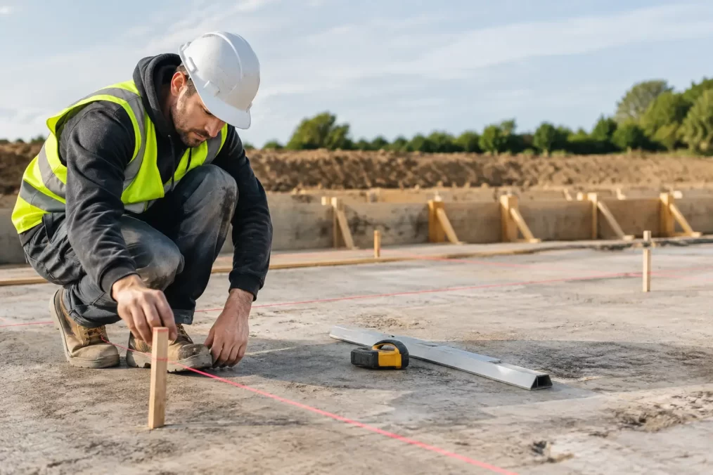
After approval and before excavation, Central Coast Surveyors can establish survey control and set out key elements of the build. On a typical duplex, this may include building corners, grid lines, wall offsets, floor levels, driveway alignment, retaining wall locations and subdivision-related reference marks.

The builder should provide the latest approved-for-construction plans, not an earlier planning set. Small revisions to walls, garages, balconies or levels are common between approval and construction. Setting out from superseded drawings is an avoidable source of error.

A practical set-out uses offsets where necessary so the builder can preserve reference marks through excavation and concrete works. The surveyor explains what each peg, nail or mark represents and provides supporting information for the site team. This is especially valuable on compact blocks where boundary clearances are tight and multiple trades are working in a confined area.

Stage 5: Check critical construction points

Set-out is not always a one-visit service. The need for additional checks depends on project complexity, site conditions and the builder’s quality processes. On this example, an additional survey check is arranged before the slab pour because the external walls are close to the side setbacks and a stepped footing responds to the slope.

Further checks may be worthwhile before retaining walls, drainage structures, driveways or boundary fencing are completed. They cost less than demolition and rework when a problem is found early. However, not every project needs every check. A simple, well-controlled build with generous setbacks may need less survey attendance than a steep site with complex retaining, basement works or zero-lot-line elements.

Construction survey records can also assist the certifier, engineer and owners if questions arise about finished levels or location. They are not a substitute for workmanship inspections, but they provide measured evidence of key spatial outcomes.

Stage 6: Prepare the subdivision documentation

Once the duplex is substantially complete and the subdivision can proceed, the surveyor undertakes the work needed for the plan of subdivision. This commonly includes field measurements, boundary reinstatement where required, preparation of the deposited plan and coordination of supporting documents.

For the two-lot Torrens example, the plan defines the new lots and any required easements. Depending on the consent and servicing arrangements, the project may also require evidence or approvals from council and service authorities. The sequence can vary significantly. Some developments need subdivision works completed and certified before a subdivision certificate is issued; others have conditions that affect when plans can be finalised.

This is where an end-to-end survey partner is useful. The plan must reflect what has actually been built and the legal arrangements required for the lots to function. A last-minute discovery that a shared pipe, metre or driveway has not been accommodated can delay registration and settlement.

Stage 7: Register the plan and create saleable titles

After the relevant approvals, certificates and signed documents are in place, the deposited plan can be lodged with NSW Land Registry Services for registration. Registration creates the new legal lots. The owners’ solicitor or conveyancer will usually manage the wider title and sale process, while the surveyor provides the registered survey plan and handles the survey components of the lodgement pathway.

Timing matters here. Builders, agents and purchasers may all be working to settlement dates, but title registration relies on complete documentation and compliant works. Starting the subdivision survey process early and keeping the surveyor informed of construction changes gives the project the best chance of avoiding a rushed finish.

What keeps a duplex survey workflow moving

The strongest duplex projects have one current set of drawings, a clear consultant contact list and prompt communication when site conditions change. Owners should tell the surveyor early if the building footprint, finished floor level, driveway, retaining wall or service arrangement changes. A change that seems minor to the build team can affect setbacks, easements or the subdivision plan.

For property owners and project teams, the practical aim is not to order surveys in isolation. It is to use accurate survey information at the point each decision needs to be made. That approach protects the design, keeps construction aligned with approvals and makes the final title outcome far more manageable.

Example Subdivision From Survey to Title

Example Subdivision From Survey to Title

A subdivision can look straight forward on a sketch: split one large residential allotment into two lots, build a new dwelling at the rear, then sell or retain it. In practice, an example subdivision from survey to title involves a sequence of planning, engineering, legal and surveying decisions. Each step depends on the one before it, which is why early, accurate advice can prevent costly redesigns and registration delays.

This example follows a typical two-lot Torrens title subdivision in the Central Coast region of NSW. It is illustrative only. Lot size, zoning, slope, drainage, bushfire constraints, servicing and approval conditions can materially change the pathway for any site.

The starting point: can the land be subdivided?

Consider an owner with an 820-square-metre corner block containing an existing house. Their aim is to retain the front dwelling and create a second lot at the side or rear for a future home. Before a planner produces a concept layout or an architect designs a new building, the project needs reliable site and title information.

A registered surveyor starts by reviewing the current Certificate of Title, deposited plan and any registered easements, restrictions or covenants. These documents identify the legal parcel, but they do not always answer every practical question. Old boundary marks may be missing, fences may not sit on the boundary, and an apparent driveway corridor may be affected by an easement or restriction.

The first field task is commonly a detail and contour survey combined with boundary investigation. Using survey control and cadastral evidence, the surveyor locates buildings, fences, retaining walls, trees, visible services, kerbs, driveways and ground levels. The survey also records the position of the existing house in relation to the legal boundaries.

This information gives the wider consultant team a sound base for assessing the proposal. The town planner can consider zoning and minimum lot size requirements. The engineer can assess drainage and access. The designer can test setbacks, private open space and vehicle movements. Most importantly, the owner can make an informed decision before spending heavily on detailed plans.

Example subdivision from survey to title: the approval pathway

For this example, the initial survey shows the existing home can remain on a 430-square-metre front lot, leaving a 390-square-metre rear lot with access from the side street. The concept is viable in principle, but it is not yet approved and it is not yet a legal subdivision.

1. Prepare a workable subdivision concept

The planner and designer use the survey base to prepare a concept plan. It needs to do more than draw a line through the block. It must allow for practical building envelopes, driveway access, stormwater management, waste collection, utility connections and any required easements.

On a sloping Central Coast site, levels can be decisive. A proposed battle-axe driveway may be possible on paper but expensive to build once retaining, grades and drainage are considered. Likewise, a rear lot may need a drainage easement over the front lot to reach a lawful point of discharge. Creating that easement early is usually simpler than trying to solve it after construction has started.

2. Obtain development consent

A subdivision development application is then prepared for council, usually with supporting plans and reports from the relevant consultants. Depending on the land and proposal, this may include stormwater design, bushfire assessment, geotechnical advice, ecology, traffic input or a servicing strategy.

Council assesses the development application and, if satisfied, issues consent with conditions. Those conditions matter. They can require road or drainage works, completion of infrastructure, easements, contributions, landscaping, service authority approvals or updated plans.

Development consent approves the proposed development. It does not create two separate titles. That distinction catches many property owners out. A subdivision only becomes legally effective when the final plan is registered with NSW Land Registry Services.

3. Complete the physical works and conditions

After consent, the owner coordinates the work required to satisfy the conditions. In this example, the rear lot needs a new vehicle crossing, driveway construction, stormwater drainage and separate water, sewer and electricity arrangements. The existing house may also need its own compliant services once the land is divided.

The surveyor assists throughout construction by setting out proposed boundaries where needed, marking driveway or drainage alignments and supplying levels for contractors. Construction set-out is not a substitute for design or approvals, but it helps ensure approved works are built in the right location.

Service requirements vary greatly. A site connected to reticulated water and sewer may need approvals, inspections and certificates from the relevant authority. Where drainage passes through another lot, a formal easement may be required. If a development condition calls for works to be completed before the subdivision certificate is issued, leaving them until late in the process can hold up the whole registration programme.

4. Carry out the final cadastral survey

Once the proposed lot boundaries are settled and relevant works are complete, the registered surveyor performs the final subdivision survey. This is not simply a reprint of the concept plan.

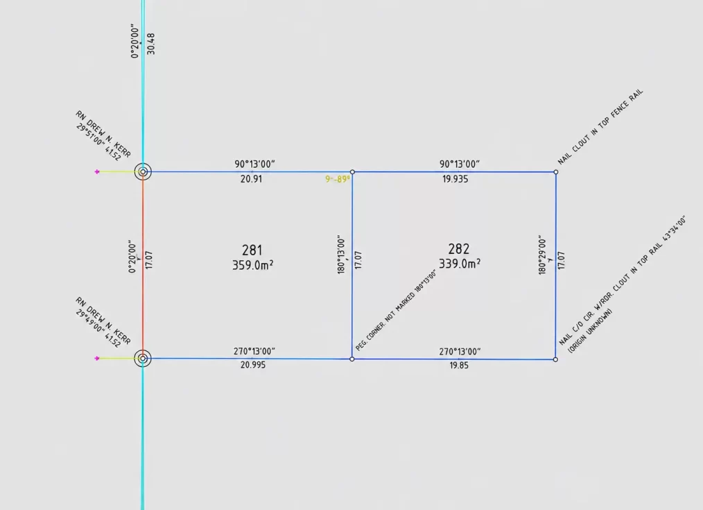
The surveyor measures and marks the new boundaries, checks the relationship of improvements to the new lots, compiles evidence required under NSW surveying standards and prepares a deposited plan. Where an easement, restriction on the use of land or positive covenant is needed, the plan and associated legal documentation must accurately describe it.

For the two-lot example, the deposited plan may show Lot 1 containing the retained home and Lot 2 as the new vacant lot. It may also create an easement for stormwater drainage over Lot 1 for the benefit of Lot 2. The exact wording, dimensions and beneficiaries need careful coordination between the surveyor, engineer, planner and legal representative.

A small drafting error at this stage can have a large consequence. If an easement does not match the constructed drainage line, future building work, lending and sale can become more difficult. This is why final survey work should be treated as a compliance and legal deliverable, not an administrative afterthought.

From subdivision certificate to registered titles

With the deposited plan prepared, the next stage is obtaining the subdivision certificate. Council, or an accredited certifier where applicable, checks whether the approved subdivision conditions have been met. The certifier may require evidence such as service authority certificates, engineering completion documents, works-as-executed information and any required legal instruments.

Once the subdivision certificate is issued, the plan can proceed towards registration. In NSW, this is generally managed through electronic lodgement, with the registered surveyor, conveyancer or solicitor and other parties completing their respective parts of the process.

NSW Land Registry Services examines the plan and related dealings. If there are requisitions, they must be answered before registration can occur. Common causes of delay include inconsistent names or title references, missing authority approvals, incorrectly prepared easement documentation, outstanding mortgagee consents or plan information that does not align with the approved documentation.

When the deposited plan is registered, the original parcel is replaced by the new lots shown on the plan. Separate folios of the Register, commonly referred to as new titles, are created for Lot 1 and Lot 2. The owner can then deal with each lot separately, subject to any registered interests, mortgages, easements or restrictions.

Where time and cost usually move

The field survey itself is often one of the faster parts of a subdivision. The longer lead times are more commonly found in planning assessment, redesign, external authority requirements, construction works and satisfying subdivision certificate conditions.

A clean project usually starts with a survey that is fit for purpose, then keeps all consultants working from the same current base information. Changes should be communicated promptly. If a driveway shifts, a retaining wall grows, or drainage changes direction, the surveyor and engineer need to know before the final plan is locked in.

There are trade-offs. A simple two-lot subdivision may save time by retaining an existing dwelling and minimising works, but it can leave less flexibility for access, services and future building design. A more ambitious layout may improve end value, yet bring higher engineering costs, additional reports and more complex easement arrangements. The right outcome depends on the land, the approval controls and the owner’s commercial objectives.

The practical lesson for property owners

The best time to involve a registered surveyor is before the subdivision line is treated as fixed. A properly scoped initial survey and title review can reveal boundary issues, level constraints and registered interests while they are still manageable. It also gives planners, architects and engineers accurate information to work from, reducing the chance of late changes.

For an owner, the goal is not merely to obtain a plan with two lots drawn on it. The goal is to complete an approved, buildable and registrable subdivision that supports the next decision – whether that is constructing, selling, refinancing or retaining the property. Starting with precise survey information makes that path clearer from the outset.

Do You Need a Boundary Survey on the Central Coast?

Do You Need a Boundary Survey on the Central Coast?

A fence that has stood for decades, a peg near the kerb or a line shown on an online map can all look convincing. None of them, by themselves, establishes the legal boundary of a property. A boundary survey on the Central Coast provides the evidence needed to identify or re-establish the title boundary before a decision becomes expensive – whether that decision involves building, fencing, buying, selling or subdividing.

For property owners, the value is certainty. For builders, architects and developers, it is reliable information that prevents design changes, approval delays and site disputes after work has started.

What a boundary survey actually establishes

A boundary survey is a cadastral survey carried out by a registered land surveyor. Its purpose is to determine the position of a parcel’s legal boundaries by analysing the registered plan, title information, survey records and physical evidence on or near the site.

The process is more involved than finding an existing survey mark. Older marks may have been disturbed, buried, incorrectly assumed to be a boundary mark, or positioned as part of a previous survey with a different purpose. A registered surveyor assesses the available evidence, measures the land in relation to adjoining properties and survey control, and applies the requirements that govern cadastral surveying in NSW.

The resulting work may identify existing corners, re-establish boundary positions where marks are absent, and allow the relevant boundary points to be marked out on site. What is included depends on the brief, the condition of the evidence and the property’s history.

This distinction matters. A property boundary is a legal line connected to title, not simply the line where a fence, retaining wall, garden bed or driveway happens to sit.

When a Central Coast boundary survey is worth arranging

The right time to arrange a boundary survey is before work, negotiations or assumptions lock you into a position. It is particularly useful when the boundary affects the location, cost or compliance of a project.

Before building close to a boundary

New homes, additions, garages, pools, retaining walls and carports often need to be designed around setbacks and boundary clearances. If the boundary position is uncertain, an architect or designer may be working from dimensions that do not reflect the legal parcel.

Finding this out after plans are lodged, materials are ordered or construction has commenced can lead to redesign, variations and delays. Early survey information gives the project team a dependable reference point for design and construction set-out.

Before replacing or moving a fence

A fencing project can appear straightforward until neighbours disagree about the line. Fences are commonly built inside, outside or across a boundary for practical reasons, especially on older properties or sloping blocks. They may also follow a convenient line rather than the surveyed line.

A boundary survey will not resolve every neighbour dispute, but it establishes the factual cadastral position from which practical conversations can proceed. That is far preferable to relying on an assumption once a new fence has been installed.

When buying, selling or checking improvements

If a building, deck, shed, pool or driveway appears close to a boundary, an identification survey may be required or recommended as part of a property transaction, a council building certificate application or a waterfront licence transfer. An identification survey reports on the relationship between visible improvements and the title boundaries.

Where the actual boundary itself needs to be determined or marked, a cadastral boundary survey may also be needed. The appropriate service depends on the issue at hand, which is why a clear discussion of the property’s purpose and history is useful before quoting.

Before subdivision, an easement or title work

Boundary evidence is fundamental to subdivision and easement projects. Whether the goal is a Torrens title, strata or community title subdivision, a right-of-carriageway, drainage easement or another title arrangement, the survey work needs to align with registered land information and NSW Land Registry Services requirements.

Starting with accurate cadastral information helps the broader consultant team identify constraints early. It also reduces the risk of planners, engineers and designers progressing work from incomplete assumptions.

A boundary survey is not the same as a topographical survey

Both services are valuable, but they answer different questions.

A topographical or detail and contour survey captures the physical features of a site. It may show buildings, levels, trees, fences, driveways, services visible above ground and other features that influence design. It is commonly the starting point for architectural, engineering and planning work.

A boundary survey focuses on legal title boundaries and cadastral evidence. It may be required where a design relies on exact setback dimensions, where construction will occur close to a boundary, or where physical occupation needs to be checked against the title.

On many projects, the most efficient approach is to coordinate both scopes from the start. The survey team can advise whether a detailed feature survey, a boundary mark-out, an identification survey or a combined approach is appropriate. Ordering only the cheapest-looking survey without considering the project stage can create a gap that later needs to be addressed urgently.

What happens during the survey process

A registered surveyor begins with a review of the available title and survey records. This research is essential because the land’s legal definition is not determined solely by what can be seen on site.

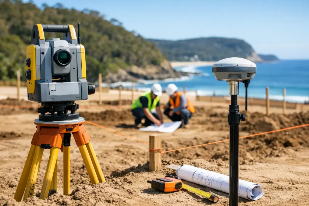
The field survey then records relevant existing marks, occupation features and measurements. Depending on the site, this can involve locating adjoining marks, examining nearby survey evidence and connecting the work to recognised control. Modern equipment, including Trimble surveying technology, supports precise field capture, but technology does not replace cadastral judgement. The interpretation of evidence and application of NSW survey requirements remains central to the result.

Once the evidence has been assessed, the surveyor can advise on the boundary position and arrange marking where included in the scope. Marks may be placed at accessible points, although dense vegetation, structures, rock, hard paving or unsafe access can affect what is practical. If a boundary point cannot be marked directly, the surveyor can explain suitable alternatives for setting out the line.

Turnaround time depends on property size, terrain, vegetation, access, the availability of historic records and the complexity of adjoining parcels. A level suburban block with clear marks is very different from a waterfront site, rural acreage or land with a long and irregular survey history. Providing a current address, plan details, photos and the reason for the survey helps the surveyor scope the work accurately from the outset.

Why local conditions can change the scope

Across the Central Coast, surveying conditions vary sharply between established coastal suburbs, steep hinterland blocks, bushland acreage and waterfront land. Sloping terrain can make a fence line appear to sit differently from the legal boundary. Older subdivisions may have limited visible evidence, while vegetation, retaining walls and redevelopment can obscure marks that were once readily accessible.

Waterfront and environmentally constrained sites can add further considerations. Licence areas, seawalls, jetties and structures near the water may involve arrangements that are separate from the freehold title boundary. A survey should clearly distinguish the land parcel from other rights, licences or occupation areas rather than treating them as interchangeable.

These are not reasons to delay the survey. They are reasons to involve a registered surveyor early enough for the evidence to be properly assessed.

Choosing the right surveyor for the job

For work that establishes or marks a legal boundary, engage a registered land surveyor with cadastral experience in NSW. Ask what the quoted scope includes, whether boundary marks will be placed where possible, what documents or plan will be provided, and whether the work is suitable for your intended use.

It is also worth explaining who else is involved. If an architect is preparing plans, a builder needs set-out information, or a solicitor is managing a title matter, early coordination avoids each party working from different information. Central Coast Surveyors works with direct property owners as well as project consultants, helping align survey deliverables with the next approval or construction step.

A clear boundary is not merely a line on paper. It is a practical foundation for decisions that affect your land, budget and relationships with adjoining owners. Before you build, fence or rely on an assumed line, get the boundary assessed properly and give the rest of the project a sound place to start.

Who Should I Hire for a Land Survey Near Terrigal NSW?

Who Should I Hire for a Land Survey Near Terrigal NSW?

A fence line, old peg or neighbour’s advice is not reliable evidence of where a Terrigal property boundary sits. This matters before you build a deck, plan an extension, replace fencing, buy a home or start a subdivision. If you are asking, “who should I hire for a land survey near Terrigal NSW?”, the short answer is a NSW Registered Surveyor with experience in the specific type of work your project requires.

That qualification is more than a title. A Registered Surveyor can determine and mark cadastral boundaries, prepare plans for legal and title purposes, and provide survey information that architects, builders, councils and NSW Land Registry Services can rely on. The right appointment can prevent an expensive redesign, a neighbour dispute or a construction delay later on.

Hire a Registered Surveyor, not just a measurement provider

Many businesses can measure a site. A draftsperson may prepare drawings, a building inspector can assess a dwelling, and a conveyancer can explain title documents. None of these roles replaces a Registered Surveyor where the question involves a legal boundary, easement, subdivision or title.

In NSW, cadastral surveying is regulated work. A Registered Surveyor has university-level surveying qualifications, supervised practical experience and registration to undertake work that defines or re-establishes land boundaries. They understand how to interpret deposited plans, surveys, dealings and title information, then reconcile that evidence with measurements on the ground.

For a straightforward design project, you may initially need a detail and contour survey rather than boundary mark-out. Even then, engaging a qualified local surveying consultancy is usually the practical choice. The survey needs to give your designer dependable levels, structures, trees, services visible on site and other physical features, rather than a rough sketch that leaves important decisions unresolved.

Who should I hire for a land survey near Terrigal NSW?

Hire a registered land surveyor whose service matches the decision you need to make next. The phrase “land survey” covers several different jobs, and choosing the wrong scope is one of the most common sources of wasted time and cost.

When you need to know where the boundary is

For fencing, retaining walls, encroachments, boundary questions or building close to a side boundary, ask for a cadastral boundary survey or boundary mark-out. The surveyor researches the title and survey evidence, carries out field measurements, assesses existing marks and places or identifies boundary marks where appropriate.

Do not assume existing pegs are correct just because they are visible. Marks can be disturbed during landscaping, construction or drainage works. A registered surveyor’s role is to evaluate the full evidence, not simply locate the nearest piece of metal in the ground.

When you are buying, selling or seeking a building certificate

An identification survey is commonly required where there is a concern about whether buildings and improvements sit within the property boundaries, or when a council building certificate is being pursued. It identifies the relationship between improvements and title boundaries, including apparent encroachments.

This is particularly useful for older homes, properties with additions, and sites where sheds, decks, pools or garages sit close to a boundary. The result can help a purchaser, owner, solicitor or council understand whether a problem needs further action before a transaction or approval proceeds.

When you are designing an extension or new home

For architectural and engineering design, request a detail and contour survey. It captures the landform and visible site features that influence building placement, stormwater design, access, excavation and compliance.

Terrigal and nearby coastal suburbs have varied topography, established vegetation and constrained residential sites. A survey that accurately records levels, existing buildings, driveways, retaining walls and neighbouring features can make the design process far more efficient. Depending on the project, your architect may also need boundary information incorporated into the survey.

When you are ready to build

A builder may need construction set-out to position the proposed works correctly from the approved plans. This can include set-out for excavations, footings, building lines, drainage or structural elements. Later, a floor level report or final survey may be needed to demonstrate that critical levels and locations meet approval requirements.

Construction set-out should not be treated as an informal site measurement. A small error at the start can affect setbacks, drainage falls, structural coordination and final certification.

When land, access or titles are changing

Subdivision, strata and community title work, easement creation and title registration require a Registered Surveyor with demonstrated experience in NSW land titling processes. These projects involve more than fieldwork. They demand coordination with planners, engineers, solicitors, certifiers, council and NSW Land Registry Services.

If access, drainage or services cross property boundaries, an easement may be part of the solution. A surveyor can help establish the practical and legal spatial information needed for the relevant documentation and plan preparation.

What local experience changes

Local knowledge is valuable, but it should sit alongside registration and sound technical process. A surveyor working regularly across the Central Coast is more likely to understand common site conditions, local approval pathways and the way consultants need survey information presented.

On coastal and hillside sites, details such as steep grades, retaining structures, older subdivisions, narrow access and complex drainage can affect the survey scope. Properties near waterways may also involve waterfront licence or occupation considerations that require careful identification of relevant features and boundaries.

A local surveyor should not promise that every issue will be simple. The better sign is that they explain foreseeable risks early, identify information they need before attending site and coordinate promptly with the rest of the project team.

Questions worth asking before you appoint a surveyor

A useful first conversation should quickly establish the purpose of the survey, the property address, the stage of your project and any deadline tied to finance, design, council or construction. You should also ask whether the person responsible for cadastral work is a NSW Registered Surveyor, and whether they have handled comparable work.

Ask what the quoted scope includes. For example, will it include title and plan research, site work, boundary mark placement, a survey plan, contours, visible services, floor levels or coordination with your architect? The answer matters because two quotes with similar names can cover very different deliverables.

It is also reasonable to ask about turnaround time, site access requirements and what may cause a variation. A difficult boundary re-establishment may require additional research or field investigation. A large, heavily vegetated or inaccessible block can take longer than a clear suburban allotment. Straight answers at the quoting stage are usually more useful than an unrealistically low price.

Avoid these common shortcuts

The cheapest price is not always the lowest project cost. If incomplete survey information forces a designer to revisit plans, delays a builder, or leaves a boundary issue unresolved, the apparent saving disappears quickly.

Be cautious about relying on online mapping, estate plans, aerial imagery or dimensions taken from a contract for sale. These documents can be useful background material, but they are not a substitute for a current survey prepared for your site and purpose. Likewise, do not ask a surveyor to mark a boundary from measurements alone without the appropriate cadastral investigation.

It also helps to engage the surveyor early. Waiting until plans are final may mean discovering a boundary constraint, easement or level issue after design decisions have been made. Early survey data gives your architect, planner and engineer a dependable base to work from.

Choose a surveyor who can support the next stage

The best surveyor is not necessarily the largest firm or the one closest to your address. It is the registered professional who understands the required outcome, provides a clear scope, delivers accurate information when the project needs it and works effectively with your other consultants.

Central Coast Surveyors supports property owners and project teams from initial detail surveys through boundary work, construction set-out and title registration. For clients, that continuity can reduce handovers and keep the surveying information consistent as a project develops.

Before accepting a quote, state the decision you need the survey to support: confirming a fence line, designing a home, obtaining a building certificate, setting out construction or creating a new title. That one clear sentence will help the surveyor recommend the right work from the outset, rather than asking you to pay twice for information that should have been captured the first time.

How to Verify Boundary Marks on Your Property

How to Verify Boundary Marks on Your Property

A fence that has stood for 30 years can still be in the wrong place. So can a garden edge, retaining wall, driveway or neighbour’s informal ‘boundary peg’. If you are asking how to verify boundary marks, the key point is simple: finding a mark is not the same as proving a legal boundary.

For Central Coast property owners, this distinction matters before fencing, building near a side boundary, buying or selling, applying for a building certificate, resolving a neighbour discussion, or planning a subdivision. A boundary error can lead to redesign costs, construction delays and difficult disputes that were avoidable with the right survey evidence.

What counts as a boundary mark?

Boundary marks are physical reference points that help define the legal limits of a parcel of land. Depending on the age and type of subdivision, they may include survey pegs, metal pipes, nails, drill holes, concrete marks, reference marks or marks set into kerbs and walls.

Not every visible object near a boundary is an official survey mark. Old timber pegs can rot, be shifted or be mistaken for building set-out pegs. A star picket may have been installed for a fence. A concrete path may have been poured over a mark. Even a genuine survey mark cannot be relied on in isolation without checking it against the registered plan, title information and surrounding survey evidence.

The legal boundary is established through the cadastral survey process, not by the fence line or what a neighbour believes has always been accepted.

How to verify boundary marks correctly

Verification is a process of gathering and assessing evidence. It is not a matter of measuring from a kerb with a tape measure or using a mobile mapping app. Those methods can be useful for rough orientation, but they cannot establish a boundary suitable for construction, legal documentation or dispute resolution.

Start with your title and deposited plan

Your Certificate of Title and deposited plan provide a starting point. They identify the lot, plan number, dimensions, easements and other registered interests affecting the land. The plan may show boundary lengths, angles, curved frontages and the relationship between lots.

However, plans are technical documents. A listed dimension does not always translate into a straightforward on-site measurement. Older plans may reference original marks that are no longer visible, while later developments can involve multiple stages, easements, road widening or changes to adjoining parcels.

Title information also does not show where a boundary sits on the ground in a way that makes it safe to build a wall, place a fence or excavate. It must be interpreted alongside physical evidence and relevant survey records.

Look for marks, but do not move them

You can inspect the property for visible marks at corners, along side boundaries and near the road frontage. Check garden beds, fence returns, driveway edges and areas near retaining walls, where marks may be obscured. Take clear photos and note their approximate positions for the surveyor.

Do not dig aggressively, remove soil around a mark, pull it out or replace a missing peg yourself. A mark may be evidence that needs professional assessment, and moving it can create confusion or compromise the survey. It may also be an offence to interfere with a survey mark.

Visible marks are useful clues. They are not a DIY confirmation of ownership.

Compare the site with the survey evidence

A registered land surveyor examines the available plans and survey records, then searches for and assesses marks on the subject land and often on neighbouring land or in the road reserve. The surveyor considers the age, type and condition of each mark, as well as its relationship to other original and reference marks.

This is where professional judgement matters. Surveyors do not simply accept the nearest peg. They weigh the evidence under NSW surveying requirements to determine whether a mark is original, undisturbed and consistent with the adopted boundary definition.

Modern Trimble equipment provides highly accurate measurement, but technology alone does not decide the legal position. Accurate field observations must be combined with cadastral records, calculations and the expertise of a registered surveyor.

Have the boundary marked out for the purpose you need

Once the boundary has been determined, the surveyor can mark it on site. A cadastral boundary mark-out is commonly requested before fencing, demolition, excavation, designing an extension or building close to a side or rear boundary.

The right service depends on the project. If you need to establish where the boundary is, a boundary mark-out may be appropriate. If council, a purchaser or a lender needs confirmation of buildings, fences, encroachments and easements in relation to the title, an identification survey may be required. For a new dwelling or development, the boundary work may also inform building set-out and floor level planning.

Asking for the correct survey at the start avoids paying for information that does not answer the question your builder, architect, council or conveyancer actually has.

Why fences are not reliable boundary evidence

Many boundary questions begin with a fence. It is natural to assume that a long-standing fence follows the title line, particularly in established Terrigal and Central Coast neighbourhoods. Sometimes it does. Sometimes it does not.

Fences can be set inside a boundary to avoid difficult ground, established before a later subdivision, rebuilt without a survey, or shifted over time. They may also jog around trees, rock shelves, drainage lines or existing structures. On rural and larger residential lots, the difference can be more substantial than expected.

A fence that encroaches by a small amount may seem inconsequential until you plan a new garage, sell the property, replace a retaining wall or subdivide. At that point, the location of the legal line can affect setbacks, design options, consent requirements and negotiations with adjoining owners.

When a boundary survey is worth arranging

A professional boundary assessment is sensible whenever the answer will influence a decision with cost, approval or legal consequences. This includes situations such as:

  • installing or replacing a boundary fence, retaining wall or pool barrier;
  • building an addition, garage, deck or secondary dwelling near a boundary;
  • purchasing a property where improvements appear close to lot lines;
  • responding to a concern about an encroachment or access arrangement;
  • preparing plans for subdivision, easement creation or title work; and
  • obtaining an identification survey for a building certificate or property transaction.

It can also be valuable before design work begins. Architects and builders can make better decisions when they have confirmed boundary information, easement locations and accurate site detail before drawings are advanced. That early clarity is usually less expensive than redesigning plans after a boundary issue appears on site.

Boundary marks, easements and other limits

Verifying the parcel boundary does not automatically answer every question about where you can build. A registered easement for drainage, sewer, services, access or another purpose may run within the property. Council planning controls, building setbacks, bushfire requirements, flood constraints and utility infrastructure can also affect what is possible.

For example, a proposed shed may sit wholly within your lot but still conflict with an easement. Likewise, a wall may be clear of the title boundary yet create a problem if the design assumes the fence is the legal line. Survey information provides the accurate spatial foundation, but it should be coordinated with planning, engineering and construction advice.

This is particularly relevant on sloping sites, waterfront land and properties with older improvements, where levels, structures and title constraints often need to be considered together.

What to provide your surveyor

A surveyor can begin with the property address and lot and plan details, but any additional information may help streamline the work. Provide copies of your title documents or deposited plan if available, photos of suspected marks, details of proposed work and any correspondence that explains why the boundary is being checked.

Tell the surveyor if access is restricted, dogs are on site, dense vegetation covers corners, or a neighbour has raised a specific concern. If the work supports an architect, builder, planner or conveyancer, explain their required deliverable and timeframe. Clear coordination helps keep approvals and construction moving.

A practical next step

If the boundary location will affect a fence, building line, approval, purchase or neighbour discussion, arrange a registered surveyor before committing to work on the ground. A clear, properly marked boundary gives everyone involved a reliable point from which to make decisions – and helps keep a straightforward project from becoming an expensive correction later.

Top Survey Mistakes Delaying Approvals in NSW

Top Survey Mistakes Delaying Approvals in NSW

A development application can be ready to lodge, a builder can be booked and finance can be in place, yet the project still stops because the survey information is incomplete, out of date or prepared for the wrong purpose. The top survey mistakes delaying approvals are rarely dramatic. More often, they are small gaps in scope, title information or coordination that force council, a certifier or another consultant to request further detail.

For Central Coast property owners and project teams, the practical answer is to involve a registered surveyor early and make sure the survey brief matches the decision ahead. A contour plan for preliminary design, for example, does not necessarily answer the legal boundary questions needed for a building certificate, land transfer or subdivision.

1. Ordering the wrong type of survey

“Survey” is a broad term, but each survey serves a different purpose. Treating them as interchangeable is one of the most common causes of rework.

A detail and contour survey gives architects, planners and engineers reliable information about levels, existing buildings, trees, services visible on site and other physical features. It is usually the right starting point for designing a house, extension, drainage solution or development proposal. It does not automatically establish every legal boundary position.

An identification survey examines the relationship between title boundaries and existing improvements. It may be required where a building certificate is sought, when selling or transferring certain properties, or where there is a concern that a structure encroaches over a boundary or easement. A cadastral boundary mark-out, meanwhile, is used to identify and mark boundary positions on the ground.

The approval risk arises when a design is prepared from a basic plan, then later requires legal boundary confirmation. If a proposed wall, pool, driveway or balcony is close to a boundary, establish what level of certainty the designer and certifier need before finalising the plans. The cheapest initial scope is not always the fastest or most economical project decision.

2. Relying on old plans or informal boundary assumptions

Old subdivision plans, marketing diagrams, neighbour advice and online mapping can be useful background material. They are not a substitute for a current survey undertaken for the project.

Fences are particularly misleading. A fence may be inside a title boundary, over it, or built to serve a practical purpose rather than mark a legal line. Retaining walls, garden beds and driveways can create the same false confidence. On established Central Coast sites, alterations over decades can make the discrepancy between occupation and title boundaries significant.

Designing to an assumed fence line can create approval and construction problems. A proposed building may fail required setbacks, a pool may be too close to a boundary, or excavation works may affect land outside the owner’s title. Fixing this after plans are prepared can mean redesign, amended consultant drawings and delays to the approval pathway.

A registered surveyor assesses available evidence, title information and marks on the ground to determine boundary positions. That process provides a dependable basis for design decisions, rather than an assumption that becomes expensive later.

3. Leaving survey information out of the design brief

A survey is only useful when the design team understands what it records and what the site requires. A common mistake is sending the survey to an architect or building designer without discussing critical constraints.

Before design begins, identify matters such as intended building footprint, excavation, access, drainage, retaining walls, proposed pool location and whether the site has waterfront, bushfire, flood or steep-slope considerations. This helps determine whether extra levels, adjoining features, visible drainage structures or other site details need to be captured.

On sloping land, insufficient level information can quickly affect earthworks estimates, floor-level design and stormwater planning. On tighter urban lots, the location of existing structures and boundary offsets may be the decisive information. For larger rural properties, access, contours and the extent of the proposed works area need careful consideration.

The right approach depends on the project. A small internal renovation will not require the same fieldwork as a new dwelling, dual occupancy or multi-lot subdivision. A clear brief avoids paying for irrelevant detail while ensuring the information needed for design and approval is available when it is needed.

4. Ignoring easements, restrictions and title burdens

A title boundary is not the only line that matters. Easements for drainage, sewerage, access, electricity or other services can limit where structures may be placed and what work can occur. Restrictions on the use of land may also affect development options.

Problems often emerge when an easement is noticed after a garage, pool, retaining wall or proposed subdivision layout has already been designed. Even where building within or near an easement may be possible, it can require consent from the relevant authority or a redesign to avoid the burden. That process is rarely quick.

For subdivisions, title matters become even more important. New lots, access handles, common property, rights of carriageway and service easements must be planned in a way that works physically on site and legally on the final plan. Surveying, planning, civil engineering and legal requirements need to align from the outset.

Ask for title constraints to be considered as part of the early project review. This allows the project team to resolve conflicts on paper, where changes are far more manageable than they are after a development application or construction certificate has been submitted.

5. Failing to coordinate survey data with other consultants

Approval drawings are a coordinated set, not a collection of separate documents. Differences between the survey, architectural plans, stormwater design, landscape plans and civil drawings can trigger questions from council or a certifier.

Typical inconsistencies include different site levels, a driveway shown in one location on one plan and another location on a second plan, or setbacks measured from an assumed boundary rather than the surveyed boundary. Even a small mismatch can affect compliance calculations, drainage design or construction set-out.

The solution is straightforward: provide the current survey file and plan to every relevant consultant, and make it the agreed base for the project. If site conditions change, such as a structure being demolished or a boundary issue being resolved, let the whole team know. A revised survey should not sit unnoticed in one consultant’s inbox while everyone else continues using an earlier version.

Early coordination is especially valuable where a site has constrained access, significant slope, neighbouring development, heritage considerations or a complicated title arrangement. These projects benefit from a surveyor who can communicate directly with architects, engineers, planners and project managers as questions arise.

6. Leaving surveys until the approval deadline

A survey cannot be treated as a last-minute administrative task. Fieldwork, research, calculations, drafting and quality checks all take time, particularly where a property has complex boundaries, dense vegetation, difficult access or limited evidence of existing survey marks.

The pressure increases when survey findings require design changes. If the survey is commissioned days before a council lodgement or construction start, there is little room to resolve a setback issue, obtain additional title information or adjust engineering. Rushing the process can also lead to a scope that does not cover the actual approval requirement.

Book the initial detail and contour survey before concept design is locked in. If the project involves boundary-sensitive construction, title transfer, building compliance or subdivision, discuss those requirements at the same time. This gives the surveyor an opportunity to recommend the correct sequence of work.

Fast turnaround is valuable, but it works best when paired with complete instructions, safe access to the site and current title documents where available. Prompt decisions from the client and consultant team also keep the work moving.

7. Assuming approval is the end of the surveying role

Many projects need survey support after approval. Construction set-out transfers the approved design accurately onto the ground, helping builders position buildings, walls, roads and services correctly. Floor level reports may be required during construction to verify finished levels. Final surveys and plans are essential for subdivision registration and creating new titles through NSW Land Registry Services.

If these later stages are not considered early, designs may be difficult to set out, level requirements may be unclear, or final title work may expose an issue that should have been addressed during planning. This does not mean every project needs every service from day one. It means the project team should understand the likely surveying pathway before committing to timelines and contracts.

A better starting point for approval-ready plans

Before asking for a fee proposal, gather the property address, current title information if available, any existing plans, photographs of the site and a short explanation of what you intend to build, alter, certify or subdivide. Mention deadlines, known boundary concerns and the consultants already involved. That information helps a registered surveyor recommend a scope that supports the actual project rather than simply supplying a generic plan.

The most effective approvals begin with reliable ground and title information. When the survey reflects the site, the design responds to the constraints and the consultant team works from the same base, approval questions become easier to answer and construction can proceed with greater certainty.

Top Rated Land Surveyors on the Central Coast NSW

Top Rated Land Surveyors on the Central Coast NSW

A survey that arrives late, misses a critical level or does not match a planner’s requirements can hold up far more than a set of drawings. It can delay a DA, push back a build, create uncertainty around a boundary or leave a subdivision plan unable to progress. When searching for top rated land surveyors on the Central Coast NSW, the right choice is not simply the firm with the strongest online profile. It is the one with the registration, local knowledge and practical systems to keep your particular project moving.

For a homeowner, that may mean a clear identification survey before selling, renovating or applying for a building certificate. For an architect or builder, it may mean accurate contour data delivered early enough to inform design. For a developer, it often means a surveyor capable of managing the work from initial feature survey through to subdivision and plan registration.

What makes a land surveyor highly rated in practice?

A good reputation should be supported by outcomes that matter on site and in the approval process. Land surveying is regulated professional work, not just measuring a block with GPS equipment. The survey information can affect property rights, design decisions, construction levels, council documentation and title registration.

The strongest indicators of a dependable surveyor are usually registration, relevant experience, responsive communication and a clear understanding of the required scope. A registered land surveyor has the authority and competency to undertake cadastral work, including boundary definition and subdivision plans. That distinction matters whenever the work concerns title boundaries, easements, strata plans or dealings with NSW Land Registry Services.

Speed also matters, but it should mean organised fieldwork, capable staff and efficient processing rather than rushed work. A rapid turnaround is valuable when a builder is ready to start, a contract is conditional on an identification survey or consultants are waiting on base information. It still needs to be backed by checking, sound records and a plan that the next consultant can use confidently.

How to assess top rated land surveyors on the Central Coast NSW

Rather than comparing firms on a single rating or a broad service description, ask how they would approach your site and deliverable. The answer will quickly show whether they understand the job.

Confirm the surveyor is registered for title and boundary work

If you need to locate a boundary, create an easement, subdivide land or prepare a plan for registration, confirm that the work is led by a NSW registered land surveyor. This is especially important where old fencing, occupation lines or neighbouring improvements do not appear to match the title boundary.

A fence is not automatically a legal boundary. Nor is a peg found in the ground necessarily reliable without the survey evidence and calculations needed to verify it. A registered surveyor investigates title information, existing marks and relevant records before determining the position of a boundary. That work can prevent costly assumptions before a fence, retaining wall, driveway or new building goes in.

Match the service to the decision you need to make

The phrase ‘land survey’ covers several different services. Appointing the wrong type can create a second round of work and unnecessary delay.

A detail and contour survey records features, levels, buildings, trees, services visible on site and other information needed for design. It is commonly the first step for architects, designers and engineers. An identification survey focuses on the relationship between property boundaries and existing improvements, and may be needed for a building certificate, a sale, a waterfront licence transfer or to clarify encroachments.

Construction set-out transfers approved design information onto the ground so builders can establish building corners, grids, levels and structural elements accurately. Floor level reports provide verified levels against nominated benchmarks or flood-related requirements. Subdivision work can involve boundary definition, easements, survey plans and the coordination required to progress Torrens, strata or community title outcomes.

Explain the reason for the survey when you make contact. A clear brief lets the surveyor recommend the correct scope rather than supplying a generic plan that does not serve the next stage of the project.

Look for local planning and site knowledge

Central Coast sites can bring practical complications that do not always show up in an aerial image. Sloping blocks, bushland, older subdivisions, waterfront land, narrow access, dense vegetation and established residential areas each affect fieldwork and design decisions. Local experience helps a surveyor anticipate what an architect, certifier, council officer, builder or adjoining owner may need to see.

This does not mean every project needs the largest possible scope. A straightforward urban building set-out and a complex waterfront subdivision demand different levels of investigation. The value of local expertise is in identifying those differences early, before they become variations or approval questions later.

Ask how the survey data will work with other consultants

Surveying should make it easier for the project team to do their work. For design projects, ask whether the survey will be issued in formats suitable for architectural and engineering software, and whether the plan will clearly show the information needed for concept design, stormwater design or structural planning.

For construction, establish the nominated datum, control points, design files and set-out responsibility before site work begins. Small discrepancies between plans, levels and assumed boundaries can become expensive once excavation or concrete is underway. A surveyor who communicates directly with your architect, engineer, planner, project manager or builder can resolve questions before they reach site.

Advanced field technology, including Trimble surveying equipment, can improve accuracy and efficiency. However, equipment is only part of the picture. The quality of the field records, office calculations, professional judgement and checking process remains just as important.

Questions worth asking before you appoint a surveyor

A practical conversation at the quotation stage can save weeks later. Ask what information the surveyor needs from you, what the deliverables include, whether a site visit is required before pricing, and what timeframe applies from instruction to final plans.

It is also sensible to ask whether title documents, deposited plans, development consent, architectural drawings or engineering files are needed. For an identification survey or boundary mark-out, ask how existing boundary evidence will be assessed and whether any adjoining issues may need further investigation. For a subdivision, ask which parts of the process the surveyor can coordinate and which approvals or specialist reports sit with other consultants.

Price matters, but the cheapest fee is not always the lowest project cost. A quote may look attractive because it excludes field complexity, plan formats, liaison, additional marks, construction visits or registration-related work. Compare scopes line by line. A transparent quotation should identify the purpose of the survey, what will be delivered, key assumptions and likely factors that could affect the fee.

When a quick survey is appropriate – and when it is not

Some work genuinely needs a fast response. A builder may need set-out before a scheduled pour, or a property owner may require an identification survey to satisfy a transaction deadline. A well-equipped local consultancy can often respond quickly when the brief, access and documents are ready.

Other work needs time because the risk is higher. Boundary discrepancies, incomplete records, difficult terrain, complex title histories and subdivision designs can require additional research and field verification. In these circumstances, a surveyor who explains the reason for the extra work is protecting the project, not creating unnecessary delay.

Early engagement usually provides the best balance. Involve the surveyor before finalising building placement, signing off civil design or committing to a fence line. The earlier accurate information is available, the more cheaply a design issue can be resolved.

Choose a project partner, not just a plan provider

The best surveying appointment gives you more than a PDF at the end of a job. It gives your team dependable information, a clear point of contact and practical guidance when the site or title records raise questions. Central Coast Surveyors supports this full process, from detail surveys and boundary work through construction set-out, subdivision and registration requirements.

Before committing, provide the property address, the project purpose, any available plans and your required timeframe. A capable registered surveyor can then define the right scope, identify foreseeable issues and help you take the next step with confidence rather than assumption.

How to Choose the Best Land Surveyor in Terrigal

How to Choose the Best Land Surveyor in Terrigal

A survey can look like a small line item on a building or property budget – until an unclear boundary, missing level or incorrect set-out holds up the job. Finding the best land surveyor in Terrigal is less about choosing the lowest quote and more about appointing someone with the right registration, local knowledge and scope for the decision in front of you.

For a new home, renovation, subdivision, fence, waterfront matter or commercial development, the survey data often becomes the starting point for everyone else. Architects design from it, engineers rely on it, certifiers and council assess it, and builders use it to put a structure in the correct place. Getting that first step right protects the programme, the budget and, in some cases, your property rights.

Start with the survey you actually need

“Land survey” is a broad description. Before comparing firms, identify the purpose of the work. A topographical or detail and contour survey records the site’s features, levels, buildings, trees, services visible on site and other relevant detail. It gives designers a dependable base plan for planning a new dwelling, extension, drainage solution or development proposal.

An identification survey has a different purpose. It identifies the property in relation to title boundaries and improvements, and may be required for a council building certificate, a property transaction or a waterfront licence transfer. If the question is whether an existing building, fence or retaining wall sits within the title boundary, a simple contour plan will not answer it.

For construction, you may need a building set-out survey to establish the approved building position on site, followed by checks at key stages. For a subdivision, easement or title matter, the work is more involved again. It may require cadastral investigation, field measurements, plan preparation and lodgement processes through NSW Land Registry Services.

The best choice depends on the job. A surveyor who is excellent at capturing detailed existing conditions for an architect may not be the right appointment for a complex strata or Torrens title subdivision unless they also have the required cadastral capability and registration. Be specific when describing your project, even if it is only at the feasibility stage.

Check registration before comparing price

Where property boundaries, subdivision plans or title matters are involved, registration matters. In NSW, only a registered land surveyor can carry out cadastral surveying work that defines or re-establishes legal boundaries and prepares certain plans for registration.

This is not a formality. A cadastral survey requires an assessment of title information, deposited plans, survey evidence and legal requirements, as well as precise field work. Pegs or old fences are not reliable proof of a boundary on their own. They may be displaced, missing, or never have represented the legal line in the first place.

Ask who will take responsibility for the work and whether a registered surveyor will be directly involved. It is also reasonable to ask about experience with the specific type of project – for example, a sloping residential site, an older property with limited survey marks, a boundary mark-out, or a multi-lot subdivision.

A low fee can be attractive, but it can become expensive if the scope is incomplete or the survey cannot be used for its intended approval, design or construction purpose. Compare like for like: the deliverables, the level of detail, the timing, any required plan lodgements, and the support included after the survey is issued.

Local experience helps on complex Terrigal sites

Terrigal sites can present practical surveying challenges that are easy to underestimate from an aerial image. Sloping blocks, established vegetation, tight access, older development patterns and coastal conditions can all affect field work, design decisions and construction planning.

A surveyor familiar with the Central Coast is more likely to anticipate what designers, builders and approval consultants need from the information. For example, accurate contours and floor levels may be essential where a proposal needs to respond to fall across the site. Boundary definition can be particularly important when an extension, pool, garage or fence is close to a title line.

Local experience does not replace formal survey investigation, and every site is different. It does, however, help the surveyor ask better questions at the start and collect the right information before the next consultant begins work.

Look for a clear scope and usable deliverables

A professional quotation should do more than state a price and a broad service name. It should explain what is included, what information the surveyor needs from you, the expected deliverables and any factors that could change the fee or timing.

For a detail and contour survey, confirm whether the plan will show the items relevant to your proposal, such as existing buildings, visible services, kerbs, driveways, significant trees, spot levels, contours and adjacent features where appropriate. If your architect or engineer has a preferred drawing format, raise that before field work begins.

For boundary work, ask whether the scope includes locating and marking the boundaries on site, providing a plan, or both. If you are planning a fence or building near a boundary, explain that clearly. The surveyor can then advise on the appropriate level of work rather than leaving a critical assumption untested.

Construction projects need equally clear communication. A set-out is only as good as the approved plans and control information supplied. Confirm which drawings will be used, what elements are to be set out, whether offsets or profiles are required, and when the builder needs the work completed. This prevents a surveyor arriving with one set of instructions while the site team is working from another.

Assess turnaround in the context of quality

Fast turnaround is valuable when a design team is waiting, a builder is ready to start or a contract date is approaching. But “fast” should mean organised field work, efficient processing and clear communication – not rushed measurements or a vague plan that creates extra questions later.

Ask about the likely timeframe from instruction to site attendance and from field work to delivery. Also ask what may affect timing. Restricted access, poor weather, unavailable title documents, extensive vegetation, complex boundary evidence and changes to scope can all have an impact.

The useful question is not simply, “When can I have it?” It is, “What do you need from me to keep this moving?” Prompt access, current architectural drawings, title documents where available and a clear project brief can remove avoidable delays.

Choose a surveyor who works well with the wider team

Surveying rarely happens in isolation. On many projects, the surveyor needs to coordinate with the owner, architect, planner, engineer, builder, certifier, solicitor or project manager. A good working relationship between these people can prevent small information gaps becoming costly redesigns or site delays.

Look for practical communication. Can the surveyor explain what they need in plain language? Will they flag an issue early if site conditions differ from the drawings? Are they comfortable providing the data formats your designers require? These details are especially valuable for clients managing their first project, but experienced builders and consultants benefit from them too.

Central Coast Surveyors approaches this as an end-to-end service, supporting projects from initial detail surveys through construction set-out and, where required, final plans and title registration. The benefit is continuity: the surveying information can remain consistent as a project moves from concept to construction and completion.

Questions worth asking before you appoint

Before engaging a surveyor, a short conversation can reveal whether the service is suited to your project. Ask whether the proposed work is the correct survey type, who will be responsible for cadastral decisions, what the final deliverables will include, and how long the work is expected to take.

You should also ask whether there are likely site-specific complications, whether additional consultant coordination is anticipated, and what could cause a variation. A surveyor cannot predict every issue before inspecting the site, particularly on older or complicated properties. However, they should be upfront about the factors that may affect scope rather than promising certainty where none exists.

Make the appointment early

The strongest time to engage a surveyor is usually before plans are advanced and before a builder is booked to start. Early, accurate information gives the design team room to respond to boundaries, levels and existing conditions while changes are still straightforward.

If you are comparing options, choose the surveyor who understands the decision you need to make next, not simply the person who offers the quickest generic quote. Clear information at the beginning gives every person on the project a firmer place to work from.

Construction Surveying That Keeps Builds Moving

Construction Surveying That Keeps Builds Moving

A building can be designed to the millimetre on paper and still run into trouble once work starts on site. A misplaced footing, incorrect finished floor level or structure built too close to a boundary can trigger expensive rework at the point when the programme is already under pressure. Construction surveying provides the control points, set-out marks and verification needed to turn approved plans into work that is built in the right place, at the right level.

For builders, property owners and project consultants, surveying is not a task to leave until the slab is ready. Early, accurate input helps the architect, engineer, certifier and construction team work from the same site information. It reduces assumptions before they become variations.

What construction surveying does on a live project

Construction surveying translates design information into physical reference points on the ground. Using calibrated equipment, a surveyor establishes positions and levels so contractors can locate elements such as building corners, excavations, footings, retaining walls, roads, services and drainage.

The work generally begins with a reliable survey base. On a residential project, that may include identifying existing features, contours, visible services, neighbouring structures and site constraints. The design team then uses this information to prepare plans that respond to the actual land rather than an assumed site condition.

Once construction drawings are ready, set-out places key points where the plans require them. This might involve marking the building grid, external walls, column locations, batter lines, kerb alignment or design levels. Survey marks are a controlled reference for the trades, not a substitute for reading the drawings. Builders and subcontractors still need to confirm the relevant plans, revisions and tolerances before proceeding.

Verification surveys are equally valuable. They check whether completed work matches the approved design and whether levels, locations and clearances are within the tolerances required for that stage. This is particularly useful before concrete is poured, walls are backfilled or elements become difficult to access.

Surveying at the stages where errors are costly

The exact scope depends on the size, design and risk profile of the job. A straightforward single dwelling will not need the same level of field control as a multi-stage subdivision or commercial development. However, there are several points where timely survey input can prevent avoidable disruption.

Before design and approvals

A detail and contour survey gives designers an accurate picture of the land. It can show ground levels, existing buildings, fences, driveways, vegetation, visible site features and services evidence where applicable. For sloping Central Coast sites, this information is especially important. Small level differences can affect cut and fill quantities, stormwater design, retaining requirements, driveway grades and the practical placement of a home.

Where the project depends on boundary position, an identification survey or cadastral boundary mark-out may also be required. A fence is not proof of a legal boundary. It may sit inside, outside or across the title line, particularly on older properties where occupation has changed over time.

Before excavation and slab work

This is often the point at which set-out becomes most visible to the site team. Building corners, grid lines, offsets and finished floor levels can be established so excavation and formwork are based on measured positions rather than tape measurements from an unreliable feature.

The finished floor level deserves particular attention. It needs to work with the approved plans, drainage design, flood or coastal considerations where relevant, access requirements and the existing ground. Changing it casually on site can have consequences for approvals, stormwater performance and connections to adjoining work.

During structural and civil works

As work progresses, survey control supports the placement of columns, walls, steelwork, retaining structures, pavements, pits and drainage. Civil works often require regular checks because grade is fundamental to drainage. A pipe that is only slightly out of level can create a significant problem once trenches are closed and the surface is finished.

For larger sites, repeat set-out and verification creates a clear chain of information between consultants, contractors and project managers. It also helps resolve practical questions quickly when drawings are revised or unexpected site conditions are found.

At completion and handover

Final or work-as-executed surveys record what has actually been built. These plans may be needed for service authority requirements, council conditions, asset records, occupation processes or future design work. They are different from a simple site measure-up because the purpose is to document completed infrastructure or structures against a defined datum and coordinate system.

If the project involves subdivision, strata, community title or new easements, the surveying process continues beyond construction. Plans must meet the relevant NSW requirements before they can proceed through certification and registration. This is where registered surveying expertise matters directly, as title and boundary work has legal consequences.

Why a small set-out error can become a major cost

Construction tolerances vary. Some work allows more movement than others, and a surveyor will set out to the accuracy appropriate to the design and construction method. The risk is not simply being a few millimetres out. It is the compounding effect of an early error carried through several trades.

A building positioned incorrectly may affect boundary setbacks, easements, fire separation or planning compliance. A retaining wall that misses its intended alignment can reduce usable space or conflict with drainage. Incorrect levels can lead to ponding water, inaccessible thresholds, unsuitable driveway grades or extra earthworks.

The cost is also rarely limited to rectification. Delays can affect concrete bookings, subcontractor sequencing, inspection dates and settlement targets. Accurate survey control is a relatively small part of the overall project cost, but it protects decisions that are difficult and expensive to reverse.

Registered expertise and practical site coordination

Not every construction set-out task has the same legal status. General engineering or building set-out can be undertaken within a broader construction workflow, while cadastral work involving property boundaries, subdivision plans and title matters requires a registered surveyor in NSW. Knowing which service is required avoids engaging the wrong professional or relying on information that cannot be used for its intended purpose.

A capable surveying consultancy also understands that site data must be usable. Builders need clear marks, offsets that are likely to survive site activity, prompt answers when drawings change and field information that aligns with the engineer’s or architect’s coordinate system. Project managers need reliable timing and records that support decisions. Property owners need plain-English advice about what the survey will establish and what it cannot establish.

Modern Trimble surveying equipment can improve speed and precision, but technology alone does not make a result dependable. The survey needs sound control, correct interpretation of the plans, careful field procedures and an experienced person checking the outcome. On a complex site, judgement is often as valuable as the instrument.

How to brief your surveyor for a better result

The best time to engage a surveyor is before the programme becomes tight. Provide the latest architectural, structural, civil and hydraulic drawings, along with any relevant approval conditions, title information and existing surveys. If there are known issues such as disputed fences, difficult access, steep terrain, waterfront constraints or previous unapproved work, raise them early.

It also helps to be clear about the immediate decision the survey must support. Do you need a design base for an architect? A legal boundary mark-out before fencing? Set-out for a slab? Verification before a pour? Or final information for council, an authority or title registration? A defined purpose allows the scope, accuracy and timing to match the work.

On active sites, nominate one person to manage drawing revisions and communicate changes. Surveying from an outdated plan is a common and preventable source of confusion. Where several consultants are involved, ask them to agree on the project datum, coordinate system and level reference at the outset.

For projects across Terrigal and the wider Central Coast, local experience can also make the process more efficient. Familiarity with steep lots, established residential areas, coastal conditions and typical approval pathways helps identify survey needs before they affect the construction sequence.

A well-timed survey does more than put pegs in the ground. It gives every person on site a dependable reference point for the next decision, helping the project move forward with fewer surprises and less rework.

Land Surveyor Recommendations for Terrigal Sites

Land Surveyor Recommendations for Terrigal Sites

A boundary peg hidden beneath garden growth, a sloping block above the beach, or plans that need to be lodged before a builder can start – these are not jobs for a generic quote and a hopeful guess. When seeking land surveyor recommendations in the Terrigal area, the right choice depends on what you need surveyed, where your project is up to and whether the work must support council, construction or NSW Land Registry Services requirements.

A good recommendation should do more than point you towards a familiar name. It should help you appoint a surveyor with the registration, local experience and capacity to provide the right information at the right point in your project.

Why recommendations need to match the job

“Land survey” can describe very different work. A homeowner preparing a new deck may need an identification survey or boundary advice. An architect designing an extension usually needs an accurate detail and contour survey. A developer creating new lots needs a registered surveyor who can manage the subdivision process through to plan registration.

The consequences of choosing the wrong scope can be significant. Design teams may work from incomplete levels, a builder may set out work incorrectly, or an approval process may pause while further information is obtained. The cheapest initial quote is not necessarily the lowest project cost if the survey needs to be repeated or does not meet the requirements of the next consultant.

For Terrigal properties, the site itself often adds complexity. Sloping terrain, older development patterns, constrained access, coastal exposure and neighbouring improvements can all affect the field work and the detail needed in the final plan. A surveyor familiar with Central Coast conditions can identify likely issues early, rather than leaving them for the designer, certifier or builder to uncover later.

Land surveyor recommendations for Terrigal projects

The most useful recommendations come from people whose project was similar to yours. An architect can usually comment on the quality and usability of a contour survey. A builder can speak to set-out accuracy and responsiveness on site. A conveyancer or solicitor may have experience with identification surveys, easements or title matters. For a subdivision, ask planners and civil engineers who regularly work with surveyors through the approval and registration stages.

Even then, confirm the details yourself. A strong recommendation is a starting point, not a substitute for checking capability.

Check registration and relevant experience

If your work involves property boundaries, subdivision plans, easements or dealings with NSW Land Registry Services, ensure the person responsible is a Registered Surveyor in NSW. Registration matters because cadastral work has legal and title implications. It requires more than operating survey equipment or producing a basic site drawing.

Ask who will oversee the work, what type of projects they complete most often, and whether they have handled comparable sites. A surveyor who mainly performs construction set-out may not be the best fit for a complex title boundary question. Equally, a specialist in cadastral surveys may not be the most efficient choice for a large commercial set-out programme.

Make sure the scope is clear

Before comparing recommendations or quotes, describe the outcome you need. Explain whether the survey is for an architect, council application, building certificate, fence, waterfront licence transfer, construction work or subdivision. Provide any available plans, title documents, consultant drawings and site access details.

A clear brief allows the surveyor to nominate the correct service and explain exclusions. It also reduces the chance of confusing a topographical survey with an identification survey. They may both involve visiting the site, but they answer different questions and are prepared for different purposes.

Look for practical local knowledge

Local knowledge should mean more than knowing the suburb. It includes understanding the type of information designers and certifiers commonly need, typical access constraints, local development conditions and the way survey information is used across a project team.

That does not mean every Terrigal site needs an elaborate survey. A straightforward residential block may only need a focused service. The value of local experience is knowing when a simple approach is appropriate and when the site, title history or proposed works justify further investigation.

Questions to ask before appointing a surveyor

A professional surveyor should be able to answer direct questions in plain language. Ask what survey is recommended for your purpose, what information will be shown, when field work can occur and when you can expect the completed deliverables.

It is also sensible to ask whether the quote allows for locating visible improvements, service features, floor levels, boundary evidence or neighbouring structures where relevant. If access is difficult, mention locked gates, dogs, dense vegetation, steep driveways and tenants early. These details affect both safety and time on site.

For boundary-related work, ask whether existing survey marks are likely to be found and what happens if marks are missing or the title history requires additional investigation. No reputable surveyor should promise a boundary outcome before completing the necessary research and field work. The evidence on the ground and in the records determines the process.

For construction work, confirm how set-out requests will be managed once the job begins. Builders benefit from a surveyor who can work to programme changes, coordinate with the project manager and supply clear information to the people actually building the project.

Match the survey to your project stage

Early decisions are usually less expensive than late corrections. Appointing a surveyor at the feasibility or concept design stage can help avoid designing around assumptions that later prove inaccurate.

A detail and contour survey gives architects, engineers and planners a reliable picture of the land. It can show levels, buildings, visible features, drainage elements, trees where required and other site conditions that shape a design. On a steep or irregular block, accurate contours are particularly valuable for assessing access, retaining, drainage and building footprint options.

An identification survey is commonly needed where a building certificate, property transaction or concern about improvements near boundaries is involved. It identifies the relationship between the title boundaries and the visible occupation or structures on the land. It is not simply a sketch of fence lines.

Cadastral boundary mark-out work may be appropriate before installing a fence, planning additions close to a boundary or resolving uncertainty about where the legal line sits. Existing fences are not always on the title boundary, particularly on older sites. Building close to an assumed line can create avoidable cost and neighbour disputes.

For new homes, additions and commercial works, construction set-out translates approved design information onto the site. Accurate set-out helps the builder establish building lines, grids, levels and other critical points before work progresses. Final surveys and floor level reports may then be needed to demonstrate that completed work aligns with approvals or design requirements.

Subdivisions require a broader service. They can involve survey, planning coordination, easement requirements, plan preparation, lodgement and registration. In this situation, a surveyor with end-to-end capability can reduce handover gaps between feasibility, approvals, civil design and final titles.

Compare quotes on deliverables, not just price

When reviewing quotes, compare the stated scope, survey plan format, turnaround, assumptions and any likely additional work. A lower figure may reflect a narrower scope, fewer located features or no allowance for title research. That can be suitable if the scope genuinely meets your needs, but it should be a conscious decision.

Also consider communication. Surveying often sits between property owners, architects, engineers, planners, certifiers, builders and legal advisers. A surveyor who responds promptly, explains technical issues clearly and coordinates with other consultants can prevent small questions from becoming programme delays.

Advanced equipment is useful, but it is not a replacement for professional judgement. Modern Trimble technology can improve field efficiency and accuracy, while the registered surveyor’s research, interpretation and checking processes remain essential for reliable outcomes.

Choose a surveyor who can support the next step

The best recommendation is usually for a surveyor who understands what happens after their plan is issued. Your architect needs usable base data. Your builder needs timely set-out. Your certifier needs clear evidence. Your subdivision needs compliant documentation that can progress to registration.

Central Coast Surveyors works across these stages, from initial detail and contour surveys through construction set-out, final surveys and title registration. For property owners and project teams, that continuity can make the process easier to manage when timing and compliance both matter.

Before accepting a recommendation, take five minutes to explain your site, intended works and deadline. The right surveyor will help define the scope before problems become expensive, giving your project a sound starting point rather than another issue to solve later.