When Do Property Boundaries Need a Survey?

When Do Property Boundaries Need a Survey?

A fence can sit in the wrong place for decades without anyone noticing. The issue usually surfaces when a new garage is planned, a neighbour replaces a boundary fence, or a sale requires certainty. Property boundaries are legal lines defined by title and survey evidence, not by where a fence, hedge, retaining wall or driveway happens to be.

For Central Coast properties, this distinction matters. Sloping blocks, older subdivisions, waterfront land and sites with extensive landscaping can make physical markers difficult to find or easy to mistake. Getting the boundary right early gives owners, builders and design consultants a sound basis for decisions that may otherwise become expensive to reverse.

Property boundaries are not your fence line

A title plan shows the dimensions, angles and boundaries of a parcel of land. It may also show easements, restrictions and other interests that affect how the land can be used. On the ground, those boundaries are commonly represented by survey marks such as pegs, nails, drill holes or reference marks. However, marks can be disturbed by excavation, roadworks, landscaping, tree roots and previous construction.

A fence is useful evidence, but it is not proof of the legal boundary. It may have been built inside the property to avoid a tree or slope, positioned by agreement between earlier neighbours, or simply set out incorrectly. The same applies to retaining walls, sheds and garden edges.

A registered land surveyor researches the relevant NSW land records, examines surrounding survey information, searches for original and later survey marks, and measures the site using professional survey equipment. This evidence is assessed to determine the boundary position and, where appropriate, reinstate or mark it on site. It is a technical process, not an estimate based on online mapping or a tape measure from the kerb.

When should you confirm property boundaries?

The right time depends on the project, the condition of the site and the consequences of getting it wrong. For straightforward works well away from every boundary, an initial discussion and a current detail survey may be enough to identify what is needed. When work is close to a side, rear or frontage boundary, a cadastral boundary survey or mark-out is often the prudent first step.

Before building near a boundary

Garages, carports, additions, pools, retaining walls and decks are commonly designed close to setbacks. If the assumed boundary is wrong, the building position and compliance assessment may also be wrong. A small error can affect council approval, private certification, excavation plans and the ability to obtain clearances during construction.

A boundary survey allows the architect, building designer or engineer to work from reliable information before drawings are finalised. Once the design is settled, a construction set-out survey can then place the approved work in the intended position. These are related services, but they solve different problems: one establishes the land boundary, while the other transfers the design onto the site.

Before replacing a fence or resolving a neighbour question

Fence replacement often starts with a reasonable assumption that the existing line is correct. That may be true, but it should not be treated as certain where there is a disagreement, a noticeable offset between fences, or plans to build a more permanent wall or retaining structure.

Having a registered surveyor mark the relevant boundary can remove uncertainty from the conversation. It gives both owners an independent, measured reference point rather than asking either party to rely on memory, informal measurements or a previous owner’s advice. A survey does not replace sensible neighbour communication, but it gives that communication a factual starting point.

Before buying, selling or applying for a building certificate

An identification survey is often requested as part of a property transaction, for a council building certificate, or when improvements need to be assessed against title boundaries. It identifies the land and reports on the relationship between visible improvements and the surveyed boundaries, including matters such as encroachments where relevant.

This is particularly valuable when there are older structures, boundary-adjacent sheds, additions, seawalls or fences. A buyer may discover a potential issue before settlement, while an owner can address a concern before it disrupts a sale. The scope required should be confirmed early, as a report prepared for one purpose may not meet the requirements of another.

Before subdivision, easements or title work

Subdivision and easement projects require much more than a rough indication of corners. New lots, rights of carriageway, drainage easements and access arrangements must be accurately surveyed, documented and prepared for registration. The existing boundaries are the foundation for every new line created on the plan.

For these matters, a registered surveyor coordinates the cadastral work with planners, engineers, solicitors, council requirements and NSW Land Registry Services processes. Establishing the parent parcel accurately at the beginning helps avoid avoidable redesign or registration delays later.

What happens during a boundary survey

The first step is a records search. The surveyor reviews the current title information, deposited plans and relevant historical surveys to understand how the parcel was originally defined and what evidence may remain in the area. On older estates or rural land, this research can be as important as the fieldwork.

On site, the survey team searches for survey marks both within and beyond the property. They measure those marks, site features and occupation lines using calibrated equipment, then compare the field evidence with the legal survey information. Modern Trimble technology improves measurement efficiency, but the outcome still depends on professional judgement and cadastral expertise.

After assessment, the surveyor can explain where the boundaries lie and whether marks have been found, reinstated or placed. The deliverables vary with the brief. You may need a boundary mark-out for fencing or design, an identification survey report for a building certificate, or a formal plan for subdivision or easement registration.

Access makes a practical difference. Survey work is more efficient when vegetation is trimmed around likely corners, dogs are secured, gates can be opened and the survey team can access adjoining areas where necessary. If a neighbour’s access is needed, it is best to discuss it in advance rather than on the morning of the survey.

Why assumptions create costly problems

The immediate cost of a survey can seem avoidable when an old fence appears straight and established. The cost of acting on the wrong assumption is usually far greater. It can include redesigning approved works, moving footings, rebuilding a fence, dealing with an encroachment, delaying settlement or managing a neighbour dispute after construction has begun.

There is also a timing issue. A survey arranged before design or site works can be incorporated into the programme. A survey arranged after excavation, concrete or fencing has started may require changes under pressure, when builders, suppliers and approvals are already committed.

Not every property needs every type of survey. A homeowner planning a fence may only require a boundary mark-out, while a developer creating new lots will need a broader cadastral and title registration service. The key is matching the scope to the decision being made, rather than paying for information that does not answer the project question or proceeding without information that does.

Choosing the right surveyor for the job

Boundary work should be undertaken by a registered land surveyor with experience in NSW cadastral surveying. Registration, local knowledge and a clear scope matter because boundary evidence can be complex, particularly on older Central Coast sites where marks may be missing or occupation does not match the title line.

Provide the surveyor with your address, title documents if available, photos of existing marks or fences, proposed plans and a clear description of why you need the survey. This helps them recommend the right service and allows your architect, builder or planner to receive information in a useful format.

Central Coast Surveyors can assess whether a boundary mark-out, identification survey, detail survey or more comprehensive cadastral work is appropriate before the project moves into design, approvals or construction.

If a boundary will influence where you build, fence, buy or divide land, treat it as a project decision rather than a line on an old plan. Clear evidence at the start gives everyone involved a better place to stand.


What Affects Construction Survey Pricing?

What Affects Construction Survey Pricing?

A set-out delay can hold up excavation, concrete pours and trades, so construction survey pricing is rarely just a question of the time spent on site. The right scope gives builders and owners accurate control where it matters, while avoiding unnecessary work. The wrong scope can create repeat visits, design queries and costly programme pressure.

For a residential build, duplex, commercial development or civil works package, survey fees should reflect the information required, the risk being managed and the stage of construction. A clear quote from a registered surveyor should make those inclusions understandable before work begins.

What construction survey pricing covers

Construction surveying translates approved design information into reliable positions, levels and reference marks on the ground. Depending on the project, this may include establishing site control, setting out building corners, grids, walls, columns, excavation limits, services, kerbs or finished floor levels.

The field component is only one part of the work. A professional fee also allows for review of architectural, structural and civil drawings; coordination with the builder or project manager; calculation of set-out data; checking existing survey control; travel and site safety requirements; and preparation of records or certification where required.

On many projects, the value lies in preventing an error before construction makes it expensive. A building line set out a few centimetres incorrectly can affect setbacks, structural alignment, drainage and neighbouring property relationships. This is why construction work should be completed by suitably qualified personnel under the direction of an experienced surveyor, with the scope matched to the project’s compliance and construction needs.

The main factors that change survey costs

There is no single fixed rate that applies to every construction survey. Two sites with similar floor areas can require very different amounts of work. The following factors have the greatest effect on construction survey pricing.

Project stage and survey type

A straightforward initial building set-out is different from a full construction support package. An early visit may establish benchmarks and mark excavation or building corners. Later stages can involve pier or footing locations, slab levels, structural gridlines, retaining walls, services and final verification surveys.

Some projects need a one-off set-out. Others benefit from planned attendance at defined hold points. This is particularly relevant where construction is staged, where multiple consultants are involved, or where accurate levels are critical to drainage, flood planning or accessible design.

Site conditions and access

A clear, level block with accessible survey marks is generally more efficient than a steep, heavily vegetated or constrained site. Central Coast sites can present additional practical issues, including sloping terrain, narrow access, established homes, coastal exposure, bushland and limited room for equipment or vehicles.

Active construction sites also need to be safe and ready for the survey task. Excavations, stockpiles, machinery, locked gates and incomplete access can turn a planned visit into a return visit. Good site coordination is one of the simplest ways to keep survey costs controlled.

Available plans and design information

Accurate, current drawings reduce uncertainty. Before set-out, the survey team may need architectural plans, structural engineering drawings, civil plans, approved levels, relevant boundary information and the required coordinate system or datum.

If plans conflict, lack dimensions, have changed since the previous issue or do not identify a usable datum, extra checking may be needed. That work is worthwhile, but it should not be mistaken for a simple field set-out. Issuing coordinated, final-for-construction documentation helps the surveyor prepare efficiently and gives the builder more dependable marks on site.

Boundary, title and approval requirements

Not every construction set-out requires a cadastral boundary survey. However, where works are close to a boundary, easement, building envelope, waterfront restriction or setback control, the boundary evidence needs careful consideration.

An old fence, retaining wall or peg is not automatically a legal boundary. If boundary position is important to the proposed works, a registered surveyor may need to assess title information, existing marks and survey evidence before relying on a line. This can change the fee, but it also avoids building decisions based on assumptions.

Accuracy, complexity and risk

A garden wall does not carry the same risk profile as a multi-storey structure, a tight infill development or a building close to title boundaries. Greater positional or level accuracy, complex geometry, high-value structural elements and detailed reporting all require more preparation and checking.

The least expensive quote is not always the lowest project cost. If it excludes essential control, re-establishment of marks, level verification or a required final survey, the apparent saving can disappear once site questions arise. Comparing scope is more useful than comparing a single total alone.

What should be clear in a survey quote?

A useful quote does more than state a price. It identifies the task, assumptions and deliverables so the builder, owner and design team know what has been allowed for.

For construction work, ask whether the quote addresses these practical points:

  • the specific elements to be set out, such as building corners, footings, grids, levels, services or retaining walls
  • the plans and revision dates used to prepare the set-out information
  • the number of site attendances included and the notice required for each visit
  • any exclusions, including boundary definition, additional design coordination, return visits or certification
  • the form of deliverables, such as physical marks, level marks, electronic data, field notes or a survey report

This detail protects both sides. It gives the client a basis for budgeting and lets the surveyor identify issues before a crew arrives on site. It also makes it easier to manage variations when the design, programme or site condition changes.

One visit or an ongoing construction survey package?

A one-off set-out can suit a simple dwelling where the builder only needs initial building corners and a level reference. It may be appropriate when the design is settled, access is clear and later stages can be managed from established control.

An ongoing package is often more effective for larger homes, sloping sites, duplexes, subdivisions, commercial projects and works with significant civil or structural components. Rather than requesting assistance only when a problem appears, the project team can schedule survey support around excavation, footing, slab, structural and final stages.

The trade-off is straightforward: planned survey attendance may involve a higher initial commitment, but it can reduce downtime and prevent different trades from working from inconsistent marks. The right approach depends on the construction methodology, programme and tolerance for rework.

How to keep survey costs predictable

The best way to control construction survey costs is not to reduce the scope blindly. It is to give the surveyor enough information to price the correct scope from the outset.

Provide the latest approved drawings in PDF and, where available, digital design files. Confirm the proposed construction start date, the key set-out stages and who will be the site contact. Advise of locked access, site inductions, difficult terrain, existing structures and any concern about boundary location. If works are changing, issue revised plans early rather than relying on verbal instructions on site.

Builders and project managers should also nominate a reasonable lead time for set-out requests. Surveying is often on the critical path, particularly before excavation or concrete. Booking ahead allows the surveyor to review documents, prepare calculations and allocate the right equipment and personnel rather than rushing a high-consequence task.

Why registered expertise matters

Construction set-out sits between design intent and physical construction. It needs technical skill, quality control and an understanding of how survey information interacts with planning controls, title boundaries, engineering and site operations.

For work involving legal boundaries, subdivision, title matters or plans intended for registration, the role of a registered surveyor is particularly significant. Their training and professional responsibility provide a level of assurance that cannot be replaced by informal measurements or assumptions made from an online map.

Central Coast Surveyors approaches construction work as part of the broader project lifecycle, from initial detail and contour surveys through set-out, final survey work and title registration where needed. That continuity can reduce duplicated information and make coordination with architects, engineers, planners and builders more straightforward.

Before accepting a construction survey quote, make sure it answers the practical question that matters most: what decisions will this survey allow the project team to make confidently? A properly scoped survey is not simply a site expense. It is a controlled step that helps construction proceed with clear positions, reliable levels and fewer avoidable surprises.

Drone Site Mapping for Better Project Decisions

Drone Site Mapping for Better Project Decisions

A steep backyard, a large acreage block or an active construction site can be difficult to understand from ground level alone. Drone site mapping gives project teams a clear overhead record of the land, existing features and changing site conditions – often far more quickly than traditional site walks alone. Used properly, it helps architects, engineers, builders and property owners make earlier, better-informed decisions.

For Central Coast projects, this can be particularly useful where sites include slopes, dense vegetation, waterfront edges, restricted access or broad areas of earthworks. The value is not simply having an impressive aerial image. It is having reliable spatial information that can support design, planning and construction decisions.

What drone site mapping actually delivers

Drone site mapping uses a remotely piloted aircraft to capture overlapping aerial photographs across a site. Specialist processing software combines those images to create useful mapping outputs, such as a high-resolution orthomosaic, a three-dimensional model or a point cloud showing the shape of the ground and visible structures.

An orthomosaic is more than a standard aerial photograph. It is corrected and scaled so it can be viewed from directly above and measured when it has been prepared with appropriate survey control. This makes it useful for identifying site features, comparing construction progress, planning access and communicating a site layout to the wider consultant team.

Depending on the brief, the data may also support contour modelling, surface comparisons, stockpile volume calculations and cut-and-fill assessment. On a broad development site, that can give a civil engineer or project manager a quick visual reference alongside the formal design and survey information.

The crucial point is that image quality and legal survey accuracy are not the same thing. A drone can collect a large amount of visual data quickly, but results need suitable ground control, checking and professional judgement before they are relied on for design set-out, levels or property decisions.

When drone mapping is the right tool

Drone mapping is most effective when site coverage, speed and visual context matter. It is particularly suited to large residential lots, rural land, subdivision sites, civil works, quarries, earthworks and projects where site conditions are changing regularly.

Before an architect begins concept design, an aerial image and terrain model can help reveal drainage lines, retaining walls, driveways, roof forms, tree cover and neighbouring development patterns. For a builder, regular flights can provide a dated visual record of progress, access routes and material storage. For a developer, the model can assist with early feasibility discussions and give consultants a common reference for a complex site.

It also has practical safety benefits. Surveying a steep embankment, watercourse edge or unstable excavation entirely on foot may expose staff to unnecessary risk. A drone does not remove the need for fieldwork, but it can reduce the time spent in difficult locations and provide a clearer view before a team enters the area.

There are limits. Dense canopy prevents a standard aerial camera from seeing the ground beneath it. Shadows, reflective surfaces, narrow laneways and poor weather can affect image capture. A drone is also not a replacement for locating underground services, inspecting title boundaries or establishing the precise levels required for construction set-out.

Survey control makes the difference

The most useful drone site mapping is tied to a known coordinate and height system. This is achieved by establishing survey control points around the site and measuring them with professional survey equipment. Those points allow the drone imagery and model to be accurately positioned, scaled and checked.

Without control, a drone model can still be valuable as a visual planning aid. However, its position and elevation may shift enough to create problems if someone assumes it is suitable for engineering design or construction. That distinction matters when decisions affect excavation quantities, stormwater grades, finished floor levels or clearances.

A registered surveyor can determine the appropriate level of control for the intended use. For an early feasibility exercise, a practical site model may be sufficient. For detailed civil design or earthworks verification, the project may require tighter control, field validation and conventional survey observations at critical locations.

This combined approach is often more efficient than treating drone capture and ground survey as competing methods. The drone gives broad coverage and context. Ground survey supplies the control, detail and confidence needed where accuracy is critical.

Aerial mapping is not a boundary survey

This is one of the most common misunderstandings. Seeing fences, walls or occupation lines clearly in an aerial image does not establish the legal boundary. Fences can be offset, moved over time or built for reasons unrelated to the title line.

If a project involves fencing, a new building near a boundary, an encroachment concern, subdivision or a sale requiring clarity over improvements, a cadastral boundary survey or identification survey may be required. These services rely on title evidence, survey records, field measurement and the professional assessment of a registered surveyor.

Drone imagery can be a helpful supporting record, but it cannot replace that process.

A practical workflow for a mapped site

The best results start with a clear question. Is the project team trying to understand the existing terrain? Monitor bulk earthworks? Calculate volumes? Brief an architect? Record the site before construction? The answer determines the flight plan, control requirements, outputs and accuracy checks.

A typical workflow begins with a site review and risk assessment. Airspace conditions, nearby people and property, powerlines, vegetation, access, weather and ground conditions all need consideration. The drone operation must comply with applicable aviation requirements, and the site still needs to be managed safely as a work area.

Survey control is then placed and observed where required. The drone captures planned image runs with enough overlap to support processing. After processing, the model is checked against surveyed points and reviewed for gaps, distortions and features that need confirmation on the ground.

The final deliverable should suit the next person who needs to use it. An architect may need an aerial base and contours. A civil designer may need a point cloud or surface model in an agreed coordinate system. A project manager may need a simple dated map and progress images. Providing a technically impressive file that cannot be used in the project software is of little value.

Using drone data through design and construction

The strongest value often comes from using drone data at more than one project stage. A mapped existing-condition survey can inform early design, while later capture can show site changes before and after demolition, earthworks or construction.

For earthworks, comparing surfaces from different dates may assist with quantity tracking and programme discussions. It should not be treated as a substitute for contractual measurement without agreement on methodology, tolerances, control and verification. Small errors spread across a large area can become significant volume differences.

During construction, aerial imagery can help coordinate teams who are not on site every day. It gives engineers, planners, clients and project managers a common visual reference when discussing drainage works, retaining structures, road formation or access constraints. It may also create a useful project record, particularly where temporary conditions will later disappear.

For residential work, the application may be simpler but no less useful. A drone image can clarify a constrained block for an architect, show the relationship between a proposed addition and existing rooflines, or help communicate a site’s slope and access to consultants before they attend.

Choosing a survey partner for drone mapping

Ask what the data will be used for, rather than asking only for a drone flight. The right provider should be able to explain whether aerial mapping is appropriate, what accuracy is realistic, where conventional survey is still necessary and which outputs will work for the project team.

Look for a surveying practice that can integrate the aerial work with detail and contour surveys, set-out, level reports, boundary work and final plans. That avoids disconnected datasets and reduces the risk of one consultant designing from imagery that does not align with the control used by another.

Central Coast Surveyors approaches drone capture as part of a broader survey solution, not as a stand-alone photo service. That means the mapping can be coordinated with the data needed for design, approvals and construction, with registered surveyor oversight where the project demands it.

A well-planned drone survey does not eliminate the need to inspect a site properly. It gives the project team a clearer starting point, a faster way to see change and better information for the decisions that need to be made next.

What to Do About Property Boundary Disputes

What to Do About Property Boundary Disputes

A fence that appears to sit in the right place can still be wrong. The same applies to a retaining wall, driveway, shed, pool or new extension. Property boundary disputes often begin when an owner relies on an old fence line, a neighbour’s assumption or an online map, then discovers that the legal boundary has never been properly identified on the ground.

For Central Coast property owners, this can quickly affect a sale, a building certificate, a proposed fence or a development timetable. The sensible first step is not to move a fence or start an argument. It is to establish the evidence with a survey undertaken by a registered surveyor.

Why boundary lines are not always obvious

A cadastral boundary is the legal extent of a parcel of land shown by the registered plan and supported by survey evidence. It is not automatically the line of an existing fence, garden bed, retaining wall or hedge. Fences are often built for convenience, follow uneven terrain, or have been replaced over decades without reference to the original survey marks.

This is particularly common on older residential sites, sloping blocks and properties where previous owners have carried out improvements. Coastal conditions can also obscure or disturb marks over time. On rural or semi-rural land, the distance between visible features and the actual title boundary can be more significant than owners expect.

An electronic map, aerial photograph or a measuring app may be useful for general orientation, but it is not adequate evidence for construction, fencing or a legal disagreement. These sources can contain scale limitations, positional offsets and outdated information. They should never be used to decide where to place a structure close to a boundary.

Common triggers for property boundary disputes

Most disputes are not caused by bad intent. They arise when an ordinary property project exposes an uncertainty that has been sitting there for years. A neighbour may be replacing a dividing fence, a purchaser may query an encroachment before settlement, or a builder may need a reliable setback before setting out new work.

Typical triggers include:

  • a new fence, retaining wall or boundary screen is proposed
  • a shed, garage, pool or house extension is close to the side or rear boundary
  • a neighbour alleges that a fence or improvement encroaches onto their land
  • an identification survey for a sale or building certificate reveals a possible issue
  • a subdivision, easement or redevelopment requires accurate title information

The cost of getting the boundary wrong is rarely limited to the first conversation with a neighbour. Work may need to stop, designs may need revision, materials can be wasted, and a disagreement can become harder to resolve once money and emotion are involved. If an encroachment is confirmed, the appropriate response depends on the circumstances, the extent of the encroachment and the parties’ willingness to reach agreement.

What a registered surveyor does

A registered surveyor does more than measure from an existing fence. They investigate the relevant deposited plans, title information and available survey records, then locate and assess physical survey evidence on and around the site. This may include original marks, reference marks, occupation features and adjoining boundary information.

Using this evidence, the surveyor applies cadastral surveying principles to re-establish the boundary position. Modern equipment, including precise GNSS and total station technology, assists with field measurement, but the result depends on professional judgement, records research and the statutory responsibilities of a registered surveyor.

The outcome may be a boundary mark-out, a plan or report, or an identification survey depending on the purpose of the work. For an owner planning a fence, a practical mark-out can show where the re-established line sits on site. For a transaction, approval or more complex concern, a formal identification survey may be needed to identify improvements in relation to title boundaries.

A survey does not force neighbours to agree, determine compensation or provide legal advice. It does, however, replace guesswork with independent technical evidence. That is usually the foundation needed for a practical discussion and, where necessary, advice from a property solicitor.

A practical response when a boundary is questioned

If a neighbour raises a concern, keep the initial response calm and factual. Avoid removing structures, shifting pegs or agreeing to a boundary position simply to keep a project moving. A rushed decision can create larger problems later, particularly where building work or a property sale is involved.

Start by gathering the documents you already hold, such as your contract of sale, title documents, deposited plan, previous survey plans and any correspondence about fencing or construction. These records may help the surveyor understand the history of the site, although they do not remove the need for field investigation.

Next, arrange for a registered surveyor to assess the boundary. Give the surveyor a clear description of the issue: whether it concerns a proposed fence, an existing structure, a claimed encroachment or a new build. If safe and appropriate, advise the adjoining owner that a survey is being arranged. Early, straightforward communication often reduces suspicion and helps with site access if it is required.

Once the survey results are available, discuss them with the surveyor before taking action. If the boundary differs from the fence line, there may be several options. The fence may be relocated, the parties may reach an agreement about its position, or legal advice may be needed before any alteration. The right path depends on the extent of the issue, the age and value of the work, applicable planning controls and the relationship between the owners.

Building near a boundary? Check before committing

Boundary uncertainty is best dealt with before plans are finalised and contractors are booked. Builders and designers need dependable information to manage setbacks, wall locations, excavation, stormwater, fire requirements and access. A small dimensional error can have a substantial effect on a constrained site.

For a new dwelling, addition, garage, pool or commercial work, a detail and contour survey may support early design. A separate cadastral boundary mark-out can then be arranged when accurate boundary location is needed. During construction, set-out by a surveyor helps ensure the approved design is transferred accurately onto the land.

This sequence can feel like an extra step, but it is usually more efficient than discovering a boundary problem after concrete has been poured or a fence contractor has completed the job. It also gives architects, planners, engineers and builders a common and reliable reference point.

When fencing is the issue

Dividing fences are a frequent source of disagreement because each owner may have a different view of where the line sits, what type of fence is reasonable and who should pay. A fencing discussion should not be used as a substitute for a survey where the location is genuinely uncertain.

Before replacing an old fence, establish whether the fence follows the title boundary. If it does not, the owners can consider their options with clear information in front of them. If there is disagreement about contributions, notice requirements or rights relating to an existing encroachment, obtain legal advice. Surveying evidence and legal advice perform different roles, and complex matters often require both.

It is also worth remembering that a fence is not the only occupation feature that matters. Eaves, gutters, retaining walls, driveways, garden structures and services can all create questions about where improvements sit. An identification survey can be particularly useful where an owner needs a clear picture of these relationships for a sale, building certificate or property decision.

Choosing the right survey for the problem

Not every project needs the same level of survey work. A homeowner who simply wants a fence placed correctly may need a cadastral boundary mark-out. An owner selling a property or seeking a council building certificate may need an identification survey. A developer or builder may require boundary work alongside topographical information and construction set-out.

The key is to explain the intended outcome at the start. A registered surveyor can assess the available information, site conditions and project requirements, then recommend a scope that is fit for purpose. This avoids paying for the wrong survey while ensuring the information is suitable for the decision being made.

For Central Coast sites, local knowledge also matters. Established suburbs, waterfront properties, steep terrain and older parcels can each present different records, access and occupation issues. A surveyor familiar with the area can coordinate efficiently with your designer, builder, solicitor or other consultants when the matter affects a wider project.

A boundary question is far easier to manage before it becomes a construction delay or neighbourhood standoff. Establish the facts early, keep communication measured and use registered survey evidence as the basis for the next decision.

Best Surveys for Property Compliance in NSW

A building certificate, waterfront licence transfer, extension, new fence or subdivision can all stall for the same reason: the property information does not match what council, a certifier or NSW Land Registry Services needs to see. The best surveys for property compliance are not a one-size-fits-all package. They are the surveys that answer the specific legal, physical and approval question in front of you.

Ordering the wrong survey can mean paying twice, delaying an application or making design decisions on incomplete information. Ordering the right one early gives your architect, builder, planner or conveyancer a reliable starting point and helps identify issues before they become expensive on site.

Start with the compliance question, not the survey name

Property compliance can involve boundaries, existing structures, planning controls, floor levels, easements, title information or the position of improvements near water. Each issue calls for different evidence.

For example, a homeowner applying for a council building certificate may need an identification survey, while a builder planning an addition on a sloping block will often need a detail and contour survey before design starts. A property owner selling or transferring a waterfront licence may need a survey that accurately establishes the relationship between their land, improvements and the relevant licence area.

The useful first question is: what decision must this survey support? That decision may be an approval, a construction set-out, a title change, a boundary discussion or confirmation that existing works are located where they should be. A registered surveyor can then confirm the appropriate scope rather than leaving you to select a report based on its name alone.

The best surveys for property compliance projects

Identification survey

An identification survey is one of the most common surveys for existing-property compliance in NSW. It identifies the property boundaries in relation to existing buildings, fences, retaining walls and other visible improvements. It can reveal whether a structure appears to encroach over a boundary, whether a boundary fence is in the expected position, or whether an easement may affect existing works.

This survey is frequently requested for council building certificate applications, property transactions, unauthorised building work matters and waterfront licence transfers. It is also valuable before committing to alterations near a side or rear boundary.

An identification survey does not make an unlawful building lawful, nor does it replace planning or building approval. What it does provide is dependable spatial evidence, allowing the relevant authority and your other consultants to assess the situation properly.

Detail and contour survey

A detail and contour survey records the site as it exists. It typically captures levels, contours, buildings, driveways, fences, visible services, vegetation, retaining walls and other relevant features. For a new home, duplex, secondary dwelling, major renovation or development application, this is usually the survey that allows the design team to work from accurate ground conditions.

On the Central Coast, this matters particularly on steep, irregular and coastal sites. Small level differences can affect cut and fill, stormwater design, driveway grades, accessible entries, building height calculations and the practical cost of construction.

A detail and contour survey is not usually the document used to legally define a boundary. However, it can incorporate boundary information where appropriate and is often most useful when coordinated with a cadastral survey. Your architect and engineer should receive the survey in a format they can use directly, reducing rework as the design progresses.

Cadastral boundary mark-out

A cadastral boundary mark-out is the right service when the central issue is where the legal boundary is on the ground. It may be needed before erecting a boundary fence, building close to a boundary, resolving uncertainty about an old fence line, locating a proposed driveway or checking clearances for construction.

It is common to find that occupation lines do not align precisely with title boundaries. Fences can move over decades, retaining walls may have been built for convenience, and previous assumptions can be repeated from one owner to the next. A boundary mark-out gives you a defensible basis for decisions rather than relying on a tape measure, online map or a neighbour’s recollection.

Where a boundary discrepancy has legal or neighbour implications, early communication is usually preferable to discovering the problem after construction has started. The surveyor’s role is to establish the boundary position from the available evidence and applicable cadastral principles, not to act as an advocate for either owner.

Floor level report

A floor level report records the levels of floors and, where required, surrounding ground or road features against the relevant datum. These reports are often required where flood planning controls, drainage, habitable floor requirements or minimum levels apply.

The correct scope depends on why the report is being requested. A certifier may need confirmation of completed floor levels against approved plans. A designer may need existing levels before preparing a renovation. A property owner in a flood-affected area may need accurate information to understand whether a proposed change triggers additional requirements.

Accuracy is essential here because a seemingly minor discrepancy can affect approval conditions, drainage outcomes and certification. The report should clearly state what has been measured and the datum used, so it can be interpreted correctly by council, engineers and certifiers.

Easement survey and plan preparation

Easements are a title matter as much as a physical site matter. They may be required for access, drainage, sewer, services or shared infrastructure. If an easement needs to be created, varied or released, a registered surveyor prepares the necessary survey information and plan for the legal process and registration requirements.

This work calls for careful coordination between the landowner, solicitor or conveyancer, affected authorities and other consultants. The proposed easement must work in practice, not merely fit on a sketch. For instance, a drainage easement needs to accommodate the designed system and future maintenance, while an access easement must provide usable access for the intended development.

Subdivision survey and plan

For Torrens title, strata or community title subdivision, compliance extends well beyond drawing a new line on a plan. The survey must address existing boundaries, proposed lots, easements, building relationships, planning consent conditions and NSW Land Registry Services requirements.

Subdivision projects benefit from engaging the surveyor at feasibility stage. Early input can identify whether lot dimensions, access, existing encroachments, road widening, drainage and service arrangements may constrain the proposal. This does not replace planning advice, but it gives the planner and designer sound information before significant time is invested in a scheme that may be difficult to register.

What a compliant survey should give you

The right deliverable should be fit for its purpose, prepared to the required standard and clear enough for the next consultant to use. For cadastral and title-related work, that means engaging a registered surveyor with the authority and competency to undertake the work. Registration matters because boundaries and plans affecting title carry legal consequences.

For design and construction work, practical coordination matters just as much. A survey that is technically accurate but arrives too late, omits critical features or cannot be readily used by the architect or engineer creates friction for the entire project team. Ask when the survey will be delivered, what features and levels are included, whether it can be issued in the required digital format, and whether boundary information is included or needs separate work.

Advanced field equipment can improve efficiency, but technology is only one part of a reliable outcome. Local knowledge, field checking, title research, professional judgement and clear communication are what turn measurements into information your project team can act on.

Common mistakes that create avoidable delays

The most frequent mistake is assuming a survey prepared for one purpose will satisfy another. A detail survey may support architectural design but not establish a legal boundary. A boundary mark-out may identify a line but not provide the contours an engineer needs for stormwater design. An old survey may be useful background, yet changes to fences, buildings, title dealings or site conditions can make it unsuitable for a current application.

Another issue is leaving the survey until after plans are substantially complete. If the survey reveals an easement, encroachment, level constraint or boundary position that changes the workable building envelope, the design may need to be revised. That is far easier before a development application, construction certificate or builder’s programme is underway.

Finally, do not treat title diagrams or online mapping as a construction set-out. They are helpful references, but they are not a substitute for a survey completed for your site and purpose.

A practical way to brief your surveyor

When requesting a quote, explain what you are planning, where the property is, whether there is a council or certifier request, and the timing of the next project decision. Provide any available title documents, approved plans, correspondence, previous surveys and photographs of the relevant area. If a builder, architect, planner or conveyancer is involved, say so early.

That information lets the surveyor recommend a scope that matches the project instead of quoting a generic service that may leave gaps. Central Coast Surveyors regularly coordinates survey information with design, planning and construction teams so issues can be dealt with in the right order.

The best time to clarify your property position is before an approval, contract or construction decision makes change difficult. A well-scoped survey gives everyone involved a clearer path forward – and a firmer foundation for the work that follows.

Internal Survey Measuring of Walls and Openings

Internal Survey Measuring of Walls and Openings

A plan based on old drawings can look convincing right up until a new kitchen will not fit, a corridor is too narrow for compliance, or a structural opening is in the wrong location. Internal survey measuring of walls and openings gives designers, builders and property owners a reliable record of what is actually there before decisions are made.

For renovations, fit-outs, change-of-use projects and existing-building alterations, this information is often the starting point for a design that can be built with fewer surprises. It turns rooms, wall lines, doorways, windows, columns and floor level changes into coordinated dimensions that architects, engineers and contractors can use.

What an internal measured survey records

An internal measured survey captures the physical layout of an existing building. The scope is tailored to the project, but it commonly records internal wall positions, room sizes, door and window openings, wall thicknesses, ceiling heights, stairs, columns, services cupboards and major fixed elements.

Measurements are not simply taken from wall to wall and added to a sketch. A useful survey establishes a consistent control system through the building so each room and opening relates accurately to the next. This matters when a designer needs to line up a new partition with an existing structural wall, confirm a clear path of travel, or coordinate cabinetry and joinery across several rooms.

The finished information may be supplied as a dimensioned plan, CAD drawing, point data or another agreed format. The right deliverable depends on who will use it. An architect preparing alteration plans needs a different level of detail from a builder pricing a straightforward internal refit.

Walls require more than one dimension

Internal walls are rarely as simple as they appear on a sales plan. Set-outs can change from floor to floor. Walls may be out of square, concealed bulkheads can reduce usable height, and older additions can have irregular junctions. A measured survey identifies these conditions rather than smoothing them over.

Wall thickness can also be critical. It affects usable room area, joinery depths, fire or acoustic construction assumptions, and the available space for new services. Where the purpose is to alter a wall, the survey should clearly distinguish the existing layout from any proposed work. It does not, by itself, determine whether a wall is structural. That assessment belongs to an appropriately qualified engineer or building professional.

Openings need clear reference points

Doors, windows, archways and service penetrations all need to be located in a way that allows others to set out work accurately. This usually means recording their position from established wall faces or control lines, along with width, height and, where relevant, sill or head heights.

The detail required depends on the job. A window replacement may need opening dimensions and sill levels. A commercial fit-out may also require door swings, accessibility clearances, glazing lines, bulkheads and the relationship between openings and fire or egress routes. Agreeing this scope at the outset avoids the common problem of a drawing that is accurate but missing the information needed for the next consultant.

When an internal survey is worth arranging

The need is strongest where an existing building is being changed and reliable drawings are unavailable. This includes home renovations, secondary dwelling conversions, retail or office fit-outs, strata alterations, medical and hospitality premises, warehouse offices and heritage-sensitive work.

It is also valuable when plans exist but cannot be trusted. Buildings are often altered over decades, and approval drawings may show what was proposed rather than what was constructed. Even minor discrepancies can affect a planning decision, building certificate application, construction price or ordering of custom materials.

On the Central Coast, this can be particularly relevant for beachside homes and older properties that have been extended in stages. A deck enclosure, enclosed verandah or reconfigured room may have shifted internal walls and openings from the original plans. Measuring first gives the project team a sound base before design fees and approval work progress.

The difference between internal measurement and a boundary survey

An internal measured survey describes the building. It does not establish the legal property boundary, confirm encroachments or replace an identification survey. These are separate tasks with different purposes and evidentiary requirements.

If a proposed extension, opening or external wall is close to a side boundary, both sets of information may be needed. Internal dimensions help the design team understand the existing building, while a cadastral or identification survey can address the relationship between improvements and title boundaries. Coordinating the surveys early is usually more efficient than discovering the need for boundary information after a design is advanced.

Similarly, an internal survey does not replace a structural inspection, building compliance assessment or services investigation. It provides accurate spatial information that helps those specialists do their work properly.

How the survey should be planned

A short discussion before site work makes a significant difference. The surveyor should understand the intended use of the data, the spaces to be included, the required accuracy, preferred file format and programme constraints. If an architect is already engaged, it is sensible to confirm their drawing requirements directly.

Access is equally important. Measurements are affected by locked rooms, stored furniture, ceiling linings, busy tenants and inaccessible service areas. Not every obstruction can be moved, but known limitations should be recorded so they are not mistaken for an omission. For occupied commercial premises, surveys can often be staged around trading hours or undertaken in defined areas to reduce disruption.

A practical scope may include the following where relevant:

  • internal floor plans with room names and principal dimensions;
  • wall positions, wall thicknesses and opening locations;
  • floor levels, ceiling heights, steps and stair geometry;
  • visible columns, bulkheads, service risers and fixed joinery; and
  • external building tie-in points where the internal layout must connect to a site or boundary survey.

Not every project needs every item. Recording visible services, for example, may be essential for a fit-out but unnecessary for a simple bathroom redesign. The aim is fit-for-purpose information, not unnecessary detail that adds cost without assisting the project.

Accuracy, technology and site conditions

Good results come from sound field methods, careful checks and experienced interpretation. Electronic measurement equipment and survey control can capture dimensions efficiently, but technology does not remove the need to identify what has actually been measured. A laser return from a plasterboard face is not confirmation of the structure behind it.

Accuracy requirements should reflect the decisions being made. A conceptual feasibility layout may require a different level of precision from fabrication drawings for custom joinery or structural alteration works. Where a building is visibly irregular, it may be necessary to show that condition rather than force it into assumed square geometry.

A complete survey also needs quality control. Closing measurements, checking diagonal relationships and reviewing the drawing against the site record help identify transcription errors before the information is issued. This is where an experienced survey team adds value: not just collecting dimensions quickly, but providing a coordinated result that makes sense to the people who will rely on it.

Turning measurements into a smoother project

The best time to arrange internal measurement is before the design is fixed. Accurate existing-condition information allows architects and designers to test options with confidence, builders to price against known conditions, and engineers to understand the layout they are assessing.

It can also reduce avoidable variation claims. There will always be conditions concealed behind linings or beneath floors that only become apparent during construction. However, clearly locating visible walls and openings means fewer issues arise from basic assumptions, outdated plans or a missed dimension.

For projects that also need detail and contour information, boundary work, construction set-out or final plans, a coordinated surveying approach can keep the data aligned from early feasibility through to construction. Central Coast Surveyors can discuss the level of internal measurement your consultant team needs and provide clear survey information suited to the next decision, rather than a generic drawing that leaves questions unanswered.

Before committing to a design, ask whether the existing layout has been measured for the work you intend to do. That simple check can prevent a small uncertainty from becoming an expensive site problem.

Modified 4WDs for Difficult Terrain Surveys

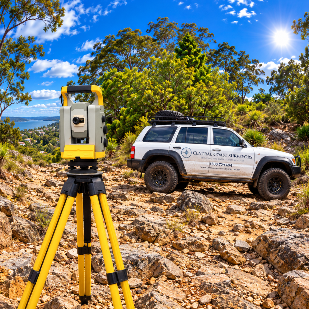
A survey is only as useful as the ground it captures. When a site sits behind a steep access track, through long grass, across soft paddocks or down an unformed easement, we use modified four-wheel drives to get into the difficult terrains where conventional vehicles cannot safely travel. That access can make the difference between an incomplete picture of a property and reliable survey data that architects, engineers, builders and owners can act on.

On the Central Coast, difficult access is not unusual. Rural holdings, acreage subdivisions, bushland lots, waterfront land and sloping residential sites can all present practical obstacles before the survey equipment is even set up. A suitably equipped 4WD helps our field team reach the areas that need to be measured while maintaining a considered approach to safety, site conditions and the surrounding environment.

Why site access affects the survey result

Topographical, cadastral and construction surveys depend on collecting the right information in the right places. If a surveyor cannot safely reach a rear boundary corner, drainage line, proposed building area, access route or level change, the resulting plan may not provide the complete basis needed for design or approvals.

This does not mean every hard-to-reach feature requires a vehicle to drive directly to it. Surveyors still assess the site and use the most appropriate method for the terrain. Sometimes that means parking at a safe point and continuing on foot with GNSS equipment, a total station or other field gear. The modified 4WD is a practical access tool, not a substitute for judgement.

Better access can reduce the time spent walking long distances with equipment and allow more of the day to be devoted to measuring features that matter. For a proposed dwelling on a steep block, that may include locating visible services, contours, retaining walls, embankments, trees, tracks and drainage paths. On a larger rural site, it may mean reaching multiple survey control points and boundary evidence spread well beyond the front gate.

How modified four-wheel drives support difficult terrain surveys

A standard passenger vehicle is not designed for deeply rutted tracks, wet ground, steep grades or uneven bush access. Modified four-wheel drives are selected and equipped to improve clearance, traction and reliability in those conditions. The purpose is straightforward: to get people and sensitive surveying equipment closer to the work area without taking unnecessary risks.

Ground clearance matters where tracks have washouts, exposed rock or drainage humps. Suitable tyres and four-wheel-drive capability can improve control on loose, uneven or muddy surfaces. Secure storage protects instruments, tripods, batteries and field equipment during travel over rough ground. Communications and recovery planning also matter, particularly where mobile coverage is limited or a site is isolated.

The vehicle itself is only one part of the process. Before attending, the survey team considers access information supplied by the client, aerial imagery, weather, recent rainfall, gates, terrain and the purpose of the survey. If access appears unsuitable, arrangements may need to be made for an owner, site manager or contractor to assist. In some cases, a different method or a return visit in better conditions is the sensible option.

Safety comes before access

A capable 4WD does not make every track safe to use. Saturated clay can become impassable quickly. Slopes may be too steep or unstable, creek crossings may be unsafe, and vegetation can conceal hazards such as holes, fallen timber, fencing wire or erosion. The field team will not drive through an area simply because the site needs data.

This is especially relevant after heavy rain, when access tracks around the Central Coast can change rapidly. A cautious decision to park short of the work area, reschedule, or use an alternative approach protects people, equipment and the client’s land. It can also avoid unnecessary damage to a track that builders, residents or livestock rely on.

Difficult terrain does not remove the need for precision

Clients sometimes assume that remote or rough ground means a survey must be less detailed. In fact, difficult sites often need greater care because their constraints affect the project more directly. A contour survey on a sloping block can influence building placement, driveway grades, drainage design, cut and fill estimates, retaining requirements and the likely cost of construction.

For boundary work, access can be just as significant. Boundary marks may be located in dense vegetation, along creek lines, near old fences or at the edge of inaccessible land. A registered surveyor assesses available title information, survey records, physical evidence and measurements to determine the boundary position. An old fence or a line shown on a mapping app is not, by itself, a reliable boundary determination.

Modified vehicle access helps the team work efficiently across these sites, but the accuracy comes from the survey method, quality control and professional interpretation. Trimble surveying technology, established control, careful observations and checks all contribute to data that can be relied upon for the intended purpose.

What clients can do before the survey team arrives

Clear information before mobilisation helps avoid wasted time and lets the team bring the right equipment. Tell the surveyor about locked gates, narrow driveways, bridge load limits, creek crossings, boggy areas, livestock, recent earthworks, aggressive vegetation, known hazards and whether a site contact will be available.

If there is a preferred access route, explain where it begins and whether it is suitable for a 4WD. Photos of the track can be useful, particularly after wet weather or when a property has not been visited recently. For construction sites, let the team know about inductions, traffic movements, excavation areas and any exclusion zones.

Access permission should be confirmed early where the survey requires entry through neighbouring land, private roads or managed bushland. A survey team cannot assume it may cross another person’s property, even if it is the most direct route to a boundary point. Sorting this out before the field visit keeps the work moving and prevents awkward delays.

The practical value for approvals and construction

Good access is not about making a field visit more convenient. It supports better decisions earlier in the project. Complete topographical information gives design consultants a sound basis for planning a home, subdivision, access road or drainage solution. Accurate construction set-out helps builders position works according to approved plans. Final survey information supports certification, plan preparation and registration requirements where applicable.

There are trade-offs. A heavily vegetated or inaccessible site may require additional field time, vegetation clearing by the owner, specialist access arrangements or staged work. The lowest upfront survey price does not always account for those realities. A clear scope that identifies access constraints is more likely to produce the data needed without avoidable variations or delays later.

Central Coast Surveyors approaches difficult sites as a planning issue as much as a fieldwork issue. The aim is to understand the property, select a safe and efficient access method, and deliver survey information that helps the rest of the project proceed with confidence.

If your block has steep tracks, bush access, remote boundary corners or uneven ground, raise it when requesting a quote. A few details at the start allow the registered surveyor to assess the likely field approach and make sure the right people, equipment and vehicle are ready for the job.

When Are Survey Plans Required Legally in NSW?

When Are Survey Plans Required Legally in NSW?

A proposed house may look straightforward on an architect’s drawings, yet a missing survey plan can stop it at the approval stage, create a boundary dispute during construction, or prevent a new title from being registered. Knowing when survey plans are required legally in NSW helps property owners and project teams engage the right surveyor before time, money and programme certainty are lost.

The key point is that there is no single survey plan required for every property project. The legal requirement depends on what is being created, approved, built, transferred or registered. In many cases, a survey is required by legislation, a development consent condition, a certifier, NSW Land Registry Services, a lender or another authority. In others, it is not strictly mandatory, but proceeding without one creates an avoidable risk.

When survey plans are required legally in NSW

Survey plans are most clearly required where land ownership, boundaries or interests in land are being formally changed. These plans must be prepared and certified by a registered surveyor before they can be lodged with NSW Land Registry Services.

A subdivision is the clearest example. If one parcel of land is being divided into two or more lots, or if lot boundaries are being adjusted, a plan of subdivision is needed for registration. This may be a Torrens title, strata or community title subdivision, depending on the development. The registered surveyor determines and marks the boundaries, prepares the plan, manages relevant survey requirements and coordinates the plan’s path towards registration.

The same applies where a legal easement is being created, such as an easement for drainage, access, services or support. An easement is not simply a line drawn on a design plan. It must be accurately defined over the affected land and shown on a registrable plan. The final location matters because it affects the rights of current and future owners.

Other title changes can also require a registered plan. These include creating a right of carriageway, covenant-related boundary changes, road widening acquisitions, certain leases and land dealings involving new parcels or defined areas. The exact process depends on the proposed dealing and the land title system involved.

Subdivision and title registration

For subdivision work, surveying should start well before construction is complete. A preliminary assessment can identify title anomalies, old survey evidence, boundary issues, existing easements and whether the proposed layout can be accurately defined on the ground.

For a typical residential subdivision on the Central Coast, the process may involve a detail and contour survey for the design team, a boundary survey, set-out of proposed works, preparation of a plan of subdivision, council or certifier documentation, and final plan registration. Not every step is legally required at the same time, but the registered plan is essential before separate titles can be issued.

Strata projects have additional requirements. A strata plan defines lots, common property and, where relevant, building boundaries. It needs to reflect the completed building accurately. Changes during construction can affect the final strata documentation, which is why early coordination between the surveyor, architect, builder and certifier is valuable.

Survey plans for development applications and building work

A development application does not always require a legally registrable survey plan. However, councils and consent authorities commonly require reliable site information before they can assess a proposal. For this reason, a detail and contour survey is often a practical starting point for a new home, duplex, secondary dwelling, commercial building or larger development.

A detail and contour survey records existing site features such as levels, buildings, fences, kerbs, drainage structures, vegetation, services visible on site and adjoining features. Architects, designers and engineers use this information to prepare plans that respond to slope, stormwater, access, height limits and site constraints.

While this survey may not be lodged as a plan changing title, it can be required by a council checklist, development consent condition or design consultant. More importantly, it gives the project team a dependable base rather than relying on aerial imagery, outdated plans or assumed levels.

A boundary survey may also be necessary where proposed works are close to a boundary. This is particularly relevant for garages, retaining walls, swimming pools, decks, boundary fencing, dual occupancies and buildings subject to setback controls. A fence line is not reliable legal evidence of a boundary. Fences are often offset, rebuilt in a different position or installed by agreement between neighbours without reference to title dimensions.

For building construction, a set-out survey is often required by the builder, certifier, engineer or approval conditions. The surveyor marks the approved building position and key design levels on site. This reduces the risk of placing a structure over a boundary, within a restricted easement or outside an approved envelope.

A set-out is not merely a convenience on complex sites. If a building is later found to encroach over a boundary or fail required setbacks, rectification can be expensive and disruptive. The cost of confirming the position before concrete is poured is usually modest compared with moving completed work.

Building certificates and existing structures

An identification survey is commonly required for building certificate applications and other situations involving an existing structure. It identifies the relationship between buildings, improvements and the legal boundaries of the property.

For example, an owner may need to demonstrate whether an existing garage, deck, dwelling or retaining wall is contained within the lot and whether it is affected by an easement. Council may request this evidence where boundary position or encroachment is relevant to its assessment.

An identification survey is not required for every sale or every existing building. But where uncertainty exists, it provides formal evidence prepared by a registered surveyor rather than an assumption based on a fence, satellite image or old marketing plan.

Property sales, boundary concerns and waterfront dealings

A survey plan is not automatically required whenever property is sold. Most standard residential conveyancing transactions proceed using the registered title and existing plan information. However, a survey becomes highly advisable, and sometimes necessary for a specific dealing, where the physical occupation of the land does not appear to match the title.

Common warning signs include a fence that appears to cross a boundary, a driveway shared with a neighbour, an old shed close to the side boundary, an unclear access route, or an adjoining owner questioning a proposed fence. A cadastral boundary survey can re-establish the legal boundary position using title records, field evidence and survey standards.

This distinction matters. A feature survey can show where a fence sits, but it does not by itself establish the legal boundary. Legal boundary definition is registered surveying work and must be undertaken by a registered surveyor.

For waterfront properties, an identification survey may also be needed for transfers or dealings involving a Crown waterfront licence. The landward title boundary, occupation and relationship to the licensed area must be clear. These projects can involve historic occupation patterns and irregular physical features, so early advice is preferable to leaving the survey until settlement is close.

Who can prepare a legally valid survey plan?

Plans intended for boundary definition, subdivision, easement creation or registration must be prepared by a registered surveyor authorised to practise in NSW. Registration is not a formality. It reflects professional qualifications, supervised practical experience, competency assessment and ongoing obligations under the state’s surveying framework.

A designer, draftsperson or builder can prepare concept drawings and construction documentation within their scope, but they cannot replace a registered surveyor where legal boundaries or registrable land interests are involved. Similarly, an online title plan can be useful background information, but it is not sufficient for setting out a fence or locating a building boundary on site.

The surveyor’s role is also broader than producing a drawing. They research title and survey records, assess occupation and existing marks, undertake field measurements, apply relevant standards, resolve survey evidence and certify the resulting plan where required.

How to determine what your project needs

The fastest way to avoid ordering the wrong survey is to define the decision your project needs to make. If the question is whether a design works on a sloping block, a detail and contour survey may be the right first step. If the question is where the legal boundary lies, request a boundary survey or boundary mark-out. If separate titles, an easement or strata lots are being created, discuss the project as a registration matter from the beginning.

Before engaging a surveyor, gather the property address, current title documents if available, any development consent, architectural or engineering drawings, and details of the intended works. A clear brief allows the surveyor to identify whether a plan is legally required, required by an authority, or simply prudent risk management.

Timing matters as much as survey type. Do not wait until the builder is ready to start, the subdivision works are complete or settlement is approaching. Survey findings can affect design, approvals and construction sequencing. Addressing them early keeps choices open and helps the wider consultant team work from the same accurate information.

A registered surveyor can confirm the appropriate scope for the land, proposed works and approval pathway. That early conversation is often the simplest way to protect a project from a boundary problem that only becomes visible when it is most expensive to fix.

Who Needs a Boundary Mark Out Before Building?

Who Needs a Boundary Mark Out Before Building?

A fence contractor is ready to start, a builder has pegged out a new addition, or a neighbour has suggested where the dividing line sits. These are the moments when a simple assumption can become an expensive mistake. If you are asking who needs boundary mark out services, the practical answer is anyone making a decision that relies on knowing the exact position of a property boundary.

A boundary mark out is not a rough indication based on an old fence, a retaining wall or an online map. It is cadastral surveying work undertaken by a registered surveyor to locate, verify or re-establish the boundary in accordance with the property title and the applicable survey evidence. The surveyor can then identify the boundary on the ground with suitable marks or pegs, where conditions allow.

For Central Coast properties, this can be particularly valuable where older subdivisions, sloping sites, dense vegetation, waterfront land or long-established fencing make the boundary difficult to interpret from visual clues alone.

Who needs a boundary mark out?

The people who most need a boundary mark out are property owners planning works close to a boundary. That includes homeowners, builders, architects, developers and purchasers who need reliable information before committing to construction, approvals or a contract.

You may not need one for every garden project. Planting a small shrub well inside your apparent yard is different from building a fence, carport, granny flat, retaining wall or substantial deck near the edge of the lot. The closer the work is to a boundary, and the higher the cost of correcting it later, the stronger the case for engaging a registered surveyor first.

A boundary mark out is also worthwhile where there is any disagreement, uncertainty or unusual site condition. A fence that has stood for decades may be useful evidence, but it is not automatically on the legal boundary. The same applies to kerbs, driveways, hedges, rock walls and neighbouring buildings.

Before installing or replacing a fence

Fencing is one of the most common reasons to request a boundary mark out. It is easy to see why: once posts are concreted into the ground, moving them can involve demolition, neighbour discussions and avoidable cost.

If both owners agree on a fence position that does not follow the true title boundary, that may suit their immediate needs. However, it should be a conscious decision rather than an assumption. A survey gives each party a clear reference point before construction begins.

This matters most when a new fence will replace an old, uneven or damaged one. It also matters where one owner wants to retain a strip for access, drainage or landscaping. On narrow residential lots, even a small offset can affect the usable width of a driveway or future building work.

A registered surveyor examines the title information and available survey records, searches for existing survey marks and carries out the field measurements needed to determine the boundary position. If the original marks cannot be found, the surveyor may need to re-establish the line from surrounding evidence. The work required, and therefore the fee and turnaround, depend on the property and the quality of evidence available.

Before designing or building near the boundary

A boundary mark out should be arranged before finalising the position of a new structure close to a side, rear or front boundary. This includes houses, extensions, garages, pools, sheds, decks, retaining walls and commercial buildings.

Architects and designers need dependable boundary information to prepare plans that respond to setbacks, building envelopes, easements and site constraints. Builders need it to set out the works in the right location. Getting the boundary right at the design stage helps prevent a situation where an approved plan cannot be built as drawn, or where the structure is later found to encroach.

There is a useful distinction here. A boundary mark out identifies the cadastral boundary. A construction set-out transfers the approved design from plans to the physical site. Many projects require both, but they serve different purposes. The first establishes where the land ends; the second establishes where the building, footings, walls or levels need to go.

For a simple project, the same registered surveying team can coordinate the boundary work with a detail and contour survey and later construction set-out. That continuity reduces the risk of designers and contractors working from inconsistent information.

When buying, selling or resolving uncertainty

A buyer does not automatically need a boundary mark out for every property purchase. Yet it can be a sensible step where the site has visible boundary concerns, additions close to the boundary, shared driveways, waterfront interfaces or unclear occupation lines.

A standard title plan is not a site measurement plan. It should not be used to scale distances for a proposed fence or to decide whether a shed is located correctly. If there is uncertainty about boundary location or potential encroachment, speak with a registered surveyor early enough for the findings to inform your due diligence and negotiations.

For sellers, a boundary mark out can help clarify questions before they become a late-stage issue in a transaction. For neighbours, it provides an independent technical basis for a conversation that might otherwise become personal or contentious. The surveyor’s role is to determine the boundary from the evidence, not to advocate for either side.

Subdivision, easements and title-related work

Developers and property owners undertaking subdivision, creating an easement or dealing with title matters will often require more than a basic mark out. These projects commonly involve cadastral survey work, plans and coordination for registration with NSW Land Registry Services.

Still, physically identifying existing boundaries is frequently an essential early step. It allows planners, engineers and designers to understand the development area, access constraints and relationship between the proposed works and adjoining land. It can also reveal issues that need to be addressed before plans progress too far.

For rural and semi-rural land, boundaries may be long, irregular and affected by terrain or vegetation. The scope may involve locating selected corners and lines rather than marking every metre of boundary. A registered surveyor can recommend an approach that suits the intended work rather than carrying out unnecessary fieldwork.

What a boundary mark out does not tell you

A boundary mark out is highly useful, but it is not a substitute for every survey or approval requirement. It does not, by itself, provide detailed levels for drainage design, identify all services, confirm planning controls or approve a building location.

Similarly, marks placed on site can be disturbed by excavation, landscaping, traffic or weather. Treat them as survey reference marks, not permanent construction protection. If work will occur near a mark, tell the builder and retain the survey information. For complex construction, further set-out and checks may be needed at key stages.

It is also wise to discuss the purpose of the work when requesting a quote. A survey needed for a short fence line may have a different scope from one supporting a new dwelling, a building certificate, an encroachment question or a proposed subdivision. Clear instructions help the surveyor provide the right service from the outset.

How to prepare for a boundary mark out

Before the surveyor attends, provide the property address, lot and deposited plan details if available, and a brief explanation of what you are planning. Photos, concept plans and information about any concern with a neighbour or existing fence can help define the scope.

Make the site accessible where possible. Unlock side gates, keep pets secured and point out any known marks, old pegs or features you believe may relate to the boundary. Do not remove or relocate existing marks. What appears insignificant may form part of the evidence the surveyor needs to assess.

The best time to arrange the work is before ordering materials, submitting final plans or booking contractors. This gives you room to adjust the design or discuss options if the surveyed boundary differs from expectations.

A boundary is a legal line with practical consequences. When your project depends on where that line sits, accurate cadastral advice from a registered surveyor is a straightforward way to protect the budget, programme and relationships around the site.

Benefits of Registered Land Surveyors in NSW

Benefits of Registered Land Surveyors in NSW

A boundary that appears obvious on site can be very different from the legal boundary shown by a title, deposited plan and survey records. That gap can affect where a home, fence, driveway, retaining wall or new lot can lawfully sit. The benefits of registered land surveyors start with having a properly qualified professional establish the facts before a costly decision is made.

For Central Coast property owners, builders and development teams, surveying is not simply a matter of measuring land. It is a regulated part of the development, construction and title-registration process. A Registered Land Surveyor has the authority, technical training and professional responsibility to undertake cadastral work that can support legal boundaries and plans lodged with NSW Land Registry Services.

Why registration matters for property decisions

In NSW, a Registered Land Surveyor has completed the required university qualifications, supervised practical training and competency assessments to be registered by the Board of Surveying and Spatial Information. Registration is not a marketing label. It distinguishes a professional who is authorised to carry out cadastral surveying from someone who may be skilled at measuring features but cannot determine or redefine a legal boundary for title purposes.

This distinction matters whenever the work affects ownership, subdivision, easements or a building’s position in relation to a boundary. A topographical survey prepared for early design, for example, may not need boundary marks reinstated straight away. But if an architect is designing close to a side boundary, or a builder needs to set out a dwelling accurately, the project team needs reliable boundary information rather than assumptions based on an old fence line.

A registered surveyor interprets the title, deposited plans, survey records and physical evidence on the ground. They assess how those records relate to the site, then apply the statutory requirements that govern the work. This provides a sound basis for design, approvals and construction.

Benefits of registered land surveyors during construction

Construction errors often begin before the first excavation. An incorrect assumption about levels, setbacks, existing services, boundary location or building position can create delays that are difficult to unwind once materials and trades are on site.

Clearer design and approval information

Architects, planners and engineers rely on survey data to make decisions. A detailed contour survey can show levels, buildings, trees, drainage features, visible services and other site conditions that influence a design. Accurate data gives the consultant team a practical starting point and reduces the risk of redesign after site work begins.

On sloping Central Coast sites, this is particularly valuable. A small level difference can affect cut and fill, drainage design, flood planning, retaining walls, accessibility and the finished floor level. Getting the survey scope right early helps the project team identify these constraints while options are still available.

Confidence in boundary-related work

Fences, garages, pools, extensions and new dwellings are frequently planned close to boundaries. An identification survey or cadastral boundary mark-out can help clarify the relationship between existing structures and title boundaries. This is useful for property transactions, council building certificate applications, neighbour discussions and pre-construction planning.

It does not mean every project needs a full boundary re-establishment at the outset. The appropriate survey depends on the purpose of the work, the available records, the site conditions and how close the proposed works are to a boundary. A registered surveyor can assess that risk and recommend the right scope rather than selling unnecessary work.

More accurate building set-out

A construction set-out survey translates approved drawings into physical reference marks on site. Builders can use those marks to position the building, grid lines, excavation, retaining walls and key design elements. When the set-out is based on dependable survey control and coordinated plans, it helps keep work aligned with the approved design.

Set-out does not replace a builder’s responsibility to build correctly or an architect’s and engineer’s responsibility for their designs. It does, however, give the construction team a precise reference point and a clear record of what has been marked.

Fewer preventable disputes and delays

Boundary disputes can become expensive quickly, particularly once a structure is built or a sale is underway. A registered surveyor cannot remove every disagreement between neighbours, but an evidence-based survey provides a defensible professional assessment of the relevant boundaries.

The same principle applies to consultant coordination. Survey data that is incomplete, outdated or inconsistent can lead to repeated questions between the architect, engineer, planner and builder. A surveyor who understands the full project lifecycle can provide information in a form that the wider team can use, reducing avoidable back-and-forth.

A registered surveyor is essential for title and subdivision work

The need for registration becomes most direct when land ownership arrangements are changing. Subdivision plans, easement plans and many dealings lodged for registration with NSW Land Registry Services require work by a Registered Land Surveyor.

Whether the project involves a Torrens title subdivision, strata plan, community title arrangement or an easement for access, drainage or services, the survey is part of the legal framework that defines rights over land. Errors can hold up registration, finance, settlement or the next stage of development.

A registered surveyor manages the technical surveying component and prepares plans to the relevant standards. They can also work closely with solicitors, conveyancers, town planners, certifiers and other consultants where the project requires coordinated approvals. This is especially helpful when a property owner is managing a subdivision for the first time and needs a clear sequence of work rather than fragmented advice.

Local experience improves practical outcomes

Registration provides the professional authority, but local experience helps projects move efficiently. Central Coast sites can present steep terrain, waterfront conditions, older subdivisions, constrained access, bushland interfaces and a mix of urban and rural land uses. Each can affect fieldwork, survey methodology, design inputs and approval timing.

A local registered surveyor is familiar with the types of constraints that commonly arise in the area and can identify the information likely to be needed by the wider consultant team. That does not guarantee an approval or remove the need for council, certifier or specialist input. It does mean the survey work is more likely to be scoped with the real project requirements in mind.

Technology also matters, but it is not a substitute for professional judgement. Modern equipment, including Trimble surveying technology, can collect precise information efficiently. The value comes from combining that capability with a registered surveyor’s interpretation of boundaries, records, site evidence and statutory requirements.

When to involve a registered land surveyor

The best time is usually before design, construction or title work creates a commitment that is hard to change. Early advice is particularly worthwhile if you are buying a property with uncertain boundaries, planning an extension near a fence, applying for a building certificate, creating an easement, subdividing land or commencing a new build.

For a straightforward internal renovation well away from boundaries, a full cadastral survey may not be necessary. For a new home on a vacant block, a sloping site, a waterfront property or a project involving new titles, the consequences of incomplete survey information are far greater. The scope should match the decisions being made.

Central Coast Surveyors works across the survey lifecycle, from detail and contour surveys through building set-out, final surveys and plan registration. The practical advantage is continuity: the team preparing the early site information can remain involved as the project moves through approvals and construction.

Before relying on a fence, a measuring app or an old plan, arrange for the relevant records and site conditions to be assessed. A registered surveyor’s advice gives your project a reliable starting point and helps the rest of the team move forward with greater certainty.