
Do You Need a Boundary Survey on the Central Coast?
A fence that has stood for decades, a peg near the kerb or a line shown on an online map can all look convincing. None of them, by themselves, establishes the legal boundary of a property. A boundary survey on the Central Coast provides the evidence needed to identify or re-establish the title boundary before a decision becomes expensive – whether that decision involves building, fencing, buying, selling or subdividing.
For property owners, the value is certainty. For builders, architects and developers, it is reliable information that prevents design changes, approval delays and site disputes after work has started.
What a boundary survey actually establishes
A boundary survey is a cadastral survey carried out by a registered land surveyor. Its purpose is to determine the position of a parcel’s legal boundaries by analysing the registered plan, title information, survey records and physical evidence on or near the site.
The process is more involved than finding an existing survey mark. Older marks may have been disturbed, buried, incorrectly assumed to be a boundary mark, or positioned as part of a previous survey with a different purpose. A registered surveyor assesses the available evidence, measures the land in relation to adjoining properties and survey control, and applies the requirements that govern cadastral surveying in NSW.
The resulting work may identify existing corners, re-establish boundary positions where marks are absent, and allow the relevant boundary points to be marked out on site. What is included depends on the brief, the condition of the evidence and the property’s history.
This distinction matters. A property boundary is a legal line connected to title, not simply the line where a fence, retaining wall, garden bed or driveway happens to sit.
When a Central Coast boundary survey is worth arranging
The right time to arrange a boundary survey is before work, negotiations or assumptions lock you into a position. It is particularly useful when the boundary affects the location, cost or compliance of a project.
Before building close to a boundary
New homes, additions, garages, pools, retaining walls and carports often need to be designed around setbacks and boundary clearances. If the boundary position is uncertain, an architect or designer may be working from dimensions that do not reflect the legal parcel.
Finding this out after plans are lodged, materials are ordered or construction has commenced can lead to redesign, variations and delays. Early survey information gives the project team a dependable reference point for design and construction set-out.
Before replacing or moving a fence
A fencing project can appear straightforward until neighbours disagree about the line. Fences are commonly built inside, outside or across a boundary for practical reasons, especially on older properties or sloping blocks. They may also follow a convenient line rather than the surveyed line.
A boundary survey will not resolve every neighbour dispute, but it establishes the factual cadastral position from which practical conversations can proceed. That is far preferable to relying on an assumption once a new fence has been installed.
When buying, selling or checking improvements
If a building, deck, shed, pool or driveway appears close to a boundary, an identification survey may be required or recommended as part of a property transaction, a council building certificate application or a waterfront licence transfer. An identification survey reports on the relationship between visible improvements and the title boundaries.
Where the actual boundary itself needs to be determined or marked, a cadastral boundary survey may also be needed. The appropriate service depends on the issue at hand, which is why a clear discussion of the property’s purpose and history is useful before quoting.
Before subdivision, an easement or title work
Boundary evidence is fundamental to subdivision and easement projects. Whether the goal is a Torrens title, strata or community title subdivision, a right-of-carriageway, drainage easement or another title arrangement, the survey work needs to align with registered land information and NSW Land Registry Services requirements.
Starting with accurate cadastral information helps the broader consultant team identify constraints early. It also reduces the risk of planners, engineers and designers progressing work from incomplete assumptions.
A boundary survey is not the same as a topographical survey
Both services are valuable, but they answer different questions.
A topographical or detail and contour survey captures the physical features of a site. It may show buildings, levels, trees, fences, driveways, services visible above ground and other features that influence design. It is commonly the starting point for architectural, engineering and planning work.
A boundary survey focuses on legal title boundaries and cadastral evidence. It may be required where a design relies on exact setback dimensions, where construction will occur close to a boundary, or where physical occupation needs to be checked against the title.
On many projects, the most efficient approach is to coordinate both scopes from the start. The survey team can advise whether a detailed feature survey, a boundary mark-out, an identification survey or a combined approach is appropriate. Ordering only the cheapest-looking survey without considering the project stage can create a gap that later needs to be addressed urgently.
What happens during the survey process
A registered surveyor begins with a review of the available title and survey records. This research is essential because the land’s legal definition is not determined solely by what can be seen on site.
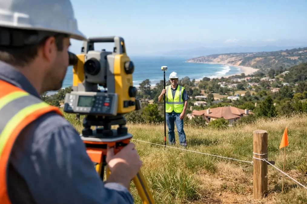
The field survey then records relevant existing marks, occupation features and measurements. Depending on the site, this can involve locating adjoining marks, examining nearby survey evidence and connecting the work to recognised control. Modern equipment, including Trimble surveying technology, supports precise field capture, but technology does not replace cadastral judgement. The interpretation of evidence and application of NSW survey requirements remains central to the result.
Once the evidence has been assessed, the surveyor can advise on the boundary position and arrange marking where included in the scope. Marks may be placed at accessible points, although dense vegetation, structures, rock, hard paving or unsafe access can affect what is practical. If a boundary point cannot be marked directly, the surveyor can explain suitable alternatives for setting out the line.
Turnaround time depends on property size, terrain, vegetation, access, the availability of historic records and the complexity of adjoining parcels. A level suburban block with clear marks is very different from a waterfront site, rural acreage or land with a long and irregular survey history. Providing a current address, plan details, photos and the reason for the survey helps the surveyor scope the work accurately from the outset.
Why local conditions can change the scope
Across the Central Coast, surveying conditions vary sharply between established coastal suburbs, steep hinterland blocks, bushland acreage and waterfront land. Sloping terrain can make a fence line appear to sit differently from the legal boundary. Older subdivisions may have limited visible evidence, while vegetation, retaining walls and redevelopment can obscure marks that were once readily accessible.
Waterfront and environmentally constrained sites can add further considerations. Licence areas, seawalls, jetties and structures near the water may involve arrangements that are separate from the freehold title boundary. A survey should clearly distinguish the land parcel from other rights, licences or occupation areas rather than treating them as interchangeable.
These are not reasons to delay the survey. They are reasons to involve a registered surveyor early enough for the evidence to be properly assessed.
Choosing the right surveyor for the job
For work that establishes or marks a legal boundary, engage a registered land surveyor with cadastral experience in NSW. Ask what the quoted scope includes, whether boundary marks will be placed where possible, what documents or plan will be provided, and whether the work is suitable for your intended use.
It is also worth explaining who else is involved. If an architect is preparing plans, a builder needs set-out information, or a solicitor is managing a title matter, early coordination avoids each party working from different information. Central Coast Surveyors works with direct property owners as well as project consultants, helping align survey deliverables with the next approval or construction step.
A clear boundary is not merely a line on paper. It is a practical foundation for decisions that affect your land, budget and relationships with adjoining owners. Before you build, fence or rely on an assumed line, get the boundary assessed properly and give the rest of the project a sound place to start.