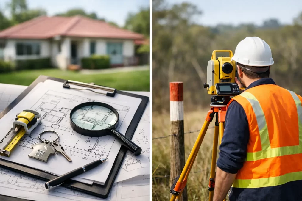
Identification Survey vs Boundary Survey in NSW

Identification Survey vs Boundary Survey in NSW

A fence line can look settled for decades and still sit on the wrong side of a title boundary. Likewise, a property may have clear boundary marks but no current plan showing whether the house, garage or retaining wall affects those boundaries. That is the practical difference behind an identification survey vs boundary survey decision.

For Central Coast property owners, builders and consultants, choosing the right survey at the start can prevent approval hold-ups, redesign work and disputes later in the project. Both survey types deal with cadastral boundaries, but they answer different questions. One focuses on where the legal boundaries are. The other shows how existing improvements relate to those boundaries.

Identification survey vs boundary survey: the key difference

A boundary survey determines, reinstates or marks the legal boundaries of a parcel of land. It is commonly needed when boundaries are uncertain, when a new fence is proposed, before construction close to a side or rear boundary, or where neighbours disagree about the position of a line.

An identification survey goes further. It identifies the property boundaries and locates visible improvements on or near the land, such as dwellings, garages, sheds, pools, fences, driveways and retaining walls. The resulting plan and report show whether those improvements appear to be within the subject property, close to a boundary or potentially encroaching onto adjoining land.

Put simply, a boundary survey answers, “Where is my land?” An identification survey answers, “Where is my land, and how do the existing buildings and structures sit in relation to it?”

That distinction matters because the right report depends on the purpose of the job. A boundary mark-out may be exactly what is required before a fence is installed. It will not necessarily provide the information council, a conveyancer or a lender needs to assess existing structures on the site.

What a boundary survey is used for

A cadastral boundary is the legal extent of the land described on a deposited plan, strata plan or other registered title document. It is not automatically defined by a fence, garden edge, kerb, wall or satellite image.

To establish a boundary, a registered surveyor researches the title and relevant plans, examines survey records and searches for existing survey marks. The fieldwork then measures available evidence and applies cadastral surveying principles to determine the boundary position. Where appropriate, the surveyor can place or identify boundary marks and provide information for a boundary mark-out.

A boundary survey is particularly useful before building work that relies on a setback or is proposed close to a boundary. Builders and designers should not assume an old paling fence reflects the title line, especially on older Central Coast sites where fencing may have been replaced more than once. The same applies to rural properties, where long fence runs and terrain can make assumptions particularly risky.

Common reasons to arrange a boundary survey include establishing a line before fencing, locating a boundary for a new dwelling or addition, resolving uncertainty before buying or selling, checking land available for a driveway or access route, and supporting easement or subdivision work.

The deliverable varies with the scope. It may involve a boundary mark-out on site, a survey plan, or cadastral information prepared for a wider land transaction or development process. The important point is that the work is based on legal survey evidence, not a visual estimate.

What an identification survey shows

An identification survey is usually prepared for an existing property. It confirms the land being examined and depicts the position of visible improvements in relation to the title boundaries. It may also note apparent encroachments, party walls, building lines and other physical features relevant to the purpose of the survey.

In NSW, identification surveys are regularly requested for council building certificate applications, property transactions, waterfront licence transfers and situations where an owner needs confidence about existing improvements. They can be especially valuable where a house, carport, deck, pool fence, retaining wall or shed is close to a boundary.

The plan does not simply say that a structure exists. It gives the owner and their advisers measured spatial information. If a garage wall is near the boundary, for example, the survey can show its relationship to that boundary. If a fence appears to sit outside the title, that issue can be identified before it becomes a surprise during a sale, approval process or neighbour discussion.

An identification survey is not the same as a building inspection, pest inspection or planning assessment. It does not determine structural condition, certify that a building approval exists, or confirm every planning control that may apply. It provides a precise land and improvement record that helps council, conveyancers, planners and owners assess the next step.

Which survey do you need for your project?

The answer depends on the decision you need to make, rather than the name of the survey alone.

If you are replacing a fence and want to know where it should go, a boundary mark-out or boundary survey is generally the starting point. If you are building a new home, extension, garage or pool close to a boundary, an accurate boundary survey should be completed before design is finalised and certainly before set-out begins.

If you own an established home and need a building certificate, an identification survey is often the relevant document because council needs to understand how existing structures relate to the property boundaries. The same logic applies when a conveyancer, purchaser or lender needs clarity around an existing dwelling and ancillary structures.

For a property purchase, it depends on the risks present. A vacant block may call for boundary certainty, while an older improved property may benefit more from an identification survey that reveals the relationship between buildings, fences and title lines. A registered surveyor can review the purpose and recommend a scope that fits, rather than supplying a report that leaves a critical question unanswered.

Why fences and online maps are not enough

Fences are practical features, not legal proof. They can be built for convenience, follow a previous owner’s assumption, avoid a tree or retaining wall, or shift gradually as they are replaced. Even where both neighbours have treated a fence as the dividing line, its location may not match the cadastral boundary.

Online mapping is useful for general orientation but is not suitable for legal boundary decisions. Mapping imagery and property overlays can contain positional differences that are insignificant at suburb scale but substantial when a building setback, fence footing or retaining wall is involved.

A survey completed years ago may also have limited usefulness for a current decision. New structures, altered fencing, changed site conditions and the specific requirements of council or a transaction can all affect what information is needed now. Existing plans are valuable evidence, but they should be reviewed in context rather than treated as a substitute for current survey work.

The value of engaging a registered surveyor early

Boundary work has legal and technical consequences. In NSW, cadastral surveys are undertaken by registered surveyors who are qualified to determine and certify land boundaries. Their work relies on title research, field evidence, survey control and established legislation and practice standards.

Early involvement gives architects, designers and builders dependable information before drawings, approvals and construction commitments progress too far. It can help prevent a building being designed too close to a boundary, avoid set-out based on an assumed fence line, and identify an existing encroachment while there is time to manage it properly.

For larger projects, the survey information can also support the broader workflow. A detail and contour survey informs design. Boundary information establishes the legal parcel. Construction set-out places approved works accurately. Final survey work and plan registration can then carry the project through to completion. Coordinating these stages with one surveying team reduces duplicated site visits and gaps between consultants.

Central Coast Surveyors uses current surveying technology alongside cadastral research and local experience to provide clear, project-ready information. The aim is not to overcomplicate a straightforward question, but to give clients the right evidence for an approval, construction decision or property matter.

What to provide when requesting a survey

A short explanation of why you need the survey will help define the right scope. Include the property address, lot and deposited plan details if available, along with any council request, building plans, photographs or previous survey documents. If there is a concern about a particular fence, wall or structure, identify it clearly.

Access is also important. Locked side gates, overgrown vegetation, parked vehicles and dogs can delay fieldwork or prevent measurements from being taken. Where neighbours’ access may be useful, it is sensible to discuss this early, although a surveyor can advise what is required for the specific job.

Before you commit to a fence, sign off a boundary-side design or lodge a building certificate application, ask the question that matters: do you need to locate the legal boundary, assess existing improvements, or both? Getting that answer from a registered surveyor early is usually the quickest path to a clearer, more confident property decision.

Subdivision Survey Checklist for NSW Projects

Subdivision Survey Checklist for NSW Projects

A subdivision can look straightforward on a concept plan, then become expensive when an old fence misses the legal boundary, a drainage easement is overlooked or a new lot cannot meet servicing requirements. A clear subdivision survey checklist gives property owners and project teams the information needed to make sound decisions before applications, construction and title registration are underway.

For Central Coast projects, the best time to involve a registered surveyor is before the design is fixed. Early, accurate survey information helps architects, planners, civil engineers and certifiers work from the same base data. It also exposes constraints while there is still room to adjust the proposal rather than redesign it after lodgement.

Subdivision Survey Checklist: Start With the Right Site Data

Every subdivision begins with an understanding of the existing parcel. This is more than measuring the apparent dimensions of the land. A registered surveyor investigates title information, available survey records and physical evidence on site to establish how the parcel relates to its legal boundaries.

An initial review should identify the current title description, deposited plans, existing easements, restrictions on use and any covenants that may affect the proposal. Easements are particularly important. A drainage, sewer, electricity or access easement may limit where buildings, driveways and services can be located, even when the affected area appears unused.

The site inspection should also record boundary evidence, such as survey marks, pegs, fences, walls and occupation lines. Fences are not automatically legal boundaries. On established Central Coast properties, a fence may have been placed for convenience, follow an older occupation line or sit well inside one owner’s land. Designing a new lot around an assumed fence line can create a costly problem later.

A detail and contour survey is usually the next practical step. It captures levels, buildings, retaining walls, driveways, vegetation, visible services, drainage features and nearby site conditions. For sloping, waterfront or irregular sites, accurate contours are essential for assessing access, earthworks, stormwater and building envelopes.

Confirm the Subdivision Path Before Design Is Locked In

The survey work needed depends on the type and scale of subdivision. A two-lot Torrens title subdivision has different requirements from a multi-lot residential development, a strata subdivision of an existing building or a community title scheme with shared infrastructure.

Before design proceeds, confirm the intended title structure and approval pathway with the wider consultant team. Your town planner will assess planning controls and development standards. A civil engineer may design roads, drainage and service works. The registered surveyor provides the cadastral framework, prepares subdivision plans and coordinates the survey components required for registration.

At this stage, check the proposed lot dimensions, frontage, access, building setbacks and practical service routes against the project objectives. A lot may satisfy a minimum area requirement but still be difficult to service or build on because of its shape, fall, easements or access constraints. The most efficient design is not always the one with the largest number of lots. It is the one that can be approved, constructed and registered with manageable risk.

Check Boundaries, Easements and Encroachments Early

Boundary definition is often the item that determines whether a project can move forward as drawn. Where marks are missing, records conflict or occupation does not match the title boundary, further investigation may be required before the subdivision plan can be finalised.

Encroachments should be identified early. These can include a neighbour’s shed, retaining wall, pool fence, driveway or building projecting over a boundary, as well as your own structures extending onto adjoining land. An encroachment does not necessarily stop a subdivision, but it may require design changes, legal advice, an easement or agreement with an adjoining owner. Leaving it until the final plan stage can delay registration.

Also consider access rights and service corridors. New lots may need easements for carriageway access, stormwater drainage, sewer, water, electricity, telecommunications or maintenance. The dimensions and wording of an easement need to suit the infrastructure and future use, not simply fit into leftover land. Poorly planned easements can limit future building options or lead to disputes between owners.

Coordinate Survey Information With Design and Approvals

A subdivision is a coordinated project, not a sequence of isolated reports. Once the base survey is complete, all consultants should work from the same current information. This reduces the risk of one drawing showing a driveway, drainage line or boundary position that conflicts with another.

For a typical NSW project, the team may need to address the following items before construction and final plan preparation:

  • confirmed title boundaries and an accurate detail and contour survey;
  • planning design, development consent and subdivision conditions;
  • civil design for roadworks, access, drainage and service connections;
  • proposed easements, restrictions and any land to be dedicated or transferred;
  • construction set-out and verification of completed works; and
  • final subdivision plan, supporting documents and NSW Land Registry Services requirements.

Not every project needs every item in the same form. A simple boundary adjustment may have limited civil works, while a greenfield development may involve extensive set-out, staged plans and several authorities. The key is to establish responsibilities early so that no critical survey or title matter is left between consultants.

Plan for Construction Set-Out and Final Verification

Approval is not the end of the survey process. Once works start, construction set-out helps contractors build roads, retaining walls, drainage, services and other works in the approved location and at the intended levels. Accurate set-out is particularly valuable on constrained sites, where small errors can affect drainage falls, easement clearances or building setbacks.

As construction progresses, keep records of variations. If a retaining wall, pit, driveway or service route changes location, the design team and surveyor need to know. A change that appears minor on site may affect the final plan, an easement location or compliance with conditions of consent.

Before the final plan is lodged, the surveyor completes the required fieldwork and plan preparation based on the approved design, completed works and legal survey requirements. Depending on the project, this can involve marking new boundaries, defining easements, preparing a plan of subdivision and providing associated documentation for the certifier, council and NSW Land Registry Services.

This stage is where early planning pays off. If boundaries have been resolved, easements designed properly and works built to the correct locations, final survey and registration are far more predictable. If not, the project may need amended plans, additional approvals or rectification works.

Keep Documents, Decisions and Timing Under Control

Subdivision delays are often caused by missing information rather than difficult surveying. Keep a current file containing title documents, previous plans, development consent, stamped drawings, service authority correspondence, approved civil plans and records of changes made during construction. Give updated drawings to the whole consultant team, not just the contractor on site.

Timing also matters. Survey work should be programmed around design milestones, approval conditions and construction activities. Booking final work only after a contractor has finished may be too late if survey set-out, easement changes or compliance issues should have been addressed during the works.

For owners managing their first subdivision, the process can feel heavily technical. The practical question to ask is simple: what information does the next decision-maker need from us? A registered surveyor can clarify boundary position and title requirements; planners can address development controls; engineers can resolve infrastructure. Clear roles keep the project moving.

Central Coast Surveyors works with property owners and project teams from early site investigation through to final plans and registration, using accurate field data and direct coordination with the wider consultant group. That continuity helps reduce handovers, duplicated work and avoidable surprises.

A good checklist is not about creating more paperwork. It is about finding the issues that could hold up a new title before they become urgent. Start with a reliable survey, keep the design team aligned and allow enough time for the final legal survey work. That is how a subdivision progresses from an idea on paper to land that can be built on, sold or developed with confidence.

How Long Does a Land Survey Take?

How Long Does a Land Survey Take?

If your architect is waiting on contours, your builder needs set-out, or you need a boundary checked before a fence goes in, the same question comes up quickly: how long does a land survey take? The short answer is that some surveys can be completed within days, while others take weeks or longer depending on the site, the survey type, access, title information and approval requirements.

That range can feel frustrating if you are trying to keep a project moving. But there is a practical reason for it. “Land survey” is not one single service. A detail and contour survey for design, an identification survey for a building certificate, a boundary mark-out, and a subdivision survey all involve different levels of field work, calculations, plan preparation and compliance.

How long does a land survey take for most projects?

For many residential projects, the on-site survey itself may only take a few hours to a day. What often takes longer is the work before and after site attendance – reviewing title documents, checking previous survey records, processing field data, preparing plans, and making sure the final deliverable suits council, design or construction requirements.

As a general guide, a straightforward boundary mark-out or identification survey might be turned around relatively quickly if records are clear and the site is accessible. A detail and contour survey for a house design can also move fast when there is good access and no unusual constraints. A larger site, a steep block, heavy vegetation, missing marks, waterfront land, easements or subdivision requirements will usually add time.

For clients, the more useful question is not just how many days the survey crew is on site. It is how long until you have the plan, marks or survey information you actually need to move to the next stage.

What actually affects survey timing?

The biggest factor is the type of survey being carried out. A topographical survey records levels, structures, services, features and contours for design. A cadastral or boundary survey requires the surveyor to investigate title boundaries, locate or reinstate marks and reconcile field evidence with legal documentation. A subdivision survey adds another layer again because it often involves plan preparation, authority requirements and title registration steps.

Site conditions matter just as much. A flat, clear suburban block is generally quicker than a large rural lot with uneven terrain, dense vegetation or difficult access. If the crew can move efficiently and obtain clear observations, the field component is faster. If they are working around locked gates, retaining walls, water edges, traffic conditions or adjoining structures, that adds time.

Existing records can either speed things up or slow them down. Good survey control, available plans and intact reference marks make the job more straightforward. If old marks are missing, title history is complex or there are inconsistencies between occupation and title, more investigation is needed. That is not delay for the sake of it. It is what protects accuracy and avoids costly mistakes later.

Timing is also influenced by what happens after the field work. Survey data has to be checked, reduced and drafted properly. If the survey supports design, approval, certification or registration, the output needs to be right the first time. Rushing that stage can create downstream issues for architects, engineers, councils or solicitors.

Typical timeframes by survey type

A boundary mark-out is often one of the quicker services, particularly for a standard residential lot with reliable reference marks. Even then, timing depends on whether boundary evidence is already in place or whether marks need to be re-established from surrounding control.

An identification survey can also be completed quickly in many cases, especially when needed for a council building certificate or a property transaction. The surveyor still needs to confirm building positions relative to title boundaries, which means the quality of boundary evidence remains critical.

A detail and contour survey for design usually requires one site visit followed by office processing and plan preparation. On smaller residential sites this can often be turned around promptly. Larger development sites, sloping land, vegetation, drainage features, multiple structures or waterfront interfaces will usually extend the timeframe.

Construction set-out is often booked around the builder’s programme, so timing depends not only on the survey itself but on coordination with excavation, formwork or slab stages. These jobs are usually time-sensitive and need a responsive surveyor who can work to the programme.

Subdivision surveys and easement work generally take longer than standard site surveys. There is more documentation, more coordination with planners, engineers and authorities, and more statutory process involved. The field work may be only one part of a much longer delivery timeframe.

Why some surveys are fast and others are not

The main difference is whether the survey ends at measurement or continues through approval and registration. If you only need existing site information for a designer, that can be relatively direct. If you need a new title created, an easement defined, or a plan registered, the survey is part of a larger legal and administrative process.

That is why two clients can both ask for a land survey and get very different timelines. One might need levels and features for house plans. Another might need a Torrens title subdivision with final plan registration. They are not comparable jobs, even if both begin with a call to a surveyor.

There is also a difference between a quick site visit and a quick outcome. A crew may complete the field work promptly, but if the project relies on external approvals, adjoining information, service authority input or registry processing, those stages can extend the overall timeline beyond the surveyor’s direct control.

How to avoid delays before the survey starts

Most avoidable delays happen before anyone arrives on site. Incomplete job information, unclear scope, poor access arrangements and last-minute booking requests all slow things down.

If you want a faster turnaround, it helps to be clear about the purpose of the survey. Is it for design, council, construction, title clarification, a fence dispute, a building certificate or subdivision? The right scope from the start prevents rework.

Providing available plans, title documents, deposited plan references, development information and site contacts also helps. If there are access issues, dogs on site, locked gates, tenant arrangements or restricted work hours, mention them early. Small details like that can be the difference between one efficient visit and a return trip.

For builders, architects and engineers, early engagement usually saves time. Waiting until the design deadline or slab booking is already tight limits options. Surveying is often one of the first technical inputs on a project, and treating it that way keeps the rest of the programme steadier.

How long does a land survey take when urgency matters?

Urgent surveys are often possible, but urgency does not remove the need for proper checking. A registered surveyor still has to verify title information, collect reliable field data and issue work that stands up technically and legally.

What changes with an urgent job is usually scheduling and internal prioritisation. If the scope is clear, the site is accessible and the records are straightforward, a fast turnaround may be realistic. If the site is complex or the survey involves legal boundary definition, there is less room to compress the process without increasing risk.

That is why the best approach is to explain the deadline and the reason for it. A good surveyor can then advise what is realistic, what can be staged, and whether an initial deliverable can be issued first to keep design or construction moving.

Choosing a surveyor who keeps projects moving

Speed matters, but only if it comes with accuracy and communication. A fast survey that has gaps, errors or unclear deliverables can create bigger delays once the architect, certifier or builder starts relying on it.

What clients generally need is responsive service, clear advice on likely timeframes, and a surveyor who understands the local approval and construction environment. On the Central Coast, that local knowledge can make a real difference when dealing with varied site conditions, council processes and coordination across consultants.

At Central Coast Surveyors, that is why the focus is on practical turnaround, registered expertise and delivering the right survey information for the next project step – not just collecting data and leaving the rest to chance.

If you are asking how long does a land survey take, the most accurate answer is usually this: long enough to do it properly, but often faster than the delays caused by unclear scope, poor coordination or waiting too late to book it. The earlier you get the right survey advice, the easier the rest of the project tends to be.

Section 88B Instrument Explained Clearly

Section 88B Instrument Explained Clearly

If your subdivision plan is nearly ready for registration and someone asks for the Section 88B instrument, it usually means the project has reached one of the most technical parts of the title process. A Section 88B instrument explained in plain terms is this – it is the legal document lodged with a plan that creates, removes or deals with easements, restrictions on use and positive covenants on title in New South Wales.

That sounds dry, but it has real consequences on what can be built, where services can run, who has access, and what future owners must do. If the document is wrong, unclear or inconsistent with the plan, registration can stall and the flow-on impact hits approvals, settlements and construction programs.

What a Section 88B instrument actually does

In NSW, a Section 88B instrument works alongside a deposited plan. The plan shows the spatial side of the title arrangement – new lots, roads, easement locations and dimensions. The 88B instrument adds the legal meaning. It identifies the burdened land, the benefited land, the authority or party involved, and the terms that apply.

In practical terms, this is the document that says whether one lot has a drainage easement over another, whether a right of carriageway exists, whether there is a restriction on building over a sewer line, or whether an owner must maintain a retaining wall or on-site detention system.

Without it, the plan may show that something exists physically or conceptually, but not how it operates legally.

When a Section 88B instrument is needed

Not every survey project requires one. If you are simply identifying boundaries for a fence issue or preparing a detail survey for design, a Section 88B instrument is generally not part of the job. It becomes relevant when a plan being lodged for registration needs to create or record legal interests affecting land.

That often includes Torrens title subdivisions, community title developments and plans involving new roads, drainage infrastructure, service corridors or access arrangements. It can also arise where existing easements need to be released or modified as part of redevelopment.

For homeowners, this often appears during a subdivision or when a solicitor, planner or council condition refers to easements or restrictions required before registration. For developers and consultants, it is a routine but critical part of plan registration strategy.

Section 88B instrument explained through common examples

The easiest way to understand the document is to look at what it commonly creates.

An easement for drainage of water might be required where stormwater pipes cross one lot to service another. A right of carriageway may be needed where legal access is shared. Easements for support can apply where walls or structures rely on adjoining land. Restrictions on the use of land might prevent building over services, limit floor levels, or control what can occur in bushfire, flooding or asset protection areas. Positive covenants can require an owner to maintain drainage works, acoustic fencing, retaining structures or stormwater systems.

These are not minor paperwork items. They shape how the land can be used long after construction is finished. That is why the wording, plan references and benefiting or burdening details need to be exact.

Why survey accuracy matters so much

The 88B instrument is legal drafting, but it depends heavily on accurate surveying. If an easement is shown in the wrong position, if lot numbering changes late in the process, or if dimensions on the plan do not align with supporting documents, the legal instrument can quickly become inconsistent.

That is where delays creep in. A plan may need amendment. Solicitors may need to redraft clauses. Consent authorities or service authorities may need to review the revised arrangement. On a live project, those issues can hold up registration, titles, settlements and civil works.

This is why experienced registered surveyors are involved early, not just at lodgement. The best outcomes happen when the survey plan, engineering design, authority requirements and legal drafting are coordinated before the document is finalised.

Who prepares the Section 88B instrument

This is where clients often get confused, because several professionals may touch the process.

The registered surveyor usually prepares the plan that the 88B instrument refers to and coordinates the spatial and title details. A solicitor or conveyancer may assist with drafting or reviewing the legal terms, especially where custom wording or non-standard arrangements are involved. For developments with infrastructure, councils, water authorities or other approving bodies may also require specific wording or execution.

So while the surveyor may not always be the only party involved, the survey component is central. If the plan is not right, the instrument cannot be right.

What information is usually included

A Section 88B instrument generally identifies the deposited plan it relates to, the lots affected, the purpose of each easement, restriction or covenant, and the parties benefiting from or burdened by it. It may also include standard statutory wording or more detailed terms depending on the issue being dealt with.

Some instruments are fairly straightforward. Others become more complex when multiple easements, staged subdivisions, authority requirements or maintenance obligations are involved. A multi-lot development with private services, shared access and detention systems will usually need more careful drafting than a simple two-lot subdivision.

That is why there is no single universal version that suits every project. The right approach depends on the land, the design, the approval conditions and the title outcome required.

Common issues that slow registration

Most delays are not caused by the existence of an 88B instrument itself. They are caused by inconsistencies around it.

One common problem is late design change. If civil design moves a pipe alignment or access width after the plan references have been prepared, the easement position may no longer match. Another issue is unclear responsibility for wording. If consultants assume someone else is handling the legal terms, the document can sit unfinished until the end of the project. Execution and authority approvals can also take longer than expected, especially where multiple parties must sign.

There are also cases where a client wants the simplest title outcome possible, but the physical design creates a need for ongoing rights or obligations. You cannot always draft around a design problem. Sometimes the cleaner solution is to adjust the design before registration rather than carry a complicated title burden forever.

Why this matters to future owners, not just the current project

A Section 88B instrument does more than get a plan registered. It stays with the title and affects future dealings with the land. Buyers, builders, certifiers and councils may all need to consider it later.

For example, a restriction on use may limit where a dwelling addition can go. A drainage easement may stop an owner from building over part of the backyard. A positive covenant may require ongoing maintenance of private infrastructure at the owner’s cost. These are not always obvious from a quick look at the site.

That is why accuracy and clarity matter from day one. A rushed or poorly coordinated instrument can create confusion years after the original development is complete.

Section 88B instrument explained for homeowners

If you are a property owner subdividing land for the first time, the main point is simple – this document is part of how legal rights and obligations are attached to your new lots. It is not just another form.

You do not need to know every clause, but you should understand what is being created over your land and why. Ask whether any part of the lot will be affected by drainage, access or service easements. Ask whether there are restrictions that could affect future building works. Ask who is responsible for maintaining any shared or private infrastructure.

Good advice early is usually cheaper than fixing title problems later.

What developers and consultants should focus on

For builders, developers, architects and engineers, the priority is coordination. The Section 88B instrument should not be treated as an end-stage admin task. It should be considered while the design is still being refined, particularly where service routes, access, retaining structures and stormwater systems cross lot boundaries.

The smoother projects are usually the ones where the surveyor, engineer, planner and legal team are aligned on the title strategy before final plan preparation. That reduces redesign, avoids last-minute authority issues and keeps registration moving.

For Central Coast projects, local experience also helps. Councils, service authorities and land registration requirements are not the place for guesswork, especially when timing matters.

A well-prepared 88B instrument does not draw much attention when everything goes to plan, and that is exactly the point. When the survey, drafting and approvals are handled properly, the title outcome supports the project instead of slowing it down. If your subdivision or development is heading towards registration, getting the title mechanics right early will save far more than time.

Who Can Place Boundary Pegs in NSW?

Who Can Place Boundary Pegs in NSW?

If you are planning a fence, extension, driveway or subdivision and wondering who can place boundary pegs, the short answer in NSW is this: boundary pegs that define a legal property boundary should be placed or reinstated by a registered land surveyor. That matters more than most owners realise, because a peg in the wrong spot can trigger neighbour disputes, council issues, redesign costs and avoidable delays.

Boundary pegs are not just handy markers in the ground. In the right context, they represent a surveyed opinion about where a title boundary sits in relation to occupation, existing marks, deposited plans and surrounding evidence. That is a legal and technical exercise, not a rough measuring job.

Who can place boundary pegs legally?

In practical terms, if the pegs are being used to mark the legal extent of land ownership, the work should be done by a registered surveyor. In NSW, registered surveyors are qualified, assessed for competency and authorised to carry out cadastral surveying work, which includes defining and marking property boundaries.

This is the key distinction many people miss. A builder, fencer, landscaper or handyman might be able to set out a line based on plans or measurements given to them, but that does not make them qualified to determine the legal boundary itself. If they guess wrong, the consequences land with the property owner.

A registered surveyor works from title information, survey plans, field evidence and statutory requirements. They do not simply measure from a fence corner and knock in a peg. They assess whether existing occupation matches title, whether old survey marks can be found, and whether enough evidence exists to reinstate the boundary with confidence.

Why a registered surveyor is usually the right answer

A boundary is rarely as simple as it looks on site. Fences can be offset, old pegs can be disturbed, retaining walls can mislead, and dimensions on old plans may need interpretation alongside surrounding survey evidence. On older properties across the Central Coast, that situation is common.

That is why a proper boundary mark-out is a professional service, not a quick favour. Registered surveyors are trained to resolve inconsistencies and apply the rules that govern cadastral boundaries. They also use surveying equipment designed for accuracy, which is critical when small errors can become expensive once construction starts.

If you are building close to a side boundary, replacing a fence, purchasing a property with unclear occupation, or preparing for subdivision, relying on assumptions is a risk. A formal survey gives you something far more useful than a stake in the ground – it gives you confidence that the mark reflects the legal boundary position as determined by a qualified professional.

When do boundary pegs need to be placed?

Not every project needs new pegs, but many benefit from a boundary mark-out before work begins. This is especially true where construction is tight to setbacks, where improvements are near a title line, or where neighbours disagree about where the boundary sits.

Common situations include fence replacement, new dwellings, garages, pools, retaining walls, granny flats, driveways and subdivision works. Identification surveys for building certificates or property transactions can also reveal when existing occupation does not align neatly with title dimensions.

Sometimes pegs are already present but unreliable. They may have been moved during earthworks, destroyed during construction or placed for temporary building set-out rather than cadastral purposes. A peg only has value if its origin and purpose are known.

Can a builder or fencer place boundary pegs?

A builder or fencer can place construction markers or align work to positions provided by a surveyor, but they should not be the person deciding where the legal boundary is. That is the crucial difference.

For example, a fencer may remove an old fence and install a new one along a line marked by a surveyor. A builder may set profiles for a slab once the boundary has been confirmed. Those trades are carrying out construction work. They are not performing a cadastral survey.

This matters because informal boundary marking often starts with good intentions. Someone measures from a plan, checks a tape against a side fence and assumes the result is close enough. But title boundaries are not established by convenience. If the measurement base is wrong, every decision that follows can also be wrong.

What happens during a boundary peg survey?

A proper boundary survey begins well before anyone arrives on site with equipment. The surveyor reviews title documents, deposited plans, easements, adjoining information and any prior survey data relevant to the parcel. They then inspect the site and surrounding evidence, looking for existing survey marks and occupation features.

From there, measurements are taken using professional survey equipment to connect the site into the broader survey framework and reconcile what is on the ground with the legal record. If sufficient evidence supports the boundary position, the surveyor can mark or reinstate corners and lines accordingly.

In some cases, the outcome is straightforward. In others, there may be missing marks, conflicting occupation or old survey anomalies that require more investigation. That is another reason the answer to who can place boundary pegs is not just about who owns a measuring tape. It is about who is qualified to evaluate evidence and stand behind the result.

Do boundary pegs guarantee there will be no dispute?

They reduce risk significantly, but context still matters. A professionally placed boundary peg is far stronger evidence than an assumed fence line, but disputes can still arise if neighbours have encroached, if occupation differs from title, or if someone later removes or ignores the marks.

This is why timing matters. It is far better to clarify the boundary before building or fencing than after concrete is poured or a dispute is already underway. Early surveying usually costs less than fixing the consequences of getting it wrong.

For owners, builders and designers, that early clarity also helps with approvals and set-out. You can proceed knowing the baseline information is reliable. That protects programme, budget and relationships with adjoining owners.

Who can place boundary pegs for subdivisions and development?

For subdivision and development work, boundary marking should be handled by a registered land surveyor with cadastral experience. These projects typically involve more than a simple corner mark-out. They can include easements, new title boundaries, plan preparation, coordination with consultants, authority requirements and registration processes.

Where development is involved, accuracy is not just about avoiding a neighbour issue. It affects design, engineering, services, compliance and the eventual registration of plans. An error at the boundary stage can ripple through the whole project.

That is why developers, architects and project managers generally want a surveyor who can support the job from initial survey through to final plan lodgement. A local consultancy with registered capability and fast turnaround can remove a lot of friction from that process.

How to choose the right surveyor

If you need boundary pegs placed, ask whether the person carrying out the work is a registered surveyor in NSW and whether the service includes a cadastral boundary mark-out rather than general set-out. Those are not the same thing.

It also helps to choose a surveyor familiar with local conditions, older subdivisions and the approval environment in your area. On the Central Coast, site history, terrain and development patterns can all affect how quickly a boundary can be resolved. Experience in local residential and development work tends to make the process faster and more practical.

Clear communication matters too. You want to know what is being marked, what evidence was relied on, whether there are any uncertainties, and how the survey fits into the next stage of your project. Good surveying advice should make decisions easier, not more confusing.

Central Coast Surveyors regularly works with homeowners, builders, architects and developers who need dependable boundary mark-outs and broader cadastral support across the region. The benefit is not just technical compliance. It is getting accurate information early enough to keep the project moving.

The real cost of getting it wrong

People often ask about survey costs when they should be asking about risk. A misplaced fence, non-compliant setback, encroaching slab or neighbour dispute can cost far more than a proper boundary survey. Even when the physical error is small, the delay and rework can be significant.

So if you are still asking who can place boundary pegs, the safest answer is the one that protects your title, your build and your timeline – engage a registered land surveyor and get the boundary marked properly before work starts.

Subdivision Plan Registration NSW Explained

Subdivision Plan Registration NSW Explained

A subdivision project can feel close to finished once the design is approved, civil works are done and the paperwork is moving. In practice, subdivision plan registration NSW is the point where all of that work either converts into new legal titles or gets held up by a missing document, incorrect plan detail or unresolved authority requirement.

That is why registration needs to be treated as a technical project milestone, not an admin task at the end. For owners, developers, builders and consultants across the Central Coast, understanding what happens before lodgement, during examination and before titles issue can save weeks of avoidable delay.

What subdivision plan registration NSW actually means

In simple terms, subdivision plan registration is the formal process of lodging a subdivision plan and supporting documents so NSW Land Registry Services can register the new lots, roads, easements or common property shown on the plan. Once registration is complete, the new title structure is legally created.

That sounds straightforward, but registration only happens when the plan, survey information, consents, certificates and legal documents all line up. If one part is inconsistent with the approved development outcome, the deposited plan or strata plan can be delayed until the issue is fixed.

For that reason, registration sits at the end of a chain. Surveying, engineering, planning, legal documentation and authority approvals all feed into it. A problem early in the project often shows up late, when everyone is waiting for titles.

Why delays happen so often

The most common reason projects stall is that people assume registration is mostly paperwork. It is not. It is a compliance checkpoint. The final plan has to match the approved subdivision layout, dimensions have to be survey-correct, easements have to be drafted properly and required certificates need to be in place.

Timing can also be affected by the type of subdivision. A Torrens title subdivision, strata subdivision and community title subdivision each have different document pathways and supporting requirements. A two-lot residential split is not managed the same way as a staged land subdivision or a strata redevelopment.

Then there is project coordination. If the surveyor, planner, solicitor, engineer and certifier are not working from the same current information, errors creep in. A small inconsistency in lot numbering, road width, easement wording or authority sign-off can slow the entire lodgement.

The surveyor’s role before registration

A registered land surveyor is central to getting the plan ready for registration. This starts well before the final lodged plan is produced. Boundary definition, field work, title review, easement investigation and compliance with survey standards all affect whether the final document will stand up to examination.

For a subdivision, the surveyor prepares the plan showing the new parcel layout and any associated restrictions or rights affecting the land. Depending on the project, that may include easements for drainage, services, access or rights of carriageway. The surveyor also works with the design team to make sure the legal plan reflects the approved and constructed outcome.

This is where experience matters. Registration problems are often caused by matters that are not obvious to the client – old title anomalies, boundary occupation issues, inconsistencies between approval drawings and site conditions, or infrastructure details that trigger changes to the legal plan.

What needs to be ready before lodgement

For most projects, a subdivision plan cannot be registered until several moving parts are complete. The exact combination depends on the subdivision type and consent conditions, but generally the lodged package needs the final plan, relevant certificates, signed dealings and any legal instruments needed to create easements, restrictions or positive covenants.

There is also usually a practical completion threshold to meet before registration can proceed. If council or the certifier requires works completion, servicing, drainage, road construction, access or monumentation before sign-off, those items have to be cleared first. In other matters, registration may proceed with bonds or staged arrangements, but that depends on the approval pathway and authority requirements.

This is one of the biggest areas where clients benefit from early advice. If you know at the start what must exist before the plan can be lodged, you can sequence civil works, inspections, final surveys and legal drafting in the right order.

Subdivision plan registration NSW for Torrens, strata and community title

Not all subdivisions follow the same registration path.

Torrens title subdivisions

These are common for land splits and new lot creation. The lodged plan creates separate legal lots, and often includes easements, restrictions on use and positive covenants. Accuracy in boundary definition and legal drafting is critical because the resulting titles will stand alone.

Strata subdivisions

Strata projects involve lot boundaries defined differently from Torrens title land subdivisions and often require associated strata documents, common property treatment and building-related information. Registration timing may also depend on occupation status, building completion and certification requirements.

Community title subdivisions

These are more layered again, with development lots, association property and management statements often forming part of the registration package. There is more coordination involved, and the legal structure needs to be consistent across all documents.

The practical point is simple: the earlier the subdivision type is reflected correctly in the survey, design and legal process, the smoother registration tends to be.

Common issues that hold up registration

Some delays are outside a client’s control, but many are preventable. One regular problem is a mismatch between approved plans and final surveyed dimensions. Another is incomplete or incorrect easement documentation. Missing signatures, outdated title references, unresolved requisitions and late authority clearances are also common.

There can also be site-based issues. Encroachments, fence lines that do not reflect the title boundary, services sitting outside expected corridors, or constructed works that differ from approved layouts may require plan amendment or further advice before lodgement proceeds.

For larger projects, staging adds another layer. If one stage depends on prior easements, road widening, residue lots or service corridors being created correctly, an error in the first plan can affect later stages.

How to reduce risk and speed up the process

The most effective way to avoid registration delays is to involve the surveyor early and keep them engaged through to the end. When the same consultant understands the existing title, the approved layout, the site conditions and the intended registration outcome, fewer issues are left to sort out at the last minute.

It also helps to treat registration as a coordinated delivery task. Survey, engineering, planning, certification and legal work should not run in separate silos. The more complex the development, the more important it is to confirm critical items early – easement strategy, lot numbering, authority requirements, final works sign-off and document sequencing.

For Central Coast projects, local knowledge can make a real difference. Different councils, service authorities and project types create different pressure points. A surveyor who regularly works across local subdivision and title registration matters can often spot likely hold-ups before they become formal requisitions.

When to ask for help

If you are still at feasibility stage, it is worth getting advice before designs are locked in. A quick review of title constraints, boundaries, existing easements and likely registration requirements can prevent redesign later.

If your project is already approved and under construction, the focus shifts to readiness. Are the conditions of consent being tracked properly? Is the legal plan reflecting the approved and built outcome? Are any easements or restrictions being drafted early enough? These questions matter most in the final stretch.

If you are already at lodgement stage and something has stalled, the fastest path is usually to identify exactly where the inconsistency sits – survey, title, authority condition, legal document or plan detail – and resolve that issue directly rather than circulating partial revisions between multiple parties.

A registered consultancy such as Central Coast Surveyors can help manage that process from final survey through to registration support, while coordinating with your planner, engineer, solicitor and certifier to keep the job moving.

Why registration is really about project certainty

Clients usually focus on registration because they want new titles issued. That is fair enough, but the bigger value is certainty. Registration confirms that the subdivision has been converted from a proposed design into a recognised legal outcome. That affects settlements, finance, construction timing, service connections, future sales and project cash flow.

The earlier that outcome is planned for, the smoother the back end of the project becomes. If the survey work is precise, the documents are aligned and the approval conditions are being managed properly, registration becomes a controlled step rather than a stressful scramble.

If your subdivision is heading towards finalisation, the best time to tidy up registration issues is before they become urgent. A clear plan, the right survey advice and prompt coordination across the project team usually make the difference between titles issuing on time and a preventable delay at the finish line.

Subdivision Survey Cost Factors Explained

Subdivision Survey Cost Factors Explained

If you’re planning to subdivide land in NSW, survey pricing can vary more than many owners expect. The main subdivision survey cost factors are rarely just about land size. In practice, cost is shaped by the title setup, site conditions, council requirements, servicing constraints, plan complexity and how efficiently the project is coordinated from the start.

That matters because survey work sits across the whole subdivision process, not just one point in time. A subdivision usually needs different survey inputs for feasibility, design, approvals, construction and final registration. When the scope is clear early, you avoid unnecessary return visits, redesign and approval delays that can push total project costs up well beyond the original survey fee.

What subdivision survey cost factors usually include

A subdivision survey fee is generally based on the time, expertise and risk involved in producing compliant information and plans. For a simple lot split with clear title and good existing records, the work may be relatively straightforward. For a multi-lot development with easements, level differences, access issues and service constraints, the scope becomes broader and more technical.

One of the biggest cost factors is the number of stages involved. Early-stage detail and contour surveys support planners, architects and civil designers. Boundary investigation confirms title dimensions and occupation. Later stages can include set-out, work-as-executed information, final plan preparation and registration support. If the project only needs one of those tasks, costs will differ significantly from a full end-to-end survey package.

Another key point is that not all sites carry the same level of uncertainty. A site with established boundary marks, a recent deposited plan and clean occupation evidence is faster to deal with than land where corners are missing, fencing is inconsistent or old title information needs careful interpretation by a registered surveyor.

Site conditions have a direct impact on cost

Physical site conditions are among the most practical subdivision survey cost factors because they affect field time, equipment setup and safety planning. Steep land takes longer to traverse than a level residential block. Dense vegetation, waterfront edges, retained areas, difficult access and built-up improvements can all slow data capture.

The size of the site matters, but shape matters too. A regular lot with easy frontage access is generally simpler than a long, narrow or irregular parcel with multiple changes in level. If crews need extra time to locate boundaries through heavy occupation or work around structures, that effort is reflected in the fee.

Urban and rural sites also behave differently. In established suburban areas, there may be more services, structures and neighbouring improvements to work around. On rural land, distances are larger and access can be more time-consuming. Neither is automatically cheaper. It depends on what is on the ground and what level of control and accuracy the job requires.

Title complexity and boundary evidence often drive the scope

Clients sometimes assume a subdivision survey starts from a clean set of dimensions on paper. It rarely works that way. Registered surveyors must assess the legal title, deposited plans, adjoining plans, previous survey evidence and the physical occupation on site before they can form an opinion on boundaries.

If original marks are intact and the cadastre is well defined, this part of the process is more efficient. If marks are gone, nearby reference marks are sparse or historical plans contain inconsistencies, the investigation becomes more involved. This is one of the most underestimated subdivision survey cost factors because it is largely invisible until the title and field evidence are reviewed properly.

The same applies where easements, restrictions on use, rights of way or access handles are involved. These are not just drafting issues. They affect how new lots can be configured, what needs to be shown on plans and what supporting work may be required for lodgement and approval.

Council, planning and servicing requirements can change the fee

Subdivision surveying does not happen in isolation. The survey scope is often influenced by what council, planners, civil designers and service authorities need. If a proposed subdivision requires more detailed level information, existing drainage data, road tie-ins or service location coordination, the survey task expands.

This is where early consultant coordination saves money. A detail and contour survey prepared to suit the design team can prevent redesign later. If critical levels, structures, retaining walls, existing driveways or adjoining constraints are missed at the start, amended plans and repeat site work may follow.

In practical terms, a two-lot Torrens title subdivision on a relatively clear site is very different from a multi-lot subdivision requiring new roads, drainage, easements and utility servicing. The second project involves more stakeholders, more compliance steps and usually more survey deliverables across a longer timeframe.

Survey type and project stage affect pricing

When people ask for a subdivision quote, they are sometimes talking about different things. One client may need only a detail and contour survey for feasibility. Another may need the full package from existing conditions through to final plan registration. The fee depends on the actual deliverables.

A typical project may involve several stages. The first is often the topographical or detail and contour survey used by designers. The next may be boundary definition and proposed subdivision plan preparation. Later, there may be construction set-out for new boundaries, roads or services, followed by final surveys and plan lodgement support. Each stage requires different levels of precision, documentation and coordination.

Bundling these stages with one consultancy can sometimes improve efficiency because the survey team already understands the site, title and approval pathway. That does not always mean the lowest upfront fee, but it often means fewer handover issues and less duplication across the life of the project.

Technology, turnaround and consultant experience matter

Not all survey quotes are priced on the same basis. Equipment capability, staff experience and turnaround expectations influence cost as well. Advanced survey technology can improve speed and accuracy, especially on complex or constrained sites, but the real value comes from how that data is interpreted and applied to approvals and construction.

A registered surveyor is not simply collecting measurements. They are taking responsibility for legal boundary interpretation, plan compliance and the accuracy of information relied on by the broader project team. That level of accountability matters in subdivision work because errors can lead to delays, revised designs, construction problems or title registration issues.

Urgency is another factor. If a project needs priority site attendance, fast drafting turnaround or close coordination to meet a council or construction deadline, pricing may reflect that resourcing requirement. For many clients, paying for responsive service is justified if it protects the overall programme.

How to control subdivision survey costs without cutting corners

The best way to manage survey costs is not to under-scope the job. It is to define the project properly. Clear information at the quoting stage helps a surveyor identify the likely tasks, risks and timing. That includes the title details, concept plans if available, development intent, known council requirements and whether you need just one survey or support across multiple stages.

It also helps to bring the surveyor in early. If boundary or topographical information is delayed until after concept design begins, consultants can end up working from assumptions. Those assumptions are often expensive to unwind.

There is also value in using a surveyor who understands local approval pathways and works regularly with planners, architects, engineers and builders. On the Central Coast, that local knowledge can help identify likely issues before they become formal delays. Central Coast Surveyors often sees the benefit of this in projects where early, accurate survey information keeps the approval and construction process moving.

The cheapest fee is not always the lowest project cost. A narrow scope might look attractive at the start, but if it leaves out essential detail, misses title complications or creates rework for other consultants, the total cost of the subdivision rises.

What to ask when comparing quotes

When reviewing proposals, ask what is included at each stage and what assumptions the fee relies on. You want to know whether the quote covers title investigation, boundary reinstatement, detail and contour pickup, drafting, plan preparation, council or lodgement support, and any likely return visits.

It is also worth asking what could change the cost later. Hidden boundary issues, revised lot layouts, extra consultant requests and construction changes are common examples. A clear quote should explain the base scope and identify where variations may arise.

That conversation is often more useful than chasing the lowest number. Subdivision work is technical, sequential and tied to approvals. A precise scope, realistic timing and a registered surveyor who can coordinate with the rest of your team will usually put you in a stronger position than a fee that looks low on paper but creates friction later.

If you’re budgeting for a subdivision, treat survey input as part of project control, not just a line item. The right scope at the right time can protect approvals, reduce rework and keep your project moving with fewer surprises.

Boundary Survey for Retaining Wall Work

Boundary Survey for Retaining Wall Work

Retaining wall projects often look simple at first – until the wall sits hard against a side boundary, changes drainage, or triggers a disagreement with the neighbour halfway through construction. That is where a boundary survey for retaining wall work becomes more than a box to tick. It gives you reliable, survey-based evidence of where the legal boundary sits before design, approvals and construction start moving.

For homeowners, that can mean avoiding an expensive mistake. For builders, engineers and designers, it means working from accurate cadastral information rather than assumptions, old fencing or rough measurements taken from online mapping. When a retaining wall is close to a boundary, even a small error can affect footing location, wall alignment, access, easements and responsibility for ongoing maintenance.

Why retaining walls create boundary issues so often.

A retaining wall changes levels, carries load and can alter the way water moves across a site. Unlike a simple garden edge, it usually has structural implications and often sits in the part of the block where space is tight. On many Central Coast sites, especially sloping land, there is not much room to move the wall if the original set-out is wrong.

The biggest problem is that people frequently rely on visible occupation lines. Existing fences, old walls and landscaped edges are not always on the legal boundary. Some are offset. Some were built from guesswork years ago. Some pre-date current plans or were placed to suit terrain rather than title dimensions. If a retaining wall is then designed off that physical line instead of the surveyed title boundary, the project can drift into encroachment territory very quickly.

That risk increases where the retaining wall also supports fill for a driveway, pool area, extension or new dwelling platform. In those cases, a boundary mistake is not just a fencing issue. It can affect engineering design, compliance, neighbour relations and future property transactions.

What a boundary survey for retaining wall projects actually does

A boundary survey for retaining wall projects is used to identify and mark the legal title boundary on the ground. A registered surveyor reviews the deposited plan, title information and survey evidence, then undertakes field work to locate existing boundary marks and determine the correct boundary position.

This is different from estimating where the boundary should be. A proper cadastral boundary survey involves legal and technical responsibility. In New South Wales, boundary definition is regulated work and should be carried out by a registered land surveyor.

Once the boundary is established, the survey data can be used by the rest of the project team. The designer can position the wall with confidence. The engineer can design based on actual setbacks and site constraints. The builder can set out the work accurately. If council approval or certification is required, the project has a much stronger compliance foundation from the outset.

When you should arrange the survey

The best time is early – before final design and well before excavation starts. If the wall is proposed anywhere near a side or rear boundary, waiting until construction is underway usually creates unnecessary cost and pressure.

In practical terms, a survey is worth arranging when the retaining wall sits close to a title line, replaces an older wall of uncertain position, supports a building platform, or forms part of broader site works tied to approval conditions. It is also sensible where neighbour concerns already exist, because independent survey evidence helps keep discussions factual.

There are also cases where the wall itself may be entirely on one property, but excavation, footing width, drainage lines or construction access affect the adjoining land. A boundary survey helps identify those risks early, when the design can still be adjusted without major rework.

Why fences and online maps are not enough

This is one of the most common issues on residential jobs. A client assumes the fence marks the boundary, the designer draws the wall along the fence line, and the builder prices the works on that basis. Then the survey shows the fence is out by 150 millimetres, 300 millimetres or more. On a narrow site, that is enough to change the whole design.

Online mapping and satellite imagery are even less reliable for construction decisions. They are useful for broad context, but not for legal boundary definition or accurate set-out. Image position, scale and overlay accuracy can all vary. They should never be used as the basis for placing a retaining wall near a title boundary.

Survey control, title interpretation and physical boundary evidence are what count. That is what a registered surveyor brings to the project.

How the survey supports design, approvals and construction

A retaining wall rarely sits in isolation. It often connects to drainage design, stormwater disposal, cut and fill calculations, driveway grades, landscape works and neighbour interface. Accurate boundary information helps every consultant work from the same base data.

For architects, planners and engineers, this reduces redesign risk. If the boundary is wrong at concept stage, errors can flow through the entire documentation set. For builders and project managers, it improves sequencing and lowers the chance of disputes once machinery is on site. For property owners, it gives clarity before committing to construction costs.

In some projects, the boundary survey is paired with a detail and contour survey. That combination is especially useful on sloping sites, because it allows the retaining wall to be designed with both the legal boundary and the actual site levels in mind. You get a clearer picture of where the wall can go, how high it needs to be and what constraints need to be managed.

Boundary survey for retaining wall approval issues

Whether council approval is required depends on the wall height, location, associated works and local planning controls. Some retaining walls may fall within exempt development parameters, while others need approval or supporting documentation. The exact pathway depends on the project.

What does not really change is the value of accurate survey information. If the wall is near a boundary, survey data helps show the true relationship between the proposed structure and the title line. That can be critical where setbacks, drainage, structural certification or neighbour impacts are under review.

It also helps avoid the awkward situation where approval drawings show a compliant wall position, but the built outcome shifts because the actual boundary was never properly marked. Fixing that after the fact is far harder than getting it right up front.

What happens if you skip it

Sometimes nothing dramatic happens. The wall is built, no one asks questions, and the project moves on. But that is not a reliable risk strategy – especially when land levels, structures and property rights are involved.

When things do go wrong, the consequences can be expensive. The wall may encroach across the boundary. Footings may extend into the adjoining lot. Drainage may discharge in the wrong direction. A neighbour may object once they realise the wall affects their land or future fencing. In more serious cases, you may be looking at redesign, demolition, legal advice or delayed certification.

Even if the wall remains inside the lot, a poor understanding of the boundary can still lead to over-engineering or under-utilisation of available space. Both outcomes cost money. Survey accuracy gives the design team room to make informed decisions rather than conservative guesses.

Choosing the right survey input for your project

Not every retaining wall needs the same level of survey work. A simple low wall well inside the property may only need limited input. A structural wall near a boundary on a sloping site usually calls for a more complete approach, often combining boundary definition with topographical information and later construction set-out.

That is why early advice matters. A surveyor can assess the title, site conditions and intended works, then recommend the survey scope that fits the job. This avoids paying for unnecessary work, but it also helps prevent the far more expensive mistake of under-scoping the survey at the start.

For clients across the Central Coast, local knowledge also counts. Terrain, older subdivisions, missing marks and site access can all affect the way a boundary survey is carried out and how quickly useful results can be delivered. Central Coast Surveyors works with homeowners and project teams to provide clear boundary information that can be used straight away by designers, engineers and builders.

The practical value is certainty

A retaining wall near a boundary is not the place for assumptions. The cost of a survey is small compared with the cost of getting the wall position wrong, delaying approvals or arguing over encroachment after construction.

The real value of a boundary survey for retaining wall work is certainty. It gives everyone involved – owner, designer, engineer, builder and neighbour – a clear starting point based on measured evidence, not guesswork. If your wall is close to a boundary, that clarity is usually the difference between a straightforward project and a problem that grows legs. Get the boundary right first, and the rest of the job tends to move far more cleanly.

What a Strata Subdivision Survey Involves

What a Strata Subdivision Survey Involves

If you’re converting a duplex, townhouse development or mixed-use building into separate titles, the strata subdivision survey is one of the steps that turns a completed build into saleable or transferrable lots. It is not just a box to tick at the end. It is the survey work that confirms how the building is divided, how common property is identified and what plan can be lodged for registration in NSW.

For owners and developers, that matters because timing at this stage affects settlements, finance, occupancy planning and final project costs. For architects, planners and builders, it matters because any mismatch between the approved design, constructed outcome and survey plan can create avoidable delays.

What is a strata subdivision survey?

A strata subdivision survey is the process of measuring and preparing the survey information needed to create strata lots and common property within a building or development. In practical terms, it establishes the legal boundaries of each lot, usually by reference to walls, floors and ceilings, and shows the areas that will remain shared.

In NSW, strata subdivision is commonly used for duplexes, villa developments, apartment buildings and some commercial projects. Instead of creating new land parcels in the same way as a Torrens title subdivision, a strata scheme divides ownership within a built form. That distinction is important because the survey has to reflect the building as constructed, not just the original design intent.

That is why strata work usually happens near the end of construction, once the building is sufficiently complete to measure accurately. If there have been on-site changes during the build, those need to be picked up properly so the final plan matches reality.

Why the survey stage matters more than many clients expect

A strata plan is a legal document. Once registered, it affects ownership boundaries, common property responsibilities, access arrangements and future property transactions. If the underlying survey is wrong, the consequences can stay with the development long after handover.

At a project level, the survey stage often sits right at the point where everyone wants speed. Builders want practical completion finalised, developers want titles issued, and buyers want certainty. That pressure can tempt teams to treat the strata survey as an administrative follow-up. In reality, this is one of the points where precision matters most.

Even small issues can slow things down. A layout that differs from the approved plans, unresolved questions around exclusive use areas, or incomplete common property definition can all create extra review time. Getting the survey organised early helps reduce that risk.

What a strata subdivision survey typically includes

The exact scope depends on the type of development, but the core task is to identify the lots and common property in a form that can be legally registered. That usually involves measuring the completed building, checking the title and cadastral framework, and preparing the strata subdivision plan and related survey documentation.

In many projects, the surveyor is also coordinating closely with the architect, certifier, planner, solicitor or conveyancer and the owner or developer. That coordination is often what keeps the process moving. If one consultant is working from an outdated plan set, or if the final built form differs from earlier assumptions, the surveyor needs to identify that quickly.

For a simple duplex, the work may be relatively straightforward if construction aligns closely with approvals. For a larger residential or commercial development, the plan preparation can be more involved, especially where there are multiple levels, service areas, parking allocations, storage spaces or staged delivery.

Strata subdivision survey in NSW: how the process usually runs

On most projects, the process starts with a review of the existing title, approvals and final design information. The surveyor needs to understand the legal parcel, the consent conditions and the intended lot layout before field work begins.

Once the building is ready, the site is measured so the lot boundaries and common areas can be defined accurately. That information is then used to prepare the draft strata plan and any associated documentation required for lodgement.

From there, the process usually involves review and sign-off by the relevant parties before registration with NSW Land Registry Services. Depending on the project, there may also be council, certifier or authority requirements to satisfy before the plan can move to the next stage.

This is where local experience helps. Requirements are not identical across every development, and the practical pathway can vary depending on the consent, the certifier’s expectations and how well the project documentation has been managed up to that point.

Common issues that can delay registration

The most common delays are not usually caused by the surveying itself. They are caused by gaps between design, approvals and construction. If a wall has shifted, a store room has changed configuration, or common access space has been built differently to the approved plan, those differences need to be dealt with.

Sometimes the issue is timing. A client may request the strata subdivision survey before the building is ready to measure properly. In that case, the surveyor can review the project and advise on readiness, but accurate final plan preparation may need to wait until key elements are complete.

Documentation can also be a problem. Missing approval documents, unresolved easements, unclear allocation of car spaces or late consultant changes can all add friction. None of these issues are unusual, but they are much easier to resolve when identified early rather than at the point of urgent lodgement.

Strata title or Torrens title – which one suits the project?

This is one of the most common questions from owners planning a duplex or small multi-dwelling development. The right answer depends on the design, approval pathway, services layout and long-term ownership goals.

A strata subdivision can be the practical option when dwellings share some built elements, access, services or common areas. It can also suit developments where separate ownership is needed without fully separate land parcels. A Torrens title subdivision, on the other hand, may offer simpler ownership arrangements in some cases, but it is not always achievable under the planning controls or the physical layout of the site.

This is where early surveying advice is valuable. Choosing the wrong pathway at concept stage can affect design efficiency, approval timing and sale strategy later on. It is better to test feasibility early than redesign a project after plans are already advanced.

Why registered survey input matters

Strata subdivision is not just drafting. It requires cadastral understanding, statutory compliance and confidence that the plan being prepared will stand up legally. A registered surveyor brings that level of responsibility to the process.

That matters when questions arise around title boundaries, easements, common property limits or plan interpretation. It also matters when the surveyor is working with other consultants who need clear, accurate information to finalise approvals and registration.

For clients, the benefit is not only compliance. It is also efficiency. An experienced registered surveyor can identify issues earlier, communicate clearly with the broader consultant team and keep the plan moving without unnecessary back-and-forth.

How to keep your strata project moving

The best time to think about strata is not when construction is already finished and settlements are waiting. It is earlier, when the project team can still align the approval strategy, design intent and title outcome.

If you are a homeowner developing a duplex, ask early whether strata is the likely pathway and what that means for timing. If you are a builder or developer, make sure final built changes are being tracked properly and issued to the consultants who will need them. If you are an architect or planner, early coordination with the surveyor can help avoid rework later.

On the Central Coast, where projects often move quickly from design to construction, that early coordination can save weeks at the end of the job. A dependable surveying consultant should be able to tell you what information is needed, when the site is ready to survey and what might hold up registration before it becomes a problem. That practical, end-to-end support is exactly where a local team like Central Coast Surveyors adds value.

A strata subdivision survey works best when it is treated as part of the delivery plan, not an afterthought. Get the survey side right, and the path from completed building to registered title is far more manageable.

How to Prepare Land for Subdivision Survey

How to Prepare Land for Subdivision Survey

Subdivision projects rarely get held up because of one big issue. More often, the delays come from small site problems that were avoidable from the start. If you need to prepare land for subdivision survey work, the goal is simple – give your surveyor safe access, reliable information and a site that can be measured without guesswork.

That matters whether you are splitting a backyard lot, planning a Torrens title subdivision or coordinating a larger development with architects, planners and civil consultants. Good preparation does not replace the survey itself, but it can reduce return visits, prevent missed detail and keep the approvals process moving.

What a subdivision survey actually needs

A subdivision survey is not just a quick measure-up of a block. In most cases, your surveyor needs to understand the existing site, confirm boundaries, locate improvements, identify physical constraints and gather the information required for design, council approval and plan preparation.

Depending on the project stage, that may include detail and contour survey data, cadastral boundary evidence, easements, services, fences, retaining walls, existing buildings, driveways, waterfront structures, vegetation and levels across the site. On a straightforward residential block, this can be relatively efficient. On sloping land, rural land or built-up sites with older occupation lines, it can take more time and more investigation.

That is why site readiness matters. If boundary corners are buried, access is blocked, dogs are loose, or old plans are missing, the work becomes slower and less certain.

Prepare land for subdivision survey by clearing access

The first practical step is access. Your surveyor needs to move across the whole site, not just the easy parts near the street. If there are side passages, rear yards, overgrown fence lines or steep sections, those areas should be accessible before the survey date.

This does not mean stripping the block bare. It means removing obstacles that stop measurements being taken properly. Long grass, dense scrub, stacked materials, temporary fencing, rubbish piles and locked gates are common problems. If the surveyor cannot physically reach a feature or boundary line, it may not be able to be located with the accuracy needed.

On residential sites, it also helps to move vehicles, trailers, boats and building materials away from key areas. On development sites, make sure machinery, stored pallets and site sheds are not sitting over boundary corners, service pits or other important features.

If parts of the land are occupied by tenants, neighbours or contractors, organise access in advance. A missed appointment with one adjoining owner can be enough to delay the whole job.

Gather the documents before the field work starts

One of the fastest ways to improve survey efficiency is to provide the background documents early. Even when a registered surveyor carries out title and plan searches, client-supplied information can still be useful, especially if there have been previous approvals, private works or unresolved title issues.

Relevant documents may include a current title reference, deposited plans, old survey plans, subdivision approvals, easement documents, sewer diagrams, architectural drawings, engineering concepts and any council correspondence already received. If you have reports from previous consultants, those can also help identify known issues before field work begins.

The reason this matters is simple. A survey is stronger when the field evidence and documentary evidence can be reviewed together. If an old fence does not match the title dimensions, or an easement affects the proposed lot layout, it is better to know that early than after design work has already begun.

Know where the boundaries are – or do not assume

Property owners often have a rough idea of where their boundaries sit. Sometimes they are right. Sometimes the back fence has drifted over time, a retaining wall has been built across the line, or a corner peg disappeared years ago.

Before a subdivision is designed around existing occupation, boundary definition should be handled properly. That may involve a cadastral survey, boundary re-establishment or mark-out work depending on the site and project stage. Relying on what looks right can create expensive redesign later, particularly where setback compliance, lot area or access width is tight.

If your project depends on a narrow driveway handle, a secondary dwelling being retained, or a proposed new lot meeting minimum dimensions, a few hundred millimetres can make a real difference. This is where registered survey input is critical, not optional.

Services and underground constraints need attention too

Subdivision planning is not just about fences and lot lines. Existing services can influence what is practical and what council or servicing authorities will accept. Sewer, stormwater, water, power and telecommunications infrastructure may all affect the final design.

Before the survey, identify any known service locations, access covers, pump systems, on-site detention works, septic systems or private drainage lines. If there are service plans available, pass them on. If there are concealed features you already know about, mention them even if they do not appear on title documents.

This is especially relevant on older Central Coast properties, where years of additions and repairs may have created undocumented drainage paths, filled land, retaining works or service alignments that do not match the original plan.

Make the site safe and workable

Surveyors are used to working on active building sites, sloping land and difficult terrain, but there are limits. If the site is unsafe, wet, unstable or obstructed by uncontrolled hazards, field work may need to be postponed.

Basic preparation helps. Secure animals, unlock gates, notify occupants, identify unstable ground and ensure the surveyor can move around without unnecessary risk. If there are waterfront edges, thick vegetation, recent excavation, demolition works or damaged structures, make that clear before the visit.

For larger sites, it is also worth nominating one contact person who understands the property and can answer questions quickly. That avoids wasted time when access points, occupation history or service locations need to be clarified on the day.

Timing can change the outcome

The best time to survey a site is not always the first available date. If demolition is scheduled, it may be smarter to capture existing structures before they come down if those structures affect approvals or title matters. If bulk earthworks are about to begin, existing levels may need to be surveyed first. If the grass is waist-high after heavy rain, a short delay for slashing may save time overall.

This is one of those areas where it depends on the project. For some subdivisions, early detail and contour survey work should happen before any physical changes occur. For others, a staged approach makes more sense, with initial survey, design coordination, set-out and final plan work happening at different points.

A practical surveyor will usually advise on the best sequence. That is part of reducing rework and controlling cost.

Working with the rest of the consultant team

Subdivision surveying rarely happens in isolation. Architects, town planners, civil engineers, certifiers and project managers all rely on accurate survey information, but they may need different outputs at different times.

If you are managing the project, let your surveyor know who else is involved and what stage the design has reached. A concept subdivision layout, stormwater strategy or council pre-lodgement issue can change the survey scope. The more coordinated the consultant team is, the fewer surprises appear later.

This is where an end-to-end approach is valuable. A local firm such as Central Coast Surveyors can coordinate from initial detail and contour survey through subdivision plan preparation and registration, which helps keep the technical work consistent across the life of the project.

Common mistakes when people prepare land for subdivision survey

The most common mistake is treating the survey as a formality. It is not. The survey data often drives the design, highlights constraints and exposes title or occupation issues that affect the entire project.

The second mistake is underestimating site conditions. Owners may assume a survey can be done around dense vegetation, locked rear access, tenant storage or unmarked changes to the land. Sometimes it can. Often it leads to slower field work, incomplete pickup or the need for a return visit.

The third mistake is holding back information because it seems minor. Old drainage, neighbour agreements, previous fence disputes, informal access arrangements and known encroachments should be raised early. Even if they do not alter the survey method, they may affect advice on the subdivision pathway.

A better result starts before the surveyor arrives

If you want the subdivision process to run cleanly, preparation is part of the job. Clear the access, gather the plans, flag the known issues and speak up about anything unusual on the site. That gives your surveyor the best chance to capture accurate data quickly and gives the wider project team something reliable to work from.

A well-prepared site does not guarantee a simple subdivision, because every parcel has its own constraints. But it does put the project on firmer ground from day one, which is exactly where good decisions start.