
Construction Surveying That Keeps Builds Moving
A building can be designed to the millimetre on paper and still run into trouble once work starts on site. A misplaced footing, incorrect finished floor level or structure built too close to a boundary can trigger expensive rework at the point when the programme is already under pressure. Construction surveying provides the control points, set-out marks and verification needed to turn approved plans into work that is built in the right place, at the right level.
For builders, property owners and project consultants, surveying is not a task to leave until the slab is ready. Early, accurate input helps the architect, engineer, certifier and construction team work from the same site information. It reduces assumptions before they become variations.
What construction surveying does on a live project
Construction surveying translates design information into physical reference points on the ground. Using calibrated equipment, a surveyor establishes positions and levels so contractors can locate elements such as building corners, excavations, footings, retaining walls, roads, services and drainage.
The work generally begins with a reliable survey base. On a residential project, that may include identifying existing features, contours, visible services, neighbouring structures and site constraints. The design team then uses this information to prepare plans that respond to the actual land rather than an assumed site condition.
Once construction drawings are ready, set-out places key points where the plans require them. This might involve marking the building grid, external walls, column locations, batter lines, kerb alignment or design levels. Survey marks are a controlled reference for the trades, not a substitute for reading the drawings. Builders and subcontractors still need to confirm the relevant plans, revisions and tolerances before proceeding.
Verification surveys are equally valuable. They check whether completed work matches the approved design and whether levels, locations and clearances are within the tolerances required for that stage. This is particularly useful before concrete is poured, walls are backfilled or elements become difficult to access.
Surveying at the stages where errors are costly
The exact scope depends on the size, design and risk profile of the job. A straightforward single dwelling will not need the same level of field control as a multi-stage subdivision or commercial development. However, there are several points where timely survey input can prevent avoidable disruption.
Before design and approvals
A detail and contour survey gives designers an accurate picture of the land. It can show ground levels, existing buildings, fences, driveways, vegetation, visible site features and services evidence where applicable. For sloping Central Coast sites, this information is especially important. Small level differences can affect cut and fill quantities, stormwater design, retaining requirements, driveway grades and the practical placement of a home.
Where the project depends on boundary position, an identification survey or cadastral boundary mark-out may also be required. A fence is not proof of a legal boundary. It may sit inside, outside or across the title line, particularly on older properties where occupation has changed over time.
Before excavation and slab work
This is often the point at which set-out becomes most visible to the site team. Building corners, grid lines, offsets and finished floor levels can be established so excavation and formwork are based on measured positions rather than tape measurements from an unreliable feature.
The finished floor level deserves particular attention. It needs to work with the approved plans, drainage design, flood or coastal considerations where relevant, access requirements and the existing ground. Changing it casually on site can have consequences for approvals, stormwater performance and connections to adjoining work.
During structural and civil works
As work progresses, survey control supports the placement of columns, walls, steelwork, retaining structures, pavements, pits and drainage. Civil works often require regular checks because grade is fundamental to drainage. A pipe that is only slightly out of level can create a significant problem once trenches are closed and the surface is finished.
For larger sites, repeat set-out and verification creates a clear chain of information between consultants, contractors and project managers. It also helps resolve practical questions quickly when drawings are revised or unexpected site conditions are found.
At completion and handover
Final or work-as-executed surveys record what has actually been built. These plans may be needed for service authority requirements, council conditions, asset records, occupation processes or future design work. They are different from a simple site measure-up because the purpose is to document completed infrastructure or structures against a defined datum and coordinate system.
If the project involves subdivision, strata, community title or new easements, the surveying process continues beyond construction. Plans must meet the relevant NSW requirements before they can proceed through certification and registration. This is where registered surveying expertise matters directly, as title and boundary work has legal consequences.
Why a small set-out error can become a major cost
Construction tolerances vary. Some work allows more movement than others, and a surveyor will set out to the accuracy appropriate to the design and construction method. The risk is not simply being a few millimetres out. It is the compounding effect of an early error carried through several trades.
A building positioned incorrectly may affect boundary setbacks, easements, fire separation or planning compliance. A retaining wall that misses its intended alignment can reduce usable space or conflict with drainage. Incorrect levels can lead to ponding water, inaccessible thresholds, unsuitable driveway grades or extra earthworks.
The cost is also rarely limited to rectification. Delays can affect concrete bookings, subcontractor sequencing, inspection dates and settlement targets. Accurate survey control is a relatively small part of the overall project cost, but it protects decisions that are difficult and expensive to reverse.
Registered expertise and practical site coordination
Not every construction set-out task has the same legal status. General engineering or building set-out can be undertaken within a broader construction workflow, while cadastral work involving property boundaries, subdivision plans and title matters requires a registered surveyor in NSW. Knowing which service is required avoids engaging the wrong professional or relying on information that cannot be used for its intended purpose.
A capable surveying consultancy also understands that site data must be usable. Builders need clear marks, offsets that are likely to survive site activity, prompt answers when drawings change and field information that aligns with the engineer’s or architect’s coordinate system. Project managers need reliable timing and records that support decisions. Property owners need plain-English advice about what the survey will establish and what it cannot establish.
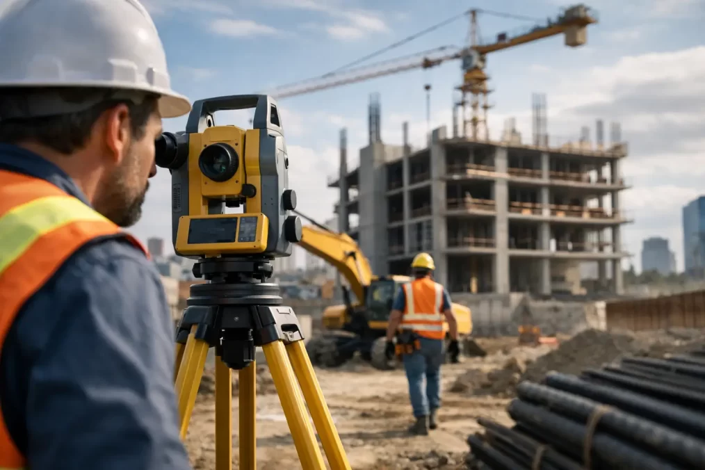
Modern Trimble surveying equipment can improve speed and precision, but technology alone does not make a result dependable. The survey needs sound control, correct interpretation of the plans, careful field procedures and an experienced person checking the outcome. On a complex site, judgement is often as valuable as the instrument.
How to brief your surveyor for a better result
The best time to engage a surveyor is before the programme becomes tight. Provide the latest architectural, structural, civil and hydraulic drawings, along with any relevant approval conditions, title information and existing surveys. If there are known issues such as disputed fences, difficult access, steep terrain, waterfront constraints or previous unapproved work, raise them early.
It also helps to be clear about the immediate decision the survey must support. Do you need a design base for an architect? A legal boundary mark-out before fencing? Set-out for a slab? Verification before a pour? Or final information for council, an authority or title registration? A defined purpose allows the scope, accuracy and timing to match the work.
On active sites, nominate one person to manage drawing revisions and communicate changes. Surveying from an outdated plan is a common and preventable source of confusion. Where several consultants are involved, ask them to agree on the project datum, coordinate system and level reference at the outset.
For projects across Terrigal and the wider Central Coast, local experience can also make the process more efficient. Familiarity with steep lots, established residential areas, coastal conditions and typical approval pathways helps identify survey needs before they affect the construction sequence.
A well-timed survey does more than put pegs in the ground. It gives every person on site a dependable reference point for the next decision, helping the project move forward with fewer surprises and less rework.