
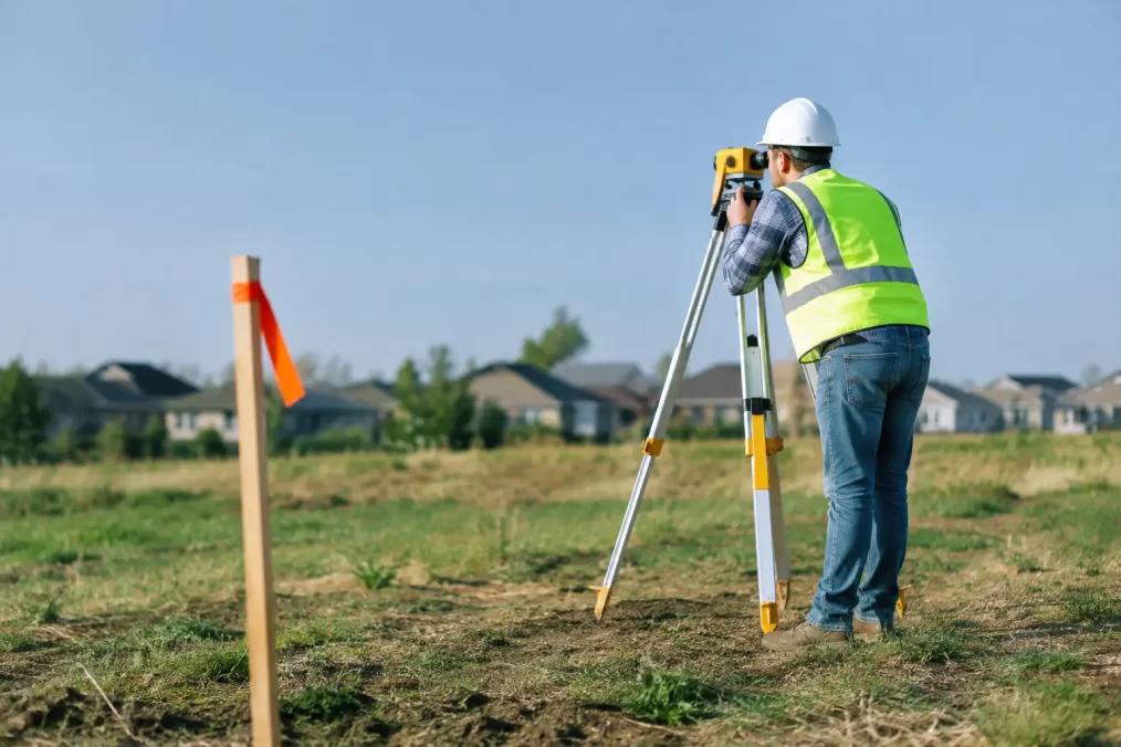
Survey Pegs Versus Boundaries on Your Site
A peg beside a fence can look conclusive, particularly when a build, sale or neighbour discussion is waiting on an answer. But survey pegs versus boundaries is not a simple choice between a physical marker and an invisible line. A peg may be highly relevant evidence, but it does not always show the exact location of the legal boundary or give you enough information to build, fence or subdivide with confidence.
For Central Coast property owners, this distinction matters on older residential blocks, waterfront land, bush sites and properties with long-established fencing. A small error can affect a retaining wall, garage, pool, fence, easement or proposed subdivision. The practical answer is to treat any visible mark carefully, then obtain a cadastral boundary mark-out from a registered surveyor when the position matters.
What is the legal boundary?
A property boundary is the legal extent of the land described by its title and supporting survey plans. It is not created by a fence, garden edge, driveway, wall or neighbour agreement. In NSW, boundaries are determined by interpreting the relevant plans, title information, survey records and physical evidence in accordance with surveying law and established principles.
This is why a boundary cannot usually be confirmed by measuring from a kerb, relying on an online map, or extending a fence line with a tape measure. Mapping tools are useful for general planning, but their displayed lines are approximate and are not suitable for construction or legal boundary decisions.
A registered surveyor investigates the evidence, assesses the relationship between existing marks and the original survey, and determines where the boundary should be marked on the ground. This work requires professional judgement, not simply locating coordinates on a device.
What are survey pegs and boundary marks?
Survey pegs are physical marks placed in the ground to indicate a surveyed point. Depending on the survey, they may be timber pegs, steel pins, drill holes, nails, witness marks or other durable reference marks. Some are placed at a boundary corner. Others identify a line, offset point, construction position or temporary control point.
That difference is the source of much confusion. Not every peg is a boundary peg, and even a peg that was originally placed at a boundary corner may no longer be reliable without verification.
Pegs can be disturbed during excavation, fencing, landscaping, roadworks or building works. They can rot, be buried, be replaced incorrectly or be mistaken for marks left by another contractor. On a sloping or heavily vegetated block, a peg may also be an offset mark rather than the actual corner, placed where the true boundary point could not be practically marked.
A surveyor may use witness marks and measurements from known reference points to re-establish a corner where the true position is inaccessible, such as within a wall, waterway or hard surface. The plan and field evidence explain what the marks represent. The peg alone rarely tells the full story.
Survey pegs versus boundaries: the key difference
The boundary is the legal line. A peg is evidence of a point that may help identify that line.
Where a registered surveyor has recently completed a boundary identification or mark-out, clearly labelled and undisturbed marks are useful on-site references. Builders can use them to understand where not to build, and owners can see the relation between the title boundary and existing occupation.
However, a visible peg should not be treated as automatic authority to start work. The following questions need answers: Who placed it? What survey was it placed for? Is it at the corner or an offset? Has it been disturbed? Does it agree with the title and adjoining evidence?
The stakes rise when works are close to a boundary. If a new structure is proposed near the side or rear line, the builder and designer need a current, clear boundary mark-out. A few hundred millimetres can be the difference between a compliant design and an encroachment that is expensive to rectify.
Why fences are not dependable boundary evidence
Many properties have fences that do not sit on the legal boundary. They may have been installed for convenience, avoid a tree or drainage path, follow an older occupation line, or simply be put up without a survey. A fence can be inside one owner’s land, outside it, or vary along its length.
This is common where land has changed hands many times or where a large parcel has been developed progressively. Coastal and semi-rural sites can be particularly complex because vegetation, retaining walls, informal access tracks and changes in ground level obscure earlier evidence.
A fence may still be useful evidence that a surveyor considers during a boundary investigation. It is not, by itself, proof. Removing a fence or building against it before confirming the title boundary can create avoidable disputes with neighbours and delay a project already moving through design or approval.
When should you arrange a boundary mark-out?
A boundary mark-out is sensible whenever the location of a boundary will affect money, compliance or neighbour relations. For a straightforward project, arranging it before finalising design can prevent redraws. For active construction, it should occur before excavation or setting out works close to the boundary.
Common situations include building a new dwelling, extension, garage, carport, pool, retaining wall or fence. It is also valuable before buying a property where occupation appears unusual, when resolving uncertainty with a neighbour, or before preparing a subdivision, easement or strata plan.
For council building certificates and some property transactions, an identification survey may be required rather than a simple boundary mark-out. An identification survey records the relationship between improvements and boundaries, identifies apparent encroachments and provides formal information for the relevant purpose. The correct scope depends on what you are trying to achieve, so it is worth explaining the proposed works and timing when requesting advice.
What a registered surveyor does differently
A registered surveyor is authorised to determine and mark cadastral boundaries in NSW. The process starts with research. Relevant title documents, deposited plans, historical survey information and available records are reviewed before fieldwork begins.
On site, the surveyor searches for existing marks and measures the land using professional surveying equipment. Modern Trimble technology improves field efficiency and precision, but equipment does not replace cadastral expertise. The critical work is assessing the evidence and applying the correct survey methodology to the particular parcel of land.
After the boundary has been determined, marks can be placed or referenced to assist the owner, designer and builder. The surveyor can also explain practical limitations, such as a corner that cannot be pegged directly, a boundary that runs through dense vegetation, or an occupation feature that does not align with title.
This clarity helps each consultant work from the same information. Architects can position the design accurately, engineers can design retaining or drainage solutions with the right setbacks, and builders can establish work without relying on assumptions.
Avoid these costly shortcuts
The most common mistake is measuring from a peg, fence or neighbour’s building without knowing whether the starting point is correct. Errors multiply quickly, especially over longer distances or uneven ground.
Another mistake is assuming a previous owner’s survey remains enough for a new project. An old plan may be useful, but its marks may have disappeared and the scope may not answer today’s construction question. A survey completed for a previous fence is not necessarily suitable for a new dwelling or subdivision.
It is also risky to ask a builder to decide where the boundary is. A capable builder can set out construction accurately from verified survey control, but determining the legal boundary is registered surveyor work. Keeping those roles clear protects everyone involved.
Make the survey useful to the whole project
The best time to discuss boundaries is before a design is locked in or machinery reaches site. Provide the surveyor with the property address, title details if available, photos of visible pegs or fences, and a clear description of the proposed work. Mention any neighbour concerns, old plans, waterfront interfaces, retaining walls or unusual site features.
If a detail and contour survey is also needed for design, coordinating it with boundary work can give the project team a more complete base of information. Rather than designing around assumed lines, the team can make informed decisions about setbacks, building footprint, access and levels from the outset.
A peg is worth investigating, but the legal boundary deserves more than a visual guess. Before you commit to a fence line, excavation or building position, a registered surveyor can turn uncertainty on the ground into information your project team can act on.