
Property Compliance Survey Checklist for NSW
A property compliance survey checklist is most useful before a contract is exchanged, a building certificate is lodged or construction reaches a point where an error becomes expensive. The key question is not simply whether you need a survey. It is which survey will answer the issue in front of you, using current field evidence, title information and the standards that apply in NSW.
For Central Coast property owners, builders and project consultants, that distinction matters. A fence line may look settled but sit away from the legal boundary. A deck, carport or addition may need to be accurately located for a council application. A waterfront transfer can require an identification survey that confirms the relationship between improvements, title boundaries and the relevant lease or licence area.
Start with the compliance trigger
Property compliance is not one single approval. The reason you need documentation determines the survey scope, required accuracy and reporting format. Ordering the wrong product can cost time because architects, certifiers, solicitors or council may still be missing the information they need.
An identification survey is commonly required where a building certificate, property transaction, waterfront licence transfer or concern about encroachments is involved. It identifies the title boundaries and shows visible improvements in relation to them. It is not the same as a basic real estate sketch, an online boundary overlay or a topographical survey prepared only for design.
A detail and contour survey is generally the starting point for design, planning and building work. It records levels, structures, services visible on site, vegetation and other features that affect a proposed development. It can be essential to a compliant design, but it does not necessarily establish boundaries unless boundary work is specifically included.
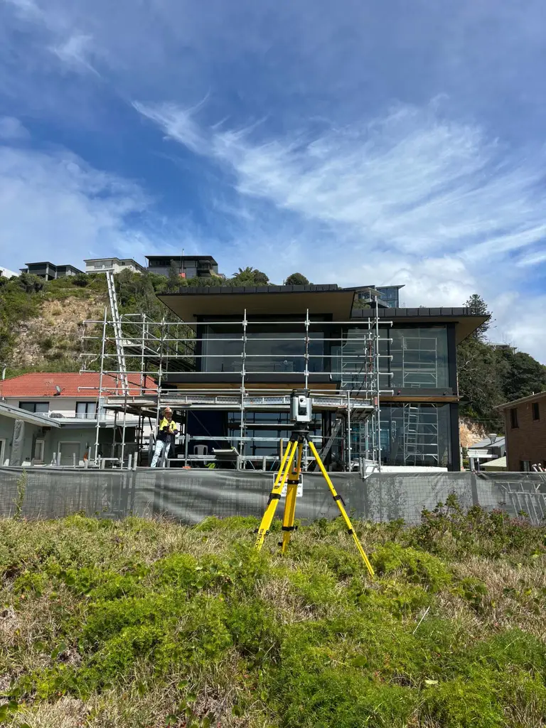
For new construction, a construction set-out survey places the approved design in the correct location. A final survey, floor level report or as-built information may then be needed to demonstrate that the built work matches approved levels, setbacks or plans. Each task supports compliance differently.
Property compliance survey checklist: documents to gather
A registered surveyor can investigate much of the cadastral information required, but a clear brief and the right documents avoid unnecessary assumptions. Before requesting a quote or booking fieldwork, gather what you have and explain the decision that depends on the survey.
The following checklist provides a practical starting point:
- The current title, deposited plan and any available dealings, especially where easements, restrictions or covenants affect the land.
- Council correspondence, building certificate requests, development consent, complying development documents or conditions of consent.
- Approved architectural, structural, civil or landscape plans, including revisions issued during construction.
- Any previous survey plans, set-out records, floor level certificates or boundary mark-out information.
- Details of the concern: for example, a suspected encroachment, uncertain fence position, proposed sale, waterfront transfer or final approval requirement.
- Site access information, including locked gates, dogs, tenants, steep terrain, dense vegetation and safe access to all parts of the property.
Do not assume old plans settle the issue. Older survey information can be valuable evidence, but changes to fencing, buildings, retaining walls and ground levels still need to be checked in the field. In some cases, marks may be disturbed, buried or absent, requiring additional cadastral investigation before a boundary can be marked.
Check the title, not just the fence
The practical occupation of a site is not always aligned with the legal parcel. This is particularly relevant on older Central Coast properties, irregular lots, sloping sites and land with long-standing fencing. A retaining wall, driveway, shed or pool fence can also create an issue where it crosses a boundary or easement.
A cadastral boundary mark-out establishes boundary positions from available survey evidence and registered information. It is the appropriate starting point where you need to know where the boundary is before building a fence, positioning a structure or resolving a discrepancy. It should not be replaced with measurements from a feature shown on an online map.
If an encroachment is found, the next step depends on the facts. It may involve redesign, removal, an agreement between owners, a formal easement or legal advice. The surveyor’s role is to provide reliable spatial evidence and, where required, prepare plans for a registered dealing. The legal outcome sits with the owners, their solicitor and relevant authorities.
Confirm the survey matches the approval pathway
A common cause of delay is providing a document that is accurate but not fit for the approval pathway. Council, a private certifier, a purchaser’s solicitor and NSW Land Registry Services can each require different information.
For a building certificate, the survey may need to identify all relevant structures and show their relationship to boundaries. If the issue is the height or placement of a building, measured floor levels and feature levels may also be required. For a proposed addition, an architect may first need a detailed existing-conditions survey, then the builder may need set-out before work begins.
Subdivision and title work require a different level of coordination. Whether the project involves Torrens title, strata or community title, the survey must work alongside planning approvals, engineering design, servicing requirements and registration processes. Leaving cadastral work until the end can expose conflicts that are far easier to address at feasibility stage.
Ask early about easements and restrictions
Easements are not a minor note on a title. They can affect where you can build, excavate, drain or install services. A proposed easement may also need a survey plan capable of registration. Existing easements must be considered against the current site layout, particularly where structures, pools, driveways or stormwater works are proposed nearby.
Restrictions on the use of land, covenants and planning controls are separate matters, but they often intersect with survey findings. A registered surveyor can identify the land and spatial constraints shown in title documents. Your planner, certifier or solicitor can then advise on the wider approval or legal implications.
Prepare the site for accurate fieldwork
A quick turnaround starts with safe, complete access. Move vehicles where possible, unlock side gates, advise tenants and clear practical access to boundary areas. Overgrown vegetation, stored materials and locked compounds can hide survey marks or prevent the surveyor from locating structures accurately.
That said, avoid moving a fence, peg or marker because you think it is wrong. Survey marks may be significant evidence, and disturbed evidence can make investigation more difficult. If a mark is exposed or appears damaged, point it out to the surveyor and leave it in place.
For construction work, make sure the latest approved drawings are issued before set-out occurs. A set-out based on a superseded plan can create an avoidable and costly correction. Builders and project managers should also confirm whether gridlines, offsets, finished floor levels, excavation limits or service locations need to be set out, rather than assuming a single visit covers every stage.
Review the deliverable before relying on it
When the survey is complete, check that it addresses the original question. If the purpose was a building certificate, confirm the requested structures are shown. If it was boundary clarification, make sure you understand which marks have been located or placed and what they represent. If it supports construction, confirm the drawing revision and datum match the consultant team’s current documents.
It is also worth circulating the survey promptly to the architect, planner, engineer, certifier or solicitor who needs it. A survey often reveals a design issue early enough to resolve without disrupting the programme. Waiting until a lodgement deadline or concrete pour creates pressure that no consultant can fully remove.
When a simple checklist is not enough
A checklist helps identify the likely scope, but complex sites need a registered surveyor’s assessment. Extra care is often required for waterfront land, rural properties, steep blocks, older subdivisions, land affected by easements, strata schemes and sites with conflicting occupation evidence. The right approach may involve staged work: first establish the boundary or existing conditions, then prepare the compliance, set-out or registration plan required.
Central Coast Surveyors can help clients define that scope before work begins, using local site knowledge, registered expertise and survey data suited to design, approval and title requirements. Bringing the surveyor into the project early usually gives every other consultant a clearer base to work from.
The most useful next step is to state the property decision you need to make, provide the plans and correspondence you already hold, and ask what survey evidence will allow that decision to proceed with confidence.