
Choosing a Registered Land Surveyor in NSW
A boundary shown on an old fence, a sketch in a sales contract or a neighbour’s recollection may be useful background, but none of them establishes where your legal boundary sits. When people search for a registered land surveyor NSW, they are usually facing a decision that affects an approval, construction programme, property transaction or title. Getting the right advice early can prevent expensive changes later.
For Central Coast properties, this is particularly relevant. Sloping sites, older coastal subdivisions, waterfront land, irregular boundaries and long-established improvements can make assumptions risky. A registered surveyor provides the professional authority, technical process and accountable result needed when land rights or legally defined plans are involved.
What makes a surveyor registered in NSW?
A registered land surveyor in NSW is a professional who has met the education, practical training and competency requirements set by the Board of Surveying and Spatial Information. Registration is not simply a job title. It reflects university-level qualifications, supervised professional experience and demonstrated competency in cadastral surveying, which deals with land boundaries, titles and interests in land.
This matters because a cadastral survey can affect legal rights. The position of a boundary may determine where a home, retaining wall, driveway or fence can be built. It can also affect access, easements, development potential and the area being sold or subdivided.
Registered surveyors are authorised to undertake the cadastral work required for plans lodged through NSW Land Registry Services. They take responsibility for interpreting title information, considering prior survey evidence, locating or reinstating boundaries and preparing plans that meet applicable requirements.
That does not mean every site measurement needs a registered surveyor personally holding the prism or operating the instrument. Surveying teams often include experienced field staff and spatial professionals. The critical point is that cadastral work and registered plans are directed, checked and certified by the registered surveyor who is accountable for the result.
When you need a registered land surveyor in NSW
Registration becomes essential where the work involves defining land boundaries or creating, changing or documenting title interests. The right time to engage a surveyor is often before plans are finalised, materials are ordered or a contract becomes unconditional.
Before building close to a boundary
If a proposed dwelling, garage, deck, pool, retaining wall or fence will sit near a boundary, a cadastral boundary survey or boundary mark-out may be needed. This establishes the relationship between the proposal and the legal parcel, rather than relying on a fence line that could be offset, replaced or entirely unrelated to the title boundary.
Your architect, building designer or engineer may also need accurate boundary information before completing detailed plans. Discovering a setback issue after the design has been approved can mean redesign, amended applications and construction delays.
For subdivisions and new titles
Torrens title, strata and community title subdivisions require precise surveying and formal plan preparation. Depending on the project, the surveyor may coordinate from the initial subdivision concept through to the final plan lodged for registration.
A registered surveyor can identify practical constraints early, including access requirements, existing easements, title inconsistencies, encroachments and the survey evidence available around the site. Not every issue prevents a subdivision, but each needs to be understood before the project programme and budget are locked in.
When an easement is needed
Easements are commonly required for drainage, sewer, access, services or rights of carriageway. They are legal interests recorded on title, so their location and dimensions must be clearly defined in a compliant plan.
The detail matters. An easement that does not suit the proposed pipe alignment, driveway geometry or maintenance access can create problems for owners and service authorities. Early collaboration between the surveyor, civil engineer, planner and solicitor helps ensure the intended arrangement works on paper and on site.
For property transactions and compliance matters
An identification survey may be requested during a sale, for a council building certificate, a waterfront licence transfer or when there is concern about encroachments. It compares visible improvements with the property boundaries and title information.
This type of survey can reveal a shed crossing a boundary, a fence built on adjoining land, a driveway outside the parcel or an improvement affected by an easement. The findings are not always a deal-breaker, but they give buyers, sellers and advisers the information needed to deal with the issue properly rather than inherit a surprise.
Registration is not the only selection criterion
For legally defined boundary and title work, registration is non-negotiable. Beyond that, the best fit depends on the project. A homeowner marking out a fence needs clear advice and a reliable site visit. A developer needs a surveyor who can manage changing requirements, work with consultants and maintain momentum through approvals and registration.
Ask whether the surveyor regularly performs the specific work you need. Topographical surveys, construction set-out, identification surveys and strata subdivision plans call for related but different skills, documentation and workflows. A practice with end-to-end capability can reduce handovers between feasibility, design, construction and final title work.
Local experience also has practical value. Survey records, terrain, access constraints and the expectations of councils and service authorities can vary considerably across NSW. A surveyor familiar with Central Coast sites is more likely to anticipate field conditions and coordinate efficiently with the architects, planners, builders and engineers involved.
Turnaround time should be discussed openly as well. Fast service is useful only when the scope is correct and the work has been checked properly. A dependable surveyor will explain what information is needed, identify any records or site access issues, and provide realistic timing rather than promising a date that cannot be met.
What to prepare before requesting a quote
A clear brief allows the surveyor to assess the work properly. Provide the property address, lot and deposited plan details if available, the purpose of the survey and any relevant plans, sketches, development application documents or title information.
It also helps to explain the project stage. For example, a contour and detail survey for an architect has a different scope from a boundary survey needed before building works commence. If construction is planned, share the proposed building footprint and the required set-out date. If the matter involves a dispute or possible encroachment, say so from the outset.
Site access is another practical consideration. Locked gates, dense vegetation, dogs, parked vehicles and limited access to boundary areas can affect field time. For waterfront, rural or steep land, access planning may be a significant part of the job. Raising these matters early helps avoid aborted visits and unnecessary delay.
How the surveying process usually works
The process begins with an assessment of the purpose of the survey and the available evidence. For cadastral work, the surveyor investigates title documents, prior plans and relevant survey records before attending the site. This office-based work is fundamental, because a boundary cannot be established from site measurements alone.
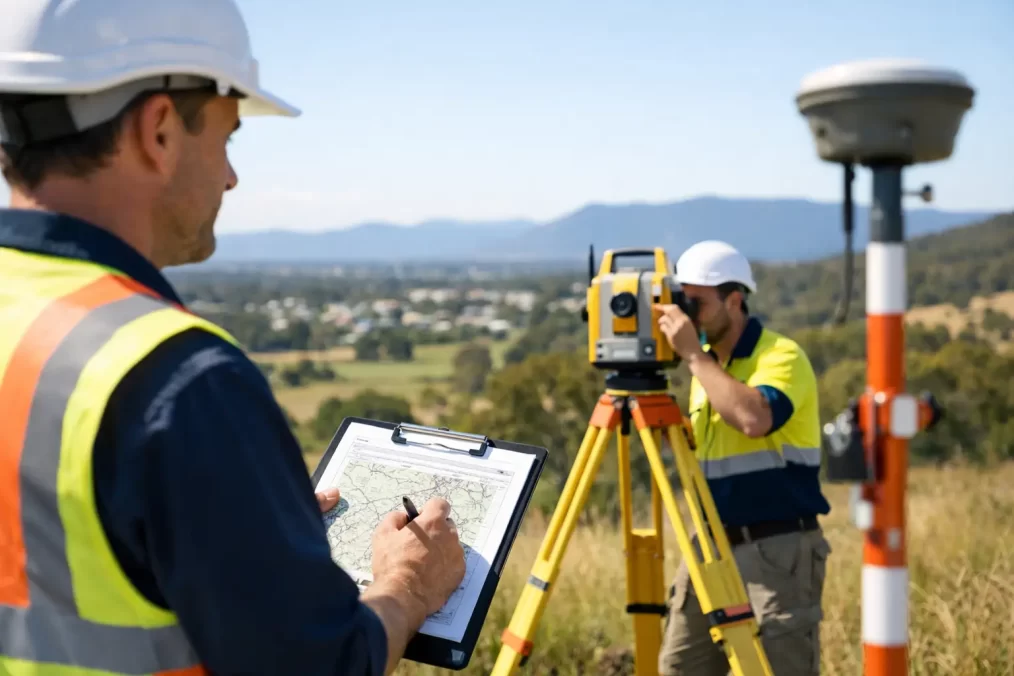
Fieldwork then locates existing survey marks, occupation features, structures, services and terrain relevant to the brief. Modern equipment, including Trimble surveying technology, supports efficient and accurate data capture, but technology does not replace professional judgement. The surveyor must assess how the physical evidence, historic records and current title information fit together.
The final deliverable depends on the project. It may be a detailed topographical plan for design, an identification survey report, boundary marks placed on site, construction set-out information, a level report or a subdivision plan prepared for registration. Good communication at this stage is as valuable as accurate data. Your consultant team needs information in a format they can use without losing time interpreting it.
Avoid the false economy of assumptions
It can be tempting to defer a boundary survey until construction is ready to start. The apparent saving can disappear quickly if the design is based on an assumed boundary, an old fence or dimensions copied from a plan without verification. Moving a wall, adjusting stormwater design or resolving an encroachment once work has started usually costs more than obtaining the right survey at the beginning.
The same principle applies to subdivisions. A concept may look straightforward until survey evidence, easements, drainage requirements or site conditions are examined. Early registered surveyor input gives the wider project team better information for feasibility, design and approvals.
A registered surveyor is not simply engaged to produce a plan. They help establish a reliable starting point for decisions that carry legal, financial and construction consequences. Whether you are buying, building, subdividing or resolving a boundary question, a short conversation with a registered professional before the next commitment can keep the project moving on solid ground.