Best Methods for Locating Property Corners
A fence line, an old timber peg and a line shown on a mapping app can all look convincing. None, on their own, necessarily establishes your legal boundary. The best methods for locating property corners depend on why you need the answer, the age and condition of the existing marks, and whether the result will affect a fence, building, sale, subdivision or neighbour discussion.
For Central Coast properties, boundary evidence is often complicated by sloping blocks, coastal conditions, older subdivisions, retaining walls, renovations and long-established occupation that does not match the title. A careful approach can prevent an expensive mistake. If the corner needs to be relied on for construction or a boundary matter, a registered surveyor should assess and mark the boundary.
Best Methods for Locating Property Corners
Start with the purpose of the search
The right method changes with the risk. If you are simply trying to understand the rough shape of a block before discussing a garden layout, publicly available mapping and title information can provide useful context. If you are planning a new fence, carport, extension, retaining wall, pool or driveway near a side boundary, an approximate position is not enough.
A builder also needs a different level of certainty from a purchaser reviewing a property. Construction set-out relies on accurate control, while an identification survey may be needed to show how existing buildings relate to the boundaries for a building certificate, waterfront licence transfer or property transaction. Being clear about the intended use helps a surveyor recommend the appropriate scope rather than supplying information that is either insufficient or unnecessarily broad.
Review the deposited plan and title information
A deposited plan records the parcel dimensions, bearings, easements and other legal information associated with the land. It is a valuable starting point, but it does not tell you where a corner sits on the ground without interpretation and field measurement.
Plans may refer to survey marks, reference marks, old boundary marks or adjoining parcels. Their notation needs to be read alongside the wider survey record and the physical evidence found on site. On older Central Coast land, original marks may be buried, disturbed by earthworks, concealed by landscaping or no longer present.
Title information can also reveal easements, restrictions or covenants that affect where you can build. A corner of your lot is not always the only line that matters. A drainage or access easement may restrict a structure even when it is set back from the boundary.
Look for physical survey evidence, carefully
Property corners are often marked by a survey peg, nail, drill hole, rod or other mark. Finding one can be useful, particularly where it corresponds with reliable survey records. However, a visible peg should not be treated as proof simply because it is in the ground.
Pegs can be moved during fencing, excavation or landscaping. They can also relate to an older survey, a construction reference or a neighbouring project rather than the current boundary definition. A fence junction, kerb alignment or retaining wall may also be close to the legal line without being on it.
Avoid digging blindly for marks. Underground services may be present, and disturbed evidence can make later assessment more difficult. Before any excavation, obtain current service information and use appropriate care around known utility routes.
Use online maps only as a preliminary guide
Online cadastral maps and aerial imagery are convenient for visualising a lot, but they are not a boundary survey. Map layers can be offset from aerial photography, simplified for display or affected by the accuracy of the underlying imagery. A line that appears to run through the middle of a fence on screen may differ materially on site.
Mobile GPS and consumer GPS devices have the same limitation. They are useful for navigation and broad positioning, not for establishing a legal corner. Even when a device reports a small accuracy range, that figure does not convert a map boundary into a surveyed boundary on the ground.
Use these tools to prepare questions, not to decide where to place concrete, posts or a building footing.
Check whether fences and occupation agree with the title
Longstanding fences are one of the main sources of boundary assumptions. Sometimes a fence follows the surveyed line. Sometimes it was placed for convenience around a tree, rock shelf, drainage path or existing structure. On semi-rural and larger residential lots, it is not unusual for occupation lines to vary from the title boundary in more than one location.
This does not mean a fence is irrelevant. It is evidence that a registered surveyor will inspect and consider with plans, marks and measurements. But occupation alone does not replace a cadastral boundary determination. Where a replacement fence is proposed, confirming the line before removal of the old fence can preserve useful evidence and reduce disagreement with neighbours.
When a Registered Surveyor Is the Best Method
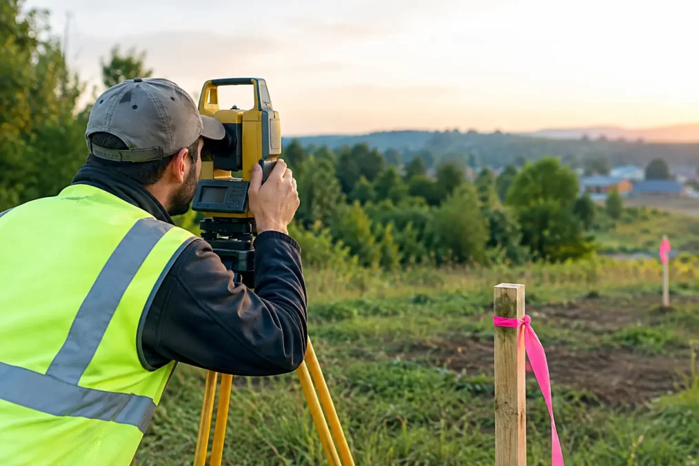
Where the boundary position has legal, approval or construction consequences, engaging a registered surveyor is the reliable option. A cadastral boundary survey involves researching the relevant plans and records, locating available marks, measuring the land with survey-grade equipment and assessing the evidence under NSW surveying requirements.
The surveyor may place boundary marks or provide a boundary mark-out so the line can be identified on site. The scope varies according to the property and purpose. A straightforward suburban lot with clear marks can be very different from a waterfront parcel, an irregular battle-axe allotment or land affected by road widening, easements and prior subdivisions.
This work is more than measuring dimensions from a title plan. Boundaries must be re-established by considering the survey system as a whole. That is why a tape measurement from a fence corner, or coordinates copied from an app, can produce a result that looks precise but is wrong.
For projects around Terrigal, Gosford, Erina, Woy Woy and across the Central Coast, early boundary advice is particularly valuable where sites are steep, tightly developed or close to foreshore areas. It allows architects, designers and builders to work from dependable information before drawings or construction decisions become costly to change.
Boundary mark-out versus an identification survey
These services can overlap, but they answer different questions. A boundary mark-out focuses on locating and marking the property boundaries for a practical purpose such as fencing, design or construction planning.
An identification survey shows the relationship between existing improvements and the property boundaries. It may identify encroachments, setbacks and visible occupation, making it useful for council requirements, building certificates and certain property transactions. If a client needs to know whether an existing garage, deck or retaining wall crosses a line, an identification survey may be the more suitable instruction.
A registered surveyor can explain which service is appropriate after reviewing the site, available records and intended outcome. That conversation is worth having before engaging a fencing contractor or finalising building plans.
Common mistakes that create avoidable cost
The most expensive boundary problems often begin with a reasonable assumption made too early. Rebuilding a fence in the old position may seem sensible until a later survey shows the fence sat inside or outside the boundary. Moving it after posts are concreted can create extra labour, neighbour tension and delay.
Another common issue is designing to a presumed boundary. A small error can affect setback compliance, building envelope calculations, retaining wall placement and stormwater design. It can also force late changes to drawings or approvals.
Do not rely on verbal advice from a previous owner, neighbour or contractor as the final answer. Their information may be well intentioned and still be based on a peg that disappeared years ago or a fence installed without a survey. A clear written scope and proper survey evidence give everyone a more dependable reference point.
What to provide when requesting a boundary survey
A surveyor can assess the job more efficiently when you provide the property address, lot and deposited plan details if available, recent title documents, photographs of any visible pegs or fences, and a brief description of what you intend to do. Mention any neighbour concerns, previous survey plans, easements, proposed structures and deadlines tied to council or construction.
It also helps to allow safe access to the relevant parts of the site. Dense vegetation, locked side access, dogs, stored materials and steep ground can affect field time. If boundary marks are likely to be close to a proposed fence or excavation area, arrange the survey early enough that the result can inform the work rather than interrupt it.
Central Coast Surveyors can assess whether a cadastral boundary mark-out, identification survey or another survey service best fits the project. The aim is not merely to find a peg. It is to provide reliable information that lets property owners, designers and builders proceed with confidence.
Before committing to a fence line or structure, treat the property corner as a survey question rather than a visual guess. A prompt assessment by a registered surveyor can turn an uncertain line on the ground into a practical, defensible starting point for the work ahead.