
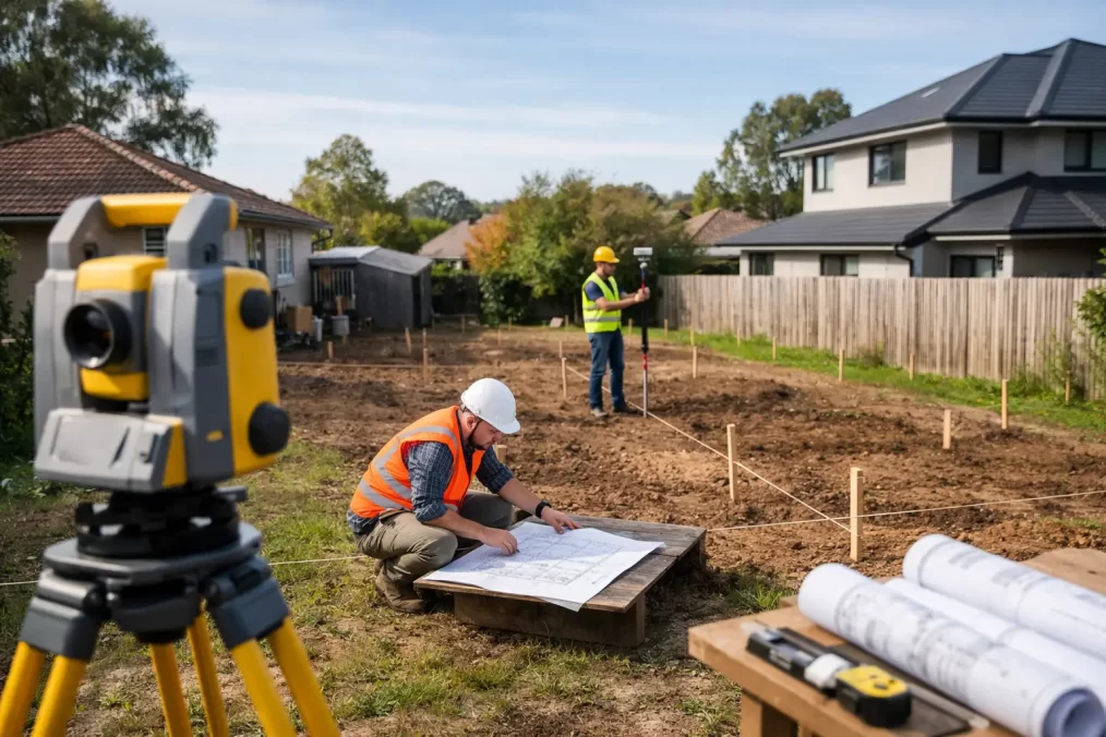
Best Survey for Backyard Subdivision in NSW
A backyard subdivision can look straightforward from the fence line: there seems to be enough room for a second dwelling, access down the side and a clear place for a new lot boundary. On paper, however, the best survey for backyard subdivision depends on what must be designed, approved and legally created. Starting with the wrong information can cause redesigns, council delays and expensive surprises once construction is underway.
For most Central Coast properties, the right starting point is a detailed topographical survey combined with reliable boundary information. The exact scope may then expand to include an identification survey, easement work, subdivision plan preparation and construction set-out. The key is to match the survey to the stage of the project rather than treating every survey as the same service.
What is the best survey for a backyard subdivision?
For early feasibility and design, a detail and contour survey is generally the most useful survey. It gives your architect, building designer, town planner and civil engineer an accurate base plan of the existing site. This includes levels, buildings, fences, driveways, trees, retaining walls, drainage features, visible services and other site constraints that influence the proposed layout.
A good topographical survey shows far more than whether a new dwelling will physically fit. It helps the design team assess driveway grades, stormwater drainage, cut and fill, private open space, vehicle access and the likely position of new services. On sloping Central Coast blocks, accurate contours are especially important. A concept that looks workable on an aerial image may require substantial retaining, difficult drainage solutions or a driveway that does not meet relevant design requirements.
That said, a detail and contour survey alone does not prove where the legal boundary sits. If the proposed new lot line, building location, access handle or easement is close to a boundary, a registered surveyor may need to investigate and mark the cadastral boundary. This is where an identification survey or boundary survey becomes essential.
Why aerial imagery and old plans are not enough
Property owners often begin with online mapping, a deposited plan from a previous purchase or measurements taken from an existing fence. These can be helpful for an initial conversation, but they are not suitable for subdivision design or legal boundary decisions.
Fences regularly sit inside or outside the true boundary. Older plans may not show later structures, retaining walls, drainage works or changes to neighbouring land. Mapping imagery can also be offset from the actual cadastral position. Designing a dwelling, driveway or new lot around assumptions can lead to encroachments, unusable setbacks and delays when the formal subdivision plan is prepared.
A registered land surveyor assesses the relevant title information, existing survey marks and field measurements to determine how the property boundaries relate to the site. This work provides dependable information for your consultant team and prevents a costly problem from being discovered late in the approval process.
The surveys commonly needed from feasibility to new title
Backyard subdivision is a process, not a single drawing. The survey requirements change as the project progresses.
Detail and contour survey for design
This is normally the first field survey. It records the physical features and levels across the site and, where needed, adjoining features that affect the proposal. Your architect or designer uses it to prepare concept plans, while the planner and engineer use it to assess constraints and servicing.
Ask for enough detail to suit the intended development. For example, a battle-axe subdivision may need careful pickup of existing driveways, kerbs, poles, pits, drainage paths and neighbouring structures near the proposed access. A corner block may need accurate information about both street frontages and any existing vehicle crossings.
Identification or boundary survey for confidence around title lines
An identification survey identifies the relationship between visible occupation, such as fences and buildings, and the legal boundaries of the land. It is particularly valuable where an existing dwelling is close to a side boundary, where a fence is likely to become the division between lots, or where a new building is proposed near a title line.
The level of boundary work needed depends on the proposal and available evidence. A simple rear-lot subdivision on a large, well-defined site may require different investigation from an older property with missing survey marks, irregular boundaries or structures close to the proposed new lot line.
Subdivision survey and plan preparation
Once a development pathway is established and approvals are in place, the registered surveyor prepares the legal subdivision documentation. This may involve a plan of subdivision for Torrens title land, or different survey and plan requirements for strata or community title developments.
The plan must accurately create the proposed lots, identify new boundaries and deal with any required easements or restrictions. It is then lodged through the required NSW registration process after relevant certifications and approvals have been obtained. This is legal land definition, not simply a copy of an architectural site plan.
Easement surveys where access or services cross land
Many backyard subdivisions require easements. These can be needed for drainage, sewer, electricity, water, access or support of structures, depending on the site and servicing strategy. An easement may affect the placement of buildings, pools, landscaping and future additions, so it should be considered early rather than added as an afterthought.
The surveyor works with the project team to define the easement location accurately and prepare the plan documentation required for registration. Early coordination is critical where an existing or proposed service route does not sit neatly within the new lot boundaries.
Construction set-out and final survey work
After approval, surveying continues to protect the design on site. Construction set-out places key building, boundary and infrastructure positions accurately for builders and contractors. This is particularly useful when clearances are tight, retaining walls are proposed or a driveway must follow a specific alignment and grade.
Final survey work may also be needed to verify completed works, floor levels or built positions for certification, compliance and registration purposes. Keeping the same surveying team involved from the initial survey through to final plans reduces the risk of mismatched information between project stages.
Factors that change the scope and cost
There is no one-size-fits-all answer because every allotment has different physical and title constraints. The best approach is to obtain a scope based on the actual site, intended subdivision type and approval pathway.
Four issues usually have the greatest effect on survey requirements:
- Site shape and slope: Narrow, irregular or steep blocks need more detailed level and feature information to test access, drainage and building platforms.
- Boundary evidence: Missing marks, old subdivisions and inconsistencies between fences and title boundaries can require additional cadastral investigation.
- Existing structures: Homes, garages, pools, retaining walls and sheds near proposed boundaries need accurate location to avoid setbacks or encroachment issues.
- Servicing and access: Drainage routes, sewer locations, driveway design and easements can affect both the subdivision layout and legal plan requirements.
A quick, low-cost survey that misses key constraints may not be economical if it forces the design team to return to site, redraw plans or adjust a lodged application. The better value is accurate information delivered early enough for informed decisions.
When should you engage a surveyor?
Engage a surveyor before spending heavily on architectural drawings or lodging a development application. A preliminary conversation with a registered surveyor can clarify what information the design team needs and whether boundary work should be completed with the detail survey.
This is also the right time to coordinate with your planner, architect or building designer. They may have specific council controls or design questions that the survey needs to address. Clear communication at this stage avoids duplicate site visits and gives every consultant a consistent, accurate base plan.
If you are considering a duplex, detached dual occupancy, rear-lot subdivision or a secondary dwelling that may later form part of a broader development strategy, explain the longer-term goal from the outset. The current approval and title pathway may be different, and early survey advice can help avoid making decisions that limit future options.
Choosing a surveyor for a Central Coast subdivision
For subdivision work in NSW, use a registered land surveyor with experience in both site measurement and cadastral plan preparation. Registration matters because boundary definition and subdivision plans involve legal land matters, not only the collection of levels and features.
Look for a consultant who can explain the scope in plain language, provide data suitable for your other consultants and remain involved through the project. Fast turnaround is valuable, but accuracy, local knowledge and responsive coordination are what keep an approval and construction programme moving.
Central Coast Surveyors can assist from the first detail and contour survey through boundary investigation, easement creation, subdivision plan preparation, construction set-out and NSW title registration. The practical advantage is continuity: your project team works from reliable survey information at every critical stage.
Before sketching the new driveway or choosing where the second dwelling will sit, arrange a site-specific survey discussion. A clear understanding of levels, boundaries and servicing early in the process gives your project the best chance of progressing without avoidable redesigns later.