How Accurate Is a Professional Land Survey?
A fence that appears to follow the boundary, a peg found near a garden bed, or a measurement from an online map can all look convincing. None of them provides the certainty needed to design, build, buy, subdivide or resolve a boundary issue. So, how accurate is a professional land survey? When it is completed for the right purpose by a suitably qualified surveyor, it can be accurate to millimetres or centimetres in measured position, while the legal boundary opinion is supported by careful title research, field evidence and NSW surveying standards.
The practical answer is that survey accuracy is not one fixed number. The required tolerance depends on whether the survey is mapping a site for an architect, locating a proposed building, marking a title boundary, or preparing a plan for registration. A reliable surveyor defines the required outcome before selecting the method, equipment and level of checking.
How Accurate Is a Professional Land Survey in Practice?
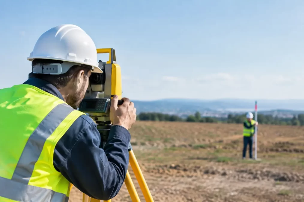
Modern field equipment is extremely precise, but a professional survey is more than an instrument reading. Total stations, GNSS equipment and digital levels can measure positions and heights very accurately when used correctly. On a clear, controlled site, construction set-out and boundary work can commonly work to millimetre-level tolerances. Detail and contour surveys are typically presented at a scale and accuracy appropriate for design, often with point positions accurate to centimetres.
Those figures need context. Measuring a point precisely is different from proving what that point represents. For example, a total station may locate an old fence post to within a few millimetres, but that does not establish the post as the legal boundary corner. It may be offset, disturbed, replaced over time, or simply have never been on the boundary.
A professional survey combines measurement accuracy with evidence-based judgement. The surveyor assesses survey marks, deposited plans, title information, easements, occupation, adjoining surveys and the history of the parcel before determining where a boundary should be marked.
Different surveys need different tolerances
A topographical survey gives architects, builders and engineers dependable information about site levels, existing buildings, kerbs, trees, drainage features and visible services. Its purpose is to support design decisions, not necessarily to define every title boundary. It needs enough accuracy for floor levels, cut and fill estimates, stormwater design and building placement.
A cadastral or boundary survey has a different job. It identifies the legal parcel boundaries by reference to the title system and survey evidence. This level of work is required when boundary certainty matters, such as before constructing close to a boundary, replacing a fence where ownership is disputed, creating an easement, or subdividing land.
Construction set-out is also highly precise, but it is only as dependable as the approved plans and control information supplied. A surveyor can place grid lines, footings, walls and floor levels accurately on site. If the architectural or engineering design has unresolved boundary assumptions, those need to be addressed before set-out begins.
Why Legal Boundary Accuracy Is More Than a Measurement
Property boundaries in NSW are legal lines, not physical objects. Their position may be defined by a registered plan, dimensions, bearings, old survey marks and surrounding survey evidence. On older Central Coast sites, particularly in established suburbs, bushland areas or waterfront locations, some original marks may be missing, buried or affected by later works.
That is why a registered surveyor does not simply use a GPS reading, measure from a fence, or rely on a real estate plan. They investigate the parcel within the broader survey framework. This can include locating reference marks in nearby roads, searching for original marks, comparing adjoining titles and checking whether previous registered surveys affect the determination.
There can be a small level of tolerance in any physical mark-out because the ground is not a drawing and older survey evidence can be complex. However, the objective is not to produce an approximate line. It is to establish the boundary position as accurately as the legal evidence and applicable standards allow, then clearly communicate what has been found.
What Can Affect Survey Accuracy?
Good equipment improves efficiency, but site conditions and available evidence still matter. A survey completed under tree canopy, beside tall buildings or on steep terrain may need different methods from an open, level block. Satellite-based positioning can be affected by obstructions and signal reflection, while a total station requires clear lines of sight between the instrument and prism.
The main factors that affect the final result include the survey type, terrain, vegetation, access, the condition of existing marks, the age and quality of title information, and whether reliable survey control is close by. A large rural parcel with dense vegetation will generally require more investigation than a vacant suburban lot with accessible reference marks.
Human activity can also create confusion. Retaining walls, driveways, pools and fences are frequently built without regard to the precise title line. Earthworks can cover marks, and renovations can alter the apparent relationship between a building and the boundary. These issues do not make accurate surveying impossible, but they may increase the fieldwork, research and time required.
The Difference Between a Survey Plan and an Online Map
Online mapping is useful for general location, planning travel and gaining an early sense of a site. It is not suitable for establishing a boundary, choosing a building location or measuring compliance setbacks. Imagery can be old, layers can be offset, and displayed parcel lines are often indicative only.
Similarly, a title diagram or deposited plan should not be treated as a scale drawing for site measurement. It records important legal dimensions and information, but applying it correctly to the ground requires surveying knowledge, reliable control and an assessment of existing evidence.
For a homeowner, the risk of relying on an approximate source can be significant. A shed, retaining wall, fence or addition built in the wrong position may trigger neighbour disputes, redesign costs, approval issues or expensive remedial work. For a developer or builder, a small error can flow into delays across design, certification and construction.
When Should You Commission a Boundary Survey?
A boundary survey is worth arranging before decisions become expensive. This is particularly relevant where a proposed building is close to a side or rear boundary, where a neighbour has raised a concern, or where an old fence is being replaced and its position is uncertain.
It is also sensible before purchasing a property with unclear improvements near the boundaries, undertaking a subdivision, creating an easement, or transferring a waterfront licence where the relationship between land and improvements must be understood. An identification survey may be required for building certificate or property transaction purposes, but its scope should be discussed with the surveyor so it addresses the actual issue.
For design work, commissioning a current detail and contour survey early gives the project team a dependable base. Architects and engineers can design around accurate levels, structures and site constraints instead of making assumptions that need correction later. This usually saves time well beyond the survey fee.
Ask for the right survey, not just a price
The lowest-priced survey is not always the lowest-cost outcome. A quote should make clear what is being surveyed, whether boundaries are included, what information will be shown, and whether the work is suitable for council, design, construction or registration.
If you need legal boundary advice in NSW, use a registered surveyor. Registration matters because cadastral boundary work carries legal and professional responsibilities. A registered surveyor is qualified to assess boundary evidence and prepare the plans required for many title and land dealings.
Central Coast Surveyors can also coordinate survey information with architects, planners, engineers and builders, helping avoid the common handover gaps that slow down approvals and site works.
Accuracy Starts Before the Field Crew Arrives
The best result begins with a clear brief. Tell the surveyor what you are planning, whether there is a neighbour concern, what approvals are involved, and whether you have old plans, correspondence or evidence of existing marks. This helps them identify the right survey scope before attending site.
Provide safe access where possible and avoid moving or disturbing pegs, nails or other marks. If vegetation blocks key areas, discuss whether selective clearing is needed. A good surveyor will explain what information is reliable, what has been assumed, and whether further investigation is needed before you commit to construction.
If a boundary, level or structure will influence a costly decision, treat the survey as the project’s reference point rather than an administrative step. Getting reliable information onto the ground early gives every consultant and contractor a clearer path forward.