
How to Set Building Grid Accurately on Site
A building grid is the reference framework that turns approved drawings into a structure in the correct physical position. Knowing how to set building grid accurately is not simply a matter of putting pegs in the ground. It requires reliable boundary information, survey control, coordinated drawings and checks that account for excavation, access and the realities of the site.
For a new home, duplex, commercial building or extension, an error at set-out can affect setbacks, structural alignment, drainage, floor levels and the ability to complete a final survey with confidence. Fixing a grid before concrete is poured is straightforward. Fixing it after construction has progressed can be expensive.
What a building grid does
A building grid establishes the design position of the proposed structure using a set of marked axes, usually shown on architectural and structural plans. Grid lines often relate to wall faces, structural columns, centre lines or a nominated building corner. They provide the builder and trades with consistent reference points throughout construction.
The grid should not be confused with a cadastral boundary. A boundary defines the legal extent of a parcel of land. The building grid is the proposed construction position within that land. The connection between the two is critical because planning controls, development consent conditions and building requirements may nominate setbacks from the legal boundary.
On a typical residential project, the grid gives the builder clear points for excavation and footing works, then remains available as a reference for formwork, walls, slabs and structural elements. On larger projects, it may form part of a wider site control network used by multiple contractors.
Start with verified survey and design information
Accurate construction set-out starts well before anyone attends site. The surveyor needs to review the documents that control the job, including the approved architectural plans, structural drawings, civil drawings where relevant, and any conditions that affect the building location or levels.
The starting survey information matters just as much. A current detail and contour survey may show site features, existing levels and visible improvements, but the proposed building position usually needs to be related to a verified cadastral boundary. Where setbacks are tight, a registered surveyor may need to identify or mark the boundary before setting out the building.
This is particularly relevant on Central Coast sites with irregular lots, older subdivisions, steep ground, retaining walls or existing buildings close to the proposed works. A fence line is not automatically a boundary, and dimensions scaled from a plan are not suitable for construction set-out.
Before the grid is calculated, resolve any inconsistency between drawings. Common issues include architectural plans showing a different finished floor level from engineering plans, grid labels that do not match between disciplines, or setback dimensions measured from an assumed rather than surveyed boundary. A short clarification at this stage can prevent the survey team from setting out information that later needs to change.
How to set building grid: establish reliable control
The practical field process begins by establishing survey control. These are stable, coordinated reference marks from which the grid can be set out and checked. Depending on the project, control may be tied to existing marks, a project control network or a suitable survey datum.
Control points must be placed where they are unlikely to be disturbed by demolition, excavation, machinery or deliveries. This is one reason the most convenient location is not always the best one. A mark inside the excavation area might be easy to access on day one but useless once earthworks start.
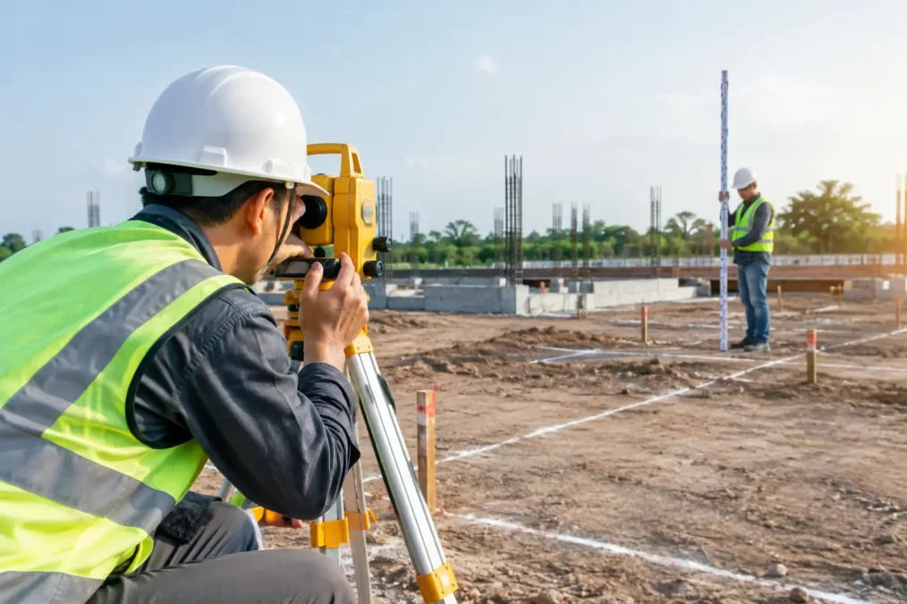
A registered surveyor will use calibrated electronic equipment, commonly a total station, to position grid points precisely from the approved design coordinates. Advanced Trimble equipment allows measurements and checks to be carried out efficiently, but the equipment is only as useful as the control, calculations and professional judgement behind it.
For most building work, the surveyor will not rely on a single point. The grid is established through multiple points and independent observations so its position, orientation and dimensions can be checked. This reduces the risk of a simple transcription error or a disturbed peg influencing the build.
Mark the grid where it will survive construction
Grid intersections may be marked with timber pegs, nails, paint marks or other site-appropriate methods. However, the point marking the exact building corner is often in the path of excavation or footing trenches. For that reason, the key construction marks are commonly offset beyond the proposed building line.
An offset peg carries a known relationship to the true grid line or corner. For example, it may be located at a set perpendicular distance from the building line, allowing the builder to re-establish the line with string when required. Clear labels are essential. Each mark should identify the relevant grid line, offset distance and direction, rather than leaving the site team to interpret an unlabelled peg weeks later.
Batter boards or profile boards can also be used where the builder needs string lines to remain in place during excavation. Their suitability depends on the site. On a compact suburban block, boards may be practical. On a heavily trafficked site or a sloping block requiring extensive earthworks, protected offset marks may be more reliable.
The goal is not to leave as many marks as possible. It is to leave marks that the construction team can understand, use and preserve.
Set horizontal position and levels together
A building grid addresses horizontal position, but construction set-out should also clearly establish the vertical information needed for the works. This normally includes a temporary benchmark or control mark, its reduced level, and the nominated finished floor level where applicable.
The builder may need levels for cut and fill, slab preparation, footings, retaining walls, driveway grades and stormwater connections. If the floor level is wrong, a building can face drainage problems or non-compliance even if its walls are in the correct horizontal position.
Level information should be communicated in a form that matches the drawings and the construction sequence. Where a project uses Australian Height Datum or another nominated datum, all consultants should work consistently from it. Mixing an assumed site datum with design levels from another datum creates avoidable risk.
Check setbacks, squareness and critical dimensions
Once the building grid is marked, verification is not optional. The surveyor should check the grid against the boundary and design dimensions, and confirm that the nominated offsets have been applied correctly. On rectangular buildings, diagonal checks provide a useful test of squareness. On angled or irregular designs, the survey calculations and multiple independent measurements become even more important.
Particular attention should be given to the elements with the greatest consequence if they are wrong. These may include:
- boundary setbacks and building envelopes;
- fire separation distances;
- columns, load-bearing walls and transfer beams;
- basement walls, retaining walls and excavation limits; and
- interfaces with existing buildings, easements or services.
It depends on the project whether every internal wall needs survey set-out. A simple slab may only need principal grid lines and external building corners. A detailed commercial structure may require column centres, penetrations, lift shafts and several staged set-outs. The right scope is based on the drawings, construction method and tolerance requirements, not a one-size-fits-all peg layout.
Keep the grid under control through construction
A grid can be accurately set once and still become unreliable if controls are damaged or construction changes are not communicated. Excavators can remove offset pegs, site fencing can block access, and revised engineering details can change a critical location after the initial set-out.
Builders should protect survey control and notify the surveyor before moving any marked point. If a control mark has been disturbed, do not estimate its original position from memory, strings or nearby fences. Request a re-establishment from retained control or a new survey check.
Staged work is often the most efficient approach. Initial set-out can establish the building footprint and levels for earthworks. A second visit may be required for footings, columns or retaining walls. A further check before a slab pour can provide confidence that formwork is in the right position and that changes made on site have not affected the approved footprint.
This approach gives architects, engineers and project managers a clear chain of information from the design model through to physical construction. It also helps avoid the common situation where a late discovery requires rushed decisions about boundaries, encroachments or amended approvals.
When a registered surveyor is needed
A builder may use basic site measurements for internal fit-out or non-critical work, but construction set-out affecting building location, setbacks, structural elements or legal boundaries should be undertaken by a suitably qualified survey professional. Where the work depends on the legal position of a boundary, a registered surveyor provides the appropriate level of authority and accountability.
Central Coast Surveyors can coordinate building set-out with the initial detail survey, boundary work and final requirements, so the same project information is carried through from design to construction. That continuity is valuable where a project has tight tolerances, complex levels or several consultants working to the same plans.
Before earthworks begin, make sure the approved drawings, boundary information, set-out marks and level datum all tell the same story. A well-established building grid gives the construction team a practical reference they can trust when decisions on site need to be made quickly.