
When Do Property Boundaries Need a Survey?
A fence can sit in the wrong place for decades without anyone noticing. The issue usually surfaces when a new garage is planned, a neighbour replaces a boundary fence, or a sale requires certainty. Property boundaries are legal lines defined by title and survey evidence, not by where a fence, hedge, retaining wall or driveway happens to be.
For Central Coast properties, this distinction matters. Sloping blocks, older subdivisions, waterfront land and sites with extensive landscaping can make physical markers difficult to find or easy to mistake. Getting the boundary right early gives owners, builders and design consultants a sound basis for decisions that may otherwise become expensive to reverse.
Property boundaries are not your fence line
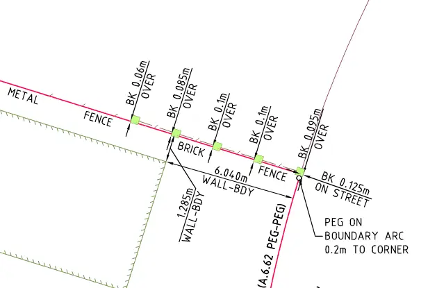
A title plan shows the dimensions, angles and boundaries of a parcel of land. It may also show easements, restrictions and other interests that affect how the land can be used. On the ground, those boundaries are commonly represented by survey marks such as pegs, nails, drill holes or reference marks. However, marks can be disturbed by excavation, roadworks, landscaping, tree roots and previous construction.
A fence is useful evidence, but it is not proof of the legal boundary. It may have been built inside the property to avoid a tree or slope, positioned by agreement between earlier neighbours, or simply set out incorrectly. The same applies to retaining walls, sheds and garden edges.
A registered land surveyor researches the relevant NSW land records, examines surrounding survey information, searches for original and later survey marks, and measures the site using professional survey equipment. This evidence is assessed to determine the boundary position and, where appropriate, reinstate or mark it on site. It is a technical process, not an estimate based on online mapping or a tape measure from the kerb.
When should you confirm property boundaries?
The right time depends on the project, the condition of the site and the consequences of getting it wrong. For straightforward works well away from every boundary, an initial discussion and a current detail survey may be enough to identify what is needed. When work is close to a side, rear or frontage boundary, a cadastral boundary survey or mark-out is often the prudent first step.
Before building near a boundary
Garages, carports, additions, pools, retaining walls and decks are commonly designed close to setbacks. If the assumed boundary is wrong, the building position and compliance assessment may also be wrong. A small error can affect council approval, private certification, excavation plans and the ability to obtain clearances during construction.
A boundary survey allows the architect, building designer or engineer to work from reliable information before drawings are finalised. Once the design is settled, a construction set-out survey can then place the approved work in the intended position. These are related services, but they solve different problems: one establishes the land boundary, while the other transfers the design onto the site.
Before replacing a fence or resolving a neighbour question
Fence replacement often starts with a reasonable assumption that the existing line is correct. That may be true, but it should not be treated as certain where there is a disagreement, a noticeable offset between fences, or plans to build a more permanent wall or retaining structure.
Having a registered surveyor mark the relevant boundary can remove uncertainty from the conversation. It gives both owners an independent, measured reference point rather than asking either party to rely on memory, informal measurements or a previous owner’s advice. A survey does not replace sensible neighbour communication, but it gives that communication a factual starting point.
Before buying, selling or applying for a building certificate
An identification survey is often requested as part of a property transaction, for a council building certificate, or when improvements need to be assessed against title boundaries. It identifies the land and reports on the relationship between visible improvements and the surveyed boundaries, including matters such as encroachments where relevant.
This is particularly valuable when there are older structures, boundary-adjacent sheds, additions, seawalls or fences. A buyer may discover a potential issue before settlement, while an owner can address a concern before it disrupts a sale. The scope required should be confirmed early, as a report prepared for one purpose may not meet the requirements of another.
Before subdivision, easements or title work
Subdivision and easement projects require much more than a rough indication of corners. New lots, rights of carriageway, drainage easements and access arrangements must be accurately surveyed, documented and prepared for registration. The existing boundaries are the foundation for every new line created on the plan.
For these matters, a registered surveyor coordinates the cadastral work with planners, engineers, solicitors, council requirements and NSW Land Registry Services processes. Establishing the parent parcel accurately at the beginning helps avoid avoidable redesign or registration delays later.
What happens during a boundary survey
The first step is a records search. The surveyor reviews the current title information, deposited plans and relevant historical surveys to understand how the parcel was originally defined and what evidence may remain in the area. On older estates or rural land, this research can be as important as the fieldwork.
On site, the survey team searches for survey marks both within and beyond the property. They measure those marks, site features and occupation lines using calibrated equipment, then compare the field evidence with the legal survey information. Modern Trimble technology improves measurement efficiency, but the outcome still depends on professional judgement and cadastral expertise.
After assessment, the surveyor can explain where the boundaries lie and whether marks have been found, reinstated or placed. The deliverables vary with the brief. You may need a boundary mark-out for fencing or design, an identification survey report for a building certificate, or a formal plan for subdivision or easement registration.
Access makes a practical difference. Survey work is more efficient when vegetation is trimmed around likely corners, dogs are secured, gates can be opened and the survey team can access adjoining areas where necessary. If a neighbour’s access is needed, it is best to discuss it in advance rather than on the morning of the survey.
Why assumptions create costly problems
The immediate cost of a survey can seem avoidable when an old fence appears straight and established. The cost of acting on the wrong assumption is usually far greater. It can include redesigning approved works, moving footings, rebuilding a fence, dealing with an encroachment, delaying settlement or managing a neighbour dispute after construction has begun.
There is also a timing issue. A survey arranged before design or site works can be incorporated into the programme. A survey arranged after excavation, concrete or fencing has started may require changes under pressure, when builders, suppliers and approvals are already committed.
Not every property needs every type of survey. A homeowner planning a fence may only require a boundary mark-out, while a developer creating new lots will need a broader cadastral and title registration service. The key is matching the scope to the decision being made, rather than paying for information that does not answer the project question or proceeding without information that does.
Choosing the right surveyor for the job
Boundary work should be undertaken by a registered land surveyor with experience in NSW cadastral surveying. Registration, local knowledge and a clear scope matter because boundary evidence can be complex, particularly on older Central Coast sites where marks may be missing or occupation does not match the title line.
Provide the surveyor with your address, title documents if available, photos of existing marks or fences, proposed plans and a clear description of why you need the survey. This helps them recommend the right service and allows your architect, builder or planner to receive information in a useful format.
Central Coast Surveyors can assess whether a boundary mark-out, identification survey, detail survey or more comprehensive cadastral work is appropriate before the project moves into design, approvals or construction.
If a boundary will influence where you build, fence, buy or divide land, treat it as a project decision rather than a line on an old plan. Clear evidence at the start gives everyone involved a better place to stand.