
Survey Control for Civil Works Done Properly
A road can be built to the wrong level with excellent machinery, experienced operators and a sound design if the control behind it is wrong. Survey control for civil works is the reference framework that tells every person on site where work belongs horizontally and vertically. Get it right early and set-out, earthworks, drainage and final verification can proceed with confidence. Get it wrong and errors can carry through the project before anyone notices.
For civil contractors, developers, engineers and project managers, control is not a background task to be rushed through before construction starts. It is the practical basis for building to approved drawings, managing quantities and demonstrating that completed works meet the required tolerances.
What survey control means on a civil site
Survey control is a network of accurately established reference points with known coordinates and levels. Surveyors use these marks to position design elements on the ground and to check completed construction. Depending on the project, the network may include permanent survey marks, temporary control marks, benchmarks, offset pegs and stable reference points outside the construction area.
Horizontal control establishes position. It governs where a road alignment, kerb, pit, retaining wall, boundary interface or services corridor sits across the site. Vertical control establishes level. It is used for excavation depths, pavement layers, drainage grades, finished floor levels, kerb profiles and earthworks batters.
The design data must also be understood correctly. A drawing may refer to a project-specific grid, Map Grid of Australia coordinates, Australian Height Datum levels, or an assumed local datum. These are not interchangeable. A small misunderstanding between coordinate systems or level datums can create a site-wide error, particularly where new works must connect to existing roads, drainage or services.
Why survey control for civil works prevents expensive rework
Civil work is cumulative. If the first pavement layer is placed too high, the next layers, kerb and driveway tie-ins are all affected. If a stormwater line begins at an incorrect level, achieving the required grade at the downstream connection may become impossible without redesign or additional excavation.
Control provides a common reference for the surveyor, site supervisor, machine operator, engineer and subcontractors. It reduces reliance on informal marks, assumptions and measurements taken from a feature that may itself be inaccurate. It also allows work to be checked at meaningful hold points rather than waiting until practical completion.
The cost of establishing reliable control is modest compared with moving pavement, re-laying drainage, modifying concrete work or resolving a dispute about whether construction follows the approved design. It also protects program certainty. A quick check before a major pour or bulk excavation is far easier to arrange than a correction once crews and plant have moved on.
Control is different from construction set-out
The terms are often used together, but they are not the same service. Control creates the dependable reference framework. Construction set-out uses that framework to mark the location and level of specific works, such as road centreline points, kerb returns, pit positions, building grids or batter toes.
A project can have accurate set-out calculations and still suffer errors if the control marks have been disturbed, incorrectly adopted or not adequately verified. Conversely, good control alone does not replace detailed set-out. Both are required, and the right level of checking depends on the project’s risk, complexity and tolerances.
How a reliable control network is established
A surveyor starts by reviewing the available information: approved civil drawings, design surfaces, coordinate schedules, existing survey marks, title boundaries, services information and the proposed construction sequence. The aim is to understand what the site must connect to and which reference system the design uses.
Existing marks may be adopted where they are suitable, current and capable of being verified. On some sites, particularly those with extensive clearing or earthworks, new control must be established in locations unlikely to be disturbed. Marks should be accessible enough for efficient site use but protected from plant movements, stockpiles and changing access arrangements.
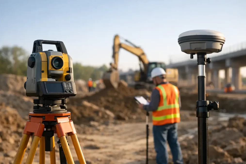
Modern Trimble GNSS equipment, robotic total stations and digital levels can establish and check control efficiently. However, technology does not remove the need for professional judgement. Satellite observations may be limited by tree cover, steep terrain, buildings or poor sky visibility. A total station traverse may be more appropriate for tightly constrained sites, while precise levelling can be necessary where drainage grades or floor levels are critical.
Redundancy matters. A single benchmark or lone control point provides little protection if it is damaged or wrong. Good practice is to establish sufficient independent checks so a discrepancy can be identified before it affects construction. The appropriate method depends on the scope, contract requirements and consequences of error.
Managing control through changing site conditions
A civil site does not stand still. Bulk earthworks remove surfaces, access tracks change, contractors install services, and temporary marks disappear under fill or pavement. Survey control therefore needs active management, not a one-off field visit.
Before work starts, the contractor should know which control marks are protected, who may use them and what must happen if a mark is damaged. Marks should not be moved simply to make room for equipment. If relocation is necessary, it should be completed and verified by the survey team before the original reference is removed.
Regular checks become particularly valuable after major earthworks, heavy rain, excavation near marks or any event that could affect stability. On waterfront, steep or heavily vegetated Central Coast sites, access and ground conditions can add another layer of complexity. A stable mark on a plan may not remain practical or secure once construction activity begins.
Clear site records also make a difference. Control reports, mark sketches, coordinates, levels and datum information should be issued in a format the construction team can use. The drawings should distinguish between design information and marks physically available on site. When there is uncertainty, the safest approach is to stop and verify rather than build from an assumed point.
Typical civil activities that rely on accurate control
The need for control extends well beyond initial earthworks. It supports setting out subdivision roads, drainage pits and pipe alignments; checking trench invert levels; positioning retaining structures; forming kerb and gutter; and verifying pavement layers against the design surface.
It is equally important at project interfaces. New works often need to tie into an existing road, driveway, stormwater system or neighbouring development. These locations can have little tolerance for error because levels and grades must work together. An accurate survey of the existing condition, tied to the correct datum, is essential before final set-out decisions are made.
As-built surveys rely on the same framework. They provide evidence of what was constructed and help engineers, councils, asset owners and future designers assess whether works meet approved requirements. If the original control is weak, final survey information can be difficult to rely on or reconcile with design data.
Where a registered surveyor adds value
Not every control task requires cadastral work, but property boundaries, easements, road reserves and subdivision interfaces frequently sit close to civil construction. In these situations, it is essential to distinguish construction control from legal boundary definition.
Only a registered land surveyor can determine and mark cadastral boundaries for NSW purposes. Where civil works approach a boundary, easement or title constraint, early coordination can prevent the common mistake of treating an old fence, kerb or assumed offset as a legal line.
Central Coast Surveyors can coordinate detail and contour surveys, boundary information, civil set-out and final survey requirements so the project team works from consistent information. That coordination is particularly useful when architects, civil engineers, planners and builders are all working to a tight approval or construction program.
Questions to settle before set-out begins
Before issuing a crew to site, project managers should confirm the design datum, required coordinate system, nominated benchmark, applicable tolerances and who is responsible for protecting control marks. They should also identify whether the work has boundary, easement or council interface issues that require registered surveyor input.
It is worth confirming the format and timing of deliverables as well. A contractor may need a simple site control sketch for daily use, while the engineer may require a verification report, machine-control model checks or detailed as-built data. Agreeing on these requirements at the start avoids duplicated visits and gaps in documentation later.
Reliable civil construction starts with a reference system everyone can trust. Establish the control before the first cut, protect it as the site changes, and verify it at the moments when a small error would become a costly one.