
Can Surveyors Locate Utilities on Your Property?
A new driveway, pool excavation or retaining wall can become an expensive problem the moment a machine strikes an unseen pipe or cable. So, can surveyors locate utilities? A land surveyor can identify, measure and document many visible service features and known utility information, but they are not usually the specialist responsible for physically proving the precise position and depth of underground services.
That distinction matters before any excavation starts. A reliable project plan combines survey information, utility records, on-site investigation and, where required, a specialist utility locator. Each has a different purpose, and none should be treated as a substitute for safe digging procedures.
Can surveyors locate utilities accurately?
Surveyors can locate and map visible evidence of utilities across a site. This may include sewer inspection openings, electrical pillars, telecommunications pits, water meters, hydrants, overhead power poles, stormwater grates and service connection points. These features can be picked up during a detail and contour survey and shown in relation to boundaries, buildings, levels and proposed works.
This information is highly useful for architects, engineers and builders. It helps them position a new dwelling, driveway, drainage system, pool or addition with a clearer understanding of the site constraints. It can also flag practical issues early, such as a sewer line near a proposed extension or a power pole affecting access.
However, a visible pit or meter does not prove the route, depth, material or condition of the service running underground. Services may deviate from a direct line, have been altered over time, or be installed without current records reflecting the final position. On older Central Coast properties in particular, assumptions based on surface features can create unnecessary risk.
A registered surveyor may incorporate information supplied by a utility authority or specialist locator into a survey drawing where appropriate. The source and limitations of that information should be clearly understood by everyone relying on the plan.
What a land survey can tell you
A properly scoped detail and contour survey gives a project team an accurate spatial base for design. It records the physical features that can be observed and measured on the day, along with contours or spot levels that show how the land falls.
For utility planning, a survey can show where known above-ground infrastructure sits relative to the title boundary and existing improvements. That may include the location of a sewer manhole, an overhead electricity line crossing a site, a drainage inlet at the kerb, or a telecommunications pit near a proposed crossover.
It can also identify easements shown on the title. An easement may provide rights for a sewer, drainage line, electricity infrastructure or access. It is a legal interest in land, not proof that a particular service is located exactly along its centreline. Nevertheless, it is an essential design constraint. Building over or obstructing an easement can trigger approval issues, access requirements and costly redesign.
For a development, subdivision or construction project, survey data allows the architect and engineer to coordinate proposed works with real site conditions rather than working from an aerial image or an old plan. That early coordination is often where delays and avoidable variations are prevented.
When you need a specialist utility locator
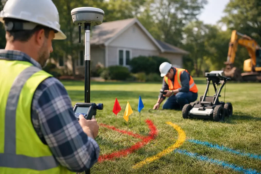
If excavation is proposed near suspected underground assets, engage a suitably qualified utility locating provider before work begins. They use methods such as electromagnetic detection, signal tracing, ground penetrating radar and, where necessary, non-destructive digging to investigate service locations.
The right method depends on the asset and site conditions. Metallic services may respond well to electromagnetic tracing, while non-metallic pipes can be more difficult to detect. Ground penetrating radar can assist in some circumstances, but soil type, moisture, reinforcement, rock and site congestion can limit results. A locator should explain what has been detected, what remains uncertain and whether potholing or vacuum excavation is needed to expose and verify a service safely.
Specialist locating is particularly worthwhile where work involves deep excavation, piers, retaining walls, drainage trenches, bored holes, demolition, road crossings or machinery access. It is also sensible where the consequence of a strike would be serious, such as near gas, high-voltage electrical infrastructure, major water mains or telecommunications networks serving neighbouring properties.
Before excavation, obtain current utility plans through the relevant before-you-dig enquiry process. These plans are an important first step, but they are generally indicative only. They should be read alongside site observations and specialist locating, not relied upon as the sole authority for digging locations.
Why utility records and survey plans can differ
Clients are often surprised when a service plan does not match what is found on site. There are several reasonable explanations. Utility plans may show approximate alignments, older services can be abandoned in place, and private lines installed after subdivision may not appear on public asset records.
A service can also cross a property in a location that is not obvious from the street. Stormwater from an upstream property, for example, may pass through a private drainage arrangement. Sewer connections can include bends and junctions that cannot be inferred from the position of an inspection opening. A building renovation may have changed private plumbing without updating every available record.
This is why surveyors, designers, locators and builders need to share the same current information. A survey drawing is not just a plan for council or design purposes. Used properly, it becomes a coordination document that lets each consultant identify conflicts before they become site problems.
A practical process before you dig
For a small residential project, the process may be straightforward: obtain utility information, arrange a detail survey if one is needed for design, have critical services located, then confirm the work area with the builder before excavation. Larger developments require more formal coordination between the surveyor, civil engineer, structural engineer, architect, utility locator and construction team.
The key is to arrange investigations early enough for the findings to influence the design. Discovering a sewer conflict after plans are approved can mean relocating footings, changing drainage falls, revising a driveway, seeking authority consent or redesigning part of a building. Those outcomes cost more once consultants and trades are already committed.
Before engaging a surveyor or locator, provide as much project detail as possible. Let them know whether you are planning a new home, extension, pool, granny flat, retaining wall, subdivision, drainage works or commercial construction. Identify the proposed excavation areas and expected depths if known. This allows the right scope of work to be quoted rather than paying for information that does not answer the construction question.
Surveying support through design and construction
A registered land surveyor has a distinct role in keeping a project accurately positioned. They can establish boundaries, prepare a detail and contour survey for design, identify title interests such as easements, set out approved building locations and confirm completed works for plans or certification requirements.
During construction, set-out work ensures the builder has reliable marks for building corners, grids, levels and other design points. It does not replace service locating, but it helps prevent another common problem: a correctly located service being affected because the structure, excavation or drainage run was positioned incorrectly on site.
For waterfront, sloping, constrained or heavily developed sites, coordination is especially valuable. The more existing infrastructure a project needs to work around, the less room there is for assumptions. Central Coast Surveyors can help clients understand which survey information is needed at each stage and coordinate survey data with the wider project team.
Frequently asked questions
Can a surveyor tell me where my sewer line runs?
A surveyor can locate visible sewer features and show registered easements or available information on a survey plan. To confirm the actual underground route, depth and condition of a sewer line, arrange utility locating, CCTV investigation or advice from the relevant water authority or licensed plumber, depending on the situation.
Does an easement show the exact location of a utility?
Not always. An easement defines a legal area where certain rights apply. The service may be within that area, but its exact alignment should not be assumed without further investigation. Design should also allow for access and authority requirements affecting the easement.
Do I need services located for a fence or landscaping?
It depends on the work. Hand-dug shallow planting may carry less risk than post holes, retaining wall footings or excavation with machinery. If digging could reach underground assets, obtain current utility information and assess whether specialist locating is appropriate before work starts.
The safest time to resolve a utility question is while the design can still move on paper. Accurate survey information, realistic service investigations and clear communication between consultants give your project a far better chance of starting without an avoidable surprise below ground.