What Survey Is Needed Before Building?
If you get this part wrong, the cost shows up later – in redesigns, approval delays, boundary disputes or a slab in the wrong place. When clients ask what survey is needed before building, the short answer is that it depends on the site, the approval pathway and what stage the project is at. The more useful answer is that most projects need more than one survey across the life of the job, and the first one is usually the most important.
Before a builder prices the works or an architect finalises plans, the design team needs reliable site data. That is what stops guesswork creeping into levels, setbacks, drainage, retaining walls and service connections. On the Central Coast, where sloping blocks, waterfront land, older subdivisions and complex title issues are common, the right survey early can save a great deal of time and money.
What survey is needed before building on most sites?
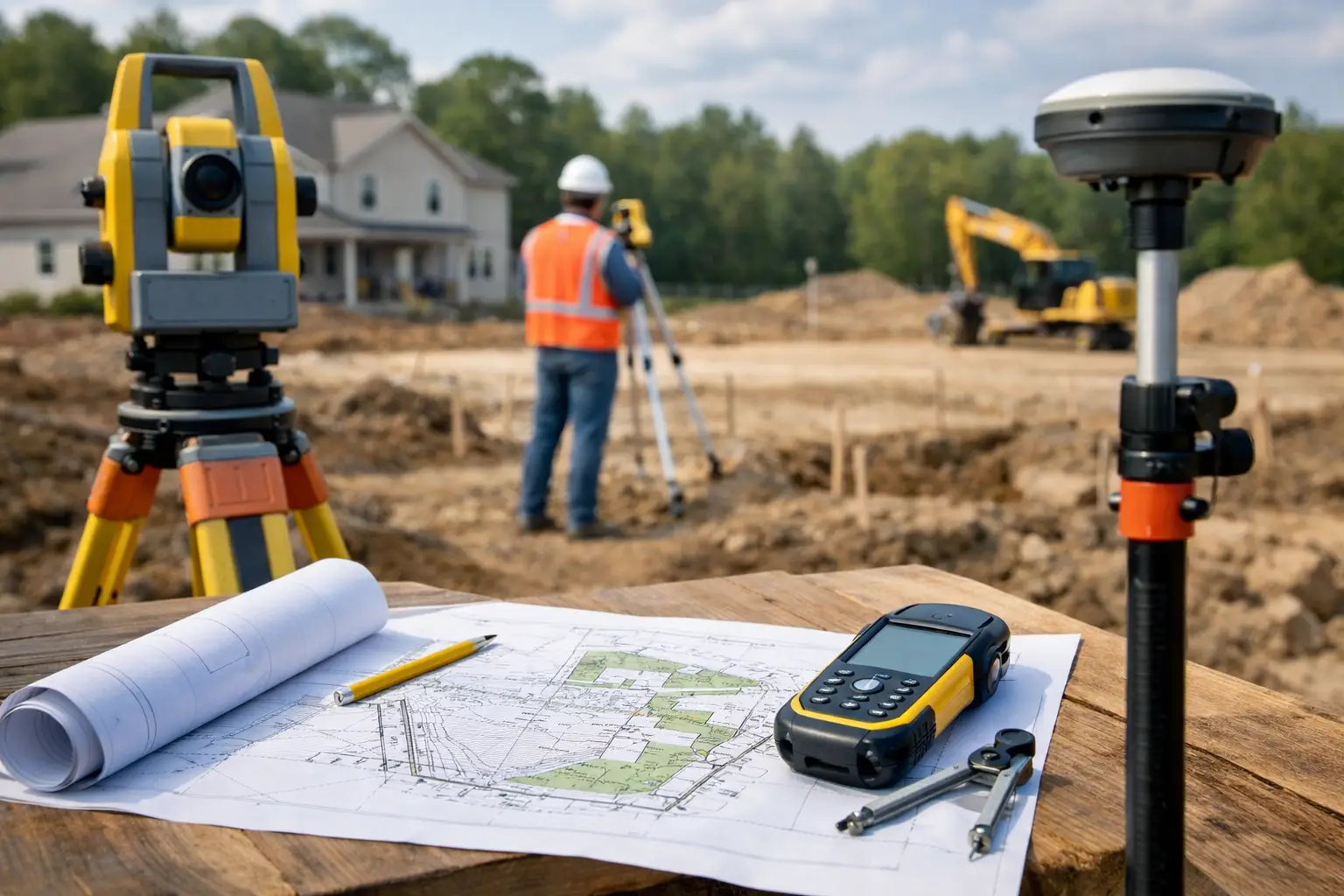
For most new homes, extensions, duplexes and small developments, the starting point is a detail and contour survey, also called a topographical survey. This survey captures the physical features of the land so the design team can work from accurate information rather than assumptions or old plans.
A proper detail and contour survey generally shows ground levels, contours, existing buildings, fences, driveways, trees, retaining walls, visible services, stormwater pits, kerbs, footpaths, adjoining features and other site constraints. It can also pick up building floor levels and spot heights that matter for drainage design, access compliance and finished floor level decisions.
This is usually the survey your architect, designer, planner or engineer needs first. If the block slopes, has drainage challenges, adjoins a waterway or has tight planning controls, that need becomes even more pressing. Designing without current survey data often leads to amended drawings and wasted consultant time.
When a boundary survey is also needed before building
A topographical survey is not always enough on its own. If the location of the legal boundary matters – and in many projects it does – you may also need a cadastral boundary survey or boundary mark-out by a registered surveyor.
This becomes important when you are building close to a side or rear boundary, replacing an old fence, planning a secondary dwelling on a narrow lot, building near an easement, or working on land where pegs are missing or unreliable. It is also common on older sites where occupation lines do not match the title boundary.
A boundary survey is different from simply measuring to an existing fence. Fences are often not built on the title line, and old marks can be disturbed over time. A registered surveyor examines title data, deposited plans and field evidence to determine the legal position of the boundary. That is the level of certainty needed when compliance and setbacks are on the line.
For owners, this can avoid expensive mistakes. For builders and designers, it reduces the risk of setting out from the wrong reference point. For developers, it helps avoid disputes that can stall a project just as approvals or construction are due to start.
The most common surveys before and during construction
The question of what survey is needed before building often mixes together several stages of work. In practice, different surveys are used for different decisions.
A detail and contour survey is typically used first for design and planning. A boundary survey or boundary identification may be needed where setbacks, title limits or fencing are critical. Once approvals are in place and construction is ready to begin, a building set-out survey is usually required so the approved structure is positioned correctly on the site.
That set-out stage is not just a formality. It transfers the approved design onto the ground with precision so the building sits in the correct location and at the correct level. If this step is rushed or done from poor reference information, the consequences can be serious – particularly where clearances to boundaries, easements or neighbouring structures are tight.
Later in the project, there may also be a need for floor level reports, as-built surveys, identification surveys or final subdivision work, depending on the type of development. That is why the best approach is to look at the entire surveying pathway early, not just the first drawing package.
Which survey is needed before building a house, extension or granny flat?
For a standard house build, the first requirement is usually a detail and contour survey. If the home is close to boundaries, on a constrained block or part of an older subdivision, a boundary survey may also be needed before final design is locked in.
For an extension, boundary certainty can matter even more, especially if the new works push toward a setback line or connect to an existing structure that was built decades ago. It is not uncommon to find that old improvements sit differently from what owners expect.
For granny flats and secondary dwellings, accurate levels and boundary information are both important because these projects are often squeezed into the remaining space on an already developed lot. Driveway access, drainage falls, existing sewer lines and separation distances all need to be understood upfront.
If the block is waterfront, bushfire-prone, irregular in shape or affected by easements, the design team may need extra survey detail to support planning and engineering decisions. That is where local experience matters. A surveyor familiar with council expectations and common site conditions can help identify likely issues before they turn into formal delays.
What developers and consultants usually need
For developers, architects, engineers and planners, the answer to what survey is needed before building is rarely one-size-fits-all. A duplex, townhouse project, industrial shed or mixed-use site may require a broader survey scope from the outset.
At feasibility stage, detail and contour information helps test yield, access, parking, drainage and retaining costs. If title constraints are present, boundary re-establishment or easement investigation may be needed early as well. On some sites, neighbouring building locations, invert levels, road levels and service infrastructure can materially affect the layout and cost plan.
This is where a responsive surveyor becomes part of the wider project team, not just a data provider. Good survey information allows architects to design confidently, planners to prepare cleaner applications and engineers to resolve levels before they become site problems. It also reduces rework across the consultant group.
Why relying on old plans can be risky
One of the most common causes of avoidable delay is using outdated or incomplete site information. A sales plan, sewer diagram or old DA drawing might be useful background, but none of them replace a current survey for design and construction.
Levels change. Fences move. Trees are removed. Services are added. Neighbouring development can alter site conditions in ways that affect privacy, drainage or access. Even where old information looks close enough, close enough is rarely good enough once a project reaches approval or construction.
Registered surveyors work from measured evidence, title research and professional standards. That level of accuracy is what gives the rest of the project team confidence to proceed. It is also what protects the owner when decisions have legal or financial consequences.
How to know what you need before you start
The easiest way to work out what survey is needed before building is to start with the purpose of the project, not just the property address. Ask what decisions need to be made first. Is the immediate need concept design, council approval, boundary clarification or construction set-out? The answer will shape the scope.
If you are an owner-builder or homeowner, you do not need to know every technical term before making contact. What helps is being clear about what you are planning to build, whether you already have drawings, and whether there are any known issues with boundaries, levels, drainage or access.
If you are an architect, planner or builder, it is worth flagging early whether you need adjoining floor levels, invert levels, boundary marks, easement positions or other specific deliverables. That makes the survey more useful from day one and avoids a second site visit.
At Central Coast Surveyors, that early scoping discussion is often where the biggest time savings happen. A well-briefed survey allows the project to move from design to approvals to construction with fewer surprises and less backtracking.
The right survey before building is not just about ticking a box for the next consultant. It is about making sure the project starts on solid ground, with accurate information that supports every decision that follows. If you are unsure which survey applies to your site, getting clear advice early is usually the cheapest part of the whole build.