
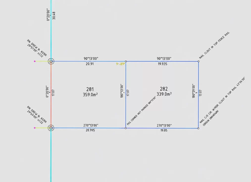
Survey Plan Digitisation in LandXML Format
Key Details of the LandXML Mandate
Mandate 2 (Started 1 July 2026): Deposited plans (including compiled plans) must include a Stage 1 LandXML file alongside the PDF plan. This initial stage requires a limited dataset including new lots, roads, survey connections, and control marks.
Built-in validation tools in LRS Connect allow surveyors to check LandXML files for errors prior to final plan lodgment to minimize requisitions.
A scanned survey plan can be perfectly readable and still be difficult to use for survey. Survey plan digitisation in LandXML format addresses that gap by converting suitable survey information into structured data that can be used across modern software.
For Central Coast projects, the value is often speed with control. Rather than redrawing old information from a PDF, the project team can work from a file that has been carefully interpreted, checked and documented.
What survey plan digitisation in LandXML format does
LandXML can carry coordinates, points, parcels, alignments, and other geometric information between survey software and CAD platforms. Its practical benefit is that data is less likely to be locked inside a single drawing or software package.
When a historical survey plan, deposited plan, engineering sketch or hard-copy detail survey needs to inform a new project, digitisation converts selected plan features into digital geometry. Depending on the source material and project brief, this may include boundary dimensions, easements, building outlines, survey marks, contours, spot levels, roads, kerbs, services or proposed works.
The first question: is the original plan fit for purpose?
Not every plan should be digitised for every purpose. A quality outcome begins with understanding what the original document represents, when it was prepared and how accurate it is likely to be.
For this reason, the most reliable workflow starts with the strongest available source information. That can include original coordinate files, field observations, a CAD drawing, survey control records, and relevant registered plan information.
Interpret the plan rather than trace it blindly
Survey plans contain conventions that need professional interpretation. A dimension may be a title dimension or a measured field distance. Symbols, notes, plan dates and survey mark references all affect how information should be treated.
The digitisation should preserve meaningful distinctions through layers, point codes, feature descriptions or LandXML object types. A boundary should not be delivered as generic linework if the recipient needs to distinguish it from an easement.
Check geometry, attributes and deliverables
Before issue, the data should be checked against the source plan and the agreed scope. This includes testing closure and parcel geometry where relevant, confirming units, checking linework connections and ensuring the file opens correctly in the intended software environment.
A clear transmittal should identify the source material used, the coordinate basis, the date of the source survey, what has been digitised and any known limitations. These notes are not administrative extras. They help downstream consultants use the information safely and avoid treating historic data as current survey evidence.
When LandXML is the right file format
For title and registration work in NSW, digital exchange formats do not remove the need for compliant survey documentation and registered surveyor involvement. LandXML supports the project workflow. It does not itself create legal title boundaries, register an easement or satisfy every lodgement requirement.
A better starting point for design and approvals
For property owners, developers and consultants, the best request is a specific one: explain the project stage, provide every available source plan and identify which outgoing files will be required. That allows the surveyor to recommend whether digitisation is appropriate.
Central Coast Surveyors can assess existing survey information alongside the requirements of a proposed development, construction or subdivision project. Where digitisation is appropriate. Good digital survey data does not remove professional judgement.