Boundary Survey for Retaining Wall Work

Retaining wall projects often look simple at first – until the wall sits hard against a side boundary, changes drainage, or triggers a disagreement with the neighbour halfway through construction. That is where a boundary survey for retaining wall work becomes more than a box to tick. It gives you reliable, survey-based evidence of where the legal boundary sits before design, approvals and construction start moving.

For homeowners, that can mean avoiding an expensive mistake. For builders, engineers and designers, it means working from accurate cadastral information rather than assumptions, old fencing or rough measurements taken from online mapping. When a retaining wall is close to a boundary, even a small error can affect footing location, wall alignment, access, easements and responsibility for ongoing maintenance.

Why retaining walls create boundary issues so often

A retaining wall changes levels, carries load and can alter the way water moves across a site. Unlike a simple garden edge, it usually has structural implications and often sits in the part of the block where space is tight. On many Central Coast sites, especially sloping land, there is not much room to move the wall if the original set-out is wrong.

The biggest problem is that people frequently rely on visible occupation lines. Existing fences, old walls and landscaped edges are not always on the legal boundary. Some are offset. Some were built from guesswork years ago. Some pre-date current plans or were placed to suit terrain rather than title dimensions. If a retaining wall is then designed off that physical line instead of the surveyed title boundary, the project can drift into encroachment territory very quickly.

That risk increases where the retaining wall also supports fill for a driveway, pool area, extension or new dwelling platform. In those cases, a boundary mistake is not just a fencing issue. It can affect engineering design, compliance, neighbour relations and future property transactions.

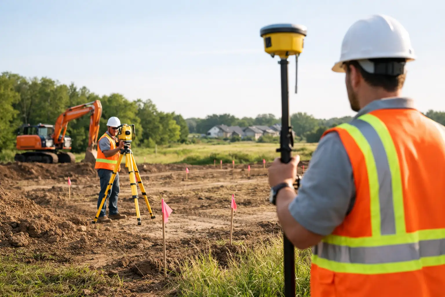
What a boundary survey for retaining wall projects actually does

A boundary survey for retaining wall projects is used to identify and mark the legal title boundary on the ground. A registered surveyor reviews the deposited plan, title information and survey evidence, then undertakes field work to locate existing boundary marks and determine the correct boundary position.

This is different from estimating where the boundary should be. A proper cadastral boundary survey involves legal and technical responsibility. In New South Wales, boundary definition is regulated work and should be carried out by a registered land surveyor.

Once the boundary is established, the survey data can be used by the rest of the project team. The designer can position the wall with confidence. The engineer can design based on actual setbacks and site constraints. The builder can set out the work accurately. If council approval or certification is required, the project has a much stronger compliance foundation from the outset.

When you should arrange the survey

The best time is early – before final design and well before excavation starts. If the wall is proposed anywhere near a side or rear boundary, waiting until construction is underway usually creates unnecessary cost and pressure.

In practical terms, a survey is worth arranging when the retaining wall sits close to a title line, replaces an older wall of uncertain position, supports a building platform, or forms part of broader site works tied to approval conditions. It is also sensible where neighbour concerns already exist, because independent survey evidence helps keep discussions factual.

There are also cases where the wall itself may be entirely on one property, but excavation, footing width, drainage lines or construction access affect the adjoining land. A boundary survey helps identify those risks early, when the design can still be adjusted without major rework.

Why fences and online maps are not enough

This is one of the most common issues on residential jobs. A client assumes the fence marks the boundary, the designer draws the wall along the fence line, and the builder prices the works on that basis. Then the survey shows the fence is out by 150 millimetres, 300 millimetres or more. On a narrow site, that is enough to change the whole design.

Online mapping and satellite imagery are even less reliable for construction decisions. They are useful for broad context, but not for legal boundary definition or accurate set-out. Image position, scale and overlay accuracy can all vary. They should never be used as the basis for placing a retaining wall near a title boundary.

Survey control, title interpretation and physical boundary evidence are what count. That is what a registered surveyor brings to the project.

How the survey supports design, approvals and construction

A retaining wall rarely sits in isolation. It often connects to drainage design, stormwater disposal, cut and fill calculations, driveway grades, landscape works and neighbour interface. Accurate boundary information helps every consultant work from the same base data.

For architects, planners and engineers, this reduces redesign risk. If the boundary is wrong at concept stage, errors can flow through the entire documentation set. For builders and project managers, it improves sequencing and lowers the chance of disputes once machinery is on site. For property owners, it gives clarity before committing to construction costs.

In some projects, the boundary survey is paired with a detail and contour survey. That combination is especially useful on sloping sites, because it allows the retaining wall to be designed with both the legal boundary and the actual site levels in mind. You get a clearer picture of where the wall can go, how high it needs to be and what constraints need to be managed.

Boundary survey for retaining wall approval issues

Whether council approval is required depends on the wall height, location, associated works and local planning controls. Some retaining walls may fall within exempt development parameters, while others need approval or supporting documentation. The exact pathway depends on the project.

What does not really change is the value of accurate survey information. If the wall is near a boundary, survey data helps show the true relationship between the proposed structure and the title line. That can be critical where setbacks, drainage, structural certification or neighbour impacts are under review.

It also helps avoid the awkward situation where approval drawings show a compliant wall position, but the built outcome shifts because the actual boundary was never properly marked. Fixing that after the fact is far harder than getting it right up front.

What happens if you skip it

Sometimes nothing dramatic happens. The wall is built, no one asks questions, and the project moves on. But that is not a reliable risk strategy – especially when land levels, structures and property rights are involved.

When things do go wrong, the consequences can be expensive. The wall may encroach across the boundary. Footings may extend into the adjoining lot. Drainage may discharge in the wrong direction. A neighbour may object once they realise the wall affects their land or future fencing. In more serious cases, you may be looking at redesign, demolition, legal advice or delayed certification.

Even if the wall remains inside the lot, a poor understanding of the boundary can still lead to over-engineering or under-utilisation of available space. Both outcomes cost money. Survey accuracy gives the design team room to make informed decisions rather than conservative guesses.

Choosing the right survey input for your project

Not every retaining wall needs the same level of survey work. A simple low wall well inside the property may only need limited input. A structural wall near a boundary on a sloping site usually calls for a more complete approach, often combining boundary definition with topographical information and later construction set-out.

That is why early advice matters. A surveyor can assess the title, site conditions and intended works, then recommend the survey scope that fits the job. This avoids paying for unnecessary work, but it also helps prevent the far more expensive mistake of under-scoping the survey at the start.

For clients across the Central Coast, local knowledge also counts. Terrain, older subdivisions, missing marks and site access can all affect the way a boundary survey is carried out and how quickly useful results can be delivered. Central Coast Surveyors works with homeowners and project teams to provide clear boundary information that can be used straight away by designers, engineers and builders.

The practical value is certainty

A retaining wall near a boundary is not the place for assumptions. The cost of a survey is small compared with the cost of getting the wall position wrong, delaying approvals or arguing over encroachment after construction.

The real value of a boundary survey for retaining wall work is certainty. It gives everyone involved – owner, designer, engineer, builder and neighbour – a clear starting point based on measured evidence, not guesswork. If your wall is close to a boundary, that clarity is usually the difference between a straightforward project and a problem that grows legs. Get the boundary right first, and the rest of the job tends to move far more cleanly.

What a Strata Subdivision Survey Involves

What a Strata Subdivision Survey Involves

If you’re converting a duplex, townhouse development or mixed-use building into separate titles, the strata subdivision survey is one of the steps that turns a completed build into saleable or transferrable lots. It is not just a box to tick at the end. It is the survey work that confirms how the building is divided, how common property is identified and what plan can be lodged for registration in NSW.

For owners and developers, that matters because timing at this stage affects settlements, finance, occupancy planning and final project costs. For architects, planners and builders, it matters because any mismatch between the approved design, constructed outcome and survey plan can create avoidable delays.

What is a strata subdivision survey?

A strata subdivision survey is the process of measuring and preparing the survey information needed to create strata lots and common property within a building or development. In practical terms, it establishes the legal boundaries of each lot, usually by reference to walls, floors and ceilings, and shows the areas that will remain shared.

In NSW, strata subdivision is commonly used for duplexes, villa developments, apartment buildings and some commercial projects. Instead of creating new land parcels in the same way as a Torrens title subdivision, a strata scheme divides ownership within a built form. That distinction is important because the survey has to reflect the building as constructed, not just the original design intent.

That is why strata work usually happens near the end of construction, once the building is sufficiently complete to measure accurately. If there have been on-site changes during the build, those need to be picked up properly so the final plan matches reality.

Why the survey stage matters more than many clients expect

A strata plan is a legal document. Once registered, it affects ownership boundaries, common property responsibilities, access arrangements and future property transactions. If the underlying survey is wrong, the consequences can stay with the development long after handover.

At a project level, the survey stage often sits right at the point where everyone wants speed. Builders want practical completion finalised, developers want titles issued, and buyers want certainty. That pressure can tempt teams to treat the strata survey as an administrative follow-up. In reality, this is one of the points where precision matters most.

Even small issues can slow things down. A layout that differs from the approved plans, unresolved questions around exclusive use areas, or incomplete common property definition can all create extra review time. Getting the survey organised early helps reduce that risk.

What a strata subdivision survey typically includes

The exact scope depends on the type of development, but the core task is to identify the lots and common property in a form that can be legally registered. That usually involves measuring the completed building, checking the title and cadastral framework, and preparing the strata subdivision plan and related survey documentation.

In many projects, the surveyor is also coordinating closely with the architect, certifier, planner, solicitor or conveyancer and the owner or developer. That coordination is often what keeps the process moving. If one consultant is working from an outdated plan set, or if the final built form differs from earlier assumptions, the surveyor needs to identify that quickly.

For a simple duplex, the work may be relatively straightforward if construction aligns closely with approvals. For a larger residential or commercial development, the plan preparation can be more involved, especially where there are multiple levels, service areas, parking allocations, storage spaces or staged delivery.

Strata subdivision survey in NSW: how the process usually runs

On most projects, the process starts with a review of the existing title, approvals and final design information. The surveyor needs to understand the legal parcel, the consent conditions and the intended lot layout before field work begins.

Once the building is ready, the site is measured so the lot boundaries and common areas can be defined accurately. That information is then used to prepare the draft strata plan and any associated documentation required for lodgement.

From there, the process usually involves review and sign-off by the relevant parties before registration with NSW Land Registry Services. Depending on the project, there may also be council, certifier or authority requirements to satisfy before the plan can move to the next stage.

This is where local experience helps. Requirements are not identical across every development, and the practical pathway can vary depending on the consent, the certifier’s expectations and how well the project documentation has been managed up to that point.

Common issues that can delay registration

The most common delays are not usually caused by the surveying itself. They are caused by gaps between design, approvals and construction. If a wall has shifted, a store room has changed configuration, or common access space has been built differently to the approved plan, those differences need to be dealt with.

Sometimes the issue is timing. A client may request the strata subdivision survey before the building is ready to measure properly. In that case, the surveyor can review the project and advise on readiness, but accurate final plan preparation may need to wait until key elements are complete.

Documentation can also be a problem. Missing approval documents, unresolved easements, unclear allocation of car spaces or late consultant changes can all add friction. None of these issues are unusual, but they are much easier to resolve when identified early rather than at the point of urgent lodgement.

Strata title or Torrens title – which one suits the project?

This is one of the most common questions from owners planning a duplex or small multi-dwelling development. The right answer depends on the design, approval pathway, services layout and long-term ownership goals.

A strata subdivision can be the practical option when dwellings share some built elements, access, services or common areas. It can also suit developments where separate ownership is needed without fully separate land parcels. A Torrens title subdivision, on the other hand, may offer simpler ownership arrangements in some cases, but it is not always achievable under the planning controls or the physical layout of the site.

This is where early surveying advice is valuable. Choosing the wrong pathway at concept stage can affect design efficiency, approval timing and sale strategy later on. It is better to test feasibility early than redesign a project after plans are already advanced.

Why registered survey input matters

Strata subdivision is not just drafting. It requires cadastral understanding, statutory compliance and confidence that the plan being prepared will stand up legally. A registered surveyor brings that level of responsibility to the process.

That matters when questions arise around title boundaries, easements, common property limits or plan interpretation. It also matters when the surveyor is working with other consultants who need clear, accurate information to finalise approvals and registration.

For clients, the benefit is not only compliance. It is also efficiency. An experienced registered surveyor can identify issues earlier, communicate clearly with the broader consultant team and keep the plan moving without unnecessary back-and-forth.

How to keep your strata project moving

The best time to think about strata is not when construction is already finished and settlements are waiting. It is earlier, when the project team can still align the approval strategy, design intent and title outcome.

If you are a homeowner developing a duplex, ask early whether strata is the likely pathway and what that means for timing. If you are a builder or developer, make sure final built changes are being tracked properly and issued to the consultants who will need them. If you are an architect or planner, early coordination with the surveyor can help avoid rework later.

On the Central Coast, where projects often move quickly from design to construction, that early coordination can save weeks at the end of the job. A dependable surveying consultant should be able to tell you what information is needed, when the site is ready to survey and what might hold up registration before it becomes a problem. That practical, end-to-end support is exactly where a local team like Central Coast Surveyors adds value.

A strata subdivision survey works best when it is treated as part of the delivery plan, not an afterthought. Get the survey side right, and the path from completed building to registered title is far more manageable.

How to Prepare Land for Subdivision Survey

How to Prepare Land for Subdivision Survey

Subdivision projects rarely get held up because of one big issue. More often, the delays come from small site problems that were avoidable from the start. If you need to prepare land for subdivision survey work, the goal is simple – give your surveyor safe access, reliable information and a site that can be measured without guesswork.

That matters whether you are splitting a backyard lot, planning a Torrens title subdivision or coordinating a larger development with architects, planners and civil consultants. Good preparation does not replace the survey itself, but it can reduce return visits, prevent missed detail and keep the approvals process moving.

What a subdivision survey actually needs

A subdivision survey is not just a quick measure-up of a block. In most cases, your surveyor needs to understand the existing site, confirm boundaries, locate improvements, identify physical constraints and gather the information required for design, council approval and plan preparation.

Depending on the project stage, that may include detail and contour survey data, cadastral boundary evidence, easements, services, fences, retaining walls, existing buildings, driveways, waterfront structures, vegetation and levels across the site. On a straightforward residential block, this can be relatively efficient. On sloping land, rural land or built-up sites with older occupation lines, it can take more time and more investigation.

That is why site readiness matters. If boundary corners are buried, access is blocked, dogs are loose, or old plans are missing, the work becomes slower and less certain.

Prepare land for subdivision survey by clearing access

The first practical step is access. Your surveyor needs to move across the whole site, not just the easy parts near the street. If there are side passages, rear yards, overgrown fence lines or steep sections, those areas should be accessible before the survey date.

This does not mean stripping the block bare. It means removing obstacles that stop measurements being taken properly. Long grass, dense scrub, stacked materials, temporary fencing, rubbish piles and locked gates are common problems. If the surveyor cannot physically reach a feature or boundary line, it may not be able to be located with the accuracy needed.

On residential sites, it also helps to move vehicles, trailers, boats and building materials away from key areas. On development sites, make sure machinery, stored pallets and site sheds are not sitting over boundary corners, service pits or other important features.

If parts of the land are occupied by tenants, neighbours or contractors, organise access in advance. A missed appointment with one adjoining owner can be enough to delay the whole job.

Gather the documents before the field work starts

One of the fastest ways to improve survey efficiency is to provide the background documents early. Even when a registered surveyor carries out title and plan searches, client-supplied information can still be useful, especially if there have been previous approvals, private works or unresolved title issues.

Relevant documents may include a current title reference, deposited plans, old survey plans, subdivision approvals, easement documents, sewer diagrams, architectural drawings, engineering concepts and any council correspondence already received. If you have reports from previous consultants, those can also help identify known issues before field work begins.

The reason this matters is simple. A survey is stronger when the field evidence and documentary evidence can be reviewed together. If an old fence does not match the title dimensions, or an easement affects the proposed lot layout, it is better to know that early than after design work has already begun.

Know where the boundaries are – or do not assume

Property owners often have a rough idea of where their boundaries sit. Sometimes they are right. Sometimes the back fence has drifted over time, a retaining wall has been built across the line, or a corner peg disappeared years ago.

Before a subdivision is designed around existing occupation, boundary definition should be handled properly. That may involve a cadastral survey, boundary re-establishment or mark-out work depending on the site and project stage. Relying on what looks right can create expensive redesign later, particularly where setback compliance, lot area or access width is tight.

If your project depends on a narrow driveway handle, a secondary dwelling being retained, or a proposed new lot meeting minimum dimensions, a few hundred millimetres can make a real difference. This is where registered survey input is critical, not optional.

Services and underground constraints need attention too

Subdivision planning is not just about fences and lot lines. Existing services can influence what is practical and what council or servicing authorities will accept. Sewer, stormwater, water, power and telecommunications infrastructure may all affect the final design.

Before the survey, identify any known service locations, access covers, pump systems, on-site detention works, septic systems or private drainage lines. If there are service plans available, pass them on. If there are concealed features you already know about, mention them even if they do not appear on title documents.

This is especially relevant on older Central Coast properties, where years of additions and repairs may have created undocumented drainage paths, filled land, retaining works or service alignments that do not match the original plan.

Make the site safe and workable

Surveyors are used to working on active building sites, sloping land and difficult terrain, but there are limits. If the site is unsafe, wet, unstable or obstructed by uncontrolled hazards, field work may need to be postponed.

Basic preparation helps. Secure animals, unlock gates, notify occupants, identify unstable ground and ensure the surveyor can move around without unnecessary risk. If there are waterfront edges, thick vegetation, recent excavation, demolition works or damaged structures, make that clear before the visit.

For larger sites, it is also worth nominating one contact person who understands the property and can answer questions quickly. That avoids wasted time when access points, occupation history or service locations need to be clarified on the day.

Timing can change the outcome

The best time to survey a site is not always the first available date. If demolition is scheduled, it may be smarter to capture existing structures before they come down if those structures affect approvals or title matters. If bulk earthworks are about to begin, existing levels may need to be surveyed first. If the grass is waist-high after heavy rain, a short delay for slashing may save time overall.

This is one of those areas where it depends on the project. For some subdivisions, early detail and contour survey work should happen before any physical changes occur. For others, a staged approach makes more sense, with initial survey, design coordination, set-out and final plan work happening at different points.

A practical surveyor will usually advise on the best sequence. That is part of reducing rework and controlling cost.

Working with the rest of the consultant team

Subdivision surveying rarely happens in isolation. Architects, town planners, civil engineers, certifiers and project managers all rely on accurate survey information, but they may need different outputs at different times.

If you are managing the project, let your surveyor know who else is involved and what stage the design has reached. A concept subdivision layout, stormwater strategy or council pre-lodgement issue can change the survey scope. The more coordinated the consultant team is, the fewer surprises appear later.

This is where an end-to-end approach is valuable. A local firm such as Central Coast Surveyors can coordinate from initial detail and contour survey through subdivision plan preparation and registration, which helps keep the technical work consistent across the life of the project.

Common mistakes when people prepare land for subdivision survey

The most common mistake is treating the survey as a formality. It is not. The survey data often drives the design, highlights constraints and exposes title or occupation issues that affect the entire project.

The second mistake is underestimating site conditions. Owners may assume a survey can be done around dense vegetation, locked rear access, tenant storage or unmarked changes to the land. Sometimes it can. Often it leads to slower field work, incomplete pickup or the need for a return visit.

The third mistake is holding back information because it seems minor. Old drainage, neighbour agreements, previous fence disputes, informal access arrangements and known encroachments should be raised early. Even if they do not alter the survey method, they may affect advice on the subdivision pathway.

A better result starts before the surveyor arrives

If you want the subdivision process to run cleanly, preparation is part of the job. Clear the access, gather the plans, flag the known issues and speak up about anything unusual on the site. That gives your surveyor the best chance to capture accurate data quickly and gives the wider project team something reliable to work from.

A well-prepared site does not guarantee a simple subdivision, because every parcel has its own constraints. But it does put the project on firmer ground from day one, which is exactly where good decisions start.